world.wikisort.org - India
Chittaurgarh district is one of the 33 districts of Rajasthan state in western India.[2] The historic city of Chittaurgarh is the administrative headquarters of the district.[1] The modern district of Chittaurgarh was established on 1 August 1948 by integrating portions of various princely states: Mewar, Pratabgarh, Tonk, and Jhalawar.[3] Chittaurgarh is famous for the Chittor fort, home to various famous Rajput dynasties.
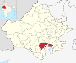
Chittorgarh district | |
|---|---|
District of Rajasthan | |
     Clockwise from top-left: Kirti Stambha with nearby temple at Chittorgarh Fort, Rani Padmini Palace, Dewaria Balaji Temple in Nagari, View of Chittorgarh city, Baroli Temples | |
 Chittorgarh district | |
| Country | |
| State | Rajasthan |
| Division | Udaipur |
| Headquarters | Chittaurgarh |
| Area | |
| • Total | 7,822 km2 (3,020 sq mi) |
| Population (2011)[1] | |
| • Total | 1,544,338 |
| • Density | 200/km2 (510/sq mi) |
| Time zone | UTC+05:30 (IST) |
Economy
In 2006 the Ministry of Panchayati Raj named Chittorgarh one of the country's 250 most backward districts (out of a total of 640).[4] It is one of the twelve districts in Rajasthan currently receiving funds from the Backward Regions Grant Fund Programme (BRGF).[4]
Demographics
According to the 2011 census Chittorgarh district has a population of 1,544,338,[5] roughly equal to the nation of Gabon[6] or the US state of Hawaii.[7] This gives it a ranking of 323rd in India (out of a total of 640).[5] The district has a population density of 193 inhabitants per square kilometre (500/sq mi) .[5] Its population growth rate over the decade 2001-2011 was 16.09%.[5] Chittaurgarh has a sex ratio of 970 females for every 1000 males,[5] and a literacy rate of 62.51%. Scheduled Castes and Scheduled Tribes make up 16.20% and 13.05% of the population respectively.[5]
Languages in Chittorgarh district (2011)[9]
At the time of the 2011 census, 67.88% of the population spoke Mewari, 15.52% Rajasthani and 13.86% Hindi as their first language.[9]
| Year | Pop. | ±% p.a. |
|---|---|---|
| 1901 | 234,331 | — |
| 1911 | 288,969 | +2.12% |
| 1921 | 308,082 | +0.64% |
| 1931 | 352,415 | +1.35% |
| 1941 | 417,574 | +1.71% |
| 1951 | 472,109 | +1.24% |
| 1961 | 571,327 | +1.93% |
| 1971 | 714,436 | +2.26% |
| 1981 | 921,629 | +2.58% |
| 1991 | 1,104,610 | +1.83% |
| 2001 | 1,330,360 | +1.88% |
| 2011 | 1,544,338 | +1.50% |
| source:[10] | ||
See also
- Chittor Fort
- Sanwariaji Temple
- Kalika Mata Temple, Chittorgarh Fort
- Avari Mata temple
- Tourism in Rajasthan
References
- District Census Handbook Chittaurgarh. Directorate of Census Operations. 2011.
- "Statistical Data of Rajasthan State Pertaining to Census-2011". www.rajcensus.gov.in. Retrieved 7 September 2018.
- Rajasthan District Gazetteers - Chittaurgarh. Directorate of District Gazetteers. 1977.
- Ministry of Panchayati Raj (8 September 2009). "A Note on the Backward Regions Grant Fund Programme" (PDF). National Institute of Rural Development. Archived from the original (PDF) on 5 April 2012. Retrieved 27 September 2011.
- "District Census Handbook 2011 - Chittaurgarh" (PDF). Census of India. Registrar General and Census Commissioner of India.
- US Directorate of Intelligence. "Country Comparison:Population". Archived from the original on 13 June 2007. Retrieved 1 October 2011.
Gabon 1,576,665
- "2010 Resident Population Data". U. S. Census Bureau. Archived from the original on 19 October 2013. Retrieved 30 September 2011.
Hawaii 1,360,301
- "Table C-01 Population By Religion - Rajasthan". census.gov.in. Registrar General and Census Commissioner of India.
- "Table C-16 Population by Mother Tongue: Rajasthan". censusindia.gov.in. Registrar General and Census Commissioner of India.
- Decadal Variation In Population Since 1901
External links
Places adjacent to Chittorgarh district | ||||||||||||||||
|---|---|---|---|---|---|---|---|---|---|---|---|---|---|---|---|---|
| ||||||||||||||||
Places adjacent to Chittorgarh district | ||||||||||||||||
|---|---|---|---|---|---|---|---|---|---|---|---|---|---|---|---|---|
| ||||||||||||||||
Capital: Jaipur | |||||||||||||||
| Outline |
|  | |||||||||||||
| Governance |
| ||||||||||||||
| Divisions and districts |
| ||||||||||||||
| Major cities | |||||||||||||||
| Related templates |
| ||||||||||||||
Authority control | |
|---|---|
| General | |
| National libraries | |
На других языках
[de] Chittorgarh (Distrikt)
Der Distrikt Chittorgarh (Hindi चित्तौड़गढ़ जिला) ist ein Distrikt im westindischen Bundesstaat Rajasthan.- [en] Chittorgarh district
[ru] Читторгарх (округ)
Читторгарх (англ. Chittorgarh) — округ в индийском штате Раджастхан. Расположен на юго-востоке штата. Разделён на восемь подокругов. Административный центр округа — город Читторгарх. Согласно всеиндийской переписи 2001 года население округа составляло 1 802 656 человек. Уровень грамотности взрослого населения составлял 54,31 %, что ниже среднеиндийского уровня (59,5 %).Другой контент может иметь иную лицензию. Перед использованием материалов сайта WikiSort.org внимательно изучите правила лицензирования конкретных элементов наполнения сайта.
WikiSort.org - проект по пересортировке и дополнению контента Википедии