world.wikisort.org - India
Bhilwara District is a district of the state of Rajasthan in western India. The town of Bhilwara is the district headquarters.
Bhilwara district | |
|---|---|
District of Rajasthan | |
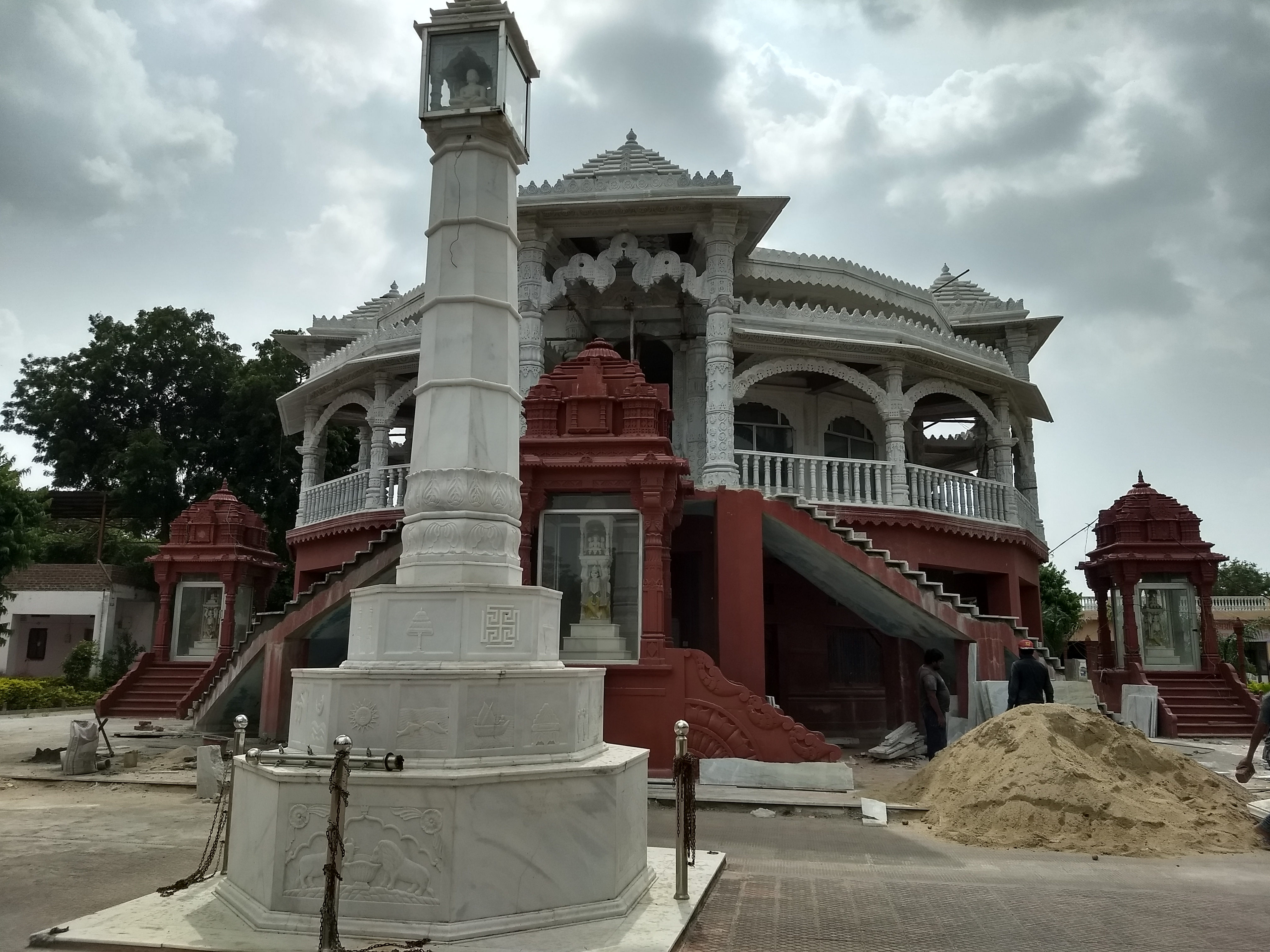     Clockwise from top-left: Bijolia Parshvanath temple, Shahpura Palace, Jahazpur Fort, Lake near Bhilwara, Amargarh Fort | |
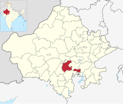 Location of Bhilwara district in Rajasthan | |
| Country | |
| State | Rajasthan |
| Division | Ajmer |
| Headquarters | Bhilwara |
| Government | |
| • District Collector | Ashish Modi |
| • Superintendent of Police | Adarsh Sidhu |
| Area | |
| • Total | 10,455 km2 (4,037 sq mi) |
| Population (2011)[1] | |
| • Total | 2,408,523 |
| • Density | 230/km2 (600/sq mi) |
| Time zone | UTC+05:30 (IST) |
| Website | bhilwara |
History
Stone Age tools dating from 5,000 to 200,000 years were found in Bundi and Bhilwara districts of the state.[2]
Geography
| Year | Pop. | ±% p.a. |
|---|---|---|
| 1901 | 354,261 | — |
| 1911 | 437,969 | +2.14% |
| 1921 | 465,050 | +0.60% |
| 1931 | 532,185 | +1.36% |
| 1941 | 634,666 | +1.78% |
| 1951 | 731,532 | +1.43% |
| 1961 | 869,410 | +1.74% |
| 1971 | 1,059,055 | +1.99% |
| 1981 | 1,315,552 | +2.19% |
| 1991 | 1,599,056 | +1.97% |
| 2001 | 2,020,969 | +2.37% |
| 2011 | 2,408,523 | +1.77% |
| source:[3] | ||
The district has an area of 10,455 km², and a population of 2,408,523 (2011 census), which increased 19.60% from 2001 to 2011. Famous for its textile & minerals Industries. It is bounded on the north by Ajmer District, on the east by Bundi District, on the south by Chittorgarh District and on the west by Rajsamand District. State Highway (Jaipur-Udaipur) passes through the district, as does a broad gauge railway line measuring 84 km and connecting Ajmer with Khandwa in Madhya Pradesh. The nearest airport is at Udaipur (171 km).
Administration
There are 7 sub-divisions in the district: Bhilwara, Shahpura, Gangapur, Gulabpura, Asind, Mandalgarh and Jahazpur. Under these sub-divisions there are 12 Tehsils as per Census of India 2011 report and these 12 Tehsils are Panachayat Samitis: Bhilwara, Banera, Mandal, Mandalgarh, Beejoliya, Kotri, Hurda, Shahpura, Jahazpur, Sahada, Asind and Raipur. There are four Sub Tehsils under the Tehsils mentioned in () also named Bagor (Mandal), Badnor (Asind), Hamirgarh and Puliakalan (Shahpura). Similarly there are 1783 villages as per census of 2001.
Demographics
According to the 2011 census Bhilwara district has a population of 2,408,523,[1] roughly equal to the nation of Kuwait[4] or the US state of New Mexico.[5] This gives it a ranking of 184th in India (out of a total of 640).[1] The district has a population density of 230 inhabitants per square kilometre (600/sq mi) .[1] Its population growth rate over the decade 2001-2011 was 19.7%.[1] Bhilwara has a sex ratio of 969 females for every 1000 males,[1] and a literacy rate of 62.71%. Scheduled Castes and Scheduled Tribes make up 16.94% and 9.52% of the population respectively.[1] This district, rather pretentiously, is boastfully called Textile City or Manchester of Rajasthan.
Languages of Bhilwara district (2011)[7]
At the time of the 2011 census, 53.08% of the population spoke Rajasthani, 27.50% Mewari, 15.00% Hindi and 1.82% Marwari as their first language.[7]
References
- "District Census Handbook 2011 - Bhilwara" (PDF). Census of India. Registrar General and Census Commissioner of India.
- Pillai, Geetha Sunil (28 February 2017), "Stone age tools dating back 2,00,000 years found in Rajasthan", The Times of India
- Decadal Variation In Population Since 1901
- US Directorate of Intelligence. "Country Comparison:Population". Archived from the original on 13 June 2007. Retrieved 1 October 2011.
Kuwait 2,595,62
- "2010 Resident Population Data". U. S. Census Bureau. Archived from the original on 19 October 2013. Retrieved 30 September 2011.
New Mexico - 2,059,179
- "Table C-01 Population By Religion - Rajasthan". census.gov.in. Registrar General and Census Commissioner of India.
- "Table C-16 Population by Mother Tongue: Rajasthan". censusindia.gov.in. Registrar General and Census Commissioner of India.
External links
Places adjacent to Bhilwara district | ||||||||||||||||
|---|---|---|---|---|---|---|---|---|---|---|---|---|---|---|---|---|
| ||||||||||||||||
Capital: Jaipur | |||||||||||||||
| Outline |
|  | |||||||||||||
| Governance |
| ||||||||||||||
| Divisions and districts |
| ||||||||||||||
| Major cities | |||||||||||||||
| Related templates |
| ||||||||||||||
Authority control | |
|---|---|
| General |
|
| National libraries | |
На других языках
[de] Bhilwara (Distrikt)
Der Distrikt Bhilwara (Hindi भीलवाड़ा जिला) ist ein Distrikt im westindischen Bundesstaat Rajasthan.- [en] Bhilwara district
[ru] Бхилвара (округ)
Бхилва́ра (англ. Bhilwara) — округ в индийском штате Раджастхан. Разделён на восемь подокругов. Административный центр округа — город Бхилвара. Согласно всеиндийской переписи 2001 года население округа составляло 2 009 516 человек. Уровень грамотности взрослого населения составлял 51,09 %, что ниже среднеиндийского уровня (59,5 %). Округ является крупным центром текстильной промышленности.Другой контент может иметь иную лицензию. Перед использованием материалов сайта WikiSort.org внимательно изучите правила лицензирования конкретных элементов наполнения сайта.
WikiSort.org - проект по пересортировке и дополнению контента Википедии