world.wikisort.org - France
Étampes (French: [etɑ̃p] (![]() listen)) is a commune in the metropolitan area of Paris, France. It is located 48.1 km (29.9 mi) south-southwest from the center of Paris (as the crow flies). Étampes is a sub-prefecture of the Essonne department.
listen)) is a commune in the metropolitan area of Paris, France. It is located 48.1 km (29.9 mi) south-southwest from the center of Paris (as the crow flies). Étampes is a sub-prefecture of the Essonne department.
Étampes | |
|---|---|
Subprefecture and commune | |
 Saint Martin | |
 Coat of arms | |
Location of Étampes  | |
 Étampes  Étampes | |
| Coordinates: 48°26′03″N 2°09′41″E | |
| Country | France |
| Region | Île-de-France |
| Department | Essonne |
| Arrondissement | Étampes |
| Canton | Étampes |
| Intercommunality | CA Étampois Sud Essonne |
| Government | |
| • Mayor (2020–2026) | Franck Marlin[1] |
| Area 1 | 40.92 km2 (15.80 sq mi) |
| Population | 25,629 |
| • Density | 630/km2 (1,600/sq mi) |
| Time zone | UTC+01:00 (CET) |
| • Summer (DST) | UTC+02:00 (CEST) |
| INSEE/Postal code | 91223 /91150 |
| Elevation | 66–156 m (217–512 ft) |
| 1 French Land Register data, which excludes lakes, ponds, glaciers > 1 km2 (0.386 sq mi or 247 acres) and river estuaries. | |
Étampes, together with the neighboring communes of Morigny-Champigny and Brières-les-Scellés, form an urban area of 30,881 inhabitants (2018). This urban area is a "satellite city" of Paris.
History
Étampes (Latin: Stampae) existed at the beginning of the 7th century and in the early Middle Ages belonged to the crown domain. During the Middle Ages it was the scene of several councils, the most notable of which took place in 1130 and resulted in the recognition of Innocent II as the legitimate pope. In 1652, during the war of the Fronde it suffered severely at the hands of the royal troops under Turenne.[3]
Geography
Étampes lies on the river Chalouette, a tributary of the Juine, which borders the eastern outskirts of the serene town.[4]
Inhabitants of Étampes are known as Étampois.
Transport
Étampes is served by two stations on Paris RER line C: Étampes and Saint-Martin-d'Étampes. Étampes station is also served by regional trains to Orléans and Paris.
Population
|
| ||||||||||||||||||||||||||||||||||||||||||||||||||||||||||||||||||||||||||||||||||||||||||||||||||||||||||||||||||
| Source: EHESS[5] and INSEE (1968-2017)[6] | |||||||||||||||||||||||||||||||||||||||||||||||||||||||||||||||||||||||||||||||||||||||||||||||||||||||||||||||||||
Sights
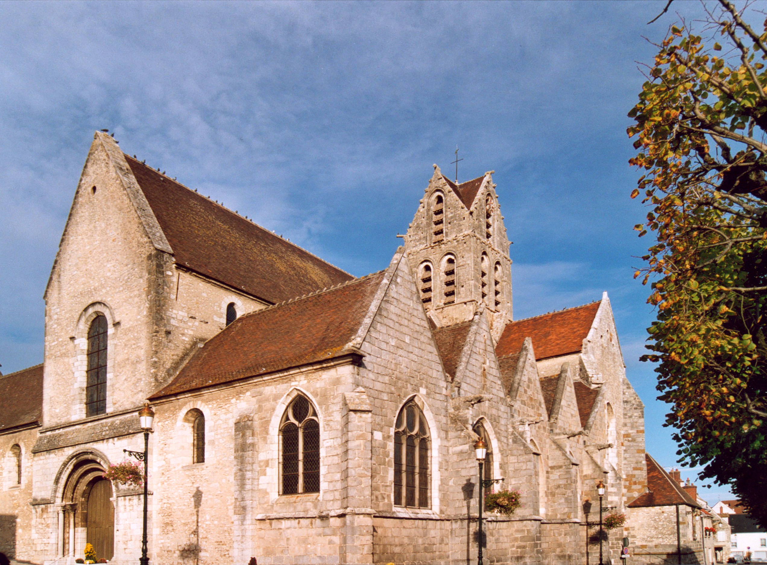
A fine view of Étampes is obtained from the Tour Guinette, a keep (now ruined) built by Louis VI in the 12th century on an eminence on the other side of the railway. Notre-Dame du Fort, the chief church, dates from the 11th and 12th centuries; irregular in plan, it is remarkable for a fine Romanesque tower and spire, and for the crenellated wall which partly surrounds it. The interior contains ancient paintings and other artistic works. St Basile (12th and 16th centuries), preserves a Romanesque doorway, and St Martin (12th and 13th centuries), has a leaning tower of the 16th century.[4]
The civil buildings offer little interest, but two houses named after Anne de Pisseleu, mistress of Francis I, and Diane de Poitiers, mistress of Henry II, are graceful examples of Renaissance architecture. In the square there is a statue of the naturalist, Étienne Geoffroy Saint-Hilaire, who was born in Étampes.[4]
Monuments and tourist attractions
 La Tour Guinette-the remains of Château d'Étampes
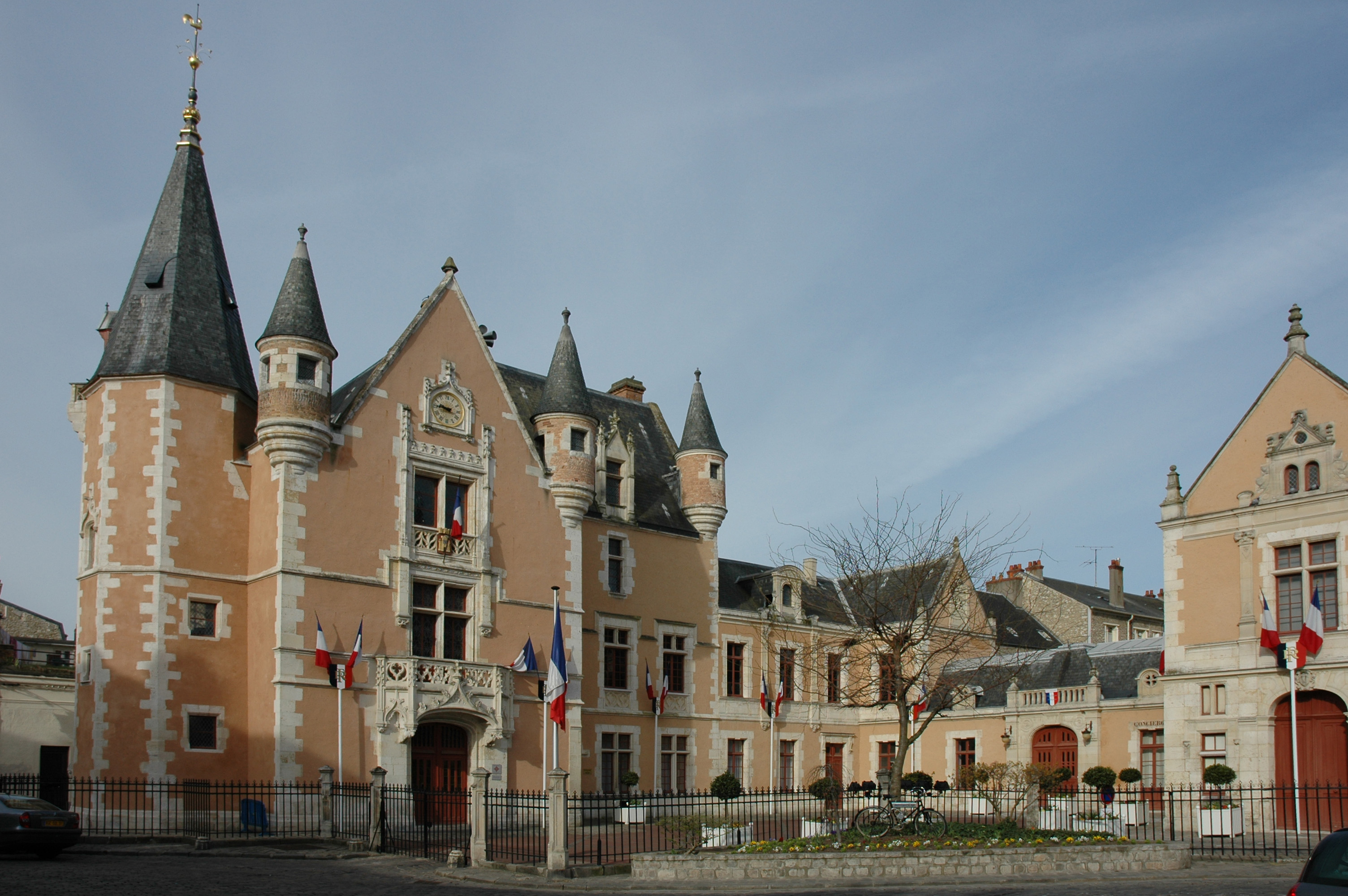
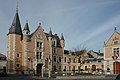 L'Hôtel de Ville
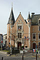 L'Hôtel de Ville


- Hôtel Anne de Pisseleu
- Théâtre built by the architect Gabriel Davioud in 1851-1852, paid for by a public subscription
- Regional leisure park (wave pool)
- Sculptures created by André Deluol: Vénus anadyomène, La Terre, Le Corbeau et le Renard, Jeune fille et oiseau, Un Ange, Deux danseuses nues
- The "Pergola de la Douce France" is located in the gardens of the Tour Guinette in Étampes and was part of a larger composition created in 1925 for the Exposition des Arts décoratifs et industriels. It was acquired by Étampes in 1934. The work comprises four large stone blocks on which sixteen bas-reliefs have been created by various sculptors. Georges Saupique executed the reliefs "Le Saint Graal" and "L'Aurochs".
Religious edifices
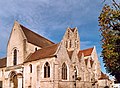
- Église Notre Dame du Fort
 Église Notre-Dame-du-Fort
 Église Notre-Dame-du-Fort
 Église Notre-Dame-du-Fort
 Église Notre-Dame-du-Fort


- Église Saint-Basile
 Église Saint-Basile
 Église Saint-Basile
 Église Saint-Basile


- Église Saint-Martin, famous for its leaning tour
 Église Saint-Martin
 Église Saint-Martin
 Église Saint-Martin
 Église Saint-Martin


- Église Saint-Gilles
 Église Saint-Gilles
 Église Saint-Gilles
 Église Saint-Gilles
 Église Saint-Gilles
 Église Saint-Gilles
 Église Saint-Gilles
 Église Saint-Gilles


- Chapelle de Gérofosse
- Chapelle de Guinette
Notable Persons
- Louise Abbéma (1853–1927), painter, sculptor, and designer
- Jean-Marc Fessard (born 1969), classical clarinetist
- Theobald of Étampes
- Jean-Victor Makengo, footballer
- Yacouba Sylla, footballer
- Bilal Ouali, footballer
- Michel Crépu (born 1954), writer and literary critic, winner of the 2012 Prix des Deux Magots
- Arnaud Beltrame, gendarme killed in the Carcassonne and Trèbes attack, 23 March 2018
Miscellaneous
The prestigious École Philippe Gaulier is located in Étampes.
See also
- Communes of the Essonne department
- Counts and Dukes of Étampes
- Georges Saupique
References
- "Répertoire national des élus: les maires" (in French). data.gouv.fr, Plateforme ouverte des données publiques françaises. 13 September 2022.
- "Populations légales 2019". The National Institute of Statistics and Economic Studies. 29 December 2021.
- Chisholm 1911, p. 804.
- Chisholm 1911, p. 803.
- Des villages de Cassini aux communes d'aujourd'hui: Commune data sheet Étampes, EHESS. (in French)
- Population en historique depuis 1968, INSEE
- This article incorporates text from a publication now in the public domain: Chisholm, Hugh, ed. (1911). "Étampes". Encyclopædia Britannica. Vol. 9 (11th ed.). Cambridge University Press. pp. 803–804.
External links
- Étampes city council website
- Base Mérimée: Search for heritage in the commune, Ministère français de la Culture. (in French)
- Land use (IAURIF) (in English)
- La Base des Loisirs, The city's park's website
- Mayors of Essonne Association (in French)
Authority control | |
|---|---|
| General | |
| National libraries | |
| Other |
|
На других языках
[de] Étampes
Étampes ist eine französische Gemeinde mit 25.629 Einwohnern (Stand 1. Januar 2019) im Département Essonne in der Region Île-de-France; sie gehört zum Arrondissement Étampes und ist Verwaltungssitz von zehn Kantonen. Étampes befindet sich rund 49 Kilometer südlich von Paris und 60 Kilometer nördlich von Orléans. Die Stadt wird vom Fluss Juine und seinem Zufluss Chalouette durchquert. Einige Kilometer außerhalb im Südwesten befindet sich der Flugplatz Étampes-Mondésir.- [en] Étampes
[fr] Étampes
Étampes (prononcé [e.t̪ɑ̃p] .mw-parser-output .prononciation>a{background:url("//upload.wikimedia.org/wikipedia/commons/thumb/8/8a/Loudspeaker.svg/11px-Loudspeaker.svg.png")center left no-repeat;padding-left:15px;font-size:smaller}Écouter) est est une commune française située dans le département de l'Essonne, en région Île-de-France située à cinquante kilomètres au sud-ouest de Paris et soixante kilomètres au nord d'Orléans.[it] Étampes
Étampes /e'tɑ̃p/ è un comune francese di 22 537 abitanti situato nel dipartimento dell'Essonne nella regione dell'Île-de-France.[ru] Этамп
Этамп (фр. Étampes) — супрефектура во французском департаменте Эссонна, в 48 км к югу от Парижа.Другой контент может иметь иную лицензию. Перед использованием материалов сайта WikiSort.org внимательно изучите правила лицензирования конкретных элементов наполнения сайта.
WikiSort.org - проект по пересортировке и дополнению контента Википедии