world.wikisort.org - France
Colombes (French pronunciation: [kɔlɔ̃b] (![]() listen)) is a commune in the northwestern suburbs of Paris, France. It is located 10.6 km (6.6 mi) from the centre of Paris. In 2019, Colombes was the 53rd largest city in France.
listen)) is a commune in the northwestern suburbs of Paris, France. It is located 10.6 km (6.6 mi) from the centre of Paris. In 2019, Colombes was the 53rd largest city in France.
Colombes | |
|---|---|
Commune | |
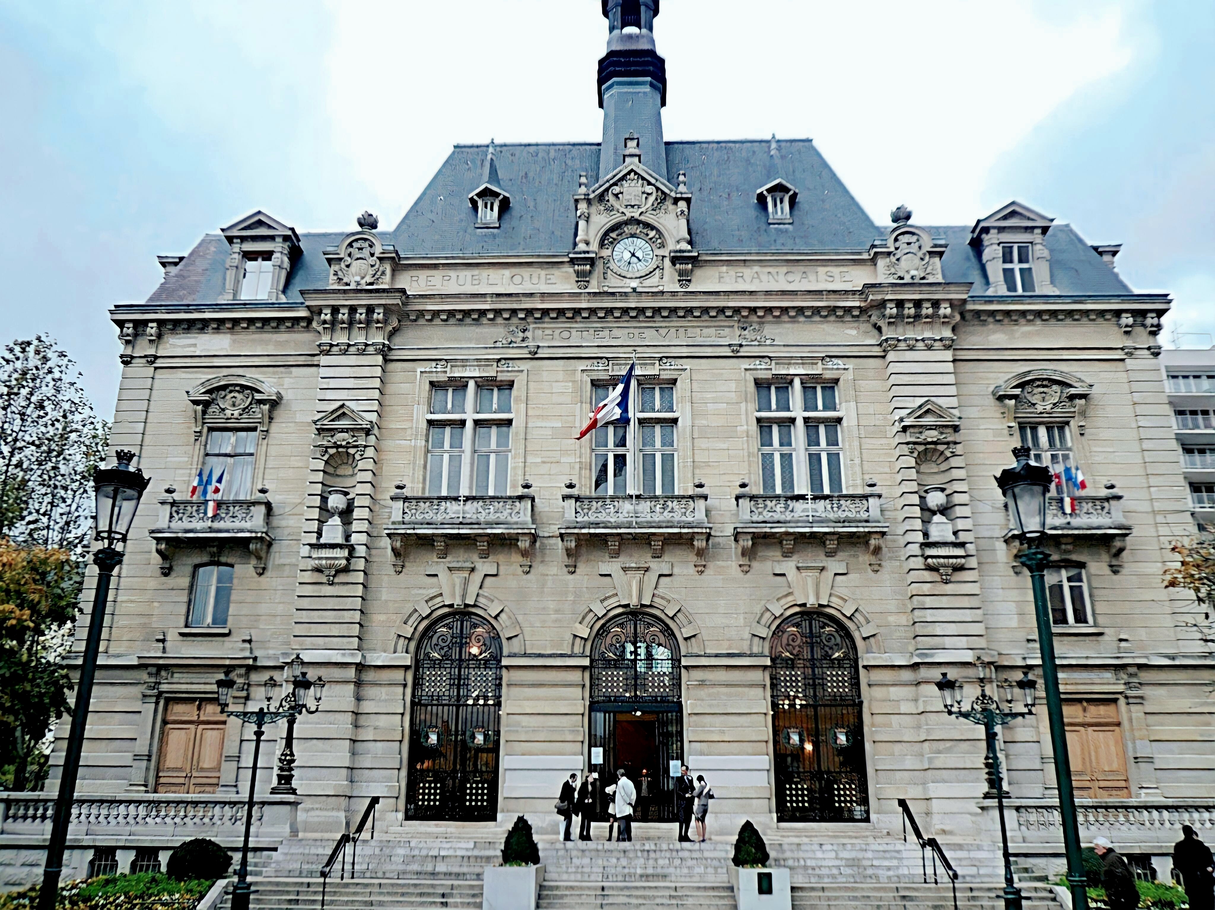 The town hall of Colombes | |
 Coat of arms | |
 Paris and inner ring départements | |
Location of Colombes  | |
 Colombes  Colombes | |
| Coordinates: 48°55′25″N 2°15′08″E | |
| Country | France |
| Region | Île-de-France |
| Department | Hauts-de-Seine |
| Arrondissement | Nanterre |
| Canton | Colombes-1 and 2 |
| Intercommunality | Grand Paris |
| Government | |
| • Mayor (2020–2026) | Patrick Chaimovitch[1] |
| Area 1 | 7.81 km2 (3.02 sq mi) |
| Population | 86,534 |
| • Density | 11,000/km2 (29,000/sq mi) |
| Time zone | UTC+01:00 (CET) |
| • Summer (DST) | UTC+02:00 (CEST) |
| INSEE/Postal code | 92025 /92700 |
| Elevation | 23–44 m (75–144 ft) |
| 1 French Land Register data, which excludes lakes, ponds, glaciers > 1 km2 (0.386 sq mi or 247 acres) and river estuaries. | |
Name
The name Colombes comes from Latin columna (Old French colombe), meaning "column". This is interpreted as referring either to a megalithic column used in ancient times by a druidic cult which stood in Colombes until its destruction during the French Revolution, or to the columns of an atrium in a ruined Gallo-Roman villa that also stood in Colombes.
History
On 13 March 1896, 17% of the territory of Colombes was detached and became the commune of Bois-Colombes (literally "Colombes Woods"). On 2 May 1910, 19% of the (reduced) territory of Colombes was detached and became the commune of La Garenne-Colombes. Thus, the commune of Colombes is now only two-thirds the size of its territory before 1896. The population data in the table and graph below refer to the commune of Colombes proper, in its geography at the given years.
Population
|
| ||||||||||||||||||||||||||||||||||||||||||||||||||||||||||||||||||||||||||||||||||||||||||||||||||||||||||||||||||
| Source: EHESS[3] and INSEE (1968-2017)[4] | |||||||||||||||||||||||||||||||||||||||||||||||||||||||||||||||||||||||||||||||||||||||||||||||||||||||||||||||||||
Geography
Climate
Colombes has a oceanic climate (Köppen climate classification Cfb). The average annual temperature in Colombes is 12.5 °C (54.5 °F). The average annual rainfall is 623.0 mm (24.53 in) with May as the wettest month. The temperatures are highest on average in July, at around 20.6 °C (69.1 °F), and lowest in January, at around 5.0 °C (41.0 °F). The highest temperature ever recorded in Colombes was 40.9 °C (105.6 °F) on 6 August 2003; the coldest temperature ever recorded was −15.0 °C (5.0 °F) on 17 January 1985.
| Climate data for Colombes (1981−2010 normals, extremes 1981−2018) | |||||||||||||
|---|---|---|---|---|---|---|---|---|---|---|---|---|---|
| Month | Jan | Feb | Mar | Apr | May | Jun | Jul | Aug | Sep | Oct | Nov | Dec | Year |
| Record high °C (°F) | 16.2 (61.2) |
21.0 (69.8) |
25.5 (77.9) |
31.1 (88.0) |
35.0 (95.0) |
37.9 (100.2) |
40.0 (104.0) |
40.9 (105.6) |
34.0 (93.2) |
30.9 (87.6) |
22.0 (71.6) |
17.5 (63.5) |
40.9 (105.6) |
| Average high °C (°F) | 7.6 (45.7) |
8.8 (47.8) |
12.7 (54.9) |
16.2 (61.2) |
20.1 (68.2) |
23.2 (73.8) |
25.8 (78.4) |
25.5 (77.9) |
21.7 (71.1) |
16.8 (62.2) |
11.2 (52.2) |
7.9 (46.2) |
16.5 (61.7) |
| Daily mean °C (°F) | 5.0 (41.0) |
5.6 (42.1) |
8.7 (47.7) |
11.5 (52.7) |
15.3 (59.5) |
18.3 (64.9) |
20.6 (69.1) |
20.3 (68.5) |
17.0 (62.6) |
13.1 (55.6) |
8.3 (46.9) |
5.5 (41.9) |
12.5 (54.5) |
| Average low °C (°F) | 2.4 (36.3) |
2.4 (36.3) |
4.7 (40.5) |
6.8 (44.2) |
10.5 (50.9) |
13.4 (56.1) |
15.4 (59.7) |
15.2 (59.4) |
12.2 (54.0) |
9.3 (48.7) |
5.5 (41.9) |
3.1 (37.6) |
8.4 (47.1) |
| Record low °C (°F) | −15.0 (5.0) |
−12.0 (10.4) |
−7.0 (19.4) |
−2.0 (28.4) |
1.9 (35.4) |
5.4 (41.7) |
9.0 (48.2) |
7.9 (46.2) |
4.7 (40.5) |
−2.2 (28.0) |
−6.7 (19.9) |
−9.1 (15.6) |
−15.0 (5.0) |
| Average precipitation mm (inches) | 49.6 (1.95) |
41.4 (1.63) |
46.9 (1.85) |
46.9 (1.85) |
63.7 (2.51) |
51.0 (2.01) |
58.3 (2.30) |
50.2 (1.98) |
48.0 (1.89) |
61.4 (2.42) |
48.1 (1.89) |
57.5 (2.26) |
623.0 (24.53) |
| Average precipitation days (≥ 1.0 mm) | 10.6 | 9.0 | 10.5 | 9.2 | 10.0 | 8.3 | 8.0 | 7.2 | 8.0 | 9.7 | 9.8 | 10.9 | 111.2 |
| Source: Météo-France[5] | |||||||||||||
Administration
The city is divided into two cantons:
- Colombes-1 (north)
- Colombes-2 (south)
Transport
Colombes is served by four stations on the Transilien Paris – Saint-Lazare suburban rail line at Colombes, Le Stade, La Garenne-Colombes and Gare Les Vallées.
Education
The commune has 21 preschools and 19 elementary schools.[6]
Secondary schools:
- Junior high schools: Robert Paparemborde, Marguerite Duras, Gay Lussac, Moulin Joly, Jean-Baptiste Clément, Lakanal[7]
- Senior high schools: Lycée Guy de Maupassant, Lycee Polyvalent Claude Garamont, Lycee Polyvalent Anatole de France
Personalities
- Quilapayún, Chilean music group forced into exile in France after the 1973 Coup. They settled in Colombes.
- Jordan Aboudou, basketball player
- Lens Aboudou, basketball player
- Josue Albert, footballer
- Bryan Alceus, footballer
- Mame-Ibra Anne, athlete
- Jean-Ricner Bellegarde, footballer
- Kelly Berville, footballer
- Zoumana Camara, footballer
- Pierre Clayette, artist
- Mathieu Cossou, karateka
- Simone Jorry, deaf/hoh rights activist
- Marie-Antoinette Katoto, footballer
- Claude Mérelle, actress
- Eliaquim Mangala, footballer
- Samuel Nadeau, basketball player
- Alexandre Postel (born 1982), writer
- Steven Nzonzi, footballer
- Kevin Thalien, basketball player
- Elodie Thomis, footballer
- Axel Tony, singer
- Jonathan Toto, footballer
- Eddy Viator, footballer
- Rama Yade, politician, moved into a council flat in Colombes with her mother and three sisters at the age of fourteen.[8]
- pierpoljak, reggae singer
Sport
The stadium was built in 1907. Officially named the Stade Olympique Yves-du-Manoir, the Olympic Stadium of Colombes was the site of the opening ceremony and several events of the 1924 Summer Olympics. The arena's capacity was increased to 60,000 for the 1938 World Cup. The stadium lost its importance after the restoration in 1972 of Paris' 49,000-seat Parc des Princes. In the 1990s, three of the four grandstands were torn down due to decay and the stadium's capacity was down to 7,000; later renovations have brought the current capacity to 14,000.
Through November 2017, it had been home to the Racing 92 rugby club, currently playing in France's Top 14, but Racing has since moved to the new U Arena in Nanterre. The RCF Paris football club, which plays in the fourth division, remains at Yves-du-Manoir. The stadium will be the field hockey venue at the 2024 Summer Olympics.
Twin towns
 Frankenthal, Germany
See also
References
- "Répertoire national des élus: les maires". data.gouv.fr, Plateforme ouverte des données publiques françaises (in French). 2 December 2020.
- "Populations légales 2019". The National Institute of Statistics and Economic Studies. 29 December 2021.
- Des villages de Cassini aux communes d'aujourd'hui: Commune data sheet Colombes, EHESS. (in French)
- Population en historique depuis 1968, INSEE
- "Fiche Climatologique Statistiques 1981-2010 et records" (PDF). Météo-France. Retrieved August 24, 2022.
- "Carte scolaire." Colombes. Retrieved on September 7, 2016.
- "Établissements d'enseignement publics sécondaires (collèges)[permanent dead link]." Académie de Versailles. Retrieved on September 7, 2016.
- Rama Yade: The political star who's eclipsing Sarko, The Independent, 14 April 2009
External links
- Official website
- (in French) Colombes in postal card (Colombes philatelic society)
- (in French) History of the Olympic Stadium
- Article: Chariots of Fire stadium reprieved
Authority control | |
|---|---|
| General | |
| National libraries | |
| Other |
|
На других языках
[de] Colombes
Vorlage:Infobox Gemeinde in Frankreich/Wartung/abweichendes Wappen in Wikidata- [en] Colombes
[ru] Коломб
Коломб (фр. Colombes) — город и муниципалитет в регионе О-де-Сен, округ Нантер, недалеко от Парижа. По оценкам, в нем проживает 84 392 человека (на 2014 год), а его площадь составляет 7,81 квадратных километров.Другой контент может иметь иную лицензию. Перед использованием материалов сайта WikiSort.org внимательно изучите правила лицензирования конкретных элементов наполнения сайта.
WikiSort.org - проект по пересортировке и дополнению контента Википедии