world.wikisort.org - France
Saint-Christophe-sur-Guiers (French pronunciation: [sɛ̃ kʁistɔf syʁ ɡje], literally Saint-Christophe on Guiers) is a commune in the Isère department in southeastern France.[3]
This article may be expanded with text translated from the corresponding article in French. (December 2009) Click [show] for important translation instructions.
|
Saint-Christophe-sur-Guiers | |
|---|---|
Commune | |
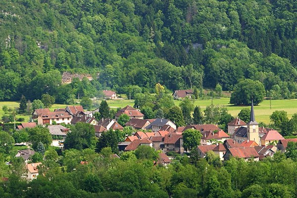 A general view of Saint-Christophe-sur-Guiers | |
 Coat of arms | |
Location of Saint-Christophe-sur-Guiers  | |
 Saint-Christophe-sur-Guiers  Saint-Christophe-sur-Guiers | |
| Coordinates: 45°26′17″N 5°46′29″E | |
| Country | France |
| Region | Auvergne-Rhône-Alpes |
| Department | Isère |
| Arrondissement | Grenoble |
| Canton | Chartreuse-Guiers |
| Intercommunality | Cœur de Chartreuse |
| Government | |
| • Mayor (2022–2026) | Claude Coux[1] |
| Area 1 | 23.54 km2 (9.09 sq mi) |
| Population | 824 |
| • Density | 35/km2 (91/sq mi) |
| Time zone | UTC+01:00 (CET) |
| • Summer (DST) | UTC+02:00 (CEST) |
| INSEE/Postal code | 38376 /38380 |
| Elevation | 386–1,761 m (1,266–5,778 ft) |
| 1 French Land Register data, which excludes lakes, ponds, glaciers > 1 km2 (0.386 sq mi or 247 acres) and river estuaries. | |
La Ruchère
La Ruchère, rural district, mainly famous for cross country skiing slopes, was attached to Saint-Christophe-sur-Guiers in 1794.
Population
|
|
See also
References
- "Répertoire national des élus: les maires" (in French). data.gouv.fr, Plateforme ouverte des données publiques françaises. 13 September 2022.
- "Populations légales 2019". The National Institute of Statistics and Economic Studies. 29 December 2021.
- INSEE commune file
Wikimedia Commons has media related to Saint-Christophe-sur-Guiers.
This Isère geographical article is a stub. You can help Wikipedia by expanding it. |
На других языках
[de] Saint-Christophe-sur-Guiers
Saint-Christophe-sur-Guiers ist eine französische Gemeinde mit 824 Einwohnern (Stand: 1. Januar 2019) im Département Isère in der Region Auvergne-Rhône-Alpes. Sie gehört zum Arrondissement Grenoble und ist Teil des Kantons Chartreuse-Guiers (bis 2015: Kanton Saint-Laurent-du-Pont). Die Einwohner werden Saint-Christolin(ne)s genannt.- [en] Saint-Christophe-sur-Guiers
[es] Saint-Christophe-sur-Guiers
Saint-Christophe-sur-Guiers es una población y comuna francesa, en la región de Ródano-Alpes, departamento de Isère, en el distrito de Grenoble y cantón de Saint-Laurent-du-Pont.[ru] Сен-Кристоф-сюр-Гьер
Сен-Кристоф-сюр-Гьер (фр. Saint-Christophe-sur-Guiers) — коммуна во Франции, находится в регионе Рона — Альпы. Департамент коммуны — Изер. Входит в состав кантона Шартрёз-Гье. Округ коммуны — Гренобль.[1]Текст в блоке "Читать" взят с сайта "Википедия" и доступен по лицензии Creative Commons Attribution-ShareAlike; в отдельных случаях могут действовать дополнительные условия.
Другой контент может иметь иную лицензию. Перед использованием материалов сайта WikiSort.org внимательно изучите правила лицензирования конкретных элементов наполнения сайта.
Другой контент может иметь иную лицензию. Перед использованием материалов сайта WikiSort.org внимательно изучите правила лицензирования конкретных элементов наполнения сайта.
2019-2026
WikiSort.org - проект по пересортировке и дополнению контента Википедии
WikiSort.org - проект по пересортировке и дополнению контента Википедии