world.wikisort.org - France
Pellafol (French pronunciation: [pɛlafɔl]) is a commune in the Isère department in southeastern France.[3]
Pellafol | |
|---|---|
Commune | |
 The town hall of Pellafol | |
Location of Pellafol  | |
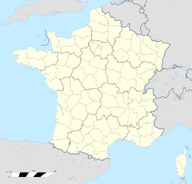  Pellafol  Pellafol | |
| Coordinates: 44°47′50″N 5°54′39″E | |
| Country | France |
| Region | Auvergne-Rhône-Alpes |
| Department | Isère |
| Arrondissement | Grenoble |
| Canton | Matheysine-Trièves |
| Government | |
| • Mayor (2020–2026) | Thierry Joubert[1] |
| Area 1 | 35 km2 (14 sq mi) |
| Population | 137 |
| • Density | 3.9/km2 (10/sq mi) |
| Time zone | UTC+01:00 (CET) |
| • Summer (DST) | UTC+02:00 (CEST) |
| INSEE/Postal code | 38299 /38970 |
| Elevation | 639–2,793 m (2,096–9,163 ft) (avg. 934 m or 3,064 ft) |
| 1 French Land Register data, which excludes lakes, ponds, glaciers > 1 km2 (0.386 sq mi or 247 acres) and river estuaries. | |
Geography
Pellafol is situated 7 km (4.3 mi) to the south of Dauphiné and Dévoluy (midway between Grenoble and Gap) on a magnificent plateau near Lake Sautet, It has limited entry to the departments of Isère and Hautes-Alpes.
Neighboring communes
Corps, Cordéac, Ambel, Beaufin, Saint-Étienne-en-Dévoluy.
History
Historically, Pellafol was a former fort château.
Administration
Since 2014, Thierry Joubert has been the mayor of Pellafol. He was re-elected in the 2020 municipal elections.[1][4]
| Term | Name |
|---|---|
| 2001–2008 | Yves Moutin |
| 2008 | Jean Pierre Arneaudo |
| 2008–2014 | Agnès Robert |
| 2014–2026 | Thierry Joubert |
Population
| Year | Pop. | ±% |
|---|---|---|
| 1962 | 283 | — |
| 1968 | 245 | −13.4% |
| 1975 | 200 | −18.4% |
| 1982 | 152 | −24.0% |
| 1990 | 149 | −2.0% |
| 1999 | 137 | −8.1% |
| 2011 | 138 | +0.7% |
See also
References
- "Répertoire national des élus: les maires". data.gouv.fr, Plateforme ouverte des données publiques françaises (in French). 2 December 2020.
- "Populations légales 2019". The National Institute of Statistics and Economic Studies. 29 December 2021.
- INSEE commune file
- Village de Pellafol, annuaire-mairie.fr

Wikimedia Commons has media related to Pellafol.

Authority control | |
|---|---|
| General |
|
| National libraries | |

 | This Isère geographical article is a stub. You can help Wikipedia by expanding it. |
На других языках
- [en] Pellafol
[ru] Пеллафоль
Пеллафоль (фр. Pellafol) — коммуна во Франции, находится в регионе Рона — Альпы. Департамент коммуны — Изер. Входит в состав кантона Матезин-Триев. Округ коммуны — Гренобль.[1]Текст в блоке "Читать" взят с сайта "Википедия" и доступен по лицензии Creative Commons Attribution-ShareAlike; в отдельных случаях могут действовать дополнительные условия.
Другой контент может иметь иную лицензию. Перед использованием материалов сайта WikiSort.org внимательно изучите правила лицензирования конкретных элементов наполнения сайта.
Другой контент может иметь иную лицензию. Перед использованием материалов сайта WikiSort.org внимательно изучите правила лицензирования конкретных элементов наполнения сайта.
2019-2026
WikiSort.org - проект по пересортировке и дополнению контента Википедии
WikiSort.org - проект по пересортировке и дополнению контента Википедии