world.wikisort.org - Ecuador
San Miguel de Urcuquí Canton, or Urkuki, is a canton of Ecuador, located in the Imbabura Province. Its seat is the town of Urcuquí. Its population in the 2001 census was 14,381[1] and was 15,671 in the 2010 census.[2] The area of the canton is 779 square kilometres (301 sq mi).
San Miguel de Urcuquí Canton | |
|---|---|
Canton | |
 Flag | |
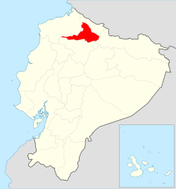 Location of Imbabura Province in Ecuador. | |
 Cantons of Imbabura Province | |
| Country | |
| Province | Imbabura Province |
| Time zone | UTC-5 (ECT) |
San Miguel de Urcuquí is located in the Andes of northern Ecuador. The town and parish of Urcuqui had a population of 4,499 in 2000 and 5,205 in 2010 and has an elevation of 2,295 metres (7,530 ft) above sea level. The town is located about 9 kilometres (5.6 mi) in straight line distance northwest of the city of Ibarra, the capital of Imbabura province.[3]
Demographics
Ethnic groups as of the Ecuadorian census of 2010:[4]
- Mestizo 83.1%
- Afro-Ecuadorian 9.3%
- Indigenous 5.5%
- White 1.9%
- Montubio 0.2%
- Other 0.1%
References
- Cantons of Ecuador at statoids.com
- "Ecuador: Municipal Division (Provinces and Parishes) - Population Statistics, Charts and Map". www.citypopulation.de. Retrieved 10 Jul 2017.
- Google Earth; https://www.citypopulation.de/php/ecuador-parish-admin.php, accessed 10 Jul 2017
- "Resultados".
| Azuay | |
|---|---|
| Bolívar | |
| Cañar | |
| Carchi | |
| Chimborazo | |
| Cotopaxi | |
| El Oro | |
| Esmeraldas | |
| Galápagos | |
| Guayas |
|
| Imbabura | |
| Loja | |
| Los Ríos | |
| Manabí | |
| Morona-Santiago | |
| Napo | |
| Orellana | |
| Pastaza | |
| Pichincha | |
| Santa Elena | |
| Santo Domingo de los Tsáchilas |
|
| Sucumbíos | |
| Tungurahua | |
| Zamora-Chinchipe | |
This Ecuador location article is a stub. You can help Wikipedia by expanding it. |
На других языках
[de] Kanton San Miguel de Urcuquí
Der Kanton San Miguel de Urcuquí befindet sich in der Provinz Imbabura im Norden von Ecuador. Er besitzt eine Fläche von 785,3 km². Im Jahr 2020 lag die Einwohnerzahl schätzungsweise bei 17.540. Verwaltungssitz des Kantons ist die Kleinstadt Urcuquí mit 3298 Einwohnern (Stand 2010). Der Kanton San Miguel de Urcuquí wurde am 9. Februar 1984 gegründet.- [en] San Miguel de Urcuquí Canton
Другой контент может иметь иную лицензию. Перед использованием материалов сайта WikiSort.org внимательно изучите правила лицензирования конкретных элементов наполнения сайта.
WikiSort.org - проект по пересортировке и дополнению контента Википедии