world.wikisort.org - Ecuador
Daule, is a canton located in the Guayas province in Ecuador. Created in 1820, it is one of the most important parts of Guayas thanks to its rice production and other products such as corn and eggs.[citation needed]
Daule Canton
Cantón Daule | |
|---|---|
Canton | |
 Flag  Coat of arms | |
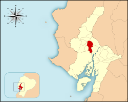 Location of the Daule Canton within Ecuador. | |
| Coordinates: 01°52′0″S 79°59′0″W | |
| Country | |
| Province | Guayas Province |
| Established | 24 June 1824 |
| Seat | Daule |
| Area | |
| • Total | 475 km2 (183 sq mi) |
| Population (2010) | |
| • Total | 120,326 |
| Time zone | UTC-5 (ECT) |
| Website | http://www.daule.gob.ec |
The Daule canton covers an area of 462 square kilometres (178 sq mi) and at the 2001 census it had a population of 85,148 people. The seat or capital of the canton is the city of Daule.[1]
Demographics
Ethnic groups as of the Ecuadorian census of 2010:[2]
- Mestizo 51.9%
- Montubio 36.1%
- White 6.4%
- Afro-Ecuadorian 5.2%
- Indigenous 0.2%
- Other 0.3%
References
- Cantons of Ecuador. Statoids.com. Retrieved 4 November 2009.
- "Resultados".
| Azuay | |
|---|---|
| Bolívar | |
| Cañar |
|
| Carchi |
|
| Chimborazo |
|
| Cotopaxi |
|
| El Oro | |
| Esmeraldas |
|
| Galápagos |
|
| Guayas |
|
| Imbabura | |
| Loja | |
| Los Ríos |
|
| Manabí |
|
| Morona-Santiago |
|
| Napo |
|
| Orellana |
|
| Pastaza |
|
| Pichincha |
|
| Santa Elena |
|
| Santo Domingo de los Tsáchilas |
|
| Sucumbíos |
|
| Tungurahua | |
| Zamora-Chinchipe |
|
| Authority control |
|
|---|
This Ecuador location article is a stub. You can help Wikipedia by expanding it. |
Текст в блоке "Читать" взят с сайта "Википедия" и доступен по лицензии Creative Commons Attribution-ShareAlike; в отдельных случаях могут действовать дополнительные условия.
Другой контент может иметь иную лицензию. Перед использованием материалов сайта WikiSort.org внимательно изучите правила лицензирования конкретных элементов наполнения сайта.
Другой контент может иметь иную лицензию. Перед использованием материалов сайта WikiSort.org внимательно изучите правила лицензирования конкретных элементов наполнения сайта.
2019-2026
WikiSort.org - проект по пересортировке и дополнению контента Википедии
WikiSort.org - проект по пересортировке и дополнению контента Википедии