world.wikisort.org - Ecuador
Ibarra Canton is a canton of Ecuador, located in Imbabura Province. Its capital is the town of Ibarra. Its population in the 2001 census was 153,256[1] and 181,175 in the 2010 census.[2] The area of the canton is 1,093 square kilometres (422 sq mi).
Ibarra Canton | |
|---|---|
Canton | |
 Ibarra | |
 Flag  Seal | |
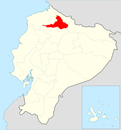 Location of Imbabura Province in Ecuador. | |
 Cantons of Imbabura Province | |
| Coordinates: 0°21′45.64″N 78°07′50.40″W | |
| Country | |
| Province | Imbabura Province |
| Capital | Ibarra |
| Population (2010) | |
| • Total | 181,175 |
| Time zone | UTC-5 (ECT) |
Ibarra is located in the Andes region of northern Ecuador. The capital city is situated at an altitude of 2,225 metres (7,300 ft) above sea level.[3]
The canton is divided into seven parishes: Ambuqui (Ampuki), Angochagua (Ankuchawa), Carolina (Karulina), La Esperanza, Lita, Salinas, San Antonio de Ibarra.[4]
Demographics
Ethnic groups as of the Ecuadorian census of 2010:[5]
- Mestizo 78.2%
- Indigenous 8.8%
- Afro-Ecuadorian 8.7%
- White 3.8%
- Montubio 0.3%
- Other 0.2%
See also
- Inca-Caranqui, archaeological site
- La Esperanza, Ecuador
- Yawarkucha
References
- Cantons of Ecuador at statoids.com
- "Ecuador: Municipal Divisions", https://www.citypopulation.de-php/ecuador-parish-admin.php, accessed 14 July 2017
- Google Earth
- https://www.citypopulation.de-php/ecuador-parish-admin.php [dead link]
- "Resultados".
| Azuay | |
|---|---|
| Bolívar | |
| Cañar | |
| Carchi | |
| Chimborazo | |
| Cotopaxi | |
| El Oro | |
| Esmeraldas | |
| Galápagos | |
| Guayas |
|
| Imbabura | |
| Loja | |
| Los Ríos | |
| Manabí | |
| Morona-Santiago | |
| Napo | |
| Orellana | |
| Pastaza | |
| Pichincha | |
| Santa Elena | |
| Santo Domingo de los Tsáchilas |
|
| Sucumbíos | |
| Tungurahua | |
| Zamora-Chinchipe | |
Authority control | |
|---|---|
| General |
|
| National libraries | |
This Ecuador location article is a stub. You can help Wikipedia by expanding it. |
На других языках
[de] Kanton Ibarra
Der Kanton Ibarra befindet sich in der Provinz Imbabura im Norden von Ecuador. Er besitzt eine Fläche von 1093 km². Im Jahr 2020 lag die Einwohnerzahl schätzungsweise bei 221.000. Verwaltungssitz des Kantons ist die Provinzhauptstadt Ibarra mit 131.800 Einwohnern (Stand 2010). Der Kanton Ibarra wurde am 24. Juni 1824 gegründet.- [en] Ibarra Canton
Текст в блоке "Читать" взят с сайта "Википедия" и доступен по лицензии Creative Commons Attribution-ShareAlike; в отдельных случаях могут действовать дополнительные условия.
Другой контент может иметь иную лицензию. Перед использованием материалов сайта WikiSort.org внимательно изучите правила лицензирования конкретных элементов наполнения сайта.
Другой контент может иметь иную лицензию. Перед использованием материалов сайта WikiSort.org внимательно изучите правила лицензирования конкретных элементов наполнения сайта.
2019-2026
WikiSort.org - проект по пересортировке и дополнению контента Википедии
WikiSort.org - проект по пересортировке и дополнению контента Википедии