world.wikisort.org - Ecuador
Antonio Ante Canton is a canton of Ecuador, located in Imbabura Province. Its population at the 2001 census was 36,053.[1] and increased to 43,518 in the 2010 census.[2] The canton has an area of 81 square kilometres (31 sq mi).
Antonio Ante Canton | |
|---|---|
Canton | |
 Flag | |
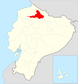 Location of Imbabura Province in Ecuador. | |
 Cantons of Imbabura Province | |
| Coordinates: 0.32°N 78.21°W | |
| Country | |
| Province | Imbabura Province |
| Capital | Atuntaqui |
| Time zone | UTC-5 (ECT) |
Its capital is the town of Atuntaqui, located 10 kilometres (6.2 mi) east in straight line distance from the provincial capital of Ibarra. The province is in the Andes, the capital at an elevation of 2,405 metres (7,890 ft) above sea level.[3]
Antonio Ante is divided into five parishes: Atuntaqui (Hauntaki), Imbaya (San Luis de Cobuendo), San Francisco de Natabuela (Natawila), San José de Chaltura, and San Roque.[4]
Demographics
Ethnic groups as of the Ecuadorian census of 2010:[5]
- Mestizo 77.6%
- Indigenous 17.8%
- White 2.5%
- Afro-Ecuadorian 1.8%
- Montubio 0.2%
- Other 0.1%
References
- Cantons of Ecuador at statoids.com
- "Ecuador: Municipal Division", https://www.citypopulation.de/php/ecuador-parish-admin.php, accessed 10 Jul 2017
- Google Earth
- "Ecuador: Municipal Division," https://citypopulation.de/php/ecuador-parish-admin.php, accessed 13 Jul 2017
- "Resultados".
| Azuay |
|
|---|---|
| Bolívar | |
| Cañar |
|
| Carchi |
|
| Chimborazo | |
| Cotopaxi | |
| El Oro | |
| Esmeraldas |
|
| Galápagos |
|
| Guayas |
|
| Imbabura |
|
| Loja | |
| Los Ríos | |
| Manabí |
|
| Morona-Santiago |
|
| Napo | |
| Orellana |
|
| Pastaza |
|
| Pichincha |
|
| Santa Elena |
|
| Santo Domingo de los Tsáchilas |
|
| Sucumbíos |
|
| Tungurahua | |
| Zamora-Chinchipe | |
This Ecuador location article is a stub. You can help Wikipedia by expanding it. |
Другой контент может иметь иную лицензию. Перед использованием материалов сайта WikiSort.org внимательно изучите правила лицензирования конкретных элементов наполнения сайта.
WikiSort.org - проект по пересортировке и дополнению контента Википедии