world.wikisort.org - Ecuador
Palanda Canton is a canton of Ecuador, located in the Zamora-Chinchipe Province. Its capital is the town of Palanda. Its population at the 2001 census was 7,066.[1]
Palanda Canton | |
|---|---|
Canton | |
 Flag | |
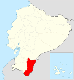 Location of Zamora Chinchipe Province in Ecuador. | |
 Cantons of Zamora Chinchipe Province | |
| Coordinates: 4.6498°S 79.1321°W | |
| Country | |
| Province | Zamora-Chinchipe Province |
| Capital | Palanda |
| Time zone | UTC-5 (ECT) |
History
This canton has a long history, from the earliest known humans occupation[2] to one of the latest inca battle, just before the colonial time.[3]
Parishes
The canton is administratively divided into 4 parishes
- Vergel
- Palanda
- El Porvenir
- Valladolid
Archaeology
The site of Santa Ana (La Florida) is located just to the north of Palanda.[4] This is an important archaeological site going back as early as 3,500 BC.
The work in this area was started in 2002 by a team of French and Ecuadoran archaeologists.
References
- Cantons of Ecuador at statoids.com
- "Mayo-Chinchipe - Proyecto Zamora Chinchipe". Archived from the original on 2014-11-29. Retrieved 2010-05-27.
- "San Agustín - Proyecto Zamora Chinchipe". Archived from the original on 2013-10-01. Retrieved 2010-05-27.
- area map
Bibliography
- Human settlements already existed in the Amazon Basin (Ecuador) 4000 years ago. 12-May-2004 eurekalert.org
- Valdez, Francisco. “Inter-zonal relationships in Ecuador”, en Handbook of South American Archaeology, Helaine Silverman y William Isbell eds., Springer, pp. 865–891, 2008
- Valdez, Francisco; Jean Gufroy; Geoffroy de Saulieu; Julio Hurtado; Alexandra Yépez (2005), Découverte d’un site cérémoniel formatif sur le versant oriental des Andes Proyecto Zamora Chinchipe
| Azuay |
|
|---|---|
| Bolívar | |
| Cañar |
|
| Carchi |
|
| Chimborazo |
|
| Cotopaxi |
|
| El Oro | |
| Esmeraldas |
|
| Galápagos |
|
| Guayas |
|
| Imbabura | |
| Loja | |
| Los Ríos |
|
| Manabí |
|
| Morona-Santiago |
|
| Napo |
|
| Orellana |
|
| Pastaza |
|
| Pichincha |
|
| Santa Elena |
|
| Santo Domingo de los Tsáchilas |
|
| Sucumbíos |
|
| Tungurahua | |
| Zamora-Chinchipe |
|
This Ecuador location article is a stub. You can help Wikipedia by expanding it. |
Текст в блоке "Читать" взят с сайта "Википедия" и доступен по лицензии Creative Commons Attribution-ShareAlike; в отдельных случаях могут действовать дополнительные условия.
Другой контент может иметь иную лицензию. Перед использованием материалов сайта WikiSort.org внимательно изучите правила лицензирования конкретных элементов наполнения сайта.
Другой контент может иметь иную лицензию. Перед использованием материалов сайта WikiSort.org внимательно изучите правила лицензирования конкретных элементов наполнения сайта.
2019-2026
WikiSort.org - проект по пересортировке и дополнению контента Википедии
WikiSort.org - проект по пересортировке и дополнению контента Википедии