world.wikisort.org - China
Songpan; former Songzhou, is a county of northwestern Sichuan province, China, and is one of the 13 counties administered by the Ngawa Tibetan and Qiang Autonomous Prefecture. It has an area of 8,486 square kilometres (3,276 sq mi), and a population of approximately 68,000 composed of Tibetan, Qiang, Han and Hui populations.
This article includes a list of general references, but it lacks sufficient corresponding inline citations. (December 2021) |
Songpan County
松潘县 | |
|---|---|
County | |
 Terrace in Huanglong Scenic and Historic Interest Area | |
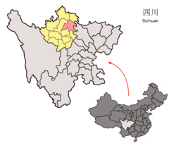 Location of Songpan County (red) within Ngawa Prefecture (yellow) and Sichuan | |
 Songpan Location of the seat in Sichuan | |
| Coordinates: 32°39′N 103°36′E | |
| Country | People's Republic of China |
| Province | Sichuan |
| Prefecture | Ngawa |
| County seat | Jin'an |
| Area | |
| • Total | 8,486 km2 (3,276 sq mi) |
| Elevation | 2,867 m (9,406 ft) |
| Population (2002) | |
| • Total | 67,972 |
| • Density | 8.0/km2 (21/sq mi) |
| • Major nationalities | Tibetan Han Qiang Hui |
| Time zone | UTC+8 (China Standard) |
| Postal code | 623300 |
| Area code | 0837 |
| Website | http://www.songpan.gov.cn/ |
| Songpan County | |||||||
|---|---|---|---|---|---|---|---|
| Chinese name | |||||||
| Chinese | 松潘 | ||||||
| |||||||
| Alternative Chinese name | |||||||
| Chinese | 松州 | ||||||
| |||||||
| Tibetan name | |||||||
| Tibetan | ཟུང་ཆུ། | ||||||
| |||||||
Transport
- China National Highway 213
- Jiuzhai Huanglong Airport
Economy and Tourism
The economy of Songpan is dominated by agriculture and livestock raising. In recent years, tourism has become an increasingly important sector, and is actively promoted by the authorities. Additionally, Songpan is popular among foreign students and other Chinese language learners staying in China as the base for treks through the scenic mountains nearby. Apart from the scenic attraction of Huanglong Scenic and Historic Interest Area which is located in the county, Songpan with its strategic location also acts as the gateway to Jiuzhaigou Valley at the north.
History

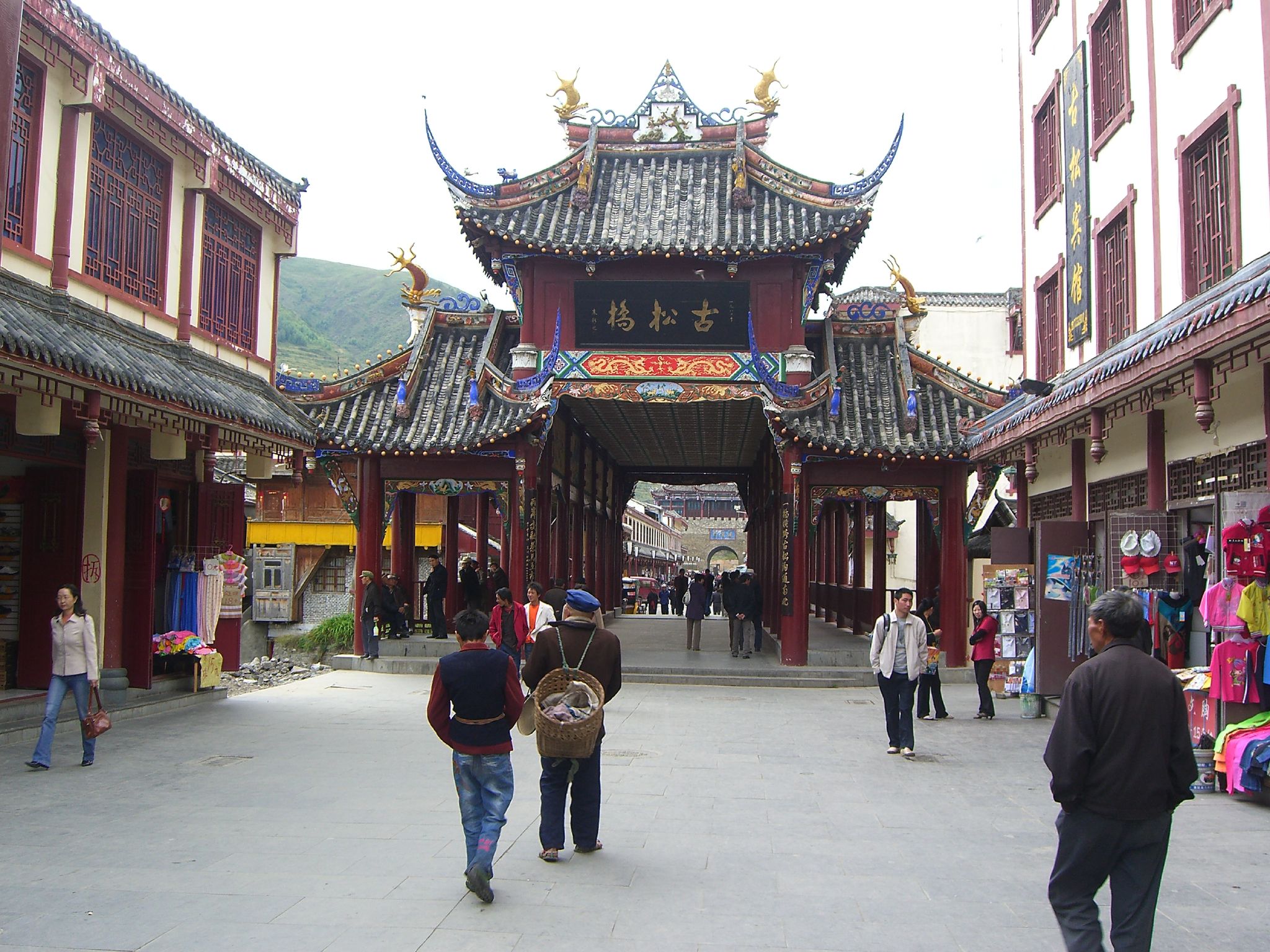
The ancient city of Songpan was built during the Tang dynasty and it was later rebuilt during Ming dynasty. Songpan was an important military post. It was also an important economic and trading center for horse and tea exchange between Sichuan, Gansu, Qinghai and Tibet.
During Tang rule, it was the border with the Tibetan Empire. Emperor Songtsen Gampo of Tibet tried to invade Tang China through this gate. Emperor Taizong of Tang offered him Princess Wencheng at Songzhou (now Songpan) in 641. According to Tibetan and Chinese legends, Princess Wencheng then brings with her among other things the Jowo statue to the Tibetan Empire. Throughout the Ming dynasty, the Chinese court was troubled by the frequent invasion of the Songpan area.[1] The area was given to a Tibetan lama friendly with the Chinese court to maintain frontier control while leaving it in local hands.
In August 1935, led by Mao Zedong and Zhou Enlai, the retreating People's Liberation Army marched through the Songpan Grasslands to advance to the northwestern province.
While Songpan can be a charming city in its own right, the countryside surrounding the city offers a variety of tourist attractions. The hills surrounding the city are visual delights of Tibetan cattle herders leading their livestock over rolling grasses, endless valleys, and generally beautiful landscape. All of this can be seen through affordable horseback riding outlets on the outskirts of the city.
Geography and climate
Songpan covers latitudes 32° 06′−33° 09′ N and longitudes 102° 38′−104° 15′ E, and has a total area of 8,608 square kilometres (3,324 sq mi). Neighbouring counties are Pingwu to the east, Beichuan to the southeast, Mao to the south, Hongyuan and Heishui to the southwest, and Jiuzhaigou and Zoigê to the north.
Due to its altitude, Songpan has a humid continental climate (Köppen Dwb), with cool winters and warm, rainy summers. The monthly 24-hour average temperature ranges from −3.4 °C (25.9 °F) in January to 14.8 °C (58.6 °F) in July, and the annual mean is 6.28 °C (43.3 °F). The high elevation also results in a large diurnal temperature variation, exceeding 17 °C (31 °F) in winter. More than 70% of the 708 mm (27.9 in) of annual precipitation occurs from May to September. With monthly percent possible sunshine ranging from 31% in September to 57% in December, the county seat receives 1,831 hours of bright sunshine annually.
| Climate data for Songpan (1981−2010 normals) | |||||||||||||
|---|---|---|---|---|---|---|---|---|---|---|---|---|---|
| Month | Jan | Feb | Mar | Apr | May | Jun | Jul | Aug | Sep | Oct | Nov | Dec | Year |
| Record high °C (°F) | 22.3 (72.1) |
21.2 (70.2) |
24.6 (76.3) |
27.8 (82.0) |
35.6 (96.1) |
29.6 (85.3) |
30.5 (86.9) |
29.3 (84.7) |
29.5 (85.1) |
26.7 (80.1) |
21.4 (70.5) |
19.7 (67.5) |
35.6 (96.1) |
| Average high °C (°F) | 7.0 (44.6) |
8.9 (48.0) |
11.9 (53.4) |
15.0 (59.0) |
18.0 (64.4) |
20.1 (68.2) |
22.4 (72.3) |
22.3 (72.1) |
18.8 (65.8) |
14.7 (58.5) |
11.1 (52.0) |
7.9 (46.2) |
14.8 (58.7) |
| Daily mean °C (°F) | −3.4 (25.9) |
−0.7 (30.7) |
3.1 (37.6) |
6.7 (44.1) |
10.1 (50.2) |
12.9 (55.2) |
14.8 (58.6) |
14.4 (57.9) |
11.5 (52.7) |
7.0 (44.6) |
1.6 (34.9) |
−2.7 (27.1) |
6.3 (43.3) |
| Average low °C (°F) | −10.2 (13.6) |
−7.2 (19.0) |
−2.9 (26.8) |
0.9 (33.6) |
4.6 (40.3) |
8.0 (46.4) |
9.7 (49.5) |
9.2 (48.6) |
7.0 (44.6) |
2.6 (36.7) |
−4.2 (24.4) |
−9.3 (15.3) |
0.7 (33.2) |
| Record low °C (°F) | −19.8 (−3.6) |
−18.5 (−1.3) |
−17.4 (0.7) |
−8.7 (16.3) |
−3.1 (26.4) |
0.6 (33.1) |
2.0 (35.6) |
0.6 (33.1) |
−1.8 (28.8) |
−8.7 (16.3) |
−14.8 (5.4) |
−20.7 (−5.3) |
−20.7 (−5.3) |
| Average precipitation mm (inches) | 6.4 (0.25) |
12.0 (0.47) |
33.2 (1.31) |
62.7 (2.47) |
105.6 (4.16) |
114.5 (4.51) |
95.8 (3.77) |
86.8 (3.42) |
102.6 (4.04) |
71.0 (2.80) |
13.3 (0.52) |
4.4 (0.17) |
708.3 (27.89) |
| Average precipitation days (≥ 0.1 mm) | 6.0 | 8.1 | 13.5 | 17.2 | 20.4 | 21.7 | 18.5 | 15.4 | 19.1 | 17.9 | 6.4 | 4.1 | 168.3 |
| Average relative humidity (%) | 50 | 53 | 58 | 62 | 65 | 71 | 72 | 72 | 73 | 71 | 60 | 53 | 63 |
| Mean monthly sunshine hours | 169.0 | 148.4 | 160.5 | 163.3 | 159.3 | 136.8 | 153.3 | 164.8 | 113.5 | 129.6 | 157.0 | 175.6 | 1,831.1 |
| Percent possible sunshine | 53 | 48 | 43 | 42 | 37 | 32 | 35 | 40 | 31 | 37 | 50 | 57 | 41 |
| Source: China Meteorological Administration (precipitation days and sunshine 1971–2000)[2][3] | |||||||||||||
Administrative divisions
Mao County has 7 townships:
- Townships:
- Anhong (安宏乡)
- Baiyang (白羊乡)
- Caoyuan (草原乡)
- Hongtu (红土乡)
- Hongxing (红星乡)
- Xiaoxing (小姓乡)
- Zhenjiang (镇江乡)
See also
- Jiandi Dao
- 1976 Songpan-Pingwu earthquake
Gallery
 Street peddlers in Songpan, 2002
 Street peddlers in Songpan, 2002
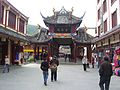 Songpan Bridge


References
- Kapstein, Matthew (2009). Buddhism between Tibet and China. Wisdom Publications.
- 中国气象数据网 - WeatherBk Data (in Chinese (China)). China Meteorological Administration. Retrieved 2020-04-15.
- 中国地面国际交换站气候标准值月值数据集(1971-2000年). China Meteorological Administration. Archived from the original on 2013-09-21. Retrieved 2010-05-25.
External links
На других языках
[de] Sungqu
Sungqu, chinesisch: Songpan, (chinesisch .mw-parser-output .Hani{font-size:110%}松潘县, Pinyin Sōngpān Xiàn) ist ein Kreis des Autonomen Bezirks Ngawa der Tibeter und Qiang im Norden der chinesischen Provinz Sichuan. Sein Hauptort ist die Großgemeinde Jin’an (进安镇). Der Kreis hat eine Fläche von 7.837 km² und 66.937 Einwohner (Stand: Zensus 2020).[1]- [en] Songpan County
[ru] Сунгчу
Сунгчу (тиб. ཟུང་ཆུ, Вайли: zung chu, тиб. пиньинь: Sungqu) или Сунпань (кит. упр. 松潘, пиньинь Sōngpān) — уезд Нгава-Тибетско-Цянского автономного округа провинции Сычуань (КНР). Правление уезда размещается в посёлке Цзиньань.Другой контент может иметь иную лицензию. Перед использованием материалов сайта WikiSort.org внимательно изучите правила лицензирования конкретных элементов наполнения сайта.
WikiSort.org - проект по пересортировке и дополнению контента Википедии