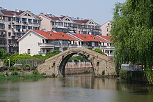
world.wikisort.org - China
Jiashan County (simplified Chinese: 嘉善县; traditional Chinese: 嘉善縣; pinyin: Jiāshàn Xiàn) is a county in the north of Zhejiang Province, bordering Shanghai to the northeast and Jiangsu province to the north. It is administered by the prefecture-level city of Jiaxing. Jiashan is nicknamed "The Land of Fish and Rice", and is 80 km (50 mi) southwest of central Shanghai, 95 km (59 mi) east of Hangzhou, and 90 km (56 mi) south of Suzhou. The county seat is located on 126 People Avenue, Weitang Town.
This article needs to be updated. (May 2022) |
Jiashan
嘉善县 Kashan | |
|---|---|
County | |
 Jiashan | |
 Jiashan Location of the seat in Zhejiang | |
| Coordinates: 30°49′52″N 120°55′34″E | |
| Country | People's Republic of China |
| Province | Zhejiang |
| Prefecture-level city | Jiaxing |
| Time zone | UTC+8 (China Standard) |
The second campus of Sanda University, known as Guangbiao Institute, is located in Jiashan County.
History
Jiashan formerly was part of Jiaxing. In 1430, Jiashan was established.
On 1 November 2022, the county was named by a guideline of the National Development and Reform Commission (NDRC) as a "leading trial area" for common prosperity.[1]
Administration divisions

Jiashan County consists of six towns, three subdistricts, 11 communities, 16 residential zones and 164 administrative villages.
Subdistricts
- Weitang(Former Weitang, Lize, Fengnan)
- Luoxing
- Huimin(Former Huimin, Datong)
Towns
- Northwest: Taozhuang(Former Taozhuang, Fenyu)
- North: Xitang(Former Xitang, Dashun, Xiadianmiao)
- Northeast: Yaozhuang(Former Yaozhuang, Dingzha, Yuhui)
- Southwest: Tianning(Former Tianning, Hongxi, Yangmiao)
- Centre: Ganyao(Former Ganyao, Fanjing)
- South: Dayun
Climate
| Climate data for Jiashan (1981−2010) | |||||||||||||
|---|---|---|---|---|---|---|---|---|---|---|---|---|---|
| Month | Jan | Feb | Mar | Apr | May | Jun | Jul | Aug | Sep | Oct | Nov | Dec | Year |
| Record high °C (°F) | 22.5 (72.5) |
27.4 (81.3) |
30.2 (86.4) |
33.7 (92.7) |
35.6 (96.1) |
38.1 (100.6) |
40.0 (104.0) |
40.2 (104.4) |
36.6 (97.9) |
33.3 (91.9) |
29.4 (84.9) |
23.7 (74.7) |
40.2 (104.4) |
| Average high °C (°F) | 8.0 (46.4) |
9.9 (49.8) |
13.8 (56.8) |
19.8 (67.6) |
25.2 (77.4) |
28.1 (82.6) |
32.4 (90.3) |
31.7 (89.1) |
27.7 (81.9) |
22.9 (73.2) |
17.1 (62.8) |
10.9 (51.6) |
20.6 (69.1) |
| Daily mean °C (°F) | 4.0 (39.2) |
5.8 (42.4) |
9.4 (48.9) |
15.0 (59.0) |
20.4 (68.7) |
24.1 (75.4) |
28.3 (82.9) |
27.9 (82.2) |
23.8 (74.8) |
18.4 (65.1) |
12.5 (54.5) |
6.4 (43.5) |
16.3 (61.4) |
| Average low °C (°F) | 0.9 (33.6) |
2.5 (36.5) |
5.9 (42.6) |
11.2 (52.2) |
16.6 (61.9) |
21.1 (70.0) |
25.1 (77.2) |
25.0 (77.0) |
20.7 (69.3) |
14.8 (58.6) |
8.7 (47.7) |
2.8 (37.0) |
12.9 (55.3) |
| Record low °C (°F) | −7.6 (18.3) |
−6.6 (20.1) |
−3.9 (25.0) |
0.3 (32.5) |
8.5 (47.3) |
13.2 (55.8) |
18.4 (65.1) |
18.1 (64.6) |
12.4 (54.3) |
2.4 (36.3) |
−2.3 (27.9) |
−8.9 (16.0) |
−8.9 (16.0) |
| Average precipitation mm (inches) | 64.9 (2.56) |
67.4 (2.65) |
113.2 (4.46) |
95.9 (3.78) |
105.5 (4.15) |
181.9 (7.16) |
149.6 (5.89) |
147.1 (5.79) |
107.5 (4.23) |
56.9 (2.24) |
56.1 (2.21) |
42.1 (1.66) |
1,188.1 (46.78) |
| Average relative humidity (%) | 77 | 77 | 78 | 78 | 77 | 82 | 81 | 82 | 82 | 80 | 78 | 76 | 79 |
| Source: China Meteorological Data Service Center[2] | |||||||||||||
Economy
Transportation
Road
- G320
- Shen-Jia-Hu High Way
- Hu-Hang High Way
- Ping-Li County Road
- Chang-Jia High Way
Railway
- Hu-Kun Railway
- Hu-Hang High Railway
Water
- Hongqitang Canel
- Luxutang Canel
- Taipu River
Industry
Agriculture
Tourism
Culture
Education
- Jiashan Senior High School
- Jiashan Second Senior High School
- Jiashan High School
Notable people
- Wu Zhen, a painter in Yuan Dynasty
- Qian Nengxun, a premier of the Republic of China
- Sun Daolin, a renowned Chinese actor
- Huang Ju, Mayor and Party chief of Shanghai, Vice-Premier of the People's Republic of China
See also
References
- Wang, Orange (2022-11-03). "China names model county in inequality reduction campaign". South China Morning Post. Retrieved 2022-11-04.
- 中国地面气候标准值月值(1981-2010) (in Simplified Chinese). China Meteorological Data Service Center. Retrieved 24 September 2022.
External links
На других языках
[de] Jiashan
Jiashan (.mw-parser-output .Hans{font-size:110%}嘉善县, Jiāshàn Xiàn) ist ein Kreis der bezirksfreien Stadt Jiaxing im Norden der chinesischen Provinz Zhejiang. Er hat eine Fläche von 505,9 km² und zählt 648.160 Einwohner (Stand: Zensus 2020).[1]- [en] Jiashan County
[ru] Цзяшань
Цзяша́нь (кит. упр. 嘉善, пиньинь Jiāshàn) — уезд городского округа Цзясин провинции Чжэцзян (КНР).Другой контент может иметь иную лицензию. Перед использованием материалов сайта WikiSort.org внимательно изучите правила лицензирования конкретных элементов наполнения сайта.
WikiSort.org - проект по пересортировке и дополнению контента Википедии