world.wikisort.org - China
Shengsi County is a county in the northeast of Zhejiang province consisting of an archipelago islands located to the east of Hangzhou Bay. It is under the administration of Zhoushan City and is the easternmost county-level division in the province. The islands of Greater and Lesser Yangshan are connected with Shanghai's Pudong New Area by the Donghai Bridge and their port forms part of the Port of Shanghai. They are, however, not counted among the islands of Shanghai.
This article needs additional citations for verification. (March 2020) |
Shengsi
嵊泗县 | |
|---|---|
County | |
 | |
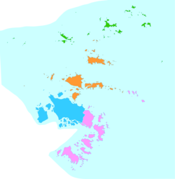 Shengsi County is in green here on the map. | |
 Shengsi Location in Zhejiang | |
| Coordinates: 30°43′26″N 122°27′16″E | |
| Country | People's Republic of China |
| Province | Zhejiang |
| Prefecture-level city | Zhoushan |
| Area | |
| • Land | 86 km2 (33 sq mi) |
| • Water | 8,738 km2 (3,374 sq mi) |
| Population (2018) | |
| • Total | 75,221 |
| Time zone | UTC+8 (China Standard) |
| Postal code | 202450 |
| Website | www |
| Shengsi | |||||||||
|---|---|---|---|---|---|---|---|---|---|
| Chinese | 嵊泗 | ||||||||
| Postal | Shengsze | ||||||||
| |||||||||
The county consists of 630 islands and islets, of which 13 have more than 100 inhabitants.[1]
Administrative divisions
Towns:[2]
- Caiyuan (菜园镇), Shengshan (嵊山镇), Yangshan (洋山镇)
Townships:
- Wulong Township (五龙乡), Huanglong Township (黄龙乡), Gouqi Township (枸杞乡), Huadao Township (花鸟乡)
Climate
| Climate data for Shengsi (1981−2010) | |||||||||||||
|---|---|---|---|---|---|---|---|---|---|---|---|---|---|
| Month | Jan | Feb | Mar | Apr | May | Jun | Jul | Aug | Sep | Oct | Nov | Dec | Year |
| Record high °C (°F) | 22.2 (72.0) |
25.9 (78.6) |
27.0 (80.6) |
29.8 (85.6) |
30.3 (86.5) |
34.3 (93.7) |
36.3 (97.3) |
36.4 (97.5) |
35.1 (95.2) |
32.4 (90.3) |
25.3 (77.5) |
21.9 (71.4) |
36.4 (97.5) |
| Average high °C (°F) | 8.5 (47.3) |
9.3 (48.7) |
12.2 (54.0) |
16.9 (62.4) |
21.7 (71.1) |
25.2 (77.4) |
29.6 (85.3) |
29.9 (85.8) |
26.7 (80.1) |
22.3 (72.1) |
17.3 (63.1) |
11.5 (52.7) |
19.3 (66.7) |
| Daily mean °C (°F) | 5.8 (42.4) |
6.5 (43.7) |
9.2 (48.6) |
13.6 (56.5) |
18.5 (65.3) |
22.4 (72.3) |
26.5 (79.7) |
26.9 (80.4) |
24.1 (75.4) |
19.8 (67.6) |
14.8 (58.6) |
8.8 (47.8) |
16.4 (61.5) |
| Average low °C (°F) | 3.7 (38.7) |
4.4 (39.9) |
6.9 (44.4) |
11.2 (52.2) |
16.1 (61.0) |
20.4 (68.7) |
24.3 (75.7) |
24.8 (76.6) |
22.3 (72.1) |
17.9 (64.2) |
12.7 (54.9) |
6.7 (44.1) |
14.3 (57.7) |
| Record low °C (°F) | −5.5 (22.1) |
−3.0 (26.6) |
−2.5 (27.5) |
3.7 (38.7) |
8.1 (46.6) |
12.7 (54.9) |
18.0 (64.4) |
18.9 (66.0) |
15.0 (59.0) |
8.1 (46.6) |
0.8 (33.4) |
−5.7 (21.7) |
−5.7 (21.7) |
| Average precipitation mm (inches) | 57.0 (2.24) |
67.2 (2.65) |
110.6 (4.35) |
101.1 (3.98) |
101.8 (4.01) |
160.7 (6.33) |
107.9 (4.25) |
120.1 (4.73) |
92.9 (3.66) |
76.6 (3.02) |
59.1 (2.33) |
50.9 (2.00) |
1,105.9 (43.55) |
| Average relative humidity (%) | 74 | 75 | 79 | 80 | 82 | 88 | 86 | 85 | 80 | 73 | 71 | 71 | 79 |
| Source: China Meteorological Data Service Center[3] | |||||||||||||
See also
References
- "嵊泗县人民政府 嵊泗简介" [Shengsi County People's Government Introduction to Shengsi]. www.shengsi.gov.cn. Retrieved 2021-04-04.
{{cite web}}: CS1 maint: url-status (link) - "舟山市-行政区划网 www.xzqh.org" (in Chinese). XZQH. Retrieved 2012-05-24.
- 中国地面气候标准值月值(1981-2010) (in Simplified Chinese). China Meteorological Data Service Center. Retrieved 5 November 2022.
На других языках
[de] Shengsi
Shengsi (嵊泗县, Shèngsì Xiàn) ist ein Kreis der bezirksfreien Stadt Zhoushan in der südostchinesischen Provinz Zhejiang. Er erstreckt sich über 404 größere und kleinere Inseln, von denen 15 ständig bewohnt sind. Die Landfläche der Inseln beträgt 70,03 km², das zugehörige Seegebiet umfasst 8.738 km². Die Einwohnerzahl beträgt 66.903 (Stand: Zensus 2020)[2], 2002 lag sie bei ca. 80.000 Menschen, und zur Volkszählung 2010 bei 76.108.- [en] Shengsi County
[ru] Шэнсы
Шэнсы́ (кит. упр. 嵊泗, пиньинь Shèngsì) — уезд городского округа Чжоушань провинции Чжэцзян (КНР).Текст в блоке "Читать" взят с сайта "Википедия" и доступен по лицензии Creative Commons Attribution-ShareAlike; в отдельных случаях могут действовать дополнительные условия.
Другой контент может иметь иную лицензию. Перед использованием материалов сайта WikiSort.org внимательно изучите правила лицензирования конкретных элементов наполнения сайта.
Другой контент может иметь иную лицензию. Перед использованием материалов сайта WikiSort.org внимательно изучите правила лицензирования конкретных элементов наполнения сайта.
2019-2026
WikiSort.org - проект по пересортировке и дополнению контента Википедии
WikiSort.org - проект по пересортировке и дополнению контента Википедии