world.wikisort.org - China
Putuo District is a district of Zhoushan City, Zhejiang, China with a population of 378,805.
Putuo
普陀区 | |
|---|---|
District | |
 | |
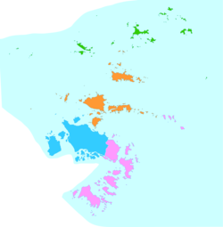 Putuo District is in pink here on the map. | |
 Putuo Location in Zhejiang | |
| Coordinates: 29°54′N 122°23′E | |
| Country | People's Republic of China |
| Province | Zhejiang |
| Prefecture-level city | Zhoushan |
| Area | |
| • Total | 55.53 km2 (21.44 sq mi) |
| Population (2017) | |
| • Total | 1,284,700 |
| • Density | 23,000/km2 (60,000/sq mi) |
| Time zone | UTC+8 (China Standard) |
| Postal code | 200333 |
| Putuo (the former county) | |||||||||
|---|---|---|---|---|---|---|---|---|---|
| Chinese | 普陀 | ||||||||
| Postal | Puto | ||||||||
| |||||||||
The district used to be a county. In 1987, it was combined with the neighbouring county of Dinghai to form the city of Zhoushan.
Basic Information
- District Seat: Shenjiamen Sub-District
- Population: 378,805[1] as of November 1, 2010
- Area: 6,730 km2 (2,600 sq mi) (459 km2 or 177 sq mi terrestrial, 6,271 km2 or 2,421 sq mi marine)
- Population Density: 825/km2 (2,140/sq mi)
- Gross Domestic Product: 24.6 billion yuan [2] as of 2011
- Per capita GDP: 64,941 yuan (approximately 10,443 US Dollars)
Geography
Putuo District occupies the southeastern part of Zhoushan archipelago. It includes the eastern end of the archipelago Zhoushan Island, which is the largest island of the archipelago, and many dozens of smaller islands. Among them:
- the small, but famous Putuo Island (Putuo Shan, i.e. "Mount Putuo"). Putuo Island with nearby small islets is administratively organized as Putuo Town within Putuo District.
- Zhujiajian Island (朱家尖), connected to Zhoushan Island by a bridge, and administratively organized as Zhujiajian Town.
- Dengbu Island, organized as an eponymous township
- Mayi Island (literally, "Ant Island"), organized as an eponymous township
- Zhongjieshan Island Chain (中街山列岛), organized as Dongji.
- many others, with half a dozen towns and townships on them
Administrative divisions
Subdistricts:[3]
- Shenjiamen Subdistrict (沈家门街道), Goushan Subdistrict (勾山街道), Donggang Subdistrict (东港街道), Zhanmao Subdistrict (展茅街道), Zhujiajian Subdistrict (朱家尖街道)
Towns:
- Liuheng (六横镇), Taohua (桃花镇), Xiazhi (虾峙镇), Dongji (东极镇), Putuoshan (普陀山镇)
Townships:
- Baisha Township (白沙乡), Dengbu Township (登步乡), Mayidao Township (蚂蚁岛乡)
Climate
| Climate data for Putuo (1981−2010) | |||||||||||||
|---|---|---|---|---|---|---|---|---|---|---|---|---|---|
| Month | Jan | Feb | Mar | Apr | May | Jun | Jul | Aug | Sep | Oct | Nov | Dec | Year |
| Record high °C (°F) | 21.5 (70.7) |
23.9 (75.0) |
28.9 (84.0) |
29.9 (85.8) |
29.7 (85.5) |
32.9 (91.2) |
38.1 (100.6) |
36.0 (96.8) |
36.1 (97.0) |
31.8 (89.2) |
27.2 (81.0) |
23.4 (74.1) |
38.1 (100.6) |
| Average high °C (°F) | 9.3 (48.7) |
10.1 (50.2) |
12.9 (55.2) |
17.7 (63.9) |
22.2 (72.0) |
25.7 (78.3) |
30.0 (86.0) |
30.6 (87.1) |
27.2 (81.0) |
22.9 (73.2) |
18.0 (64.4) |
12.4 (54.3) |
19.9 (67.9) |
| Daily mean °C (°F) | 6.2 (43.2) |
6.9 (44.4) |
9.6 (49.3) |
14.0 (57.2) |
18.6 (65.5) |
22.5 (72.5) |
26.4 (79.5) |
27.1 (80.8) |
24.2 (75.6) |
19.9 (67.8) |
14.9 (58.8) |
9.0 (48.2) |
16.6 (61.9) |
| Average low °C (°F) | 3.7 (38.7) |
4.4 (39.9) |
7.0 (44.6) |
11.3 (52.3) |
16.1 (61.0) |
20.3 (68.5) |
24.1 (75.4) |
24.7 (76.5) |
22.0 (71.6) |
17.6 (63.7) |
12.4 (54.3) |
6.5 (43.7) |
14.2 (57.5) |
| Record low °C (°F) | −5.7 (21.7) |
−3.6 (25.5) |
−1.5 (29.3) |
3.3 (37.9) |
8.3 (46.9) |
12.5 (54.5) |
18.3 (64.9) |
19.0 (66.2) |
15.5 (59.9) |
6.8 (44.2) |
1.1 (34.0) |
−5.4 (22.3) |
−5.7 (21.7) |
| Average precipitation mm (inches) | 69.5 (2.74) |
75.7 (2.98) |
135.0 (5.31) |
112.2 (4.42) |
118.3 (4.66) |
165.9 (6.53) |
96.3 (3.79) |
123.3 (4.85) |
162.2 (6.39) |
95.5 (3.76) |
78.9 (3.11) |
59.2 (2.33) |
1,292 (50.87) |
| Average relative humidity (%) | 74 | 76 | 79 | 81 | 85 | 79 | 88 | 86 | 81 | 75 | 73 | 71 | 79 |
| Source: China Meteorological Data Service Center[4] | |||||||||||||
Sister cities
 Port St. Lucie, Florida, United States of America
References
- "2008ÖÛɽͳ¼ÆÄê¼ø". Archived from the original on 2013-11-07. Retrieved 2013-01-31.
- "舟山普陀区简介--浙江频道--人民网". Archived from the original on 2013-02-19. Retrieved 2013-01-31.
- "舟山市-行政区划网 www.xzqh.org" (in Chinese). XZQH. Retrieved 2012-05-24.
- 中国地面气候标准值月值(1981-2010) (in Simplified Chinese). China Meteorological Data Service Center. Retrieved 5 November 2022.
На других языках
[de] Putuo (Zhoushan)
Der Stadtbezirk Putuo (chinesisch .mw-parser-output .Hans{font-size:110%}普陀区, Pinyin Pǔtuó Qū) ist ein Stadtbezirk der bezirksfreien Stadt Zhoushan in der südostchinesischen Provinz Zhejiang. Die Fläche beträgt 386,5 Quadratkilometer und die Einwohnerzahl 382.902 (Stand: Zensus 2020).[1]- [en] Putuo District, Zhoushan
[fr] District de Putuo (Zhoushan)
Le district de Putuo (普陀区 ; pinyin : Pǔtuó Qū) est une subdivision administrative de la province du Zhejiang en Chine. Il est placé sous la juridiction de la ville-préfecture de Zhoushan. Le district tire son nom de l'île de Putuo, sur laquelle se trouve le Putuo Shan, une montagne sacrée.[ru] Путо (Чжоушань)
Путо́ (кит. упр. 普陀, пиньинь Pǔtuó) — район городского подчинения городского округа Чжоушань провинции Чжэцзян (КНР).Текст в блоке "Читать" взят с сайта "Википедия" и доступен по лицензии Creative Commons Attribution-ShareAlike; в отдельных случаях могут действовать дополнительные условия.
Другой контент может иметь иную лицензию. Перед использованием материалов сайта WikiSort.org внимательно изучите правила лицензирования конкретных элементов наполнения сайта.
Другой контент может иметь иную лицензию. Перед использованием материалов сайта WikiSort.org внимательно изучите правила лицензирования конкретных элементов наполнения сайта.
2019-2026
WikiSort.org - проект по пересортировке и дополнению контента Википедии
WikiSort.org - проект по пересортировке и дополнению контента Википедии