world.wikisort.org - China
Linhai (simplified Chinese: 临海; traditional Chinese: 臨海; pinyin: Línhǎi; Tai-chow dialect: Lin-he) is a county-level city in Taizhou, Zhejiang Province situated on the banks of the Lin River in Eastern China.
Linhai
临海市 | |
|---|---|
County-level city | |
 Linghu Scenic Area, 2019 | |
 Linhai Location in Zhejiang | |
| Coordinates: 28°51′N 121°07′E | |
| Country | People's Republic of China |
| Province | Zhejiang |
| Prefecture-level city | Taizhou |
| Area | |
| • County-level city | 2,171 km2 (838 sq mi) |
| • Urban | 2,171 km2 (838 sq mi) |
| • Metro | 2,171 km2 (838 sq mi) |
| Population | |
| • County-level city | 1,114,146 |
| • Density | 510/km2 (1,300/sq mi) |
| • Urban | 1,114,146 |
| • Urban density | 510/km2 (1,300/sq mi) |
| • Metro | 1,114,146 |
| • Metro density | 510/km2 (1,300/sq mi) |
| Time zone | UTC+8 (China Standard) |
| Website | www |
As of the 2020 census, its population was 1,114,146 inhabitants even though its built-up (or metro) area is much smaller.
Its Cathedral of the Sacred Heart of Jesus is the episcopal see of the Roman Catholic Diocese of Linhai.
History and sights

 Linhai Ancient City Wall, dubbed the "Great Wall of Jiangnan"
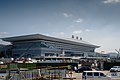 Linhai Railway Station


Its wall attracts many tourists. According to the tickets for access to the wall, construction of the wall, originally over 6 kilometres (3.7 miles) long, began in the Jin Dynasty (266–420) and was not finished until the Sui (581–618) and Tang (618–907) Dynasties. The northern portion, along a high ridge, and the western & southern portions, along the Lin River, still exist and are in good condition.
Administrative divisions
Subdistricts:[3]
- Gucheng Subdistrict (古城街道), Dayang Subdistrict (大洋街道), Jiangnan Subdistrict (江南街道), Datian Subdistrict (大田街道), Shaojiadu Subdistrict (邵家渡街道)
Towns:
- Xunqiao (汛桥镇), Dongcheng (东塍镇), Xiaozhi (小芝镇), Taozhu (桃渚镇), Shangpan (上盘镇), Duqiao (杜桥镇), Yongquan (涌泉镇), Youxi (尤溪镇), Hetou (河头镇), Yanjiang (沿江镇), Kuocang (括苍镇), Yongfeng (永丰镇), Huixi (汇溪镇), Baishuiyang (白水洋镇)
Climate
| Climate data for Linhai (1981−2010) | |||||||||||||
|---|---|---|---|---|---|---|---|---|---|---|---|---|---|
| Month | Jan | Feb | Mar | Apr | May | Jun | Jul | Aug | Sep | Oct | Nov | Dec | Year |
| Record high °C (°F) | 24.4 (75.9) |
29.9 (85.8) |
31.2 (88.2) |
35.8 (96.4) |
37.0 (98.6) |
39.0 (102.2) |
41.3 (106.3) |
39.8 (103.6) |
38.4 (101.1) |
35.1 (95.2) |
30.7 (87.3) |
26.0 (78.8) |
41.3 (106.3) |
| Average high °C (°F) | 11.3 (52.3) |
12.9 (55.2) |
16.3 (61.3) |
22.2 (72.0) |
26.5 (79.7) |
29.2 (84.6) |
33.7 (92.7) |
32.9 (91.2) |
29.0 (84.2) |
24.7 (76.5) |
19.5 (67.1) |
14.1 (57.4) |
22.7 (72.9) |
| Daily mean °C (°F) | 6.5 (43.7) |
8.1 (46.6) |
11.3 (52.3) |
16.7 (62.1) |
21.4 (70.5) |
24.8 (76.6) |
28.6 (83.5) |
28.1 (82.6) |
24.6 (76.3) |
19.8 (67.6) |
14.3 (57.7) |
8.6 (47.5) |
17.7 (63.9) |
| Average low °C (°F) | 3.1 (37.6) |
4.6 (40.3) |
7.7 (45.9) |
12.6 (54.7) |
17.7 (63.9) |
21.6 (70.9) |
24.8 (76.6) |
24.7 (76.5) |
21.4 (70.5) |
15.9 (60.6) |
10.5 (50.9) |
4.5 (40.1) |
14.1 (57.4) |
| Record low °C (°F) | −6.4 (20.5) |
−5.2 (22.6) |
−4.9 (23.2) |
0.1 (32.2) |
7.7 (45.9) |
12.4 (54.3) |
17.7 (63.9) |
17.8 (64.0) |
12.3 (54.1) |
1.9 (35.4) |
−1.3 (29.7) |
−6.0 (21.2) |
−6.4 (20.5) |
| Average precipitation mm (inches) | 63.2 (2.49) |
64.4 (2.54) |
131.4 (5.17) |
121.5 (4.78) |
148.5 (5.85) |
235.6 (9.28) |
214.3 (8.44) |
297.4 (11.71) |
217.4 (8.56) |
78.2 (3.08) |
73.1 (2.88) |
40.9 (1.61) |
1,685.9 (66.39) |
| Average relative humidity (%) | 73 | 74 | 77 | 76 | 78 | 83 | 79 | 81 | 80 | 76 | 74 | 71 | 77 |
| Source: China Meteorological Data Service Center[4] | |||||||||||||
References
- "China: Zhèjiāng (Prefectures, Cities, Districts and Counties) - Population Statistics, Charts and Map".
- "China: Zhèjiāng (Prefectures, Cities, Districts and Counties) - Population Statistics, Charts and Map". www.citypopulation.de. Retrieved 21 April 2018.
- "台州市-行政区划网 www.xzqh.org" (in Chinese). XZQH. Retrieved 2012-05-24.
- 中国地面气候标准值月值(1981-2010) (in Simplified Chinese). China Meteorological Data Service Center. Retrieved 5 November 2022.
Sources and external links
| Authority control: National libraries |
|---|
На других языках
- [en] Linhai
[fr] Linhai
Linhai (chinois : 临海市 ; pinyin : línhǎishi) est une ville de la province du Zhejiang en Chine. C'est une ville-district placée sous la juridiction administrative de la ville-préfecture de Taizhou. On y parle le wu ainsi que le mandarin.[it] Linhai
Linhai (临海市S, LínhǎiP) è una città-contea della Cina, situata nella provincia dello Zhejiang.[ru] Линьхай
Линьха́й (кит. упр. 临海, пиньинь Línhǎi) — городской уезд городского округа Тайчжоу провинции Чжэцзян (КНР).Другой контент может иметь иную лицензию. Перед использованием материалов сайта WikiSort.org внимательно изучите правила лицензирования конкретных элементов наполнения сайта.
WikiSort.org - проект по пересортировке и дополнению контента Википедии