world.wikisort.org - China
Conghua District, alternately romanized as Tsungfa,[lower-alpha 1] is one of 11 urban districts and the northernmost district of the prefecture-level city of Guangzhou, the capital of Guangdong Province, China. Conghua connects the Pearl River Delta with the mountainous area of northern Guangdong.[4] Within China, it is known for its hot springs[5] and lychees.[6] It covers an area of 1,974.15 km2 (762.22 sq mi), with a population of 543.377 in 2006. Its GDP was RMB10.369 billion (US$2,360 per person).[when?]
Conghua
从化区 Tsungfa | |
|---|---|
District | |
 Liuxi Riverfront Park in Jiekou Subdistrict | |
 | |
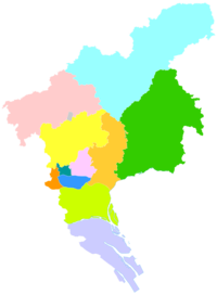 Conghua in Guangzhou | |
| Coordinates: 23°39′N 113°40′E | |
| Country | People's Republic of China |
| Province | Guangdong |
| Sub-provincial city | Guangzhou |
| Area | |
| • Total | 1,974.15 km2 (762.22 sq mi) |
| Population (2006) | |
| • Total | 543,377 |
| • Density | 280/km2 (710/sq mi) |
| Time zone | UTC+8 (China Standard) |
| Postal code | 510900 |
| Area code | 020 |
| Website | www |
| Conghua | |||||||||||||||||||
|---|---|---|---|---|---|---|---|---|---|---|---|---|---|---|---|---|---|---|---|
| Simplified Chinese | 从化 | ||||||||||||||||||
| Traditional Chinese | 從化 | ||||||||||||||||||
| Guangdong Romanization | Cung4-fa3 | ||||||||||||||||||
| Hanyu Pinyin | Cónghuà | ||||||||||||||||||
| Postal | Tsungfa | ||||||||||||||||||
| Literal meaning | From Change | ||||||||||||||||||
| |||||||||||||||||||
History
Under the Qing, the area was known as Conghua County. It was subsequently upgraded to county-level city status and then, on 12 February 2014, to an urban district of Guangzhou.[7]
Administrative divisions
| Name | Chinese (S) | Hanyu Pinyin | Canton Romanization | Population (2010)[8] | Area (km2) |
|---|---|---|---|---|---|
| Jiekou Subdistrict | 街口街道 | Jiēkǒu Jiēdào | gai1 heo2 gai1 dou6 | 96,846 | 21.84 |
| Chengjiao Subdistrict | 城郊街道 | Chéngjiāo Jiēdào | séng4 gao1 gai1 dou6 | 79,085 | 160.00 |
| Jiangbu Subdistrict | 江埔街道 | Jiāngbù Jiēdào | gong1 bou3 gai1 dou6 | 95,843 | 127.00 |
| Wenquan town | 温泉镇 | Wēnquán Zhèn | wen1 qun4 zen3 | 55,194 | 210.90 |
| Liangkou town | 良口镇 | Liángkǒu Zhèn | lêng4 heo2 zen3 | 32,829 | 530.60 |
| Lütian town | 吕田镇 | Lǚtián Zhèn | lêu5 tin4 zen3 | 23,430 | 393.00 |
| Taiping town | 太平镇 | Tàipíng Zhèn | tai3 ping4 zen3 | 94,369 | 210.32 |
| Aotou town | 鳌头镇 | Áotóu Zhèn | ngou4 teo4 zen3 | 111,308 | 410.00 |
Climate
| Climate data for Conghua (1981−2010) | |||||||||||||
|---|---|---|---|---|---|---|---|---|---|---|---|---|---|
| Month | Jan | Feb | Mar | Apr | May | Jun | Jul | Aug | Sep | Oct | Nov | Dec | Year |
| Record high °C (°F) | 28.6 (83.5) |
30.3 (86.5) |
33.0 (91.4) |
34.0 (93.2) |
35.4 (95.7) |
37.9 (100.2) |
39.0 (102.2) |
37.7 (99.9) |
37.6 (99.7) |
36.7 (98.1) |
34.1 (93.4) |
29.8 (85.6) |
39.0 (102.2) |
| Average high °C (°F) | 18.4 (65.1) |
19.0 (66.2) |
21.5 (70.7) |
25.8 (78.4) |
29.6 (85.3) |
31.6 (88.9) |
33.3 (91.9) |
33.4 (92.1) |
31.9 (89.4) |
29.4 (84.9) |
25.0 (77.0) |
20.7 (69.3) |
26.6 (79.9) |
| Daily mean °C (°F) | 12.8 (55.0) |
14.4 (57.9) |
17.3 (63.1) |
22.0 (71.6) |
25.3 (77.5) |
27.4 (81.3) |
28.6 (83.5) |
28.4 (83.1) |
26.8 (80.2) |
23.6 (74.5) |
18.7 (65.7) |
14.1 (57.4) |
21.6 (70.9) |
| Average low °C (°F) | 9.0 (48.2) |
11.2 (52.2) |
14.2 (57.6) |
19.0 (66.2) |
22.1 (71.8) |
24.3 (75.7) |
25.1 (77.2) |
25.0 (77.0) |
23.2 (73.8) |
19.5 (67.1) |
14.3 (57.7) |
9.6 (49.3) |
18.0 (64.5) |
| Record low °C (°F) | −2.9 (26.8) |
0.0 (32.0) |
1.3 (34.3) |
8.3 (46.9) |
12.9 (55.2) |
17.0 (62.6) |
20.1 (68.2) |
22.2 (72.0) |
15.5 (59.9) |
8.5 (47.3) |
1.5 (34.7) |
−1.6 (29.1) |
−2.9 (26.8) |
| Average precipitation mm (inches) | 54.2 (2.13) |
84.7 (3.33) |
135.5 (5.33) |
238.3 (9.38) |
315.3 (12.41) |
364.2 (14.34) |
237.8 (9.36) |
217.8 (8.57) |
147.0 (5.79) |
47.9 (1.89) |
39.0 (1.54) |
35.2 (1.39) |
1,916.9 (75.46) |
| Average relative humidity (%) | 73 | 79 | 82 | 83 | 82 | 83 | 80 | 81 | 79 | 74 | 71 | 70 | 78 |
| Source: China Meteorological Data Service Center[9] | |||||||||||||
See also
- Conghua city yueyuan animal breeding farm
- Guangzhou
- Wenquan, Guangdong
Notes
References
Citations
- Baynes, T. S., ed. (1878), , Encyclopædia Britannica, vol. 5 (9th ed.), New York: Charles Scribner's Sons
- Chisholm, Hugh, ed. (1911). . Encyclopædia Britannica. Vol. XV (11th ed.). Cambridge University Press.
- Gutzlaff (1838), p. 564.
- "2011年统计用区划代码和城乡划分代码:从化市" (in Simplified Chinese). National Bureau of Statistics of the People's Republic of China. Retrieved 2012-11-17.
- Conghua Hot Springs
- Lychee
- "黄埔萝岗合二为一 增城从化撤市改区". Nandu(南都网). Archived from the original on 22 February 2014. Retrieved 13 February 2014.
- shi, Guo wu yuan ren kou pu cha ban gong; council, Guo jia tong ji ju ren kou he jiu ye tong ji si bian = Tabulation on the 2010 population census of the people's republic of China by township / compiled by Population census office under the state; population, Department of; statistics, employment statistics national bureau of (2012). Zhongguo 2010 nian ren kou pu cha fen xiang, zhen, jie dao zi liao (Di 1 ban. ed.). Beijing Shi: Zhongguo tong ji chu ban she. ISBN 978-7-5037-6660-2.
- 中国地面气候标准值月值(1981-2010) (in Simplified Chinese). China Meteorological Data Service Center. Retrieved 7 November 2022.
Bibliography
- Gutzlaff, Charles (1838), China Opened, or, A Display of the Topography, History, Customs, Manners, Arts, Manufactures, Commerce, Literature, Religion, Jurisprudence, Etc. of the Chinese Empire, Vol. II, London: Smith, Elder, & Co..
External links
- Official website of Guangdong Province
- Official website of Conghua Government
- Guangzhou International Website - English version
- Lychee Festival
| Administrative divisions |    | |
|---|---|---|
| Attractions |
| |
| Culture & demographics |
| |
| Higher Education |
| |
| History |
| |
| Sports venues |
| |
| Transport |
| |
Pearl River Delta Metropolitan Region (Guangdong-Hong Kong-Macau Greater Bay Area) | ||
|---|---|---|
Pearl River Delta Economic Zone | ||
| Guangdong Province |  | |
| Special administrative regions |
| |
На других языках
[de] Conghua
Conghua (.mw-parser-output .Hans{font-size:110%}从化区, Cónghuà Qū) ist ein Stadtbezirk der Unterprovinzstadt Guangzhou in der chinesischen Provinz Guangdong. Die Fläche beträgt 1.975 Quadratkilometer und die Einwohnerzahl 717.684 (Stand: Zensus 2020)[1].- [en] Conghua District
[fr] Conghua
Conghua (从化 ; pinyin : Cónghuà) est ville-district placée sous la juridiction de la ville sous-provinciale de Canton.[it] Distretto di Conghua
Il distretto di Conghua (从化区S, CónghuàP) è un distretto della Cina, situato nella provincia del Guangdong e amministrato dalla città di Canton.[ru] Цунхуа
Цунхуа́ (кит. упр. 花都, пиньинь Huādū) — район городского подчинения города субпровинциального значения Гуанчжоу провинции Гуандун (КНР).Текст в блоке "Читать" взят с сайта "Википедия" и доступен по лицензии Creative Commons Attribution-ShareAlike; в отдельных случаях могут действовать дополнительные условия.
Другой контент может иметь иную лицензию. Перед использованием материалов сайта WikiSort.org внимательно изучите правила лицензирования конкретных элементов наполнения сайта.
Другой контент может иметь иную лицензию. Перед использованием материалов сайта WikiSort.org внимательно изучите правила лицензирования конкретных элементов наполнения сайта.
2019-2026
WikiSort.org - проект по пересортировке и дополнению контента Википедии
WikiSort.org - проект по пересортировке и дополнению контента Википедии