world.wikisort.org - Canada
Burlington is a city in the Regional Municipality of Halton at the northwestern end of Lake Ontario in Ontario, Canada. Along with Milton to the north, it forms the western end of the Greater Toronto Area and is also part of the Hamilton metropolitan census area.
Burlington | |
|---|---|
City (lower-tier) | |
| City of Burlington | |
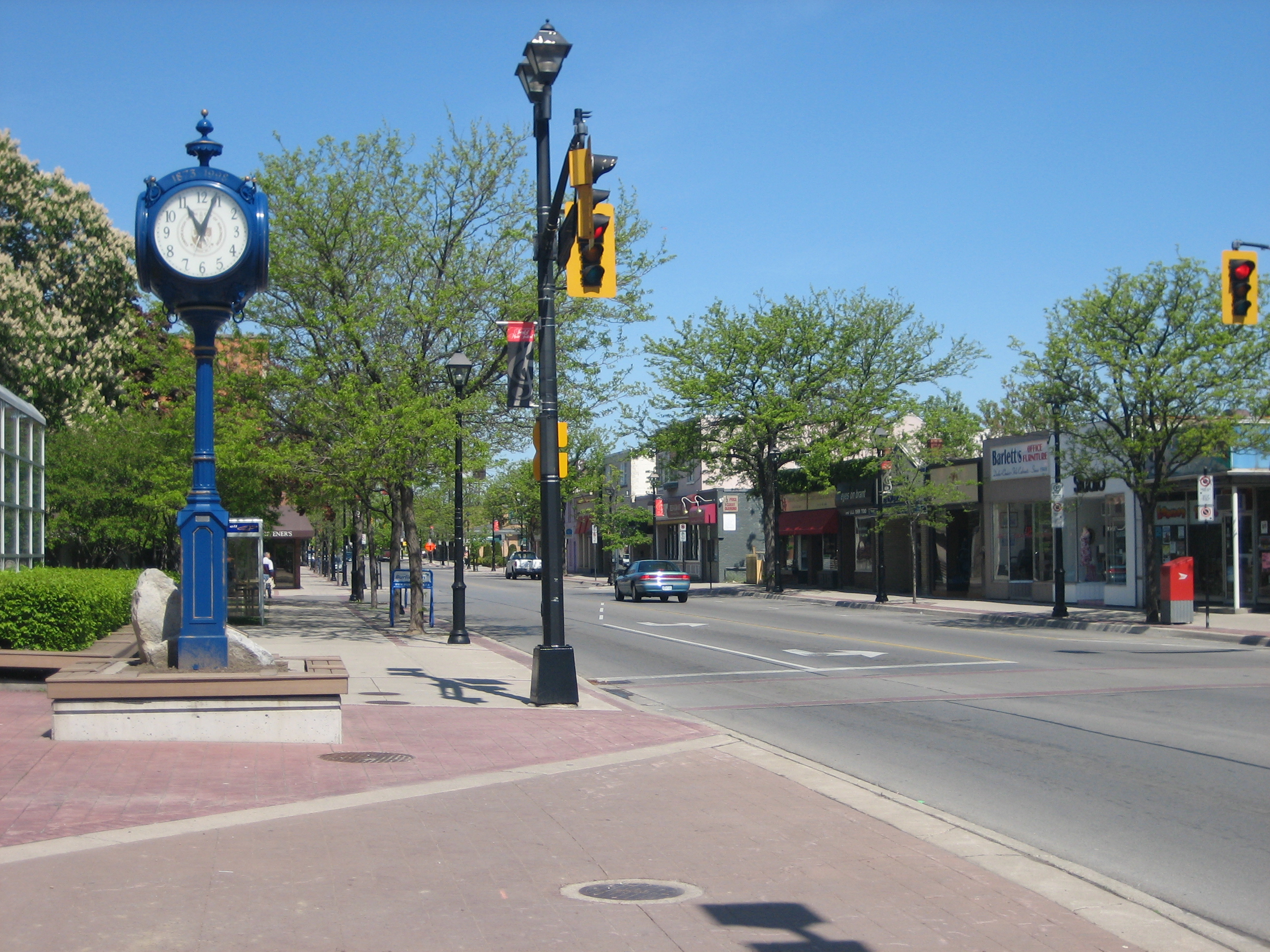 Brant Street in Downtown Burlington | |
|
Logo | |
| Motto: Stand By | |
 Burlington | |
| Coordinates: 43°22′12″N 79°48′51″W[1] | |
| Country | Canada |
| Province | Ontario |
| Region | Halton |
| Established | 1874 |
| City status | 1974 |
| Government | |
| • Mayor | Marianne Meed Ward |
| • Governing Body | Burlington City Council |
| • MPs | Karina Gould (Lib), Pam Damoff (Lib), Adam van Koeverden (Lib) |
| • MPPs | Natalie Pierre (PC), Parm Gill (PC), Effie Triantafilopoulos (PC) |
| Area | |
| • Total | 185.66 km2 (71.68 sq mi) |
| Elevation | 74 m (243 ft) |
| Population (2016)[2] | |
| • Total | 183,314 (Ranked 28th) |
| • Density | 946.8/km2 (2,452/sq mi) |
| Demonym(s) | Burlingtonian, Burlingtonite |
| Time zone | UTC−5 (Eastern) |
| • Summer (DST) | UTC−4 (EDT) |
| Forward sortation area | L7L to L7T |
| Area code(s) | 905, 289, 365, and 742 |
| Highways | Former |
| Website | www.burlington.ca |

History
![The Brant Hotel in 1902. Located on the shore of Lake Ontario in Burlington, the hotel was erected on the former homestead of Joseph Brant, and was the largest resort in Canada. The hotel was expropriated and used as a military hospital in 1917, demolished and rebuilt in the 1930s, and then demolished in 1964.[3]](http://upload.wikimedia.org/wikipedia/commons/b/b8/Brant_Hotel_-_Burlington%2C_Ontario_%281902%29.jpg)
Before the 19th century, the area between the provincial capital of York and the township of West Flamborough was home to the Mississauga nation. In 1792, John Graves Simcoe, the first lieutenant governor of Upper Canada, named the western end of Lake Ontario "Burlington Bay" after the town of Bridlington in the East Riding of Yorkshire, England.[4]
The British purchased the land on which Burlington now stands from the Mississaugas in Upper Canada Treaties 3 (1792), 8 (1797), 14 (1806), and 19 (1818). Treaty 8 concerned the purchase of the Brant Tract, 14.0 km2 (3,450 acres) on Burlington Bay which the British granted to Mohawk chief Joseph Brant for his service in the American Revolutionary War.[5][6] Joseph Brant and his household settled on this tract of land around 1802.[7] Brant is accordingly often referred to as the founder of Burlington, and the city of Burlington still celebrates an annual Joseph Brant Day in early August.[8][9] Subsequent disputes between the Mississaugas of the Credit First Nation and the Canadian government over payment for the Brant Tract and the Toronto Purchase were settled in 2010 for the sum of $145 million (CAD).[6][10]
By the turn of the 19th century, the name "Burlington" was already in common use. With the completion of the local survey after the War of 1812, the land was opened for settlement. Early farmers prospered in the Burlington area because the area had fertile soil and moderate temperatures. Produce from the farms was shipped out via the bustling docks of the lakeside villages of Port Nelson and Wellington Square, as well as Brown's Wharf in the nearby village of Port Flamborough (which was to become Aldershot). Lumber taken from the surrounding forests also competed for space on the busy docks. In the latter half of the 19th century, increased wheat production from Western Canada convinced local farmers to switch to fruit and vegetable production.
In 1874, Wellington Square and Port Nelson were incorporated into the Village of Burlington. The arrival of large steamships on the Great Lakes made the small docks of the local ports obsolete, and the increased use of railway to ship goods marked the end of the commercial wharves.
Farming still thrived though, and the resultant growth resulted in continued prosperity. By 1906, the town boasted its own newspaper—the Burlington Gazette—as well as a town library and a local rail line that connected Burlington to nearby Hamilton. During the First World War, 300 local men volunteered for duty in the Canadian Expeditionary Force—38 did not return. In 1914, Burlington was incorporated into a town.
As more settlers arrived and cleared the land, cash crops replaced subsistence farming. Gradually, mixed farming and market gardens became the dominant form of agriculture, and in the early 20th century the area was declared the Garden of Canada. The first peaches grown in Canada were cultivated in the Grindstone Creek watershed in the city's south-west part. The farming tradition has passed down through the generations. Today over forty percent of the Grindstone Creek watershed is still devoted to farms, orchards and nurseries.[11]
Following the Second World War, cheap electricity from nearby Niagara Falls and better transportation access due to the new (1939) Queen Elizabeth Way encouraged both light industry and families to move to Burlington. The population skyrocketed as new homes were built, encouraging developers to build even more new homes. On 1 January 1958, Burlington officially annexed most of the Township of Nelson, as well as Aldershot, formerly a part of East Flamborough Township. By 1967, the last cash crop farm within the city had been replaced by the Burlington Centre.[12]
Burlington was the site of the Brant Inn built by the lake in 1917, which became famous during the ’40s and ’50s for showing big-band performers.
By 1974, with a population exceeding 100,000, Burlington was incorporated as a city. The extremely high rate of growth continued, and between 2001 and 2006, the population of Burlington grew by 9%, compared to Canada's overall growth rate of 5.4%. By 2006, the population topped 160,000.
Geography and climate
Burlington is at the southwestern end of Lake Ontario, just to the north east of Hamilton and the Niagara Peninsula, roughly in the geographic centre of the urban corridor known as the Golden Horseshoe. Burlington has a land area of 187 km2 (72 sq mi). The main urban area is south of the Parkway Belt and Hwy. 407. The land north of this, and north Aldershot is used primarily for agriculture, rural residential and conservation purposes. The Niagara Escarpment, Lake Ontario and the sloping plain between the escarpment and the lake make up the land area of Burlington. The city is no longer a port; sailing vessels in the area are used for recreational purposes and moor at a 215 slip marina in LaSalle Park.
Burlington's climate is humid continental (Köppen climate classification Dfa) with warm, humid summers and long, cold and snowy winters. The climate is moderated somewhat by its proximity to Lake Ontario. Monthly mean temperatures range from 22.5 °C (72.5 °F) in July to −4.4 °C (24.1 °F) in January. The average annual precipitation is 763 mm (30.0 in) of rain and 99 cm (39 in) of snow.
Although it shares the continental climate found in Southern Ontario, its proximity to Lake Ontario moderates winter temperatures and it also benefits from a sheltering effect of the Niagara Escarpment, allowing the most northerly tracts of Carolinian forest to thrive on the Escarpment that runs through western sections of city. Several species of flora and fauna usually found only in more southern climes are present in Burlington, including paw-paw, green dragon (Arisaema dracontium), tuckahoe (Peltandra virginica), American columbo (Frasera caroliniensis), wall-rue (Asplenium ruta-muraria), plus the Louisiana waterthrush, the hooded warbler, the southern flying squirrel and the rare eastern pipistrelle. Near the visible promontory of Mount Nemo that rises some 200 m (650 ft) above the lake level, a "vertical forest" of white cedar clinging to the Escarpment face includes many small trees that are more than a thousand years old.[13]
Hamilton Harbour, the western end of Lake Ontario, is bounded on its western shore by a large sandbar, now called the Beach strip, that was deposited during the last ice age. A canal bisecting the sandbar allows ships access to the harbour. The Burlington Bay James N. Allan Skyway (part of the Queen Elizabeth Way), and the Canal Lift Bridge allow access over the canal.
| Climate data for Burlington TS Climate ID: 6151064; coordinates 43°20′N 79°50′W, elevation: 99.1 m (325 ft); 1981–2010 normals, extremes 1866–present[note 1] | |||||||||||||
|---|---|---|---|---|---|---|---|---|---|---|---|---|---|
| Month | Jan | Feb | Mar | Apr | May | Jun | Jul | Aug | Sep | Oct | Nov | Dec | Year |
| Record high °C (°F) | 18.4 (65.1) |
17.9 (64.2) |
27.2 (81.0) |
32.0 (89.6) |
36.1 (97.0) |
38.9 (102.0) |
41.1 (106.0) |
38.3 (100.9) |
37.8 (100.0) |
31.1 (88.0) |
26.7 (80.1) |
22.0 (71.6) |
41.1 (106.0) |
| Average high °C (°F) | −0.6 (30.9) |
0.8 (33.4) |
5.2 (41.4) |
12.4 (54.3) |
19.4 (66.9) |
25.0 (77.0) |
28.0 (82.4) |
26.7 (80.1) |
21.8 (71.2) |
15.1 (59.2) |
8.0 (46.4) |
2.4 (36.3) |
13.7 (56.7) |
| Daily mean °C (°F) | −4.4 (24.1) |
−3.2 (26.2) |
1.0 (33.8) |
7.5 (45.5) |
13.9 (57.0) |
19.4 (66.9) |
22.5 (72.5) |
21.4 (70.5) |
16.9 (62.4) |
10.4 (50.7) |
4.4 (39.9) |
−1 (30) |
9.1 (48.4) |
| Average low °C (°F) | −8.1 (17.4) |
−7.1 (19.2) |
−3.3 (26.1) |
2.6 (36.7) |
8.3 (46.9) |
13.8 (56.8) |
16.9 (62.4) |
16.1 (61.0) |
11.9 (53.4) |
5.7 (42.3) |
0.7 (33.3) |
−4.3 (24.3) |
4.4 (39.9) |
| Record low °C (°F) | −30.6 (−23.1) |
−29.4 (−20.9) |
−27.2 (−17.0) |
−14.4 (6.1) |
−7.2 (19.0) |
0.0 (32.0) |
1.1 (34.0) |
1.7 (35.1) |
−3.9 (25.0) |
−11.1 (12.0) |
−22.8 (−9.0) |
−27.8 (−18.0) |
−30.6 (−23.1) |
| Average precipitation mm (inches) | 66.0 (2.60) |
54.5 (2.15) |
61.6 (2.43) |
70.6 (2.78) |
81.0 (3.19) |
69.1 (2.72) |
75.3 (2.96) |
82.0 (3.23) |
83.1 (3.27) |
71.9 (2.83) |
84.9 (3.34) |
63.0 (2.48) |
863.1 (33.98) |
| Average rainfall mm (inches) | 31.8 (1.25) |
33.0 (1.30) |
44.7 (1.76) |
68.2 (2.69) |
81.0 (3.19) |
69.1 (2.72) |
75.3 (2.96) |
82.0 (3.23) |
83.1 (3.27) |
71.9 (2.83) |
79.7 (3.14) |
43.5 (1.71) |
763.3 (30.05) |
| Average snowfall cm (inches) | 34.2 (13.5) |
21.5 (8.5) |
16.9 (6.7) |
2.4 (0.9) |
0.0 (0.0) |
0.0 (0.0) |
0.0 (0.0) |
0.0 (0.0) |
0.0 (0.0) |
0.0 (0.0) |
5.3 (2.1) |
19.5 (7.7) |
99.9 (39.3) |
| Average precipitation days (≥ 0.2 mm) | 12.4 | 9.6 | 11.0 | 12.5 | 11.8 | 10.9 | 10.1 | 10.2 | 10.9 | 10.7 | 13.9 | 11.9 | 135.8 |
| Average rainy days (≥ 0.2 mm) | 4.9 | 4.5 | 8.0 | 11.7 | 11.8 | 10.9 | 10.1 | 10.2 | 10.9 | 10.7 | 12.7 | 7.7 | 113.9 |
| Average snowy days (≥ 0.2 cm) | 8.1 | 6.0 | 3.6 | 0.84 | 0.0 | 0.0 | 0.0 | 0.0 | 0.0 | 0.0 | 1.6 | 5.4 | 25.5 |
| Source: Environment Canada[14][15] | |||||||||||||
Demographics
| Year | Pop. | ±% |
|---|---|---|
| 1901 | 1,119 | — |
| 1911 | 1,831 | +63.6% |
| 1921 | 2,709 | +48.0% |
| 1931 | 3,046 | +12.4% |
| 1941 | 3,815 | +25.2% |
| 1951 | 6,017 | +57.7% |
| 1961 | 47,008 | +681.3% |
| 1971 | 87,023 | +85.1% |
| 1981 | 114,853 | +32.0% |
| 1991 | 129,575 | +12.8% |
| 1996 | 136,976 | +5.7% |
| 2001 | 150,836 | +10.1% |
| 2006 | 164,415 | +9.0% |
| 2011 | 175,779 | +6.9% |
| 2016 | 183,314 | +4.3% |
| [16][2] | ||
In the 2021 Census of Population conducted by Statistics Canada, Burlington had a population of 186,948 living in 73,180 of its 74,891 total private dwellings, a change of 2% from its 2016 population of 183,314. With a land area of 186.12 km2 (71.86 sq mi), it had a population density of 1,004.4/km2 (2,601.5/sq mi) in 2021.[17]
According to the 2016 census, Burlington's population was 183,314 where 48% of residents were male and 52% female. Minors (individuals up to the age of 19) made up 22.6% of the population (almost identical to the national average of 22.4%), and seniors (age 65+) were 19.2% (higher than the national average of 16.9%). This older population was also reflected in Burlington's median age of 43.3, which was higher than the Canadian median of 41.2.[18]
| Ethnic origin[19] | Population | % |
|---|---|---|
| English | 56,130 | 31.2 |
| Canadian | 42,935 | 23.8 |
| Scottish | 40,050 | 22.2 |
| Irish | 37,160 | 20.6 |
| German | 18,645 | 10.4 |
| French | 16,585 | 9.2 |
| Italian | 14,235 | 7.9 |
| Polish | 10,475 | 5.8 |
| Dutch | 9,115 | 5.1 |
| Ukrainian | 8,160 | 4.5 |
| East Indian | 7,245 | 4.0 |
The 2016 Census records a visible minority of 16%.[20]
The top 11 ethnic origins from the 2016 Census are listed in the accompanying table. Percentages add up to more than 100% because respondents can report more than one ethnicity.
According to the 2011 Census, 70% of Burlington residents identify as Christian, with Catholics (31.5%) making up the largest denomination, followed by Anglican (10%), United Church (9.2%), and other denominations. Others identify as Muslim (2%), Hindu (1.1%), Sikh (1%), Buddhist ( 0.4%), Jewish (0.4%), and with other religions. 25% of the population report no religious affiliation.[21]
According to the 2016 Census, the most common mother tongue in Burlington is English (78.7%), followed by French (1.6%), Spanish (1.5%), Polish (1.3%), and Arabic (1.2). The three most commonly known languages are English (99.1%), French (9%), and Spanish (2.5%).[22]
| Mother tongue | Population | % |
|---|---|---|
| English | 142,605 | 78.7 |
| French | 2,970 | 1.6 |
| Spanish | 2,680 | 1.5 |
| Polish | 2,365 | 1.3 |
| Arabic | 2,205 | 1.2 |
| Italian | 1,845 | 1.0 |
| Punjabi | 1,795 | 1.0 |
| German | 1,645 | 0.9 |
| Mandarin | 1,555 | 0.9 |
| Portuguese | 1,545 | 0.9 |
| Tagalog (Filipino) | 1,290 | 0.7 |
| Dutch | 1,080 | 0.6 |
| Knowledge of language | Population | % |
|---|---|---|
| English | 178,540 | 99.1 |
| French | 16,140 | 9.0 |
| Spanish | 4,455 | 2.5 |
| Polish | 2,920 | 1.6 |
| Italian | 2,865 | 1.6 |
| Arabic | 2,750 | 1.5 |
| German | 2,685 | 1.5 |
| Punjabi | 2,565 | 1.4 |
| Hindi | 2,055 | 1.1 |
| Portuguese | 2,040 | 1.1 |
| Mandarin | 1,990 | 1.1 |
| Tagalog (Filipino) | 1,830 | 1.0 |
Economy
Burlington's economic strength is the diversity of its economic base, mainly achieved because of its geography, proximity to large industries in southern Ontario (Canada's largest consumer market), its location within the Greater Toronto and Hamilton Area (GTHA) and proximity to Hamilton, and its transportation infrastructure including the Port of Hamilton on Burlington Bay. This diversity has allowed for sustained growth with regards to the economy.[23] The city has a robust economy with potential for growth – it is at the hub of the Golden Horseshoe, is largely driven by both the automotive and manufacturing sectors.
No single employer or job sector dominates Burlington's economy. The leading industrial sectors, in terms of employment, are food processing, packaging, electronics, motor vehicle/transportation, business services, chemical/pharmaceutical and environmental. The top five private sector employers in Burlington are Fearmans Pork Inc, Cogeco Cable, Evertz Microsystems, Boehringer Ingelheim and EMC2. Other notable business include The EBF Group, ARGO Land Development, The Sunshine Doughnut Company and TipTapPay Micropayments Ltd.[24][25][26] The largest public sector employers in the city are the City of Burlington, the Halton District School Board, the Halton Catholic District School Board and Joseph Brant Hospital.
Burlington Centre and Mapleview Centre are popular malls within the city.[citation needed] The city's summer festivals include Canada's Largest Ribfest, and the Burlington Sound of Music Festival which also attract many visitors.[citation needed]
Media and journalism
Television stations
Burlington is primarily served by media based in Toronto (other than those noted below), as it is geographically in the Greater Toronto and Hamilton Area (GTHA).
- YourTV from the studio in the Cogeco Cable Headquarters at Harvester Road & Burloak Drive.
- Yes TV is based in Burlington with studios on the North Service Road near the junction of the QEW, 403 and 407.
- Hamilton based television station CHCH-TV serves Hamilton, Halton and Niagara, thus including Burlington.
Radio
Burlington is part of the Hamilton radio market. One radio station, FM 107.9 CJXY, is licensed to Burlington and another, FM 94.7 CHKX, to "Hamilton/Burlington." Both presently broadcast from studios in Hamilton. Burlington listeners are also served by stations licensed to Toronto, St. Catharines, Niagara Falls and Buffalo, New York.
Print media
Several publications are either published in or around Burlington, or have Burlington as one of their main subjects, including Burlington Post and View Magazine.[citation needed]
Education

Burlington's public elementary and secondary schools are part of the Halton District School Board. Burlington's Catholic elementary and secondary schools are part of the Halton Catholic District School Board. French public elementary and secondary schools are part of the Conseil scolaire Viamonde and French catholic elementary and secondary schools are part of the Conseil scolaire catholique MonAvenir. Several private schools are also available in the city.
Elementary schools
There are 29 public elementary schools and 14 Roman Catholic elementary schools in Burlington.
High schools
There are six public high schools and three Catholic high schools in the area. There are also 10 private schools in Burlington.[citation needed]
Public
- Aldershot School (1964) Sports Team: Lions
- Burlington Central High School (1922) Sports Team: Trojans
- Frank J. Hayden Secondary School (2013) Sports Team: Huskies
- Gary Allan High School Burlington Campus – Adult Learners School
- M.M. Robinson High School (1963) Sports Team: Rams
- Nelson High School (1957) Sports Team: Lords
Catholic
- Assumption Secondary School (1977) Sports Team: Crusaders
- Corpus Christi Catholic Secondary School (2008) Sports Team: Longhorns
- Notre Dame Secondary School (1989) Sports Team: Fighting Irish
Universities and colleges
- McMaster University DeGroote School of Business – Ron Joyce Centre opened in September 2010 and offers MBA and Executive Management programs.[27]
- Australian university Charles Sturt University has had a study centre in Burlington since 2005 and offers programs in Master of International Education, Bachelor of Early Childhood Studies and Master of Business Administration. .[28]
- Oxford College of Arts, Business and Technology is licensed by the Ontario Ministry of Training, Colleges and Universities
Transportation
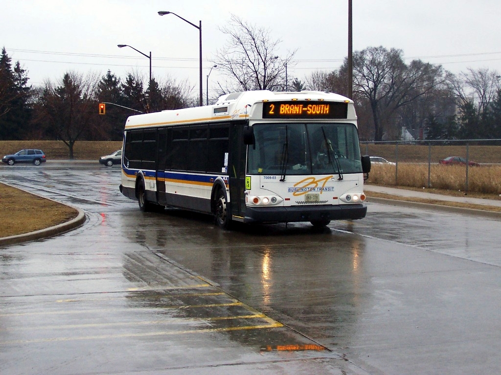
Burlington Transit, the public transport provider in the city, provides service on a transportation grid centred on three commuter GO Train stations: Appleby, Burlington and Aldershot.
Major transportation corridors through the city include the Queen Elizabeth Way, Highway 403, Highway 407, and Dundas Street (former Highway 5). Commuter rail service is provided by GO Transit at the Appleby GO Station, Burlington GO Station and the Aldershot GO station. Intercity rail service is provided by Via Rail at Aldershot, which also serves Hamilton. Rail cargo transportation is provided by both Canadian National Railway and Canadian Pacific.
Burlington Airpark in the city's north end is a thriving general-aviation without regular commercial passenger flight service. Some charter operations are provided.
On 26 February 2012, a Via Rail train traveling from Niagara Falls to Toronto Union Station derailed in Burlington, with three fatalities.[29]
Emergency services

Policing in Burlington is performed by the Halton Regional Police Service.[30]
Fire service is provided by the Burlington Fire Department with eight fire stations.
Paramedic services are provided by Halton Region Paramedic Services with four paramedic stations.[citation needed]
Politics


Local government
The city is divided into six wards, each represented by a city councillor. The mayor, who chairs the city council, is Marianne Meed Ward.
Council elected for 2018–2022
- Mayor: Marianne Meed Ward
- Ward 1: Kelvin Galbraith
- Ward 2: Lisa Kearns
- Ward 3: Rory Nisan
- Ward 4: Shawna Stolte
- Ward 5: Paul Sharman
- Ward 6: Angelo Bentivegna
Source:[31]
Federal
Federally, the city is represented by three MPs whose ridings cover parts of the city:
- Burlington (covers most of the city): Karina Gould, Member of Parliament (Liberal)
- Milton (the mainly rural countryside north of Highway 407): Adam van Koeverden (Liberal)
- Oakville North-Burlington (the area bounded by Highway 407 to the north, Upper Middle Road to the south, Guelph Line to the west and 9th Line, Oakville to the east): Pam Damoff (Liberal)
Provincial
Provincially, the city is represented by three MPPs, whose ridings are geographically contiguous with their federal counterparts:
- Burlington: Jane McKenna (Progressive Conservative)
- Milton: Parm Gill (Progressive Conservative)
- Oakville North-Burlington: Effie Triantafilopoulos (Progressive Conservative)
Recreation and sites of interest

There are 115 parks and 580 hectares (1,400 acres) of parkland in the city.

On the shore of Lake Ontario, Spencer Smith Park features an expansive shoreline walking path. The park was renovated in 2006, with the addition of an observatory, water jet play area and restaurant. The park includes the Burlington Rotary Centennial Pond, a 10,000 square-foot water feature, used for model sail boating in the spring, summer and fall. In winter, it offers free recreational ice-skating. Many annual free festivals take place in Spencer Smith Park, including Canada's Largest Ribfest and the Sound of Music Festival, Canada Day, Children's Festival and Lakeside Festival of Lights. There is also the semi-annual prix fixe Taste of Burlington dining event.
The Brant Street Pier opened in Spencer Smith Park during the Sound of Music Festival on Father's Day weekend 2013.[32] Thousands of people from Burlington and beyond flocked to the pier to enjoy sunshine and scenic views. The pier extends 137 metres over Lake Ontario and provides views of the lake and Burlington's shoreline. In the evenings, the entire pier is lit, making it a major attraction to both tourists and residents. Generally, the lighting choices are based on nationally recognized holidays or events, but also invite special requests.

The Art Gallery of Burlington is adjacent to Spencer Smith Park, and contains diverse permanent and changing exhibits. The Gallery houses a prominent collection of Canadian ceramics. The Gallery's exhibition spaces, which feature new exhibitions every eight to ten weeks, are fully accessible and are free to visitors.[33]

"Royal Canadian Naval Association Naval Memorial (1995)" by André Gauthier is a 1.93 m (6 ft 4 in) high cast bronze statue of a World War II Canadian sailor in the position of attention saluting his lost shipmates, which was erected in Spencer Smith Park. The model for the statue was a local Sea Cadet wearing Mike Vencel's naval service uniform.[34] On the black granite base, the names of Royal Canadian Navy and Canadian Merchant Navy ships sunk during World War II are engraved. On the granite wall, the names of all Royal Canadian Navy ships and Canadian Merchant Marine vessels which saw service in World War II are engraved.[35] Atop the wall is the ship's bell from HMCS Burlington. A monument commemorating the Korean War was erected in the summer of 2014 to mark the 61st anniversary of the armistice to end the war.[36]
Burlington is home to the Royal Botanical Gardens, which has the world's largest lilac collection. Ontario's botanical garden and National Historic Site of Canada features over 11 km2 (2,700 acres) of gardens and nature sanctuaries, including four outdoor display gardens, the Mediterranean Garden under glass, three on-site restaurants, the Gardens' Gift Shop, and festivals.
Lasalle Park, in the Burlington neighbourhood of Aldershot, is owned by the city of Hamilton but is leased by Burlington, which also assumes responsibility for maintenance.
Several conservation areas are minutes away and feature year round activities. Mount Nemo Conservation Area is the only area in Burlington that is operated by Conservation Halton. Bronte Creek Provincial Park, along the city's eastern boundary, features a campground and recreational activities and events year-round.
The local sections of the Bruce Trail and the Niagara Escarpment, which is a UNESCO designated World Biosphere Reserve, provide hiking trails. Kerncliff Park, in an abandoned quarry on the boundary with Waterdown, is a naturalized area on the lip of the Niagara Escarpment. The Bruce Trail runs through the park, at many points running along the edge of the cliffs, providing a clear overlook of Burlington, the Burlington Skyway Bridge, Hamilton, and Oakville. On a clear day, one can see the CN Tower in Toronto, approximately 50 km (31 mi) from the park.[citation needed]
The Joseph Brant Museum and Ireland House are also local attractions.[citation needed] Joseph Brant Museum has ongoing exhibits on the history of Burlington, the Eileen Collard Costume Collection, Captain Joseph Brant and the visible storage gallery. Ireland House at Oakridge Farm is a history museum depicting family life from the 1850s to the 1920s. In 2017 the Freeman Railway Station, originally built 1906 for the Grand Trunk Railway was reopened as an interpretive center.
Burlington offers four indoor and two outdoor pools, one splash park, nine splash pads, seven arenas and ice centres, six community centres and nine golf courses.[37] The Appleby Ice Centre is a 4-pad arena, used year-round for skating and ice hockey.[38]
The Burlington Performing Arts Centre opened in 2011. This 940-seat facility is on Locust Street in the downtown core with a main theatre featuring a six-story fly tower, a community studio theatre, and a family lobby.[39]
Malls and shopping
Burlington Centre is a two-storey mall at Guelph Line and Fairview Street. Opened in 1968, several renovations have been completed at various intervals over the years.[citation needed]
Mapleview Centre is a two-storey mall, which opened in 1990 and is located at the intersection of Fairview Street and Maple Avenue. Only 45 minutes from downtown Toronto,[citation needed] Mapleview leases retail space to over 165 upscale[citation needed] and destination stores including Banana Republic, H&M, Bath & Body Works.[citation needed]
Organizations
The Burlington Teen Tour Band has operated in the city since 1947, including members between the ages of 13 and 21. The marching band, nicknamed The Redcoats due to the colour of its uniforms, are regular participants in major international parades. They are also referred to as "Canada's Musical Ambassadors" and have represented Canada all over the world.[40] One such occasion was during the 2018 Tournament of Roses Parade, where the band represented Canada for the fifth time in the band's history.[41] The band is led by Rob Bennett, managing director. [42]
The Junior Redcoats are the younger version of the Teen Tour Band. The band includes children between the ages of 9 to 12. The Junior Redcoats' major performances are most commonly at the Burlington Santa Claus Parade, the Waterdown Santa Claus Parade, the Burlington Performing Arts Centre (along with the Teen Tour Band) and the Sound of Music Parade. They are directed by Caroline Singh. [43]
The Burlington Concert Band has been in operation since 1908. The band, composed of local volunteer musicians, plays a wide variety of musical styles and repertoire. It primarily performs to raise money for charitable causes. The Burlington Concert Band is a participating member of Performing Arts Burlington as well as the Canadian Band Association. The band maintains an open membership policy, allowing anyone who feels they can handle the music competently to join without an audition. Its primary venue has been the Burlington Performing Arts Centre since it opened in 2011. Zoltan Kalman is the former director of the Burlington Concert Band that is led by an elected board headed by Steven Hewis.[44] The current musical director is Joanne Romanow.[45]
The current Burlington Area Scouts came into existence in 1958 as "Burlington District" with amalgamation of several groups from Burlington and surrounding area. There are 17 active groups within the Area, providing Scouting to over 700 members. The Area stretches outside the city limits of Burlington and encompasses the additional communities of Waterdown, Kilbride, and Carlisle.[46]
The Burlington Symphony Orchestra, formed in 1973, is a community orchestra under the direction of Denis Mastromonaco.[47]
Sports
| Club | Sport | League | Venue |
| Burlington Cougars | Ice hockey | Ontario Junior Hockey League | Appleby Ice Centre |
| Burlington Chiefs | Box lacrosse | Ontario Junior A Lacrosse League | Central Arena |
| Burlington Jr. Barracudas | Ice hockey | Provincial Women's Hockey League | Mainway Ice Centre |
| Halton United | Soccer | Canadian Soccer League | Norton Park |
| Burlington SC | Soccer | League1 Ontario | |
Local teams
The following are the names associated with Burlington sport teams:
- Burlington Chiefs Lacrosse Teams
- Burlington Bayhawks Soccer Teams
NEXXICE is a synchronized skating team associated with the Burlington Skating Club (and the Kitchener Waterloo Skating Club). They were the 2018 Canadian Senior champions, and were the first (and only) Canadian team to win a world championship.[citation needed]
International competition
Burlington, Ontario, founded the Burlington International Games (B.I.G.). The games were first held in 1969 "to offer an athletic and cultural exchange experience for the youth of Burlington".[citation needed] Until recently,[when?] the games took place between Burlington, Ontario, and Burlington, Vermont, United States. But, other cities from places such as Quebec, Japan, the Netherlands, and the U.S. have all had athletes compete since 1998.[48] The games celebrated their 40th anniversary in 2009 and the competition ceased in 2010 due to limited participation in later years.[citation needed]

Notable people
Visual art and writing
- Robert Bateman (born 1930), painter.
- Nicole Dorsey, film director and screenwriter
- Margaret Lindsay Holton (born 1955), artist, author, and designer.
- Donato Mancini, poet
- Sylvia McNicoll (born 1954), author of over twenty novels for children and young adults
- John Lawrence Reynolds (born 1939), author, winner of two Arthur Ellis Awards
- Kelly Richardson (born 1972), artist, born in Burlington.
- James Picard (born 1964), artist and filmmaker
Music
- James Anthony (born 1955), USA Hall of Fame Blues Guitarist.
- Boys Night Out – rock band.
- The Creepshow, psychobilly band
- Jeff Danna (born 1964), film music composer.
- Dead and Divine – metal / hardcore band
- Finger Eleven – alternative rock band; all attended Lester B. Pearson High School
- Grade – rock band
- Sarah Harmer (born 1970), singer and songwriter; attended Lester B. Pearson High School
- Jordan Hastings (born 1982), Alexisonfire, drummer
- Idle Sons – rock band; attended Lester B. Pearson, Aldershot and M.M. Robinson High Schools
- Jersey (1995–2005), ska punk band
- Melissa McClelland (born 1979), singer and songwriter.
- Devraj Patnaik (born 1975), music composer, odissi dancer and choreographer
- Saint Alvia, punk rock band
- Silverstein – post-hardcore band
- Spoons – 1980s new wave band
- Tebey (born 1983), country music artist, attended Assumption Secondary School
- Walk Off the Earth, alternative rock band
- Adrianne Pieczonka (born 1963), operatic soprano singer
Sports
- Caleb Agada (born 1994), Nigerian-Canadian basketball player in the Israeli Premier League and for the Nigerian national basketball team
- Josh Anderson (born 1994), NHL player, Montreal Canadiens, born in Burlington
- Steve Bauer (born 1959), road bicycle racer; Olympic Silver Medalist (1984 Los Angeles Games); competed in 11 Tours de France, one of only two Canadians to wear the Yellow jersey; born in St. Catharines but resides in Burlington.
- Ryan Bomben (born 1987), current offensive guard for the Toronto Argonauts of the Canadian Football League.
- Melanie Booth (born 1984), soccer player (Canadian Soccer Association, Florida Gators NCAA)
- Cory Conacher (born 1989), NHL player, Buffalo Sabres, New York Islanders, Syracuse Crunch.
- Angela Coughlan (1953–2009), swimmer, winner of a bronze medal at the 1968 Olympic Games; a gold, two silvers and a bronze at the 1970 British Commonwealth Games; a gold and three silvers at the 1971 Pan American Games.
- Adam Creighton (born 1965), retired professional hockey player who played 708 NHL games
- Renata Fast (born 1994), professional ice hockey player and Canadian Olympian
- Tony Gabriel (born 1948), retired CFL tight end with the Ottawa Rough Riders and Hamilton Tiger-Cats. 8-time CFL all-star, league MVP 1978, twice winner of the Grey Cup.
- Frank Hayden, Developed the Special Olympics.
- Graham Hood (born 1972), competitive middle distance runner, Olympian, Pan Am Games champion; Born in Winnipeg but raised in Burlington. Competed at 1992 Olympics (Barcelona) and 1996 Olympics (Atlanta). Gold medallist, 1500 m, at 1999 Pan Am Games (Winnipeg).
- Russ Jackson, retired CFL quarterback, has lived in Burlington since his retirement from teaching
- Ashley Johnston (born 1992), former professional ice hockey player and captain of the Metropolitan Riveters
- Josh Jooris (born 1990), NHL player, Toronto Marlies, born in Burlington
- Mfiondu Kabengele (born 1997), Canadian professional basketball player for the Los Angeles Clippers
- Becky Kellar-Duke (born 1975), hockey player, 4 time Olympic medalist
- Jesse Lumsden (born 1982), running back with the Edmonton Eskimos and the Hamilton Tiger Cats of the Canadian Football League and Canadian Olympian in the Men's Two and Four-Man Bobsleigh at the Vancouver 2010 Olympics; attended Nelson High School.
- David Matsos (born 1973), former AHL hockey player; current assistant coach of the Windsor Spitfires
- Trevor Meier (born 1973), former Swiss Nationalliga 'A' Hockey Player, various clubs 1993–2012; born in Oakville, raised in Burlington, and resides in Switzerland.
- Andy O'Brien (born 1979), Irish soccer player, Star Striker of the 2004–2005 UCD Super League Champions, Surprise X Saint Germain.
- Mark Oldershaw (born 1983), Canadian sprint canoeist who competed at the 2008 Olympics (Beijing) and won a bronze medal in C-1 1000 m at the 2012 Olympics (London)
- Dave Ridgway (born 1959), placekicker, Saskatchewan Roughriders CFL 1982–1996. Attended M.M. Robinson High School. Inducted into Canadian Football Hall of Fame in 2003. Played NCAA football for the University of Toledo Rockets 1977–1980.
- Melville Marks Robinson (1888–1974), founder of the Commonwealth Games.
- Chris Schultz (1960–2021), offensive tackle with the NFL Dallas Cowboys and CFL Toronto Argonauts, and sportscaster for TSN; attended Aldershot High School
- Ron Sedlbauer (born 1954), former NHL player from 1974-1981.
- Simisola Shittu (born 1999), British-born Canadian basketball player for Ironi Ness Ziona of the Israeli Basketball Premier League[49]
- Jordan Szwarz (born 1991), ice hockey player for the Belleville Senators of the AHL.
- Chad Wiseman (born 1981), AHL player, Albany Devils, born in Burlington
- Shane Wright, professional hockey player
TV, film, and stage
- Jillian Barberie (born 1966), actress and television hostess, attended Assumption Secondary School.
- Lally Cadeau (born 1948), actor, played Janet King on Road to Avonlea
- Carlos Bustamante – YTV The Zone host and Entertainment Tonight Canada reporter, attended Notre Dame Catholic Secondary School.
- Jim Carrey (born 1962), comedian and actor, attended St. Francis Xavier School for grades, 6, 7 and 8; and Aldershot High School for grade 9.
- Nicole Dorsey, screenwriter and director
- Ryan Gosling (born 1980), actor, attended Lester B. Pearson High School.
- Torri Higginson (born 1969), actress.
- Myles Erlick (born 1998), actor and dancer.
- Ellora Patnaik (born 1968), actor and odissi dancer.
- Lynn Shawcroft – comedian.
- Andrew Stetson (born 1979), model, resides in Burlington
- Gordie Tapp (1922–2016) comedian and country & western musician, (Grand Ole Opry and Hee Haw), resided in Burlington
- Michael Bradshaw (1933–2001) actor, resided in Burlington
- Katherine Barrell, (born 1990), actress, writer, producer and director currently best known for portraying Officer Nicole Haught in Wynonna Earp
Crime
- Leslie Mahaffy (July 5, 1976 – June 16, 1991) was a resident of Burlington and a victim of serial killers and rapists Paul Bernardo and Karla Homolka.
Twin cities
Burlington has twin-city relationships with the following cities:[50]
- Apeldoorn, Gelderland, Netherlands
- Itabashi, Japan
Past city relationships:
- Burlington, Vermont, United States (through the BIG, Burlington International Games)
- Burlington, Iowa, United States
- Myrtle Beach, South Carolina, United States
See also
- Burlington City Council
- Burlington Executive Aerodrome
Notes
- Long term records have been recorded at various climate stations in or nearby Burlington since 1866
References
- "Burlington". Geographical Names Data Base. Natural Resources Canada.
- "Ethnocultural Portrait of Canada – Data table". 2.statcan.ca. 6 October 2010. Retrieved 10 March 2011.
- "Arts & Entertainment" (PDF). Building Stories. Retrieved 18 February 2015.
- Rayburn, Alan (1997). Place Names of Ontario. Toronto-Buffalo-London: University of Toronto Press. p. 48. ISBN 0-8020-7207-0.
- "Map of Ontario treaties and reserves". Government of Ontario. 22 February 2021. Retrieved 9 June 2021.
- Duric, Donna (28 May 2017). "The Brant Tract Treaty, No. 8 (1797)". Mississaugas of the Credit First Nation. Retrieved 9 June 2021.
- "Joseph Brant; The Dictionary of Canadian Biography". Retrieved 15 September 2021.
- "Burlington; The Canadian Encyclopedia". Retrieved 15 September 2021.
- "Joseph Brant Day; Hamilton-Halton-Brant Tourism". Retrieved 15 September 2021.
- "Ontario band approves $145M land claim settlement". CTV News. 8 June 2010. Retrieved 9 June 2021.
- Halton: Rising, Wild and Beckoning. Conservation Halton. 1998.
- Reynolds, John Lawrence (June 1993). "Sounds by the Shore: A History of Burlington, Ontario, Canada". City of Burlington. Archived from the original on 4 March 2016. Retrieved 7 December 2008.
- "Niagara Escarpment Commission: Flora & Fauna". Niagara Escarpment Commission. Archived from the original on 30 July 2012. Retrieved 21 March 2009.
- "Burlington TS". Canadian Climate Normals 1981–2010. Environment Canada. Retrieved 22 October 2021.
- "Long Term Climate Extremes for Burlington Area (Virutal Station ID: VSON95V)". Daily climate records (LTCE). Environment Canada. Archived from the original on 10 November 2021. Retrieved 10 November 2021.
- "Burlington, City Ontario (Census Subdivision)". Census profile, Canada 2011 Census. Statistics Canada. 8 February 2012. Retrieved 24 February 2012.
- "Population and dwelling counts: Canada, provinces and territories, census divisions and census subdivisions (municipalities), Ontario". Statistics Canada. 9 February 2022. Retrieved 27 March 2022.
- "Statistics Canada. 2017. Burlington, CY [Census subdivision], Ontario and Halton, RM [Census division], Ontario". www12.statcan.gc.ca. Statistics Canada. 29 November 2017. Archived from the original on 10 February 2017. Retrieved 15 January 2022.
- "Census Profile, 2016 Census: Burlington, City - Ethnic origin". Statistics Canada. Statistics Canada.
- "Census Profile, 2016 Census: Burlington, City - Visible minority". Statistics Canada. Statistics Canada.
- "2011 National Household Survey Profile - Census subdivision". www12.statcan.gc.ca. Statistics Canada. 8 May 2013.
- "Census Profile, 2016 Census: Burlington, City - Language". Statistics Canada. Statistics Canada.
- "Reasons Why People Should Move to Burlington". Bronte Movers. Archived from the original on 19 March 2014.
- "BRONTE GREEN - ARGO". 8 January 2016. Retrieved 9 August 2016.
- "Burlington Downtown | What's Here". burlingtondowntown.ca. Retrieved 9 August 2016.
- Speirs, Doug (4 December 2020). "Dec 2020: Salvation Army kettle campaign rings in new way to give". Winnipeg Free Press. Retrieved 23 April 2022.
- "McMaster Coming to Burlington". City Talk. Spring 2009. p. 1.
- "CSU Ontario 5yr Celebration" (PDF). Archived from the original (PDF) on 24 February 2011. Retrieved 6 July 2010.
- "Canadian passenger train crash kills three in Ontario". BBC News. 27 February 2012.
- "Oakville". Halton Region Police Service. Regional Municipality of Halton Police Services Board. Archived from the original on 4 March 2012.
- "Form EL08 - Certificate of Election Results" (PDF). City of Burlington. Retrieved 10 January 2019.
- "The Brant Street Pier". The City of Burlington. Archived from the original on 4 October 2013. Retrieved 2 October 2013.
- "Art Gallery of Burlington Home Page". Retrieved 14 December 2015.
- "Parades, School Visits, Royal Canadian Naval Ships Memorial". Burl-Oak Naval Veterans. Archived from the original on 22 March 2013. Retrieved 18 February 2021.
- "Public Art Inventory". burlingtonpublicart.com. 25 May 2010. Retrieved 27 March 2018.
- McNeil, Mark (29 July 2014). "Burlington memorial pays tribute to Korean War navy vets". The Hamilton Spectator. Retrieved 27 March 2018 – via www.thespec.com.
- "Locations". www.burlington.ca. 26 November 2020. Retrieved 10 January 2022.
- "Appleby Ice Centre (City of Burlington)". Retrieved 14 December 2015.
- "The Burlington Performing Arts Centre About". Retrieved 15 November 2021.
- "History | Burlington Teen Tour Band | Canada". BTTB. Retrieved 7 July 2019.
- "Honours & Awards | Burlington Teen Tour Band | Canada". BTTB. Retrieved 7 July 2019.
- "The Staff | Burlington Teen Tour Band | Canada". BTTB. Retrieved 7 July 2019.
- "Burlington Junior Redcoats | About Us". Junior Redcoats. Retrieved 7 July 2019.
- "Burlington Concert Band". Burlington Concert Band. Retrieved 7 July 2019.
- "Burlington Concert Band". Burlington Concert Band.
- "Burlington Area Scouting Website". bu.scouter.ca. 27 February 2011. Retrieved 10 March 2011.
- "HISTORY". Burlington Symphony.
- "City of Burlington Website, Burlington International Games". Archived from the original on 1 September 2006.
- "Buzz builds over Burlington hoops phenom Simisola Shittu". The Hamilton Spectator. 29 January 2015 – via www.thespec.com.
- "Twin Cities - Apeldoorn and Itabashi". www.burlington.ca. Retrieved 27 March 2018.
External links
Places adjacent to Burlington, Ontario | ||||||||||||||||
|---|---|---|---|---|---|---|---|---|---|---|---|---|---|---|---|---|
| ||||||||||||||||
Greater Toronto Area | ||
|---|---|---|
Largest city: Toronto | ||
| Regions |  | |
| Cities | ||
| Towns | ||
| Townships | ||
| Municipalities | ||
Great Lakes megalopolis as defined by the RPA | ||
|---|---|---|
Includes all metropolitan areas that have a population of 150,000 or greater according to the most recent national census. | ||
| Great Lakes region cities |
|  |
| Surrounding cities |
| |
| Cities of states south of region | ||
| Other metro-regions |
| |
Other megaregions | ||
Authority control | |
|---|---|
| General | |
| National libraries | |
| Other |
|
На других языках
[de] Burlington (Ontario)
Die Stadt Burlington [.mw-parser-output .IPA a{text-decoration:none}ˈbəɹlɪŋtən] (offiziell City of Burlington) liegt am Nordufer des Lake Ontario, etwa 50 km südwestlich von Toronto und 10 km nordöstlich von Hamilton.- [en] Burlington, Ontario
[ru] Берлингтон (Онтарио)
Бе́рлингтон (англ. Burlington) — город в провинции Онтарио в Канаде. Город Берлингтон находится по западному берегу озера Онтарио неподалеку города Гамильтон и в 50 км к западу от Торонто. Город — часть промышленного района, прозванного «Золотой подковой» (англ. Golden Horseshoe). В 2011 году численность населения города составила 175 779 человек[1].Другой контент может иметь иную лицензию. Перед использованием материалов сайта WikiSort.org внимательно изучите правила лицензирования конкретных элементов наполнения сайта.
WikiSort.org - проект по пересортировке и дополнению контента Википедии