world.wikisort.org - Canada
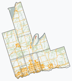
Scugog is a township in the Regional Municipality of Durham, south-central Ontario, Canada. It is northeast of Toronto and just north of Oshawa. The anchor and largest population base of the township is Port Perry. The township has a population of roughly 22,500. A smaller Scugog Township was also a historic municipality and geographic township prior to the amalgamation that formed the current municipality.
This article needs additional citations for verification. (April 2022) |
Scugog | |
|---|---|
Township (lower-tier) | |
| Township of Scugog | |
 Port Perry and Lake Scugog | |
 Scugog  Scugog | |
| Coordinates: 44°08′25″N 78°54′55″W | |
| Country | |
| Province | |
| Regional Municipality | Durham |
| Established | January 1, 1974 |
| Government | |
| • Mayor | Bobbie Drew [1] |
| • Regional Councillor | Wilma Wotten [1] |
| • Councillors | List |
| • MP | Erin O'Toole – Durham |
| • MPP | Todd McCarthy – Durham |
| Area | |
| • Land | 474.65 km2 (183.26 sq mi) |
| Population (2016)[2] | |
| • Total | 21,617 |
| • Density | 45.4/km2 (118/sq mi) |
| Time zone | UTC-5 (EST) |
| • Summer (DST) | UTC-4 (EDT) |
| Area code(s) | 905, 289, 365, and 742 |
| Website | www |
History
The original township of Scugog used to be divided between Reach and Cartwright townships in Ontario County and Northumberland and Durham County, respectively. When Lake Scugog was created by a dam in Lindsay in 1834, flooding created an island known as Scugog Island. The island was separated from Reach and Cartwright to form Scugog Township in 1856. In 1872 George Currie built a grain elevator which is currently Canada's oldest grain elevator. The new township was part of Ontario County.
According to Alan Rayburn's Place Names of Ontario, the name Scugog is derived from the Mississauga word sigaog, which means "waves leap over a canoe." This refers to the creation of Lake Scugog. Other sources indicate that it is an Ojibwe word meaning swampy or marshy land.[citation needed] The existence of two other lakes by the same name[3] (neither of which is artificial) lends support to the latter etymology.
The creation of the Regional Municipality of Durham in 1974 resulted in municipal restructuring of the various townships in Ontario County. The current township of Scugog was created through the amalgamation of the original townships of Scugog, Reach and Cartwright and the town of Port Perry.
Local government

The Township of Scugog is governed by a mayor, a regional councillor and five councillors elected on the basis of one per ward. Ward 1 includes Greenbank, Seagrave, Epsom, Utica and Manchester. Ward 2 is Port Perry (South of 7A) and Prince Albert. Ward 3 is Scugog Island. Ward 4 is Blackstock, Nestleton Station, Nestleton and Caesarea. Ward 5 is Port Perry (north of 7A). The council holds regular meetings, open to the public at the town hall in Port Perry.[citation needed]
The regional councillor joins the mayor to attend meetings at the Durham Regional Council.[4] The members of council elected in 2018 are:[5]
Mayor: Bobbie Drew[citation needed]
Regional Councillor: Wilma Wotten
Councillors:
- Ward 1 : Ian McDougall
- Ward 2: Janna Guido
- Ward 3: Robert Rock
- Ward 4: Deborah Kiezebrink
- Ward 5: Lance Brown
Current municipality
This section does not cite any sources. (April 2022) |
Port Perry is the chief commercial and administrative centre of the municipality. The township also includes the communities of:
- Aldreds Beach – east side of Scugog Island at the eastern end of Demara Road
- Blackstock – east of Port Perry on Old Scugog Road between Church Street and Highway 7A
- Cadmus – east of Blackstock on Edgerton Road at Cartwright East
- Caesarea – opposite of Aldreds Beach on Lake Scugog on Scugog Road
- Carnegie Beach – northeast end of Scugog Island on Carnegie Beach Road
- Cedar Shores – opposite Honey Beach on Lake Scugog on Island Road at Pine Point Road
- Epsom – west of Port Perry and north of Utica on Reach Street at Marsh Hill Road
- Fralicks Beach – northwest side of Scugog Island on Mississauga Trail north of Hood Drive
- Gerrows Beach – opposite of Highland Beach on Scugog Island
- Greenbank – northwest of Port Perry
- Highland Beach – located just north of Port Perry
- Honey Beach – east side of Scugog Island at end of Whitfield Road
- Lakeside Beach- opposite of Honey Beach on Lake Scugog
- Manchester – southwest of Port Perry on Highway 12
- Marsh Hill – northwest of Greenbank
- McLaren's Beach – north of Pine Point
- Nestleton – north of Nestleton on McLaughlin Road
- Nestleton Station – northeast of Blackstock on Highway 7A near Nestleton Road
- Pine Point – south of Aldreds Beach on Point Point Road east of Mississauga Trail
- Port View Beach – opposite of Port Perry on Scugog Island
- Prince Albert – located southwest of Port Perry at King Street and Simcoe Road
- Prospect – southwest of Port Perry on Highway 7 and Scugog Line 2
- Purple Hill on Shirley Road and west of Cartwright West Quarter Line
- Saintfield – north of Greenbank on Highway 7/12 at Saintfield Road
- Saint Christopher – due east of Scugog Point
- Scugog – at Island Road and Chandler Road just north of Scugog Centre
- Scugog Centre – east of Lakeside Beach at Island Road and Demara Road
- Scugog Point – north of Nestleton Station on east shore of Lake Scugog
- Seagrave – north of Port Perry on Simcoe Street
- Shirley – southeast of Port Perry on Shirley Road at Sandy Road
- Strattonville – west of Epsom and due east of Uxbridge
- Sunrise Beach- east side of Scugog Island at east end of Chandler Drive
- Sunset View – opposite of Honey Beach on Lake Scugog
- Utica – west of Port Perry and south of Epsom on Regional Road 21 and Marsh Hill Road
- Victoria Corners – northwest of Greenbank and near Leaskdale on Victoria Corners Road and Lake Ridge Road
- Williams Point – southwest of Scugog Point along east shore of Lake Scugog near Nestleton Road and Scugog Road
Mississaugas of Scugog First Nations
This section does not cite any sources. (April 2022) |
Reserves # 34 consists of two tracts, east of Mississauga's Trail between Hood Drive and Pogue Road as well as west of Mississauga's Trail from Pogue Road to Seven Mile Island Road/Chandler Drive.
Great Blue Heron Casino is located on the reserve. A Health and Resource Centre and Reserves Administration Office are located on Island Road.
Schools
Public Schools:
- R.H. Cornish P.S
- S.A. Cawker P.S
- Prince Albert P.S
- Cartwright P.S
- Greenbank P.S
High Schools:
- Port Perry High School
Catholic Schools:
- Good Shepheard Catholic School
Economy
This section does not cite any sources. (April 2022) |
The largest private-sector employer in the area is the Great Blue Heron Casino, located on the Scugog First Nation on Scugog Island. Schneider Meats also has a facility in the Township. The Township is also a popular tourist destination due to the casino and recreational opportunities from Lake Scugog. Many residents also commute to other Durham Region communities and further afield by road.
Attractions
This section does not cite any sources. (April 2022) |
- Nonquon Provincial Wildlife Area – 1,120-hectare (2,800 acre) protected area located northwest of Port Perry and managed by Ontario Ministry of Natural Resources
- Ocala Orchards Farm Winery – 100 acre winery established in 1995 by Irwin and Alissa Smith south of Utica
- Scugog Shores Museum
- Oakridges Moraine Trail – located at south end of Scugog
- Historic Downtown Port Perry
- Lake Scugog waterfront
Transportation
Roads and highways
Main roads in Scugog are:
- Simcoe Street (Durham Regional Road 2) – connect communities north and south from Port Perry
- Highway 7/Highway 12 – connects communities south and north of Greenbank, as well as to Oshawa
- Highway 7A – connects communities east and west of Port Perry
- Island Road (Durham Regional Road 7) – north and south areas on the west side of Scugog Island
Airports
There are two airports in Scugog, both are public airfields used by small propeller aircraft:
Lakeridge Health Port Perry site has a helipad for air ambulance use only.
Demographics
| Year | Pop. | ±% |
|---|---|---|
| 1991 | 17,810 | — |
| 1996 | 18,837 | +5.8% |
| 2001 | 20,173 | +7.1% |
| 2006 | 21,439 | +6.3% |
| 2011 | 21,569 | +0.6% |
| 2016 | 21,617 | +0.2% |
| 2021 | 21,581 | −0.2% |
In the 2021 Census of Population conducted by Statistics Canada, Scugog had a population of 21,581 living in 8,243 of its 8,734 total private dwellings, a change of -0.2% from its 2016 population of 21,617. With a land area of 474.38 km2 (183.16 sq mi), it had a population density of 45.5/km2 (117.8/sq mi) in 2021.[6]
| Racial makeup | |||
|---|---|---|---|
| Canada 2006 Census | Population | % of total population | |
| Visible minority group Source:[7] | South Asian | 75 | 0.4 |
| Chinese | 70 | 0.3 | |
| Black | 70 | 0.3 | |
| Filipino | 25 | 0.1 | |
| Latin American | 15 | 0.1 | |
| Southeast Asian | 0 | 0 | |
| Arab | 0 | 0 | |
| West Asian | 15 | 0.1 | |
| Korean | 35 | 0.2 | |
| Japanese | 45 | 0.2 | |
| Mixed visible minority | 10 | 0 | |
| Other visible minority | 35 | 0.2 | |
| Total visible minority population | 395 | 1.9 | |
| Aboriginal group Source:[8] | First Nations | 110 | 0.5 |
| Métis | 60 | 0.3 | |
| Inuit | 0 | 0 | |
| Total Aboriginal population | 180 | 0.9 | |
| White | 20,580 | 97.3 | |
| Total population | 21,155 | 100 | |
In film
- The 1973 TV movie, The Thanksgiving Treasure, starring Jason Robards, was partially filmed at the general store in Seagrave, and at a farm on Old Simcoe Road just to the west of Seagrave.[9]
- The 1978 TV moive, Home to Stay, starring Henry Fonda, was shot on a farm on 12 Scugog Line and at Seagrave.
- Parts of the 1996 film Fly Away Home were filmed in Scugog.
- The downtown scenes from 2004's Welcome to Mooseport were shot in Port Perry.
- The downtown scenes from Hemlock Grove were shot in Port Perry.
- In Season 3 "Lakeside" of American Gods (TV series) some parts were shot in downtown Port Perry. They painted the mill black and made other little changes around the town
See also
- List of townships in Ontario
References
- "Mayor and Council". Township of Scugog. Retrieved 2018-12-13.
- Statistics Canada 2011 Census – Scugog community profile
- "Geographical names in Canada: Search Results for Scugog". www.nrcan.gc.ca. Retrieved June 28, 2019.
- "Council Members". www.durham.ca. Retrieved December 13, 2018.
- "Mayor and Council". www.scugog.ca. October 22, 2018. Retrieved December 13, 2018.
- "Population and dwelling counts: Canada, provinces and territories, census divisions and census subdivisions (municipalities), Ontario". Statistics Canada. February 9, 2022. Retrieved April 2, 2022.
- "Community Profiles from the 2006 Census". Statistics Canada – Census Subdivision.
- "Aboriginal Peoples – Data table". Statistics Canada.
- "The Thanksgiving Treasure (1973 TV Movie) Filming & Production". IMDb. Retrieved 24 November 2018.
External links
 Media related to Scugog at Wikimedia Commons
- Official website
Greater Toronto Area | ||
|---|---|---|
Largest city: Toronto | ||
| Regions |  | |
| Cities |
| |
| Towns | ||
| Townships | ||
| Municipalities |
| |
Authority control | |
|---|---|
| General |
|
| National libraries | |
На других языках
[de] Scugog (Ontario)
Scugog (offiziell Township of Scugog) ist eine Verwaltungsgemeinde im Südosten der kanadischen Provinz Ontario. Das Township liegt in der Regional Municipality of Durham und hat den Status einer Lower Tier (untergeordneten Gemeinde).[2]- [en] Scugog
Другой контент может иметь иную лицензию. Перед использованием материалов сайта WikiSort.org внимательно изучите правила лицензирования конкретных элементов наполнения сайта.
WikiSort.org - проект по пересортировке и дополнению контента Википедии