world.wikisort.org - USA
Iron Mountain is a city in the U.S. state of Michigan. The population was 7,518 at the 2020 census, down from 7,624 at the 2010 census. It is the county seat of Dickinson County,[4] in the state's Upper Peninsula. Iron Mountain was named for the valuable iron ore found in the vicinity.[5]
Iron Mountain, Michigan | |
|---|---|
City | |
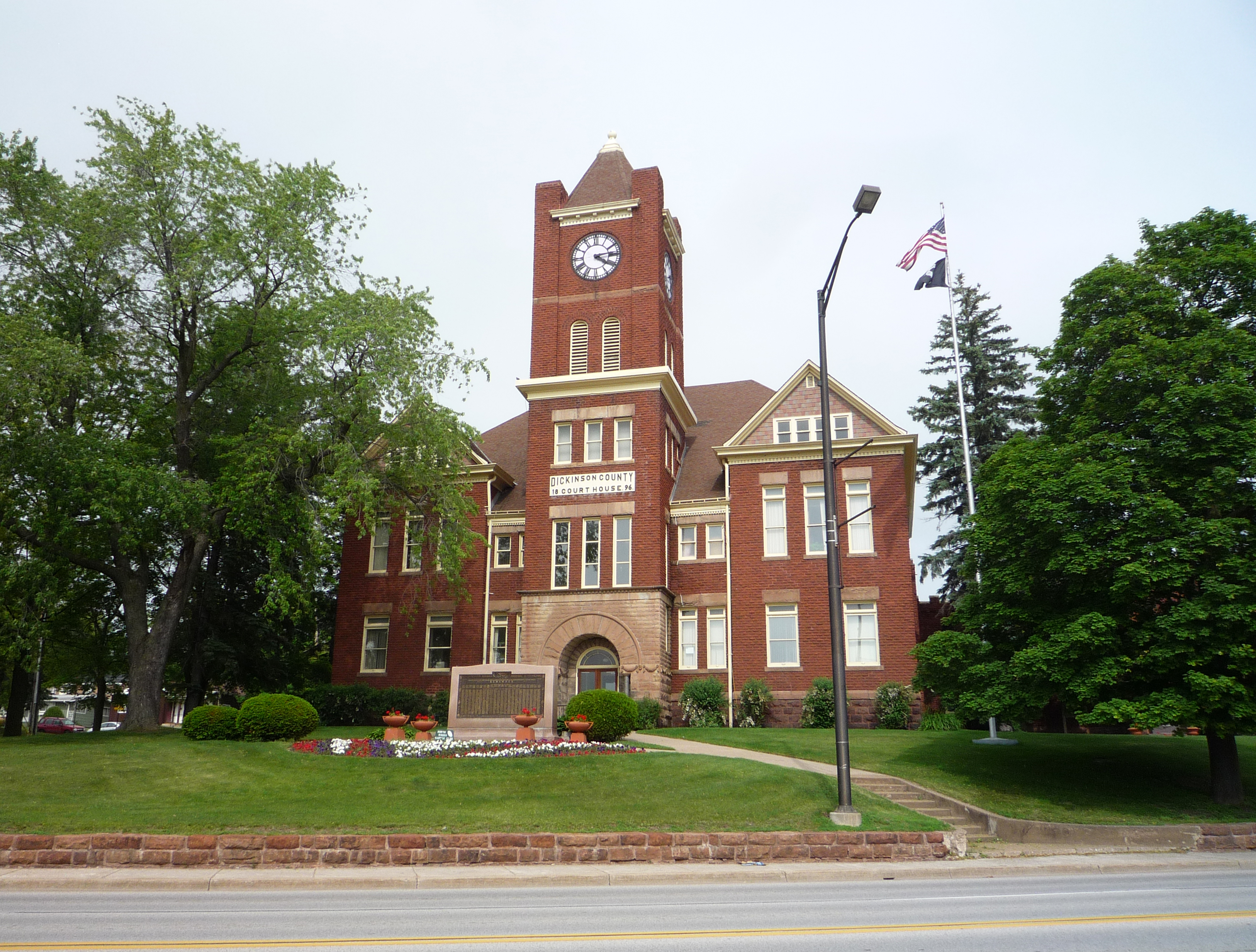
 Iron Mountain City Hall | |
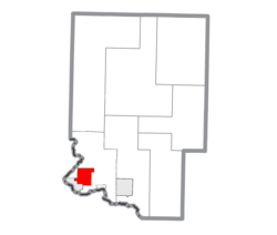 Location within Dickinson County | |
 Iron Mountain Location within the state of Michigan | |
| Coordinates: 45°49′21″N 88°3′51″W | |
| Country | United States |
| State | Michigan |
| County | Dickinson |
| Area | |
| • Total | 8.21 sq mi (21.27 km2) |
| • Land | 7.54 sq mi (19.53 km2) |
| • Water | 0.67 sq mi (1.73 km2) |
| Elevation | 1,138 ft (347 m) |
| Population (2020) | |
| • Total | 7,518 |
| • Density | 996.82/sq mi (384.88/km2) |
| Time zone | UTC-6 (Central (CST)) |
| • Summer (DST) | UTC-5 (CDT) |
| ZIP codes | 49801, 49802, 49831 |
| Area code(s) | 906 |
| FIPS code | 26-40960[2] |
| GNIS feature ID | 0629079[3] |
| Website | Official site |
Iron Mountain is the principal city of the Iron Mountain, MI-WI Micropolitan Statistical Area, which includes all of Dickinson County, Michigan and Florence County in Wisconsin.
Iron Mountain hosts a few points of interest such as the Millie Hill bat cave,[6] The Cornish Pump, and is located adjacent to Pine Mountain ski jump/ski resort, one of the largest artificial ski jumps in the world.[7] It shares Woodward Avenue with the neighboring town, Kingsford. In addition, Iron Mountain is known for its pasties, Bocce Ball Tournaments, World Cup Ski Jumps, and Italian cuisine. Iron Mountain was also named a "Michigan Main Street" community by Michigan Governor Jennifer Granholm in 2006. It is one of only thirteen such communities in the State of Michigan in 2008. It is also the hometown of Michigan State University men's basketball coach Tom Izzo and former NFL head coach Steve Mariucci.
Geography
According to the United States Census Bureau, the city has a total area of 8.04 square miles (20.82 km2), of which, 7.37 square miles (19.09 km2) of it is land and 0.67 square miles (1.74 km2) is water.[8]
Transportation
Bus service
Indian Trails provides daily intercity bus service between St. Ignace and Ironwood, Michigan.[9]
Major highways
 US 2 runs east to Escanaba and west to Ironwood.
 US 141 merges with US 2 just east of the city and heads northward toward Crystal Falls; southbound it continues on to Green Bay, Wisconsin.
 M-95 connects with Kingsford just to the south and with M-69 east at Randville about 14 miles (23 km) north.
Airport
The Iron Mountain area is served by Ford Airport (airport code: KIMT). Commercial air travel is provided by SkyWest Airlines, providing jet service as Delta Connection. Located three miles west of the city, the airport handles approximately 7,600 operations per year, with roughly 27% commercial service, 57% air taxi and 16% general aviation. The airport has a 6,501 foot asphalt runway with approved ILS, GPS and NDB approaches (Runway 1-19) and a 3,808 foot asphalt crosswind runway (Runway 13-31).[10]
Train
Soon after this area was settled the news of mineral riches brought the railroads. First was Milwaukee Road, Then Chicago & Northwestern and Wisconsin and Michigan. The W&M Railroad, after it was sold ended all service in 1938.[citation needed]
The thriving of automobile usage in the 1950s caused the rail passenger usage to wain, and the Milwaukee Road discontinued the Chippewa passenger train altogether on February 2, 1960.[11][12][13] With few riders remaining, the Copper Country Limited made its last runs on March 7, 1968.[14] The C&NW also discontinued its service to Iron Mountain in the early 1960s.
Although there is currently no direct rail passenger service to Iron Mountain, Amtrak Thruway Bus Service connects to Marinette, Wisconsin.[15]
Demographics
| Historical population | |||
|---|---|---|---|
| Census | Pop. | %± | |
| 1890 | 8,599 | — | |
| 1900 | 9,242 | 7.5% | |
| 1910 | 9,216 | −0.3% | |
| 1920 | 8,251 | −10.5% | |
| 1930 | 11,652 | 41.2% | |
| 1940 | 11,080 | −4.9% | |
| 1950 | 9,679 | −12.6% | |
| 1960 | 9,299 | −3.9% | |
| 1970 | 8,702 | −6.4% | |
| 1980 | 8,341 | −4.1% | |
| 1990 | 8,525 | 2.2% | |
| 2000 | 8,154 | −4.4% | |
| 2010 | 7,624 | −6.5% | |
| 2020 | 7,518 | −1.4% | |
| U.S. Decennial Census[16][17] | |||
2010 census
As of the census[18] of 2010, there were 7,624 people, 3,362 households, and 2,025 families residing in the city. The population density was 1,034.5 inhabitants per square mile (399.4/km2). There were 3,784 housing units at an average density of 513.4 per square mile (198.2/km2). The racial makeup of the city was 96.3% White, 0.5% African American, 0.6% Native American, 0.7% Asian, 0.3% from other races, and 1.7% from two or more races. Hispanic or Latino of any race were 1.6% of the population.
There were 3,362 households, of which 28.0% had children under the age of 18 living with them, 44.3% were married couples living together, 11.0% had a female householder with no husband present, 4.8% had a male householder with no wife present, and 39.8% were non-families. 34.2% of all households were made up of individuals, and 13.4% had someone living alone who was 65 years of age or older. The average household size was 2.21 and the average family size was 2.83.
The median age in the city was 42.4 years. 22.6% of residents were under the age of 18; 8% were between the ages of 18 and 24; 22.9% were from 25 to 44; 29.3% were from 45 to 64; and 17.2% were 65 years of age or older. The gender makeup of the city was 49.2% male and 50.8% female.
2000 census
As of the census[2] of 2000, there were 8,154 people, 3,458 households, and 2,147 families residing in the city. The population density was 1,132.6 per square mile (437.3/km2). There were 3,819 housing units at an average density of 530.5 per square mile (204.8/km2). The racial makeup of the city was 97.67% White, 0.20% African American, 0.48% Native American, 0.66% Asian, 0.01% Pacific Islander, 0.23% from other races, and 0.75% from two or more races. Hispanic or Latino of any race were 1.07% of the population. 20.6% were of Italian, 14.0% German, 9.0% Swedish, 8.8% English, 8.8% French, 5.8% Finnish and 5.5% Irish ancestry according to Census 2000. 97.2% spoke English and 1.4% Italian as their first language.
There were 3,458 households, out of which 30.0% had children under the age of 18 living with them, 48.8% were married couples living together, 9.6% had a female householder with no husband present, and 37.9% were non-families. 33.3% of all households were made up of individuals, and 16.2% had someone living alone who was 65 years of age or older. The average household size was 2.29 and the average family size was 2.94.
In the city, the population was spread out, with 25.1% under the age of 18, 7.1% from 18 to 24, 27.2% from 25 to 44, 21.1% from 45 to 64, and 19.6% who were 65 years of age or older. The median age was 39 years. For every 100 females, there were 96.4 males. For every 100 females age 18 and over, there were 90.6 males.
The median income for a household in the city was $32,526, and the median income for a family was $43,687. Males had a median income of $38,309 versus $22,533 for females. The per capita income for the city was $19,918. About 9.4% of families and 10.6% of the population were below the poverty line, including 13.5% of those under age 18 and 10.5% of those age 65 or over.
Media
Newspaper
The newspaper of record in Dickinson County is The Daily News.[19]
Television
Iron Mountain is included in the Marquette television market, NBC affiliate WLUC operates a local news bureau covering the city and neighboring areas. Due to distance from the transmitters and topography in the region terrestrial television signals are very limited in the area with the strongest signal coming from Wisconsin Public Television translator station W30DZ originating from Fence, WI.
Historically Iron Mountain was served by full power station WDHS which intermittently carried a religious format between long periods of silence, translators of various stations originating from Green Bay, and a handful of encrypted cable channels broadcast over the air.
Radio

Radio stations that are located within listening range of Iron Mountain include:
- WNMU-FM 90.1 FM Northern Michigan University Marquette, National Public Radio
- WMVM-FM 90.7 FM Goodman-Armstrong Creek, Wisconsin, Gospel
- WVCM 91.5 FM VCY America Iron Mountain, Religious
- WIMK 93.1 FM Iron Mountain, Classic Rock
- WZNL 94.3 FM Norway, Adult Contemporary
- WEUL 98.1 FM Gospel Opportunities Radio Network Kingsford, Religious
- WIKB-FM 99.1 FM Iron River, Oldies
- WOBE 100.7 FM Crystal Falls, Top 40/CHR
- WJNR-FM 101.5 FM Iron Mountain, Frog Country[20]
- WGMV 106.3 FM Stephenson, Classic Country
- WHTO 106.7 FM Iron Mountain, 80's Rock
- WFER 1230 AM Iron River, Oldies
- WMIQ 1450 AM Iron Mountain, Talk[21]
Environmental importance
Iron Mountain's abandoned Millie Hill mine is home to one of the largest bat hibernacula in the Midwest. Roughly 25,000-50,000 bats make their winter home there.
Menominee Range

Iron Mountain is located within the Menominee Iron-Bearing District, which covers southern Dickinson County and extends westward into Iron County. Iron ore was discovered in Dickinson County in 1849 and Iron County in 1851. Ore is produced from the middle Precambrian Vulcan Iron-Formation around Iron Mountain, and the Riverton Iron-Formation between Iron River, Michigan and Crystal Falls, Michigan. Both formations belong to the Marquette Range Supergroup. The Vulcan is between 300 and 800 feet thick and consists of hematite and magnetite with quartz, while the Riverton is 100–600 feet thick and consists of siderite and chert.[22]
Historical importance
Iron Mountain began as a mining city adjacent to the Chapin iron mine. The Chapin Mine iron deposit was discovered in 1879 by two men, James John Hagerman and Dr. Nelson Powell Hulst. They had leased the land from a man from Niles, Michigan, Henry Chapin, hence the name of the mine. They began to sink shafts on the slope of Millie Hill. Then on July 5, 1879, Captain John Wicks and seven other men were sent into the forest with a wagon filled with tools to search for a place to set up camp. After numerous unsuccessful shafts the company was ready to shut down operation. Hagerman and Hulst had faith in the land and tried one more shaft. The shaft was 90 feet (27 m) deep and many months later, there was a successful hit that was at the heart of the iron ore. The original land was very swampy and filled with trees. To get rid of all this water the Chapin Mine Pumping Engine was created.
Iron Mountain is home of the largest steam-driven pumping engine in the United States.[23] Chapin Mine Steam Pump Engine (Cornish Pump) was patterned after the ones used in Cornwall in the deep tin mines.
Edwin Reynolds, chief engineer for the E.P. Allis Company (now the Allis-Chalmers Co.) of Milwaukee, Wisconsin, designed the steam engine in 1890. The engine's high-pressure cylinder has a 50-inch (1,300 mm) bore, and the low-pressure cylinder is 100 inches (2,500 mm) in diameter. The flywheel is 40 feet (12 m) in diameter, weighs 160 tons, and had an average speed of only 10 revolutions per minute. The drive shaft to the flywheel is 24 inches (610 mm) in diameter. The engine itself rises 54 feet (16 m) above the floor of the room. The designers estimate the weight to be 725 tons over all.
The pumping equipment utilized a reciprocating motion to a line of steel rods extending 1,500 feet (460 m) down into the mine, with eight pumps attached at intervals of 170 to 192 feet (59 m) along the rods. Each of the pumps forced the water to the next higher pump and finally out to the surface of the mine.
As the engine was designed to run slowly, the pumps had a capacity of over 300 gallons per stroke of the pistons. At ten revolutions per minute, this meant over 3,000 gallons of water poured out through a 28-inch (710 mm) pipe every minute. A total of 5,000,000 gallons of water could be removed from the mine each day. At that time the pump's estimated cost was nearly $250,000.
After only a few years of successful operation, the giant pumping facility was moved from the "D" shaft of the Chapin Mine. More than a million tons of the best grade ore found in the entire mine was discovered directly below the pump, so it was essential that it be moved for excavation. In 1898 the pump was dismantled and stored away until 1907 when it was reassembled on the "C" shaft of the Chapin Mine. The pump operated here until 1932 when the Chapin Mine permanently closed its doors. In 1934 the pumping engine was offered to the County of Dickinson as a relic for sightseers to visit. The pump remained exposed to the elements for nearly 50 years, and in 1982 a building was constructed around the pump by the Menominee Range Historical Foundation. Today the Cornish Pumping Engine & Mining Museum exists on the site.
The Chapin Mine Pumping Engine (Cornish Pump) was designated as a National Historic Mechanical Engineering Monument by the American Society of Mechanical Engineers on June 6, 1987 and has been featured in the History Channel's Modern Marvels Series on the World's Biggest Machines.
Notable people
- James L. Adams, member of the Minnesota House of Representatives
- Randy Awrey, 1975 DII National Champion football player at Northern Michigan University and current head football coach at Concordia University Chicago
- John Biolo, former NFL player for the Green Bay Packers
- Neno DaPrato, college All-American and professional football player
- Robert J. Flaherty, filmmaker
- Walter Samuel Goodland, 31st governor of Wisconsin
- R. James Harvey, former congressman and federal judge
- Tom Izzo, men's basketball head coach for Michigan State University since 1995
- Johnny Johnson, baseball player
- Beau LaFave, member of the Michigan House of Representatives
- Gordon Lund, baseball player
- Steve Mariucci, NFL Network analyst and former NFL head coach
- Thomas Lawrence Noa, Roman Catholic bishop
- Phillip Rahoi, member of the Michigan Legislature and mayor of Iron Mountain[24]
- Gene Ronzani, former NFL head coach of the Green Bay Packers
- Albert J. Wilke, member of the Michigan Senate
- Delaney Schnell, American Olympic diver.
Climate
This climatic region is typified by large seasonal temperature differences, with warm to hot (and often humid) summers and cold (sometimes severely cold) winters. According to the Köppen Climate Classification system, Iron Mountain has a humid continental climate, abbreviated "Dfb" on climate maps.[25]
| Climate data for Iron Mountain WWTP, Michigan (1991–2020 normals, extremes 1899–present) | |||||||||||||
|---|---|---|---|---|---|---|---|---|---|---|---|---|---|
| Month | Jan | Feb | Mar | Apr | May | Jun | Jul | Aug | Sep | Oct | Nov | Dec | Year |
| Record high °F (°C) | 57 (14) |
62 (17) |
82 (28) |
94 (34) |
100 (38) |
100 (38) |
104 (40) |
101 (38) |
98 (37) |
88 (31) |
77 (25) |
64 (18) |
104 (40) |
| Average high °F (°C) | 24.0 (−4.4) |
28.3 (−2.1) |
39.2 (4.0) |
51.9 (11.1) |
66.4 (19.1) |
76.0 (24.4) |
80.4 (26.9) |
78.3 (25.7) |
70.1 (21.2) |
55.7 (13.2) |
40.8 (4.9) |
29.0 (−1.7) |
53.3 (11.8) |
| Daily mean °F (°C) | 14.2 (−9.9) |
17.2 (−8.2) |
28.0 (−2.2) |
40.5 (4.7) |
54.1 (12.3) |
64.0 (17.8) |
68.5 (20.3) |
66.7 (19.3) |
58.6 (14.8) |
45.3 (7.4) |
32.5 (0.3) |
20.9 (−6.2) |
42.5 (5.8) |
| Average low °F (°C) | 4.4 (−15.3) |
6.1 (−14.4) |
16.9 (−8.4) |
29.0 (−1.7) |
41.7 (5.4) |
52.0 (11.1) |
56.6 (13.7) |
55.1 (12.8) |
47.0 (8.3) |
34.9 (1.6) |
24.2 (−4.3) |
12.8 (−10.7) |
31.7 (−0.2) |
| Record low °F (°C) | −35 (−37) |
−39 (−39) |
−27 (−33) |
−6 (−21) |
16 (−9) |
24 (−4) |
35 (2) |
30 (−1) |
19 (−7) |
8 (−13) |
−10 (−23) |
−26 (−32) |
−39 (−39) |
| Average precipitation inches (mm) | 1.36 (35) |
1.15 (29) |
1.68 (43) |
2.79 (71) |
3.48 (88) |
3.71 (94) |
3.41 (87) |
3.38 (86) |
3.60 (91) |
3.27 (83) |
1.90 (48) |
1.76 (45) |
31.49 (800) |
| Average snowfall inches (cm) | 14.7 (37) |
11.2 (28) |
8.9 (23) |
7.1 (18) |
0.2 (0.51) |
0.0 (0.0) |
0.0 (0.0) |
0.0 (0.0) |
0.0 (0.0) |
0.4 (1.0) |
5.5 (14) |
13.0 (33) |
61.0 (155) |
| Average precipitation days (≥ 0.01 in) | 10.1 | 6.9 | 7.7 | 10.1 | 12.0 | 11.5 | 11.6 | 10.6 | 11.3 | 11.7 | 8.9 | 9.6 | 122.0 |
| Average snowy days (≥ 0.1 in) | 9.8 | 6.3 | 4.9 | 2.8 | 0.2 | 0.0 | 0.0 | 0.0 | 0.0 | 0.5 | 3.8 | 8.0 | 36.3 |
| Source: NOAA[26][27] | |||||||||||||
References
- "2020 U.S. Gazetteer Files". United States Census Bureau. Retrieved May 21, 2022.
- "U.S. Census website". United States Census Bureau. Retrieved 2008-01-31.
- "US Board on Geographic Names". United States Geological Survey. 2007-10-25. Retrieved 2008-01-31.
- "Find a County". National Association of Counties. Archived from the original on 2011-05-31. Retrieved 2011-06-07.
- Gannett, Henry (1905). The Origin of Certain Place Names in the United States. Govt. Print. Off. pp. 166.
- "#23 – Channel Your Inner Batman at the Millie Hill Bat Cave | Things to do in the U.P".
- "Pine Mountain Ski Jump". exploringthenorth.com.
- "US Gazetteer files 2010". United States Census Bureau. Archived from the original on 2012-07-02. Retrieved 2012-11-25.
- "ST. IGNACE-SAULT STE. MARIE-IRONWOOD" (PDF). Indian Trails. January 15, 2013. Archived from the original (PDF) on July 4, 2014. Retrieved 2013-02-28.
- "AirNav: Airport Information".
- Scribbins 1970, p. 200
- "Milwaukee Road Drops Channing Chippewa Train". The Escanaba Daily Press. Escanaba, MI. Associated Press. January 23, 1960. p. 1 – via Newspapers.com.
- "Milwaukee Road Moves Up Date To Curtail Service". The Escanaba Daily Press. Escanaba, MI. February 2, 1960. p. 3 – via Newspapers.com.
- Burns, Adam (December 16, 2021). "The Copper Country Limited". American-Rails.com. Retrieved February 4, 2022.
- "2022 Wisconsin Amtrak Service" (PDF). Wisconsin Department of Transportation. 2022. Retrieved April 3, 2022.
- "Census of Population and Housing". Census.gov. Retrieved June 4, 2015.
- "United States Census Bureau QuickFacts". United States Census Bureau. Retrieved February 26, 2022.
- "U.S. Census website". United States Census Bureau. Retrieved 2012-11-25.
- "IronMountainDailyNews.com - news, sports, business, jobs - The Daily News". ironmountaindailynews.com.
- "WJNR 101.5 FM, "Frog Country"". Retrieved May 9, 2012.
- On the radio.net.
- Carl e. Dutton; Paul W. Zimmer (1968). "Iron Ore deposits of the Menominee District, Michigan". In Ridge, J.D. (ed.). Ore Deposits of the United States, 1933–1967. Vol. 1. New York: American Institute of Mining, Metallurgical, and Petroleum Engineers. pp. 539–542. OCLC 333389.
- "The Cornish Pump, the Largest Steam Driven Pumping Engine in America, Iron Mountain MI". exploringthenorth.com.
- "Index to Politicians". Political Graveyard.com. Retrieved February 12, 2012.
- "Iron Mountain, Michigan Köppen Climate Classification (Weatherbase)". Weatherbase.
- "NowData - NOAA Online Weather Data". National Oceanic and Atmospheric Administration. Retrieved September 2, 2021.
- "Station: Iron MTN-Kingsford WWTP, MI". U.S. Climate Normals 2020: U.S. Monthly Climate Normals (1991-2020). National Oceanic and Atmospheric Administration. Retrieved September 2, 2021.
- Scribbins, Jim (1970). The Hiawatha Story. Milwaukee, Wisconsin: Kalmbach Publishing Company. LCCN 70107874. OCLC 91468.
External links
| Wikimedia Commons has media related to Iron Mountain, Michigan. |
- Bruss, T. P. (November 3, 2018). "C&NW Iron Mountain, MI, Depot". RRPicturearchives.NET. Retrieved 3 February 2022.
Municipalities and communities of Dickinson County, Michigan, United States | ||
|---|---|---|
County seat: Iron Mountain | ||
| Cities |  | |
| Charter township | ||
| Civil townships | ||
| CDP | ||
| Other unincorporated communities | ||
| ||
| Central cities | |
|---|---|
| Counties | |
| Geography |
|
| Transportation |
|
| Economy |
|
| |
Authority control | |
|---|---|
| General | |
| National libraries | |
| Other |
|
На других языках
[de] Iron Mountain
Iron Mountain ist eine Kleinstadt (City) im Nordwesten des US-Bundesstaates Michigan. Die Stadt gehört zum Dickinson County und ist dessen Verwaltungssitz. Bei der Volkszählung 2010 hatte Iron Mountain 7624 Einwohner.- [en] Iron Mountain, Michigan
Другой контент может иметь иную лицензию. Перед использованием материалов сайта WikiSort.org внимательно изучите правила лицензирования конкретных элементов наполнения сайта.
WikiSort.org - проект по пересортировке и дополнению контента Википедии