world.wikisort.org - USA
Allen Parish (French: Paroisse d'Allen) is a parish located in the U.S. state of Louisiana. As of the 2010 census, the population was 25,764.[1] The parish seat is Oberlin and the largest city is Oakdale.[2] Allen Parish is in southwestern Louisiana, southwest of Alexandria.
Allen Parish | |
|---|---|
Parish | |
 Allen Parish Courthouse in Oberlin (near sunset) | |
 Seal | |
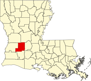 Location within the U.S. state of Louisiana | |
 Louisiana's location within the U.S. | |
| Coordinates: 30°40′N 92°50′W | |
| Country | |
| State | |
| Founded | 1912 |
| Named for | Henry Watkins Allen |
| Seat | Oberlin |
| Largest city | Oakdale |
| Area | |
| • Total | 766 sq mi (1,980 km2) |
| • Land | 762 sq mi (1,970 km2) |
| • Water | 4.1 sq mi (11 km2) 0.5% |
| Population (2010) | |
| • Total | 25,764 |
| • Estimate (2018) | 25,605 |
| • Density | 34/sq mi (13/km2) |
| Time zone | UTC−6 (Central) |
| • Summer (DST) | UTC−5 (CDT) |
| Congressional district | 4th |
| Website | www |
Allen Parish is named for former Confederate States Army general and Governor of Louisiana Henry Watkins Allen. It was separated in 1912 from the larger Calcasieu Parish to the southwest.
Leatherwood Museum
On September 27, 2008, the Allen Parish Tourist Commission opened Leatherwood Museum in Oakdale in a two-story house which served during the early 20th century as a hospital where women waited on the second-floor balcony to deliver their babies.[3]
The museum focuses on the history of agriculture and timber.[3]
Geography
According to the U.S. Census Bureau, the parish has a total area of 766 square miles (1,980 km2), of which 762 square miles (1,970 km2) is land and 4.1 square miles (11 km2) (0.5%) is water.[4]
Major highways
 U.S. Highway 165
 U.S. Highway 190
 Louisiana Highway 10
 Louisiana Highway 26
Adjacent parishes
- Vernon Parish (northwest)
- Rapides Parish (northeast)
- Evangeline Parish (east)
- Jefferson Davis Parish (south)
- Beauregard Parish (west)
Waterways
- Bundick Creek
- Calcasieu River
- Ouiski Chitto Creek
- Six Mile Creek
- Ten Mile Creek
Demographics
| Historical population | |||
|---|---|---|---|
| Census | Pop. | %± | |
| 1920 | 18,382 | — | |
| 1930 | 15,261 | −17.0% | |
| 1940 | 17,540 | 14.9% | |
| 1950 | 18,835 | 7.4% | |
| 1960 | 19,867 | 5.5% | |
| 1970 | 20,794 | 4.7% | |
| 1980 | 21,390 | 2.9% | |
| 1990 | 21,226 | −0.8% | |
| 2000 | 25,440 | 19.9% | |
| 2010 | 25,764 | 1.3% | |
| 2018 (est.) | 25,605 | [5] | −0.6% |
| U.S. Decennial Census[6] 1790-1960[7] 1900-1990[8] 1990-2000[9] 2010-2013[1] | |||
2020 census
| Race | Number | Percentage |
|---|---|---|
| White (non-Hispanic) | 15,146 | 66.58% |
| Black or African American (non-Hispanic) | 4,016 | 17.65% |
| Native American | 525 | 2.31% |
| Asian | 183 | 0.8% |
| Pacific Islander | 7 | 0.03% |
| Other/Mixed | 980 | 4.31% |
| Hispanic or Latino | 1,893 | 8.32% |
As of the 2020 United States census, there were 22,750 people, 7,925 households, and 5,566 families residing in the parish.
2000 census
As of the census[11] of 2000, there were 25,440 people, 8,102 households, and 5,930 families residing in the parish. The population density was 33 people per square mile (13/km2). There were 9,157 housing units at an average density of 12 per square mile (5/km2). The racial makeup of the parish was 71.90% White, 24.60% Black or African American, 1.72% Native American, 0.57% Asian, 0.01% Pacific Islander, 0.24% from other races, and 0.96% from two or more races. 4.50% of the population were Hispanic or Latino of any race. 6.22% reported speaking French or Cajun French at home, while 4.68% speak Spanish.[12]
There were 8,102 households, out of which 36.90% had children under the age of 18 living with them, 54.00% were married couples living together, 15.20% had a female householder with no husband present, and 26.80% were non-families. 24.30% of all households were made up of individuals, and 11.10% had someone living alone who was 65 years of age or older. The average household size was 2.62 and the average family size was 3.12.
In the parish the population was spread out, with 24.60% under the age of 18, 9.30% from 18 to 24, 33.40% from 25 to 44, 20.80% from 45 to 64, and 11.80% who were 65 years of age or older. The median age was 35 years. For every 100 females there were 126.40 males. For every 100 females age 18 and over, there were 133.50 males.
The median income for a household in the parish was $27,777, and the median income for a family was $33,920. Males had a median income of $32,371 versus $17,154 for females. The per capita income for the parish was $13,101. About 17.90% of families and 19.90% of the population were below the poverty line, including 22.60% of those under age 18 and 21.50% of those age 65 or over.
The most populated city as of the 2000 census was Oakdale, LA.
Politics
Allen was a strongly Democratic parish in Presidential and Congressional elections; the last Republican to win a majority in the parish before 2000 was Richard Nixon in 1972. Starting in 2000, when George W. Bush narrowly won the parish, Allen has become a Republican stronghold; John McCain won nearly two-thirds of the parish's vote in 2008.
Allen is part of Louisiana's 4th congressional district, held by Republican Mike Johnson. In the Louisiana House of Representatives Allen is part of the 32nd district, held by Republican R. DeWitt Carrier. In the Louisiana Senate Allen is part of the 28th district, held by Republican Heather Cloud.
| Year | Republican | Democratic | Third parties |
|---|---|---|---|
| 2020 | 77.2% 7,574 | 21.5% 2,108 | 1.3% 128 |
| 2016 | 74.3% 6,867 | 22.8% 2,106 | 3.0% 272 |
| 2012 | 69.8% 6,495 | 28.1% 2,617 | 2.1% 195 |
| 2008 | 66.9% 6,333 | 30.5% 2,891 | 2.6% 243 |
| 2004 | 56.3% 5,140 | 41.6% 3,791 | 2.1% 193 |
| 2000 | 48.7% 4,035 | 47.2% 3,914 | 4.1% 343 |
| 1996 | 29.3% 2,589 | 55.7% 4,930 | 15.0% 1,325 |
| 1992 | 30.6% 3,069 | 56.2% 5,626 | 13.2% 1,322 |
| 1988 | 40.9% 3,674 | 57.9% 5,204 | 1.2% 111 |
| 1984 | 47.7% 4,474 | 51.6% 4,842 | 0.7% 66 |
| 1980 | 34.8% 3,328 | 63.3% 6,057 | 1.9% 179 |
| 1976 | 27.1% 2,080 | 70.0% 5,373 | 2.9% 220 |
| 1972 | 59.4% 3,581 | 33.7% 2,029 | 6.9% 418 |
| 1968 | 13.8% 1,004 | 27.9% 2,026 | 58.3% 4,229 |
| 1964 | 41.7% 2,704 | 58.3% 3,787 | |
| 1960 | 27.0% 1,676 | 59.8% 3,719 | 13.2% 820 |
| 1956 | 50.5% 2,469 | 46.7% 2,284 | 2.9% 140 |
| 1952 | 28.0% 1,461 | 72.0% 3,754 | |
| 1948 | 7.5% 241 | 62.0% 1,996 | 30.5% 982 |
| 1944 | 13.2% 336 | 86.8% 2,205 | |
| 1940 | 9.7% 277 | 90.4% 2,592 | |
| 1936 | 12.8% 324 | 87.2% 2,207 | |
| 1932 | 5.9% 130 | 93.9% 2,075 | 0.2% 4 |
| 1928 | 35.7% 725 | 64.3% 1,308 | |
| 1924 | 28.8% 410 | 71.2% 1,012 | |
| 1920 | 19.4% 242 | 80.6% 1,008 | |
| 1916 | 10.2% 81 | 89.5% 708 | 0.3% 2 |
Education
Residents are zoned to Allen Parish Schools[14]
It is in the service area of Sowela Technical Community College.[15]
National Guard
Detachment 1, B Company 3-156TH Infantry Battalion of the 256TH IBCT resided in Oakdale, Louisiana. This unit deployed twice to Iraq in 2004-5 and 2010. Armory was closed, elements moved to Camp Beauregard.
Communities

City
- Oakdale (largest municipality)
Towns
Village
Unincorporated communities
- Bel
- Bernard
- Bond
- Canton
- Cherry Grove
- Coverdale (also in Jefferson Davis Parish)
- Elder
- Grant
- Lauderdale
- Le Blanc
- Mittie
Notable people
- Hoyle Granger (1944-), former American football player in the NFL. Member of the Mississippi Sports Hall of Fame and Louisiana Sports Hall of Fame
- William J. "Bill" Dodd (1909–1991), Louisiana lieutenant governor from 1948-1952 and Louisiana state representative from 1940-1948
- Faye Emerson (1917-1983), film and stage actress and television interviewer
- Gilbert Franklin Hennigan (1883-1960), Louisiana state senator from 1944 to 1956.
- Dorothy Sue Hill (1939-), rancher and retired educator. Current Louisiana state representative for the 32nd District.
- E. Holman Jones (1926-2014), United States Navy veteran of World War II and Louisiana state representative from 1968-1972
- Coleman Lindsey (1892–1968), Louisiana state senator from 1924-1928 and 1932-1939. Lieutenant Governor of Louisiana from 1939-1940
- Mary Evelyn Parker (1920-2015), first female Treasurer of Louisiana from 1968-1987
- Douglas B. Fournet (1943-1968), United States Army officer and posthumous recipient of the Medal of Honor during the Vietnam War
- Leroy Johnson (1919-1944), United States Army soldier and posthumous recipient of the Medal of Honor during World War II
- Beau Jocque (1953-1999), Louisiana French Creole zydeco musician and songwriter
- Blake Trahan (1993-), former professional baseball shortstop with the Cincinnati Reds
- Roy Brown (1925-1981), R&B singer, songwriter, and musician
See also
- National Register of Historic Places listings in Allen Parish, Louisiana
References
- "State & County QuickFacts". United States Census Bureau. Archived from the original on June 7, 2011. Retrieved August 20, 2013.
- "Find a County". National Association of Counties. Archived from the original on May 31, 2011. Retrieved June 7, 2011.
- Sumrall, Bill (September 27, 2008). "A step into past: Museum showcases history of Allen Parish". The Town Talk.
{{cite web}}: CS1 maint: url-status (link) - "2010 Census Gazetteer Files". United States Census Bureau. August 22, 2012. Archived from the original on September 28, 2013. Retrieved August 20, 2014.
- "Population and Housing Unit Estimates". Retrieved October 29, 2019.
- "U.S. Decennial Census". United States Census Bureau. Retrieved August 20, 2014.
- "Historical Census Browser". University of Virginia Library. Retrieved August 20, 2014.
- "Population of Counties by Decennial Census: 1900 to 1990". United States Census Bureau. Retrieved August 20, 2014.
- "Census 2000 PHC-T-4. Ranking Tables for Counties: 1990 and 2000" (PDF). United States Census Bureau. Retrieved August 20, 2014.
- "Explore Census Data". data.census.gov. Retrieved December 29, 2021.
- "U.S. Census website". United States Census Bureau. Retrieved January 31, 2008.
- "Language Map Data Center". apps.mla.org.
- Leip, David. "Dave Leip's Atlas of U.S. Presidential Elections". uselectionatlas.org. Retrieved March 9, 2018.
- Board, Allen Parish School. "Allen Parish School Board - Home". www.allen.k12.la.us.
- "Our Colleges". Louisiana's Technical and Community Colleges. Retrieved June 3, 2021.
External links
 Media related to Allen Parish, Louisiana at Wikimedia Commons
- Official website
- Allen Parish Sheriff's Office
Geology
- Heinrich, P. V., J. Snead, and R. P. McCulloh, 2002, Lake Charles 30 x 60 minute geologic quadrangle. Louisiana Geological Survey, Baton Rouge, Louisiana.
- Heinrich, P. V., J. Snead, and R. P. McCulloh, 2003, Crowley 30 x 60 minute geologic quadrangle. Louisiana Geological Survey, Baton Rouge, Louisiana.
- Snead, J., P. V. Heinrich, and R. P. McCulloh, 2002a, Ville Platte 30 x 60 minute geologic quadrangle. Louisiana Geological Survey, Baton Rouge, Louisiana.
- Snead, J., P. V. Heinrich, and R. P. McCulloh, 2002b, De Ridder 30 x 60 minute geologic quadrangle. Louisiana Geological Survey, Baton Rouge, Louisiana.
Places adjacent to Allen Parish, Louisiana | ||||||||||||||||
|---|---|---|---|---|---|---|---|---|---|---|---|---|---|---|---|---|
| ||||||||||||||||
Municipalities and communities of Allen Parish, Louisiana, United States | ||
|---|---|---|
Parish seat: Oberlin | ||
| City |  | |
| Towns | ||
| Village | ||
| Unincorporated communities | ||
| Indian reservation |
| |
| Footnotes | ‡This populated place also has portions in an adjacent county or counties | |
| ||
Authority control | |
|---|---|
| General | |
| National libraries | |
| Other |
|
На других языках
[de] Allen Parish
Das Allen Parish[3] (frz.: Paroisse d'Allen) ist ein Parish im US-amerikanischen Bundesstaat Louisiana. Im Jahr 2010 hatte das Parish 25.764 Einwohner und eine Bevölkerungsdichte von 13 Einwohnern pro Quadratkilometer.[4] Der Verwaltungssitz (Parish Seat) ist Oberlin.[5]- [en] Allen Parish, Louisiana
[ru] Аллен (приход)
Прихо́д А́ллен (англ. Allen Parish, фр. Paroisse d'Allen) — один из приходов штата Луизиана, США. Официально образован в 1912 году. По состоянию на 2010 год, численность населения составляла 25 764 человека. Назван в честь губернатора Луизианы времен Конфедерации Генри Уоткинса Аллена.Другой контент может иметь иную лицензию. Перед использованием материалов сайта WikiSort.org внимательно изучите правила лицензирования конкретных элементов наполнения сайта.
WikiSort.org - проект по пересортировке и дополнению контента Википедии