world.wikisort.org - United_Kingdom
North Tyneside is a metropolitan borough in the metropolitan county of Tyne and Wear, England. It forms part of the greater Tyneside conurbation. North Tyneside Council is headquartered at Cobalt Park, Wallsend.
North Tyneside | |
|---|---|
Metropolitan borough | |
 North Tyneside Council Headquarters at Cobalt Business Park | |
 Coat of Arms of the Borough Council | |
| Motto(s): We Serve | |
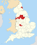
 Location of North Tyneside in England | |
| Coordinates: 55.0123°N 1.5456°W | |
| Sovereign state | United Kingdom |
| Country | England |
| Region | North East |
| County | Tyne and Wear |
| Established | 1 April 1974 |
| Admin HQ | Wallsend |
| Government | |
| • Type | Mayor and Cabinet |
| • Body | North Tyneside Council |
| • MPs | Mary Glindon Alan Campbell |
| Area | |
| • Land | 31.81 sq mi (82.38 km2) |
| Population (2011) | |
| • Estimate (2011) | 207,913 (Ranked 89th) |
| • Density | 6,026/sq mi (2,326.5/km2) |
| • Ethnicity (2011 census) [1] | 95.1% White British 1.9% Asian |
| Time zone | UTC+0 (Greenwich Mean Time) |
| • Summer (DST) | UTC+1 (British Summer Time) |
| Website | www.northtyneside.gov.uk |
North Tyneside is bordered by Newcastle upon Tyne to the west, the North Sea to the east, the River Tyne to the south and Northumberland to the north. Within its bounds are the towns of Wallsend, North Shields, Killingworth and Whitley Bay, which form a continuously built-up area contiguous with Newcastle.
History
The borough was formed on 1 April 1974 by the merger of the county borough of Tynemouth, with the borough of Wallsend, part of the borough of Whitley Bay, the urban district of Longbenton and part of the urban district of Seaton Valley, all of which were in Northumberland.
Geography
The following places are located in North Tyneside:
- Annitsford
- Backworth
- Battle Hill
- Benton
- Burradon
- Camperdown
- Cullercoats
- Dudley
- Earsdon
- Forest Hall
- Holystone
- Howdon
- Killingworth
- Longbenton
- Meadow Well
- Monkseaton
- Moorside
- Murton
- New York
- North Shields
- Northumberland Park
- Palmersville
- Percy Main
- Preston
- Seaton Burn
- Shiremoor
- Tynemouth
- Wallsend
- Wellfield
- West Allotment
- West Moor
- Whitley Bay
- Willington Quay
North Tyneside is split by the A19: the west of the borough is more urban, and is mostly contiguous with the city of Newcastle. The towns in the east of the borough are more separate from the central part of the Newcastle urban area. Many of the most affluent neighbourhoods in Tyne and Wear are found in the coastal part of the borough.
Administration and elections
Unlike most English districts, North Tyneside Council is led by a directly elected mayor; since May 2013, this post has been held by Norma Redfearn of the Labour Party. She was most recently elected on 6 May 2021.[2]
The council has sixty elected members, three from each of the twenty wards in the borough. Elections are staggered into thirds, with one councillor from each ward elected each year for three consecutive years, and the mayoral election held on the fourth year.[3]
Labour has a majority on the council, holding fifty of sixty seats. The Conservatives have nine councillors, all of whom represent wards on or near the coast. Maureen Madden, representing Howdon Ward, is the only independent councillor; she was elected as a Labour candidate in 2018, but has since left the party.[4] Since the 2021 election, the Liberal Democrats have had no representatives on the council.
| Labour | 50 | |
| Conservative | 9 | |
| Independent | 1 |
North Tyneside is part of the North of Tyne combined authority, along with Newcastle and Northumberland, and so additionally elects the Mayor of North of Tyne. Labour's Jamie Driscoll was elected as the first mayor on 2 May 2019, to a four year term.[5]
Economy
North Tyneside lies in the coalfield that covers the South-East of the historic county of Northumberland. It has traditionally been a centre of heavy industry along with the rest of Tyneside, with for example the Swan Hunter shipyard in Wallsend, and export of coal. Today most of the heavy industry has gone, leaving high unemployment in some areas (over the borough, 3.2% compared to 2.7% for the UK). The borough is the 69th most deprived in England, out of 354. However some parts function as wealthy dormitory suburbs of Newcastle, such as Tynemouth. Recent growth has come in the A19 corridor with new industrial estates and retail parks.
Transport

Two key roads serve North Tyneside:
- The A19 which leaves the A1 north of Newcastle and runs through the borough and then through the Tyne Tunnel to South Tyneside, Teesside and towards the South.
- The Coast Road (A1058) runs from Newcastle to the coast. For most of its length it is grade-separated.
North Tyneside is served by 17 stations on the Tyne and Wear Metro on a loop from Newcastle through Wallsend, North Shields, Whitley Bay, Benton and back to Newcastle. Trains operate at least every 15 minutes, with extra services in the peak hours. Most of the stations serving North Tyneside fall into fare zones B and C.
There are no National Rail stations in the borough, despite the East Coast Main Line and Blyth and Tyne routes passing through. The nearest National Rail station is Newcastle, which is also served by the Tyne & Wear Metro.
North Tyneside has an extensive bus network, with most areas benefiting from direct services to Newcastle. Many areas have direct bus services to Cramlington, Blyth or Morpeth. The principle bus operators in the area are Arriva North East (all areas), Go North East (most areas) and Stagecoach in Newcastle (Benton, Forest Hall, Killingworth and Wallsend).
The Shields Ferry links North Shields to South Shields, in South Tyneside.[6]
There is an international ferry terminal at Royal Quays in North Shields, with a service to Amsterdam (IJmuiden).[7]
Places of interest

- Segedunum Roman fort is in Wallsend (at the end of Hadrian's wall).
- The Stephenson Railway Museum in New York, named after George Stephenson and Robert Stephenson who hailed from Tyneside and lived in West Moor in North Tyneside 1802–1824.
- Tynemouth Castle and Priory
- North Tyneside includes coastline covering Tynemouth, Cullercoats and Whitley Bay
- Blue Reef Aquarium in Tynemouth
- St. Mary's Island in Whitley Bay
- North Shields Fish Quay, Clifford's Fort and the High and Low Lights of North Shields
Media
Radio
- Y Radio
Twinned towns
North Tyneside is twinned with:
- Oer-Erkenschwick in Germany[8]
- Halluin in France[9]
References
- UK Census (2011). "Local Area Report – North Tyneside Local Authority (1946157066)". Nomis. Office for National Statistics. Retrieved 14 March 2018.
- "Mayoral Election Results". North Tyneside Council. Retrieved 27 March 2022.
- "Types of Elections". North Tyneside Council. Retrieved 27 March 2022.
- "Councillors". North Tyneside Council. Retrieved 9 February 2022.
{{cite web}}: CS1 maint: url-status (link) - "Mayoral Election Results". North of Tyne CA. May 2019. Retrieved 27 March 2022.
- "Ferry - Nexus Tyne and Wear". Nexus. Retrieved 30 January 2016.
The Shields Ferry operates a daily passenger service across the river Tyne which connects the local communities of North and South Shields.
- "Newcastle ferry". Direct Ferries. Retrieved 30 January 2016.
The Newcastle to Amsterdam ferry route is operated by DFDS Seaways and the sailing itself is from around 15 hours 30 minutes.
- "Stadt Oer-Erkenschwick - Städtepartnerschaften". Retrieved 5 June 2021.
Oer-Erkenschwick - Twin Towns.
- "Halluin à l'international". Retrieved 5 June 2021.
Halluin Twintowns.
External links
| Wikimedia Commons has media related to Metropolitan Borough of North Tyneside. |
- Archives of North Tyneside (including boroughs of Tynemouth, Wallsend and Whitley Bay and Longbenton Urban District are preserved and accessible at Tyne and Wear Archives Service
- Wallsend Town Information regarding the town centre and areas covering Wallsend in North Tyneside can be found here.

Metropolitan districts of England | ||
|---|---|---|
| Districts |
|  |
| Councils |
| |
| Local elections |
| |
На других языках
[de] North Tyneside
North Tyneside ist ein Metropolitan Borough im Metropolitan County Tyne and Wear in England.- [en] North Tyneside
[ru] Норт-Тайнсайд
Норт-Тайнсайд (англ. North Tyneside) — район (англ. Metropolitan borough) в метрополитенском графстве Тайн-энд-Уир, административный центр Уолсенд[en].Другой контент может иметь иную лицензию. Перед использованием материалов сайта WikiSort.org внимательно изучите правила лицензирования конкретных элементов наполнения сайта.
WikiSort.org - проект по пересортировке и дополнению контента Википедии