world.wikisort.org - United_Kingdom
The Metropolitan Borough of Solihull is a metropolitan borough in West Midlands county, England. It is named after its largest town, Solihull, from which Solihull Metropolitan Borough Council is based. For Eurostat purposes it is a NUTS 3 region (code UKG32) and is one of seven boroughs or unitary districts that comprise the "West Midlands" NUTS 2 region. Much of the large residential population in the north of the borough centres on the communities of Castle Bromwich, Fordbridge, Kingshurst, Marston Green and Smith's Wood as well as the town of Chelmsley Wood.[2] In the south are the towns of Solihull and Shirley, and the large villages of Knowle, Dorridge, Meriden and Balsall Common.
Metropolitan Borough of Solihull | |
|---|---|
Metropolitan borough | |
 Solihull Civic Hall, the meeting place of Solihull Metropolitan Borough Council | |
 Coat of Arms of the Borough Council | |
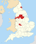
 Shown within the West Midlands and England | |
| Sovereign state | United Kingdom |
| Constituent country | England |
| Region | West Midlands |
| Historic county | Warwickshire |
| Administrative county | West Midlands |
| Admin. HQ | Solihull |
| Government | |
| • Type | Metropolitan borough |
| • Leadership: | Leader and cabinet |
| • MPs: | Julian Knight (C) Saqib Bhatti (C) |
| Area | |
| • Total | 68.8 sq mi (178.3 km2) |
| • Rank | 169th |
| Population (mid-2019 est.) | |
| • Total | 216,374 |
| • Rank | Ranked 81st |
| • Density | 3,100/sq mi (1,200/km2) |
| Time zone | UTC+0 (Greenwich Mean Time) |
| • Summer (DST) | UTC+1 (British Summer Time) |
| ISO 3166 code | GB-SOL |
| ONS code | 00CT (ONS) E08000029 (GSS) |
| Ethnicity[1] | 89.1% White (85.8% White British) 6.5% Asian 2.2% Mixed Race 1.5% Black 0.6% Other |
| Website | solihull.gov.uk |
Since 2011, Solihull has formed part of the Greater Birmingham & Solihull Local Enterprise Partnership along with neighbouring authorities Birmingham, Bromsgrove, Cannock Chase, East Staffordshire, Lichfield, Redditch, Tamworth and Wyre Forest.
History
Solihull probably derived its name from a 'miry or muddy' or soily hill. The parish church was built on a hill of stiff red marl, which turned to sticky mud in wet weather.
In 1894, Solihull (including the parishes of Shirley, Baddesley Clinton, Barston, Lapworth, Balsall, Bushwood, Elmdon, Knowle, Nuthurst, Packwood and Tanworth-in-Arden) was made into the Solihull Rural District in the county of Warwickshire. In 1932 some of its rural areas were taken away when the RDC was succeeded by Solihull Urban District Council. Expansion continued and Queen Elizabeth II granted a charter in 1954 making Solihull into a Municipal Borough; ten years later it was given the status of County Borough. Reorganisation of boundaries and council responsibilities in 1974 created the Metropolitan Borough of Solihull by the merger of the Solihull County Borough and most of the Meriden Rural District, which forms the main rural part of the borough and county. It included Balsall Common, Barston, Berkswell, Bickenhill, Castle Bromwich, Chelmsley Wood, Elmdon, Fordbridge, Hampton in Arden, Hockley Heath, Kingshurst, Knowle, Marston Green, Meriden, Olton, Smiths Wood, Solihull, Shirley and Temple Balsall.
In 1986 the Solihull borough effectively became a unitary authority when the West Midlands County Council was abolished. It remains part of the West Midlands for ceremonial purposes, and for functions such as police, fire and public transport. There is some support to return the borough to Warwickshire for ceremonial purposes, as was the case when the County of Avon was abolished and Bath was returned to Somerset.[3] There were also complaints that Solihull was not involved in the design of the Warwickshire flag in 2016.[4]
Geography
The borough is bordered by the M6 and the M40 and split by the M42 which divides the urban centre of the borough from the rural south and east. The borough's transport links have led to a number of established large businesses being based in the borough, such as Land Rover, the National Exhibition Centre and Birmingham Airport. A short automatic light transport system links the airport to the nearby Birmingham International railway station. Around three-quarters of the borough is greenbelt and a large proportion of that is worked farmland. The borough shares its boundaries with Birmingham to the west and north, Coventry to the east, Warwickshire to both the north and south and Worcestershire to the south west. The borough contains a sizeable rural area known as the Meriden Gap (after the village of Meriden) which serves as a green belt separating the Birmingham conurbation from the city of Coventry. Parts of Solihull neighbour the suburbs of Minworth and Hall Green. Parts also lie close to (but not contiguous with) the town of Coleshill and city of Coventry.
Council
Elections to the council are held in three out of every four years, with one third of the 51 seats on the council being elected at each election. Since the 2011 election The Conservative Party has had a majority on the council.
At the 2015 election to the council, the following members were returned:
| Year | Conservative | Liberal Democrat | Labour | Green | Independent | UKIP | |
|---|---|---|---|---|---|---|---|
| 2015 | 32 | 6 | 1 | 9 | 1 | 2 |
For election purposes the council is divided up into the following wards based on civil parishes. Each ward is represented by three councillors:
- Bickenhill
- Blythe
- Castle Bromwich
- Chelmsley Wood
- Dorridge and Hockley Heath
- Elmdon
- Kingshurst and Fordbridge
- Knowle
- Lyndon
- Meriden
- Olton
- Shirley East
- Shirley South
- Shirley West
- Silhill
- Smith's Wood
- St Alphege
Coat of arms
The constituent parts of the borough's coat of arms are:
- Battlements, sickles and an oak tree with golden acorns, which represent the rural and agricultural nature of the Forest of Arden.
- The Black Griffin is taken from the arms of the Earls of Aylesford, who are associated with Meriden.
- The Silver Fleur-de-lys comes from the Digby family, who were associated with Fordbridge.
- The Black Greyhound is taken from the arms of the Greswolds, the family who built the 15th century house called the Manor House in the High Street, Solihull.
A stylised version of the coat of arms can be seen on the top left of Solihull Metropolitan Borough Council's website pages, and the official, heraldic version appears on a dedicated page on the same site – external links below.
Economy
Solihull is regarded as having one of the strongest subregional economies in the West Midlands, with a significantly higher nominal GVA per capita and Silhillians enjoying considerably higher disposable income rates than both regional and UK averages.[5][6]
Analysis also shows Solihull as having the lowest (and fastest falling) claimant count for Jobseeker's Allowance in the region.[7]
The current Flybe airline maintains its head office on the second floor of Diamond House on the property of Birmingham Airport.[8]
This is a chart of trend of regional gross value added of Solihull at current basic prices published (pp. 240–253) by Office for National Statistics with figures in millions of British Pounds Sterling.
| Year | Regional Gross Value Added4 | Agriculture1 | Industry2 | Services3 |
|---|---|---|---|---|
| 1995 | 1,929 | 12 | 496 | 1,421 |
| 2000 | 2,959 | 8 | 870 | 2,082 |
| 2003 | 4,023 | 8 | 1,121 | 2,893 |
^1 includes hunting and forestry
^2 includes energy and construction
^3 includes financial intermediation services indirectly measured
^4 Components may not sum to totals due to rounding
Settlements in Solihull
Localities in the borough include:
- Balsall, Balsall Common, Barston, Bentley Heath, Berkswell, Bickenhill, Blossomfield
- Castle Bromwich, Catherine-de-Barnes, Chadwick End, Chelmsley Wood, Cheswick Green, Coleshill Heath, Copt Heath
- Dickens Heath, Dorridge
- Elmdon, Elmdon Heath
- Fordbridge
- Hampton in Arden, Hockley Heath
- Kingshurst, Knowle
- Lyndon
- Marston Green, Meriden, Monkspath Street
- Olton
- Packwood
- Sharmans Cross, Shirley, Silhill, Smith's Wood, Solihull
- Temple Balsall, Tidbury Green
- Whitlock's End
Notable people
- Dorian Yates - IFBB Pro Bodybuilder and six time Mr Olympia winner (1992-1997) born in Solihull.
- Michael Buerk – BBC news presenter and journalist born and educated in Solihull.
- Jasper Carrott – Born and lived in the Solihull Area
- Lucy Davis - Daughter of Jasper Carrott. Born and raised in Solihull
- Richard Hammond – Top Gear presenter and radio presenter was born in Solihull.
- Martin Johnson – Rugby World Cup- winning England team captain and later their manager was born in Solihull.
- John Wyndham – Science fiction author (The Day of the Triffids) was born in Dorridge in the Solihull area.
There is a longer list in the article for Solihull town.
Freedom of the Borough
The following people and military units have received the Freedom of the Borough of Solihull.
This list is incomplete; you can help by adding missing items. (May 2019) |
Individuals
Military Units
References
- "2011 Census: Key Ethnicity Statistics For Local Authority Areas in England and Wales" . ONS. Retrieved 25 December 2012
- "home". Chelmsley Wood Town Council. Retrieved 15 September 2022.
- "We came we saw . . . And we left no signs. - Free Online Library".
- "Chris Game: It's too much to bear - give our historic county a flag worth flying". 21 July 2011.
- "Regional productivity". www.ons.gov.uk. 2013. Retrieved 10 December 2019.
- "Regional profile". www.ons.gov.uk. 2013. Retrieved 10 December 2019.
- "table". www.ons.gov.uk. 2013. Retrieved 10 December 2019.
- "Conditions of carriage". Flybe. Retrieved 21 May 2022.
Our address is: 2nd Floor, Diamond House, Birmingham Airport, Birmingham, B26 3QJ.
- Live, Birmingham (16 December 2008). "Hero soldier Matt Croucher given freedom of Solihull". birminghammail. Retrieved 8 December 2019.
- "YouTube". www.youtube.com.[dead YouTube link]
External links
- Solihull Metropolitan Borough Council
- The official tourism website for the Solihull Borough
- Solihull's coat of arms
- Solihull Observer, the local Solihull newspaper
Districts of the West Midlands Region | ||
|---|---|---|
| Herefordshire |  | |
| Shropshire | ||
| Staffordshire | ||
| Warwickshire | ||
| West Midlands | ||
| Worcestershire | ||
Metropolitan districts of England | ||
|---|---|---|
| Districts |
|  |
| Councils |
| |
| Local elections |
| |
| Authority control |
|
|---|
На других языках
[de] Metropolitan Borough of Solihull
Solihull ist ein Metropolitan Borough im Metropolitan County West Midlands in England. Verwaltungssitz ist die gleichnamige Stadt Solihull, in der knapp die Hälfte der Bevölkerung lebt. Zum Bezirk gehören darüber hinaus die Städte Balsall Common, Bickenhill, Castle Bromwich, Chelmsley Wood, Dorridge, Fordbridge, Hockley Heath, Kingshurst, Marston Green, Shirley und Smith's Wood sowie mehrere weitere Dörfer.- [en] Metropolitan Borough of Solihull
[ru] Солихалл (район)
Солихалл (англ. Solihull) — метрополитенский район со статусом боро в графстве Уэст-Мидлендс (Англия). Административный центр — город Солихалл.Другой контент может иметь иную лицензию. Перед использованием материалов сайта WikiSort.org внимательно изучите правила лицензирования конкретных элементов наполнения сайта.
WikiSort.org - проект по пересортировке и дополнению контента Википедии