world.wikisort.org - United_Kingdom
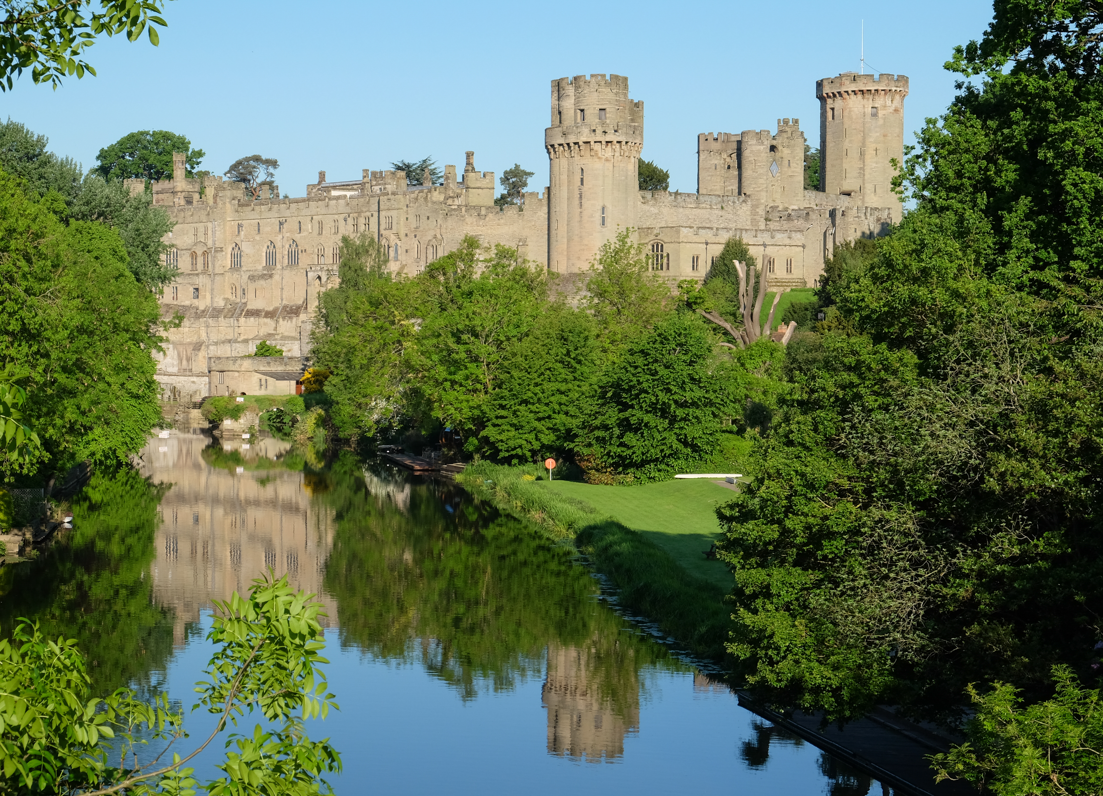
Warwick is a local government district of central Warwickshire in England. It borders the Borough of Rugby and Stratford-on-Avon District in Warwickshire as well as the West Midlands County (of which Coventry and Solihull are within the historic boundaries of Warwickshire). The City of Coventry is to the north and northeast, the Stratford-on-Avon District to the southwest and south, the Borough of Rugby to the east, and the Borough of Solihull to the west and northwest.

This article relies excessively on references to primary sources. (July 2008) |
Warwick District | |
|---|---|
Non-metropolitan district | |
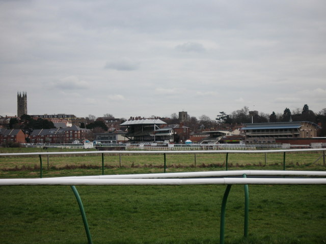
 Leamington Spa, the largest settlement in the district. | |
 Shown within Warwickshire | |
| Sovereign state | United Kingdom |
| Constituent country | England |
| Region | West Midlands |
| Administrative county | Warwickshire |
| Admin. HQ | Leamington Spa |
| Government | |
| • Leadership: | Leader and cabinet |
| • MPs: | Matt Western (L) Jeremy Wright (C) |
| Area | |
| • Total | 109.2 sq mi (282.9 km2) |
| • Rank | 138th |
| Population (2021 census) | |
| • Total | 148,500 |
| • Rank | 143rd |
| • Density | 1,360/sq mi (524/km2) |
| Time zone | UTC+0 (Greenwich Mean Time) |
| • Summer (DST) | UTC+1 (British Summer Time) |
| ONS code | 44UF (ONS) E07000222 (GSS) |
| Ethnicity | 89.2% White (83.4% White British) 7.2% Asian 0.7% Black 2.1% Mixed Race 0.9% Other [1] |
| Website | warwickdc.gov.uk |

The district is centred around a conurbation that includes the towns of Warwick, Leamington Spa and Whitnash which had a population of 95,000.[2] The district also includes the town of Kenilworth and the surrounding rural areas. In February 2021 it was announced that both Warwick District councillors and their Stratford counterparts had "agreed the next steps towards closer working between both District Councils, which could see a recommendation to Government for a merger of the two councils in July 2024."[3] However in April 2022 the merger was scrapped, with Councillor Day (Warwick Leader) accusing Councillor Jefferson (Stratford Leader) of writing to Central Government behind his back, asking for more time for the merger to take place.[4][5]
History

The district was created on 1 April 1974 under the Local Government Act 1972, by a merger of the former Leamington Spa and Warwick municipal boroughs, the Kenilworth urban district and the Warwick Rural District.[6]
Politics

The current leader of the district council is Conservative Party member Andrew Day.[7] The council is currently in no overall control, but the Conservatives run the administration through an agreement with the Whitnash Residents Association. Conservatives have 19 councillors, the Liberal Democrats have 9 councillors, the Green Party 8 councillors, Labour 5 Councillors with the remaining 3 councillors are part of the Whitnash Residents Association.[8] The district council headquarters are in Leamington Spa. It employs more than 500 people in a four-storey building close to the River Leam. The district council deals with issues such as waste management, the collection of council tax, planning/building regulations, council housing and council house repairs. In April 2016 the council announced its plans to move their headquarters nearer the town centre,[9] however in February 2019 plans were put on hold,[10] and as of July 2021 no decision had been made and is unlikely due to the probably merger with Stratford District.
The political makeup of Warwick District Council following the 2019 local elections is as follows:[11]
| Conservative | Lib Dem | Green | Labour | Whitnash Residents Association | |
|---|---|---|---|---|---|
| Seats | 19 | 9 | 8 | 5 | 3 |
| Votes | 29.4% | 23.5% | 22.5% | 19.5% | 3.9% |
In August 2020 Warwickshire County Council put forward proposals for the five district and borough councils in the county to be abolished and replaced with a single county-wide unitary authority.[12] This prompted a backlash from the district and borough councils who commissioned their own report, which argued in favour of Warwickshire being split into two unitary authorities, one for the north of the county, covering the current districts of North Warwickshire, Nuneaton and Bedworth and Rugby, and one for the south of the county, covering Warwick and Stratford districts.[13] In September 2020, it was agreed that both proposals would be sent for consideration to the Secretary of State for Housing, Communities and Local Government.[14] In February 2021 it was announced that both Warwick District councillors and their Stratford counterparts had "agreed the next steps towards closer working between both District Councils, which could see a recommendation to Government for a merger of the two councils in July 2024."[15] The joint council is expected to be called South Warwickshire District Council and as such early summer 2021 saw a South Warwickshire Local Plan to replace the two existing plans.[16] However in April 2022 the merger was scrapped, with Councillor Day (Warwick Leader) accusing Councillor Jefferson (Stratford Leader) of writing to Central Government behind his back asking for more time for the merge to take place.[17][18]
The Environment
On 27 June 2019 the elected members at the Full Council meeting declared a "climate emergency" in response to ongoing global climate change. The council aims to become carbon neutral by 2025, whilst trying to make the whole district carbon neutral by 2030.[19] On 20 January 2020 it was announced that electric cars would be given free parking in council car parks.[20] On 4 February of that year it was proposed by the Council group leaders to increase council tax by around £1 a week on Band D properties to create £3 million per year. This would be ring-fenced for environmental purposes. If this proposal was accepted by the other councillors then a district wide referendum would have been held on 7 May to decide if the public accept it.[21] On 26 February the full council unanimously agreed the proposal, triggering the 7 May referendum,[22] - which was put back to 6 May 2021, due to the 2020 COVID-19 pandemic. As of April 2022 the referendum has not yet occurred and no date has been set.
Demography
| Ethnic Group | 2001[23] | 2011[24] | ||
|---|---|---|---|---|
| Number | % | Number | % | |
| White: British | 111,043 | 88.19% | 114,739 | 83.36% |
| White: Irish | 2,525 | 2.01% | 2,146 | 1.56% |
| White: Gypsy or Irish Traveller | 41 | 0.03% | ||
| White: Other | 3,448 | 2.74% | 5,789 | 4.21% |
| White: Total | 117,016 | 92.94% | 122,715 | 89.15% |
| Asian or Asian British: Indian | 5,218 | 4.14% | 6,745 | 4.90% |
| Asian or Asian British: Pakistani | 222 | 0.18% | 480 | 0.35% |
| Asian or Asian British: Bangladeshi | 22 | 0.02% | 69 | 0.05% |
| Asian or Asian British: Chinese | 521 | 0.41% | 1,155 | 0.84% |
| Asian or Asian British: Other Asian | 435 | 0.35% | 1,496 | 1.09% |
| Asian or Asian British: Total | 6,418 | 5.10% | 9,945 | 7.22% |
| Black or Black British: Caribbean | 360 | 0.29% | 389 | 0.28% |
| Black or Black British: African | 168 | 0.13% | 474 | 0.34% |
| Black or Black British: Other Black | 59 | 0.05% | 110 | 0.08% |
| Black or Black British: Total | 587 | 0.47% | 973 | 0.71% |
| Mixed: White and Black Caribbean | 506 | 0.40% | 861 | 0.63% |
| Mixed: White and Black African | 93 | 0.07% | 233 | 0.17% |
| Mixed: White and Asian | 503 | 0.40% | 1,070 | 0.78% |
| Mixed: Other Mixed | 281 | 0.22% | 639 | 0.46% |
| Mixed: Total | 1,383 | 1.10% | 2,803 | 2.04% |
| Other: Arab | 231 | 0.17% | ||
| Other: Any other ethnic group | 981 | 0.71% | ||
| Other: Total | 504 | 0.40% | 1,212 | 0.88% |
| BAME: Total | 8,892 | 7.06% | 14,933 | 10.85% |
| Total | 125,908 | 100.00% | 137,648 | 100.00% |
| Religion | 2001[25] | 2011[26] | ||
|---|---|---|---|---|
| Number | % | Number | % | |
| Christian | 89,763 | 71.28% | 80,185 | 58.25% |
| Buddhist | 347 | 0.28% | 521 | 0.38% |
| Hindu | 848 | 0.67% | 1,633 | 1.19% |
| Jewish | 207 | 0.16% | 268 | 0.19% |
| Muslim | 630 | 0.50% | 1,299 | 0.94% |
| Sikh | 4,239 | 3.37% | 5,373 | 3.90% |
| Other religion | 355 | 0.28% | 531 | 0.39% |
| No religion | 20,494 | 16.27% | 37,859 | 27.50% |
| Religion not stated | 9,051 | 7.19% | 9,979 | 7.25% |
| Total | 125,934 | 100.00% | 137,648 | 100.00% |


Travel, Education & Healthcare
The district has six railway stations – Warwick, Warwick Parkway, Leamington Spa, Kenilworth, Hatton and Lapworth. Regular bus services run between Warwick, Leamington and Kenilworth and onwards to Coventry, Stratford upon Avon and the University of Warwick. The Grand Union Canal flows through the district and the M40 motorway also passes through. Right on the edge of the district is Coventry Airport.
National Health Service general healthcare is provided by South Warwickshire NHS Foundation Trust and mental health care by Coventry and Warwickshire Partnership NHS Trust. Local hospitals include Warwick Hospital, the Leamington Spa Hospital,[27] St Michael's Hospital and the Warwickshire Nuffield Hospital (non-NHS, part of the Nuffield Health group)[28] Social services is pro On 13 July 2021 a coronavirus "mega lab" was opened in the town. Named after English chemist Rosalind Franklin. The site is expected to be capable of processing "hundreds of thousands of samples a day". The largest laboratory of its kind in the UK, and it is hoped it will create up to 1,500 jobs. It will also play a "key role in responding to new variants of the virus".[29] Historic hospitals included St Michael's Leper Hospital, Warneford Hospital and Central Hospital. Social services and fostering are dealt with on a countywide basis by Warwickshire County Council.
Freedom of district
- MoD Kineton: 4 April 2013.[30]
- On 26 November 2013 the freedom of the district was bestowed on the Royal Regiment of Fusiliers following a parade through Royal Leamington Spa.[31]
Parishes and settlements
The Warwick district includes the settlements and Parishes of:
- Ashow
- Baddesley Clinton, Baginton, Barford, Beausale, Bishops Tachbrook, Blackdown, Bubbenhall, Budbrooke, Bushwood
- Chadwick End (part), Cubbington
- Eathorpe
- Haseley, Hatton, Honiley, Hunningham
- Kenilworth
- Lapworth, Lillington, Leamington Spa, Leek Wootton
- Norton Lindsey
- Offchurch, Old Milverton
- Radford Semele, Rowington
- Sherbourne, Shrewley, Stoneleigh
- Wappenbury, Warwick, Wasperton, Weston Under Wetherley, Whitnash, Wroxall
Electoral wards
This is a guide to the size of the wards in Warwick District based on the data from the 2001 UK Census. The entire population of the district was 125,929.
| Rank | Ward | Population |
| 1 | Brunswick | 9,299 |
| 2 | Willes | 8,601 |
| 3 | Warwick South | 8,569 |
| 4 | Warwick North | 8,488 |
| 5 | Warwick West | 8,377 |
| 6 | Milverton | 8,269 |
| 7 | Manor | 8,162 |
| 8 | Park Hill | 8,124 |
| 9 | Whitnash | 7,796 |
| 10 | Abbey | 7,552 |
| 11 | St John's | 7,543 |
| 12 | Crown | 5,829 |
| 13 | Cubbington | 5,777 |
| 14 | Budbrooke | 5,223 |
| 15 | Clarendon | 4,954 |
| 16 | Stoneleigh | 3,049 |
| 17 | Lapworth | 2,870 |
| 18 | Bishop's Tachbrook | 2,514 |
| 19 | Radford Semele | 2,494 |
| 20 | Leek Wootton | 2,439 |
N.B. Ward populations will differ from the village population which they are named after and which they are linked to as ward boundaries very rarely match village boundaries exactly. The Warwick (Electoral Changes) Order 2014 redrew the electoral boundaries in 2014, abolishing many of those outlined above.[32]
References
- http://www.ons.gov.uk/ons/rel/census/2011-census/key-statistics-for-local-authorities-in-england-and-wales/rft-table-ks201ew.xls [bare URL spreadsheet file]
- UK Census (2011). "Local Area Report – Royal Leamington Spa Built-up area (E34004841)". Nomis. Office for National Statistics. Retrieved 11 April 2021.
- "Councillors give the go ahead for working together with Warwick District Council". 25 February 2021. Retrieved 29 June 2021.
- "Plans to merge Warwick and Stratford District Councils into single 'mega authority' have been scrapped". Leamington Courier. 21 April 2022. Retrieved 21 April 2022.
- "Warwick and Stratford-on-Avon councils merger plans scrapped". BBC News. 21 April 2022. Retrieved 21 April 2022.
- "Warwickshire Civic Heraldry". Civic heraldry. Retrieved 19 August 2021.
- "Warwick DC". Retrieved 17 July 2019.
- "Political structure". Warwick District Council. Retrieved 17 July 2019.
- "Warwick District Council set to agree HQ move". leamingtonobserver.co.uk. Leamington Observer. Retrieved 7 February 2020.
- "Latest on plans to relocate council to Leamington town centre - and what could happen next". www.coventrytelegraph.net. Coventry Telegraph. 4 February 2019. Retrieved 7 February 2020.
- "Local elections". www.warwickdc.gov.uk. Warwick District Council. Retrieved 13 June 2019.
- "Local councils in Warwickshire could be scrapped". Coventry Telegraph. 23 August 2020. Retrieved 26 September 2020.
- "Warwickshire could be split into north and south councils". Rugby Advertiser. 21 September 2020. Retrieved 26 September 2020.
- "After a seven-hour long meeting, councillors decide on the next step for the future of local councils in Warwickshire". Rugby Advertiser. 22 September 2020. Retrieved 26 September 2020.
- "Councillors give the go ahead for working together with Warwick District Council". 25 February 2021. Retrieved 29 June 2021.
- "The South Warwickshire Local Plan". Retrieved 29 June 2021.
- "Plans to merge Warwick and Stratford District Councils into single 'mega authority' have been scrapped". Leamington Courier. 21 April 2022. Retrieved 21 April 2022.
- "Warwick and Stratford-on-Avon councils merger plans scrapped". BBC News. 21 April 2022. Retrieved 21 April 2022.
- "Warwick District Council declares a climate emergency". Retrieved 7 February 2020.
- "Council to offer free parking for electric vehicles". Retrieved 7 February 2020.
- "Warwick District's Climate Emergency Action Programme". Retrieved 7 February 2020.
- "Residents in Warwickshire to vote on council tax rise for climate change fund". 26 February 2020. Retrieved 27 February 2020.
- "Ethnic Group by measures". NOMIS. Retrieved 8 January 2016.
- "Ethnic Group by measures". NOMIS. Retrieved 8 January 2016.
- "Religion". Retrieved 8 January 2016.
- "QS208EW - Religion". Retrieved 8 January 2016.
- "How Leamington Rehab Hospital's friends make the road to recovery smoother for patients". Leamington Courier. 15 August 2012. Archived from the original on 13 September 2018. Retrieved 13 September 2018.
- "Nuffield Hospital Warwick". NHS Choices. Retrieved 7 December 2018.
- "Covid-19: Leamington Spa 'mega lab' opens to speed up testing". BBC News. 13 July 2021. Retrieved 13 July 2021.
- "Warwick Freedom Scroll" (JPG). www.calligraphyanddesign.com. Retrieved 7 December 2020.
- "Fusiliers granted freedom of Warwick District". BBC News. BBC. 26 November 2013. Retrieved 27 November 2013.
- "Wards of the district of Warwick and number of councillors". Legislation.gov.uk. Retrieved 18 September 2019.
External links
- www.warwickdc.gov.uk, Warwick District Council.
Warwick District towns, parishes and settlements | ||
|---|---|---|
| ||
| Towns |  | |
| Parishes, settlements |
| |
| ||
| Boroughs or districts | |
|---|---|
| Major settlements |
|
| Rivers | |
| Canals | |
| Topics |
|
Districts of the West Midlands Region | ||
|---|---|---|
| Herefordshire |  | |
| Shropshire | ||
| Staffordshire | ||
| Warwickshire | ||
| West Midlands | ||
| Worcestershire | ||
На других языках
[de] Warwick District
Warwick ist ein District in der Grafschaft Warwickshire in England. Verwaltungssitz ist die Stadt Leamington Spa. Weitere bedeutende Orte sind die Stadt Warwick sowie Bishop's Tachbrook, Budbrooke, Cubbington, Kenilworth, Lapworth, Radford Semele und Whitnash.- [en] Warwick District
[ru] Уорик (район)
Уорик (англ. Warwick) — неметрополитенский район (англ. Non-metropolitan district) в графстве Уорикшир (Англия). Административный центр — город Ройал-Лемингтон-Спа.Другой контент может иметь иную лицензию. Перед использованием материалов сайта WikiSort.org внимательно изучите правила лицензирования конкретных элементов наполнения сайта.
WikiSort.org - проект по пересортировке и дополнению контента Википедии