world.wikisort.org - Turkey
Çorum (Turkish pronunciation: [ˈtʃoɾum]) (Medieval Greek: Ευχάνεια, romanized: Euchaneia) is a northern Anatolian city that is the capital of the Çorum Province of Turkey. Çorum is located inland in the central Black Sea Region of Turkey, and is approximately 244 km (152 mi) from Ankara and 608 km (378 mi) from Istanbul. The city has an elevation of 801 m (2,628 ft) above sea level, a surface area of 12,820 km2 (4,950 sq mi), and as of the 2016 census, a population of 237,000.[3]
Çorum | |
|---|---|
Municipality | |
 Çorum Archaeological Museum | |
 Coat of arms | |
 Çorum  Çorum | |
| Coordinates: 40°32′44″N 34°57′25″E | |
| Country | Turkey |
| Province | Çorum |
| Government | |
| • Mayor | Halil Ibrahim Asgin (AKP) |
| Area | |
| • District | 2,276.81 km2 (879.08 sq mi) |
| Population (2012)[2] | |
| • Urban | 231,146 |
| • District | 265,242 |
| • District density | 120/km2 (300/sq mi) |
| Website | www.corum.bel.tr |
Çorum is primarily known for its Phrygian and Hittite archaeological sites, its thermal springs, and its native roasted chick-pea snacks known nationally as leblebi.
History
There is ample archaeological evidence for human presence in the area since the Paleolithic ages.[4] The area prospered during the Bronze Age, with the emergence of the Hittite Empire between 1650-1200 BC. Hattusa, the Hittite capital, was located in the region owing to its inherent geographic protection, and the well-established local economy as supported by the regional Karum system.[4]
There is a hypothesis that the Byzantine town of Euchaneia was at or near the site of the modern city, but others place Euchaneia further east, at Euchaita.[5]


The settlement of Çorum proper can be traced only to the 16th century. The name is of Armenian origin, and is first attested in Ottoman records, in reference to a Seljuk fortress Çorum Kalesi described by Evliya Çelebi. In the mid 16th century, the fortress was divided into four mahalle or quarters.
Çorum today


The town today is generally tidy and pleasant, with a locally popular countryside. As with most Central Anatolian and inland Black Sea towns, the population is largely conservative, leading to a generally more restricted nightlife that favors dry establishments, although there are some bars, pubs and cafés that offer a mix of contemporary and traditional Turkish folk music. Within the city, there is a good range of shops, cafés and restaurants, with a cuisine that includes a variety of pastries including the nationally-known Çorum Mantısı - a popular dish similar to ravioli that is slowly baked in a brick oven or steamed in a beef broth. As well as the archeological and other historic sites, the countryside surrounding Çorum offers many places for picnics, particularly near the Çomar reservoir or in the mountains around the province.
The old Ottoman houses, the 19th century clock tower, and the Çorum Museum that displays a range of artefacts from excavations in the region are popular tourist interests. An International Hittite Congress of archaeologists is held in Çorum every three years.
Economy
Although the economic output of the city has historically been relatively small with a focus on traditional crafts like coppersmithing, tanning, hand weaving, agriculture and animal husbandry, over the past two decades, the city has shown a significant growth in industrial production and light engineering that has made it among the most industrially advanced cities compared to its population size.
Originally home to about 20 tile and brick manufactories and 10 flour and feed mills, the city today produces a wide variety of products ranging from cement to automobile parts, refined sugar to dairy products, textiles to computer parts, and more recently, poultry through chicken farming.[6]
Population
| Population of the city of Çorum | ||
|---|---|---|
| 2017 | 527,863 | |
| 2009 | 206,600 | |
| 2000 | 161,321 | |
| 1990 | 116,810 | |
| 1985 | 96,725 | |
| 1980 | 75,726 | |
| 1970 | 57,576 | |
Geography
Çorum is on the northern edge of the Central Anatolian Plateau. There is an attractive mountainous countryside around the city. The North Anatolian Fault line passes 20 km (12 mi) south of Çorum.
Climate
Çorum has a warm summer continental climate (Köppen climate classification: Dsb or Trewartha climate classification: Dcb) with dry summers and cold, snowy winters, and mild to cool wet springs and autumns with light rain.
| Climate data for Çorum (1991–2020, extremes 1929–2020) | |||||||||||||
|---|---|---|---|---|---|---|---|---|---|---|---|---|---|
| Month | Jan | Feb | Mar | Apr | May | Jun | Jul | Aug | Sep | Oct | Nov | Dec | Year |
| Record high °C (°F) | 17.5 (63.5) |
20.4 (68.7) |
28.6 (83.5) |
30.4 (86.7) |
35.1 (95.2) |
37.5 (99.5) |
42.6 (108.7) |
40.2 (104.4) |
38.7 (101.7) |
33.6 (92.5) |
25.6 (78.1) |
19.2 (66.6) |
42.6 (108.7) |
| Average high °C (°F) | 4.6 (40.3) |
7.4 (45.3) |
12.5 (54.5) |
17.9 (64.2) |
22.9 (73.2) |
26.8 (80.2) |
30.2 (86.4) |
30.7 (87.3) |
26.7 (80.1) |
20.7 (69.3) |
12.9 (55.2) |
6.5 (43.7) |
18.3 (64.9) |
| Daily mean °C (°F) | −0.2 (31.6) |
1.4 (34.5) |
5.6 (42.1) |
10.4 (50.7) |
15.0 (59.0) |
18.7 (65.7) |
21.7 (71.1) |
21.9 (71.4) |
17.8 (64.0) |
12.5 (54.5) |
5.6 (42.1) |
1.6 (34.9) |
11.0 (51.8) |
| Average low °C (°F) | −4.1 (24.6) |
−3.5 (25.7) |
−0.3 (31.5) |
3.4 (38.1) |
7.4 (45.3) |
10.7 (51.3) |
12.8 (55.0) |
13.1 (55.6) |
9.6 (49.3) |
5.7 (42.3) |
0.2 (32.4) |
−2.2 (28.0) |
4.4 (39.9) |
| Record low °C (°F) | −25.6 (−14.1) |
−27.2 (−17.0) |
−23.3 (−9.9) |
−9.4 (15.1) |
−4.3 (24.3) |
0.2 (32.4) |
3.4 (38.1) |
3.0 (37.4) |
−3.0 (26.6) |
−6.3 (20.7) |
−15.7 (3.7) |
−21.6 (−6.9) |
−27.2 (−17.0) |
| Average precipitation mm (inches) | 37.4 (1.47) |
28.5 (1.12) |
42.0 (1.65) |
46.6 (1.83) |
61.7 (2.43) |
63.5 (2.50) |
21.4 (0.84) |
19.0 (0.75) |
24.9 (0.98) |
27.9 (1.10) |
32.9 (1.30) |
43.0 (1.69) |
448.8 (17.67) |
| Average precipitation days | 12.30 | 10.57 | 13.57 | 13.73 | 15.77 | 12.00 | 5.10 | 4.10 | 6.60 | 8.43 | 8.70 | 12.37 | 123.2 |
| Mean monthly sunshine hours | 68.2 | 98.9 | 145.7 | 192.0 | 235.6 | 267.0 | 316.2 | 310.0 | 246.0 | 173.6 | 117.0 | 62.0 | 2,232.2 |
| Mean daily sunshine hours | 2.2 | 3.5 | 4.7 | 6.4 | 7.6 | 8.9 | 10.2 | 10.0 | 8.2 | 5.6 | 3.9 | 2.0 | 6.1 |
| Source: Turkish State Meteorological Service[7] | |||||||||||||

Twin towns – sister cities
 Gimhae, South Gyeongsang, South Korea
Notable natives
- Mahmut Atalay - World champion and Olympic medalist wrestler
- Tevfik Kış - World champion and Olympic medalist wrestler
- Cevdet Cerit - professor of mathematics at Istanbul Technical University
- Komet or Gürkan Coşkun - Famous Turkish artist
- Soner Yalçın - Famous Turkish journalist, arrested for Ergenekon trials
- İbrahim Kaypakkaya - Founder of Türkiye Komünist Partisi/Marksist-Leninist
- İsmail Beşikçi - Writer
- Aşık Gülabi (Gülabi Gültekin) - Minstrel
- Gen. Ahmet Çörekçi - Former Head Commander of the Turkish Air Force
- Savaş Yurderi Kool Savas - a German rapper and hip hop artist
Neighbourhoods
- Abdalata 40°25′N 34°54′E
- Acıpınar 40.6460°N 34.7515°E
- Ahiilyas 40°27′N 34°53′E
- Ahmediye 40.6053°N 35.0697°E
- Ahmetoğlan 40°23′42″N 35°07′57″E
- Aksungur 40.5153°N 34.8044°E
- Akyazı 40.5886°N 34.7582°E
- Akçakaya 40.6662°N 34.9261°E
- Altınbaş 40.5669°N 34.8445°E
- Arpalık 40.5664°N 34.7026°E
- Arpaöz 40°20′N 34°51′E
- Arslanköy 40.6329°N 34.6728°E
- Atçalı 40°34′05″N 35°03′21″E
- Ayaz 40.6780°N 34.8569°E
- Ayvalı 40.6649°N 35.2258°E
- Aşağısaraylı 40°33′48″N 34°48′49″E
- Babaoğlu 40.3571°N 34.7981°E
- Balumsultan 40°20′N 34°46′E
- Balıyakup 40°21′N 35°05′E
- Bayatköy 40°11′N 30°16′E
- Bektaşoğlu 40.4996°N 34.7290°E
- Beydili 40.6386°N 34.2034°E
- Bozboğa 40°27′N 34°51′E
- Boğabağı 40°24′N 34°56′E
- Boğacık 40°39′N 35°08′E
- Boğazönü 40.3212°N 34.8237°E
- Budakören 40°21′N 34°50′E
- Burunköy
- Büyükdivan 40.3302°N 34.8772°E
- Büyükgülücek 40°20′42″N 34°45′06″E
- Büğdüz 40.3999°N 34.8881°E
- Büğet 40.6085°N 35.0112°E
- Büğrüoğlu 40.4069°N 34.6577°E
- Celilkırı
- Cerit
- Dağkarapınar
- Delibekiroğlu 40°26′N 34°40′E
- Deliler
- Denizköy
- Dereköy
- Değirmendere
- Dutköy
- Dutçakallı 40°36′09″N 34°45′13″E
- Düdüklük 40°17′41″N 35°01′26″E
- Düvenci
- Elicek 40°18′55″N 34°46′25″E
- Elköy 40°22′N 35°06′E
- Elmalı
- Erdek
- Ertuğrul
- Eskice
- Eskiekin 40°31′N 34°59′E
- Eskikaradona 40°27′38″N 34°37′55″E
- Eskiköy
- Eskiören
- Evcikuzkışla 40°23′N 34°38′E
- Evciortakışla
- Evciyenikışla 40°22′N 34°37′E
- Eymir
- Eğerci
- Eşençay
- Feruz
- Gemet 40°40′N 35°02′E
- Göcenovacığı 40°21′N 34°52′E
- Gökdere
- Gökköy
- Gökçepınar
- Güney
- Güvenli
- Güveçli
- Güzelyurt
- Hacıahmetderesi 40°31′N 34°35′E
- Hacıbey
- Hacımusa
- Hacıpaşa
- Hamamlıçay 40°39′N 34°52′E
- Hamdiköy 40°25′N 34°44′E
- Hankozlusu 40°20′N 34°33′E
- Harmancık
- Hımıroğlu 40°20′N 35°08′E
- Hızırdede 40°39′N 35°04′E
- Kadıderesi 40°19′N 35°04′E
- Kadıkırı
- Kalehisar 40°17′29″N 34°41′24″E
- Karaağaç
- Karabayır
- Karabürçek
- Karaca
- Karacaören
- Karadona 40°18′11″N 34°38′27″E
- Karagöz
- Karahisar
- Karakeçili
- Karapınar
- Kavacık
- Kayı
- Kazıklıkaya 40°30′N 35°00′E
- Kertme
- Kiranlık
- Kirazlıpınar 40°18′N 35°06′E
- Kireçocağı
- Konaklı
- Kozluca
- Kultak
- Kumçeltiği 40°34′45″N 34°30′35″E
- Kuruçay
- Kutluca
- Kuşsaray
- Köprüalan
- Küçükdüvenci 40°41′N 35°08′E
- Küçükgülücek
- Küçükpalabıyık 40°19′N 35°07′E
- Kılıçören
- Kınık
- Kınıkdeliler
- Kırkdilim
- Kızılpınar
- Laloğlu
- Mecidiyekavak 40°29′N 34°41′E
- Mislerovacığı 40°24′N 34°37′E
- Mollahasan
- Morsümbül 40°33′N 34°47′E
- Mustafaçelebi 40°19′N 34°58′E
- Mühürler 40°23′N 34°58′E
- Narlık
- Osmaniye
- Ovasaray
- Oymaağaç
- Palabıyık 40°33′47″N 35°05′10″E
- Pancarlık
- Paşaköy
- Pembecik
- Pınarcık
- Pınarçay
- Salur
- Sapa
- Saraylı
- Sarmaşa 40°38′57″N 34°55′19″E
- Sarıkaya
- Sarılık 41°35′N 35°42′E
- Sarımbey
- Sarışeyh
- Sazak
- Sazdeğirmeni 40°24′44″N 34°45′34″E
- Serban
- Serpin
- Sevindikalanı 40°20′56″N 34°59′32″E
- Seydim 40°33′N 34°44′E
- Seydimçakallı 40°31′N 34°41′E
- Seyfe
- Soğuksu
- Sırıklı
- Tarhan
- Tarhankozlusu 40°23′N 34°46′E
- Tatar
- Taşpınar
- Teslim
- Tolamehmet 40°29′27″N 34°59′40″E
- Tozluburun 40°36′N 34°34′E
- Turgut
- Türkayşe 40°23′N 34°59′E
- Türkler
- Uğrak
- Yakuparpa 40°41′N 34°59′E
- Yaydiğin 40°30′43″N 34°55′33″E
- Yenice
- Yenihayat
- Yenikaradona 40°18′20″N 34°39′07″E
- Yeşildere
- Yeşilyayla
- Çakır
- Çalkışla
- Çaltıcak
- Çalyayla 40°42′N 34°47′E
- Çalıca
- Çanakçı
- Çatak
- Çayhatap 40°25′28″N 34°48′50″E
- Çağşak
- Çeşmeören 40°25′45″N 34°53′03″E
- Çobandivan
- Çomarbaşı 40°37′N 35°04′E
- Çorak
- Çukurören
- Çıkrık
- Öksüzler
- Ömerbey
- Örencik
- Ülkenpınarı 40°33′N 34°36′E
- Üyük
- Üçköy
- İnalözü 40°28′N 34°35′E
- İsmailköy
- İğdeli
- Şahinkaya
- Şanlıosman 40°19′N 35°03′E
- Şekerbey 40°28′N 35°00′E
- Şendere
- Şeyhhamza
- Şeyhmustafa 40°25′N 35°03′E
See also
- Anatolian Tigers
- Amasya
- Chickpea noghl
- Leblebi
References
- "Area of regions (including lakes), km²". Regional Statistics Database. Turkish Statistical Institute. 2002. Retrieved 5 March 2013.
- "Population of province/district centers and towns/villages by districts - 2012". Address Based Population Registration System (ABPRS) Database. Turkish Statistical Institute. Retrieved 27 February 2013.
- Statistical Institute[permanent dead link]
- History of Çorum Archived 2009-03-17 at the Wayback Machine
- Christopher Walter, The Warrior Saints in Byzantine Art and Tradition (2016), citing Hippolyte Delehaye (1909).
- Economy of Çorum Archived 2009-03-17 at the Wayback Machine
- "Resmi İstatistikler: İllerimize Ait Mevism Normalleri (1991–2020)" (in Turkish). Turkish State Meteorological Service. Retrieved 28 June 2021.
External links
- Provincial governor's web site
- Pictures of the city with links to surrounding Hittite sites
- Chisholm, Hugh, ed. (1911). . Encyclopædia Britannica. Vol. 6 (11th ed.). Cambridge University Press. p. 270.
Çorum in Çorum Province of Turkey | |||||||||||||||||||||||||||
|---|---|---|---|---|---|---|---|---|---|---|---|---|---|---|---|---|---|---|---|---|---|---|---|---|---|---|---|
| Districts |  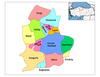 | ||||||||||||||||||||||||||
|
Metropolitan municipalities are bolded. | |||||||||||||||||||||||||||
| ||
На других языках
[de] Çorum
Çorum ist eine türkische Stadt in der anatolischen Schwarzmeer-Region. Sie ist die Hauptstadt der gleichnamigen Provinz Çorum. Çorum liegt am nordöstlichen Rand der gleichnamigen fruchtbaren Ebene östlich des Flüsschens Çorum Çayı etwa 800 m über dem Meeresspiegel.- [en] Çorum
[ru] Чорум
Чору́м[1][2] (тур. Çorum) — город и район в Северной Турции, административный центр провинции (ила) Чорум[3]. Чорум расположен в 244 км от Анкары и в 608 км от Стамбула. Население — 294 807 человек по данным 2018 года, преимущественно турки, средняя высота над уровнем моря — 820 м. Узел шоссейных дорог. Торговый центр сельскохозяйственного района (зерновые, фрукты, животноводство). Пищевая и цементная промышленность[3].Другой контент может иметь иную лицензию. Перед использованием материалов сайта WikiSort.org внимательно изучите правила лицензирования конкретных элементов наполнения сайта.
WikiSort.org - проект по пересортировке и дополнению контента Википедии