world.wikisort.org - Turkey
Ortaköy is a town and district of Çorum Province in the Black Sea region of Turkey, located at 57 km from the city of Çorum. The mayor is Taner İsbir (AKP).
Ortaköy | |
|---|---|
 Ortaköy | |
| Coordinates: 40°16′59″N 35°16′01″E | |
| Country | Turkey |
| Province | Çorum |
| Government | |
| • Mayor | Taner İsbir (AKP) |
| Area | |
| • District | 217.49 km2 (83.97 sq mi) |
| Population (2012)[2] | |
| • Urban | 2,320 |
| • District | 8,090 |
| • District density | 37/km2 (96/sq mi) |
| Climate | Dsb[3] |
Archaeological sites
The oldest settlement in the area of Ortaköy is found on top of a mound, whereas the later Hittite city of Sapinuwa was laid out on the plain. This city dates to the second millennium BC.
Sapinuwa overlooks a fertile plain and was a key point on the road to Hattusa from the west. The city was an important administrative, political, military and religious center in the Hittite kingdom. The site was later used as a cemetery during the Roman period.
Excavations started in 1990 by Turkish archaeologists from Ankara university. The most important finds discovered so far are an official building with an archive of cuneiform tablets dating to the Hittite empire, and a large store house.
References
- "Area of regions (including lakes), km²". Regional Statistics Database. Turkish Statistical Institute. 2002. Retrieved 2013-03-05.
- "Population of province/district centers and towns/villages by districts - 2012". Address Based Population Registration System (ABPRS) Database. Turkish Statistical Institute. Retrieved 2013-02-27.
- Ortaköy Climate-Data.org
External links
Ortaköy, Çorum in Çorum Province of Turkey | |||||||||||||||||||||||||||
|---|---|---|---|---|---|---|---|---|---|---|---|---|---|---|---|---|---|---|---|---|---|---|---|---|---|---|---|
| Districts |  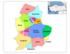 | ||||||||||||||||||||||||||
|
Metropolitan municipalities are bolded. | |||||||||||||||||||||||||||
| ||
This geographical article about a location in Çorum Province, Turkey is a stub. You can help Wikipedia by expanding it. |
Другой контент может иметь иную лицензию. Перед использованием материалов сайта WikiSort.org внимательно изучите правила лицензирования конкретных элементов наполнения сайта.
WikiSort.org - проект по пересортировке и дополнению контента Википедии