world.wikisort.org - Turkey
Akdağmadeni (Greek: Ἀργυρίων, Argyríōn[3]) is a town and district in the Yozgat Province in the Central Anatolia region of Turkey. According to the 2000 census, population of the district is 61,373 of which 20,312 live in the town of Akdağmadeni.[4] The district (or county) of Akdağmadeni is located in the east of the Yozgat province. It is surrounded to the north by the district of Kadışehri, in the south by Çayıralan, Sarikaya and Saraykent in the west and the Sarkisla district in the east.
Akdağmadeni | |
|---|---|
District | |
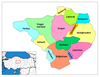
 Location of Akdağmadeni within Turkey. | |
 Akdağmadeni | |
| Coordinates: 39°40′N 35°53′E | |
| Country | |
| Province | Yozgat |
| Government | |
| • Mayor | Suphi Daştan (AKP) |
| Area | |
| • District | 1,849.04 km2 (713.92 sq mi) |
| Elevation | 1,344 m (4,409 ft) |
| Population (2012)[2] | |
| • Urban | 24,956 |
| • District | 49,442 |
| • District density | 27/km2 (69/sq mi) |
| Time zone | UTC+2 (EET) |
| • Summer (DST) | UTC+3 (EEST) |
| Postal code | 66xxx |
| Area code | 0354 |
| Licence plate | 66 |
| Website | www.akdagmadeni.gov.tr |

According to the Ottoman population statistics of 1914, the kaza of Akdağmadeni had a total population of 48.759, consisting of 37.081 Muslims, 7.892 Greeks, 3.312 Armenians, 49 Protestants and 425 Roma.[5] Most of the Armenians and Greeks were killed or expelled by 1923.
Climate
The district is situated in the central Anatolian plateau and shares its climatic peculiarities. Summers are very hot, winters are not extremely cold. Snowfall can be detected as soon as in mid-November. The average annual rainfall lies between 478 and 500 millimeters. In summer, temperatures are between 20 and 25 degrees Celsius. The annual average temperature varies between 8 and 12 degrees. Generally, the climate is quite damp. Winds blow mostly from the east and south. North wind against the mountains is a protective case.
Notes
- "Area of regions (including lakes), km²". Regional Statistics Database. Turkish Statistical Institute. 2002. Retrieved 2013-03-05.
- "Population of province/district centers and towns/villages by districts - 2012". Address Based Population Registration System (ABPRS) Database. Turkish Statistical Institute. Retrieved 2013-02-27.
- Γεώργιος Κλεάνθης Σκαλιέρης, Λαοί και φυλαί της Μικράς Ασίας. Μετά πινάκων και χαρτών. Athens (Typos) 1922, p. 42. Digitalized version
- Turkish Statistical Institute. "Census 2000. Key statistics for urban areas of Turkey" (in Turkish). Archived from the original (XLS) on 2007-09-27. Retrieved 2008-03-19.
- Kemal Karpat (1985), Ottoman Population, 1830-1914, Demographic and Social Characteristics, The University of Wisconsin Press, p. 172-173
References
- Falling Rain Genomics, Inc. "Geographical information on Akdağmadeni, Turkey". Retrieved 2008-03-18.
External links
- District governor's official website (in Turkish)
- District municipality's official website (in Turkish)
- Akdagmadeni Municipality[permanent dead link]
- Akdagmadeni History[permanent dead link]
- Akdagmadeni Geographical Structure[permanent dead link]
- Akdagmadeni Structure of interest[permanent dead link]
- Akdagmadeni Economic Structure[permanent dead link]
Akdağmadeni in Yozgat Province of Turkey | |||||||||||||||||||||||||||
|---|---|---|---|---|---|---|---|---|---|---|---|---|---|---|---|---|---|---|---|---|---|---|---|---|---|---|---|
| Districts |
|   | |||||||||||||||||||||||||
||
Metropolitan municipalities are bolded. | |||||||||||||||||||||||||||
Authority control | |
|---|---|
| General | |
| National libraries | |
This geographical article about a location in Yozgat Province, Turkey is a stub. You can help Wikipedia by expanding it. |
На других языках
[de] Akdağmadeni
Akdağmadeni, griechisch Ἀργυρίων .mw-parser-output .Latn{font-family:"Akzidenz Grotesk","Arial","Avant Garde Gothic","Calibri","Futura","Geneva","Gill Sans","Helvetica","Lucida Grande","Lucida Sans Unicode","Lucida Grande","Stone Sans","Tahoma","Trebuchet","Univers","Verdana"}Argyríōn, ist eine Stadt und ein Landkreis der türkischen Provinz Yozgat. Der Ort liegt etwa 90 Kilometer östlich der Provinzhauptstadt Yozgat. Laut Stadtsiegel erhielt der Ort 1862 den Status einer Belediye (Gemeinde).- [en] Akdağmadeni
[ru] Акдагмадени
Акдагмадени (тур. Akdağmadeni) — город в Турции, в иле Йозгат в Центральной Анатолии. Город находится в котловане севернее горы Акдаг (тур.) (рус. (Akdağ «белая гора»). Мэр — Супхи Даштан (Suphi Daştan).Другой контент может иметь иную лицензию. Перед использованием материалов сайта WikiSort.org внимательно изучите правила лицензирования конкретных элементов наполнения сайта.
WikiSort.org - проект по пересортировке и дополнению контента Википедии