world.wikisort.org - Turkey
Saraykent is a town and district of Yozgat Province in the Central Anatolia region of Turkey. The former name of the town is Karamağara.[3] According to 2000 census, population of the district is 26,077 of which 9,224 live in the town of Saraykent.[4]
Saraykent | |
|---|---|
District | |
 Location of Saraykent within Turkey. | |
 Saraykent | |
| Coordinates: 39°42′N 35°31′E | |
| Country | |
| Province | Yozgat |
| Government | |
| • Mayor | İdris Öğel (MHP) |
| Area | |
| • District | 189.35 km2 (73.11 sq mi) |
| Elevation | 1,149 m (3,770 ft) |
| Population (2012)[2] | |
| • Urban | 6,515 |
| • District | 15,620 |
| • District density | 82/km2 (210/sq mi) |
| Time zone | UTC+2 (EET) |
| • Summer (DST) | UTC+3 (EEST) |
| Postal code | 66xxx |
| Area code(s) | 0354 |
| Licence plate | 66 |
| Website | www.saraykent.gov.tr |
Notes
- "Area of regions (including lakes), km²". Regional Statistics Database. Turkish Statistical Institute. 2002. Retrieved 2013-03-05.
- "Population of province/district centers and towns/villages by districts - 2012". Address Based Population Registration System (ABPRS) Database. Turkish Statistical Institute. Retrieved 2013-02-27.
- Sezen, Tahir. 2017. Osmanlı yer adları. p.423
- Turkish Statistical Institute. "Census 2000, Key statistics for urban areas of Turkey" (in Turkish). Archived from the original (XLS) on 2007-09-27. Retrieved 2008-03-21.
References
- Falling Rain Genomics, Inc. "Geographical information on Saraykent, Turkey". Archived from the original on 2012-10-25. Retrieved 2008-03-21.
External links
- District governor's official website (in Turkish)
- District municipality's official website (in Turkish)
- General information on Saraykent (in Turkish)
Saraykent in Yozgat Province of Turkey | |||||||||||||||||||||||||||
|---|---|---|---|---|---|---|---|---|---|---|---|---|---|---|---|---|---|---|---|---|---|---|---|---|---|---|---|
| Districts |  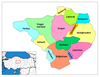 | ||||||||||||||||||||||||||
|
Metropolitan municipalities are bolded. | |||||||||||||||||||||||||||
This geographical article about a location in Yozgat Province, Turkey is a stub. You can help Wikipedia by expanding it. |
Текст в блоке "Читать" взят с сайта "Википедия" и доступен по лицензии Creative Commons Attribution-ShareAlike; в отдельных случаях могут действовать дополнительные условия.
Другой контент может иметь иную лицензию. Перед использованием материалов сайта WikiSort.org внимательно изучите правила лицензирования конкретных элементов наполнения сайта.
Другой контент может иметь иную лицензию. Перед использованием материалов сайта WikiSort.org внимательно изучите правила лицензирования конкретных элементов наполнения сайта.
2019-2026
WikiSort.org - проект по пересортировке и дополнению контента Википедии
WikiSort.org - проект по пересортировке и дополнению контента Википедии