world.wikisort.org - Philippines
Datu Salibo, officially the Municipality of Datu Salibo (Maguindanaon: Ingud nu Datu Salibo; Iranun: Inged a Datu Salibo; Tagalog: Bayan ng Datu Salibo), is a municipality in the province of Maguindanao del Sur, Philippines. According to the 2020 census, it has a population of 18,795 people. [3]
Datu Salibo | |
|---|---|
Municipality | |
| Municipality of Datu Salibo | |
 Seal | |
 | |
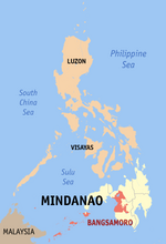
 Datu Salibo Location within the Philippines | |
| Coordinates: 7°01′N 124°30′E | |
| Country | Philippines |
| Region | Bangsamoro Autonomous Region in Muslim Mindanao |
| Province | Maguindanao del Sur |
| District | Lone district |
| Founded | July 30, 2009 |
| Barangays | 17 (see Barangays) |
| Government | |
| • Type | Sangguniang Bayan |
| • Mayor | Solaiman M. Sandigan |
| • Vice Mayor | Khominie B. Sandigan |
| • Representative | Mohamad P. Paglas Sr. |
| • Municipal Council | Members |
| • Electorate | 15,222 voters (2022) |
| Area | |
| • Total | 150.62 km2 (58.15 sq mi) |
| Elevation | 7.0 m (23.0 ft) |
| Highest elevation | 46 m (151 ft) |
| Lowest elevation | 0 m (0 ft) |
| Population | |
| • Total | 18,795 |
| • Density | 120/km2 (320/sq mi) |
| • Households | 3,244 |
| Economy | |
| • Poverty incidence | 59.31% (2018)[4] |
| • Revenue | ₱81,524,000.00 (2020) |
| • Assets | ₱54,093,000.00 (2020) |
| • Expenditure | ₱69,357,000.00 (2020) |
| • Liabilities | ₱3,417,000.00 (2020) |
| Service provider | |
| • Electricity | Maguindanao Electric Cooperative (MAGELCO) |
| Time zone | UTC+8 (PST) |
| ZIP code | 9607 |
| PSGC | |
| IDD : area code | +63 (0)64 |
| Native languages | Maguindanao Tagalog |
History
Muslim Mindanao Act No. 222 was enacted by the ARMM Regional Legislative Assembly and subsequently amended by MMA No. 253, creating the municipality of Salibo out 17 barangays.[5] The ARMM act was ratified through a plebiscite conducted by the COMELEC on July 30, 2009.
It included 4 entire barangays and portions of 10 barangays from Datu Piang (Dulawan), and 2 entire barangays and a portion of one barangay from the municipality of Datu Saudi-Ampatuan.[6]
Geography
Barangays
Datu Salibo is composed of 17 barangays.
- Alonganan
- Andavit
- Balanakan
- Buayan
- Butilen
- Dado
- Damabalas
- Duaminanga
- Kalipapa
- Liong
- Magaslong
- Masigay
- Pagatin
- Pandi
- Penditen
- Sambulawan
- Tee
Climate
| Climate data for Datu Salibo, Maguindanao | |||||||||||||
|---|---|---|---|---|---|---|---|---|---|---|---|---|---|
| Month | Jan | Feb | Mar | Apr | May | Jun | Jul | Aug | Sep | Oct | Nov | Dec | Year |
| Average high °C (°F) | 32 (90) |
32 (90) |
33 (91) |
33 (91) |
32 (90) |
31 (88) |
30 (86) |
31 (88) |
31 (88) |
31 (88) |
31 (88) |
31 (88) |
32 (89) |
| Average low °C (°F) | 21 (70) |
21 (70) |
21 (70) |
22 (72) |
23 (73) |
23 (73) |
23 (73) |
23 (73) |
23 (73) |
23 (73) |
23 (73) |
22 (72) |
22 (72) |
| Average precipitation mm (inches) | 19 (0.7) |
14 (0.6) |
15 (0.6) |
18 (0.7) |
33 (1.3) |
42 (1.7) |
44 (1.7) |
42 (1.7) |
30 (1.2) |
31 (1.2) |
28 (1.1) |
17 (0.7) |
333 (13.2) |
| Average rainy days | 6.9 | 5.6 | 6.9 | 8.1 | 15.1 | 17.5 | 17.8 | 18.5 | 14.9 | 14.9 | 12.4 | 8.0 | 146.6 |
| Source: Meteoblue (modeled/calculated data, not measured locally)[7] | |||||||||||||
Demographics
| Year | Pop. | ±% p.a. |
|---|---|---|
| 2010 | 15,062 | — |
| 2015 | 14,947 | −0.15% |
| 2020 | 18,795 | +4.61% |
| Source: Philippine Statistics Authority [8] [9] [10][11] | ||
Economy
References
- Municipality of Datu Salibo | (DILG)
- "2015 Census of Population, Report No. 3 – Population, Land Area, and Population Density" (PDF). Philippine Statistics Authority. Quezon City, Philippines. August 2016. ISSN 0117-1453. Archived (PDF) from the original on May 25, 2021. Retrieved July 16, 2021.
- Census of Population (2020). "BARMM". Total Population by Province, City, Municipality and Barangay. PSA. Retrieved 8 July 2021.
- "PSA Releases the 2018 Municipal and City Level Poverty Estimates". Philippine Statistics Authority. 15 December 2021. Retrieved 22 January 2022.
- "Muslim Mindanao Autonomy Act No. 222; An Act Creating the Municipality of Datu Salibo in the Province of Maguindanao, Providing Funds Therefor, and for Other Purposes" (PDF). Regional Legislative Assembly, Autonomous Region in Muslim Mindanao. Retrieved 27 January 2016.
- "NSCB - ActiveStats - PSGC Interactive - PSGC Updates (Third Quarter 2009)". Archived from the original on 2012-04-26. Retrieved 2012-05-22.
- "Datu Salibo, Maguindanao : Average Temperatures and Rainfall". Meteoblue. Retrieved 19 January 2019.
- Census of Population (2015). "ARMM – Autonomous Region in Muslim Mindanao". Total Population by Province, City, Municipality and Barangay. PSA. Retrieved 20 June 2016.
- Census of Population and Housing (2010). "ARMM – Autonomous Region in Muslim Mindanao". Total Population by Province, City, Municipality and Barangay. NSO. Retrieved 29 June 2016.
- Censuses of Population (1903–2007). "ARMM – Autonomous Region in Muslim Mindanao". Table 1. Population Enumerated in Various Censuses by Province/Highly Urbanized City: 1903 to 2007. NSO.
- "Province of Maguindanao". Municipality Population Data. Local Water Utilities Administration Research Division. Retrieved 17 December 2016.
- "Poverty incidence (PI):". Philippine Statistics Authority. Retrieved 28 December 2020.
- https://psa.gov.ph/sites/default/files/2012%20Municipal%20and%20City%20Level%20Poverty%20Estima7tes%20Publication%20%281%29.pdf; publication date: 31 May 2016; publisher: Philippine Statistics Authority.
- https://psa.gov.ph/sites/default/files/City%20and%20Municipal-level%20Small%20Area%20Poverty%20Estimates_%202009%2C%202012%20and%202015_0.xlsx; publication date: 10 July 2019; publisher: Philippine Statistics Authority.
- "PSA Releases the 2018 Municipal and City Level Poverty Estimates". Philippine Statistics Authority. 15 December 2021. Retrieved 22 January 2022.
External links
- Datu Salibo Profile at the DTI Cities and Municipalities Competitive Index
- MMA Act No. 222 : An Act Creating the Municipality of Datu Salibo in the Province of Maguindanao
- Philippine Standard Geographic Code
- COMELEC - Plebiscite results for 3 new Maguindanao towns
- COMELEC Resolution No. 8169
- Local Governance Performance Management System
Другой контент может иметь иную лицензию. Перед использованием материалов сайта WikiSort.org внимательно изучите правила лицензирования конкретных элементов наполнения сайта.
WikiSort.org - проект по пересортировке и дополнению контента Википедии