world.wikisort.org - Netherlands
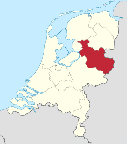
Overijssel (Dutch: [ˌoːvərˈɛisəl] (![]() listen), lit. 'Upper IJssel'; Low German: Oaveriessel [ˌɒːvərˈiːsl̩]; German: Oberyssel) is a province of the Netherlands located in the eastern part of the country. The province's name translates to "across the IJssel", from the perspective of the Episcopal principality of Utrecht by which it was held until 1528. The capital city of Overijssel is Zwolle (pop. 127,497[4]) and the largest city is Enschede (pop. 158,986). The province had a population of 1,162,215 as of November 2019. The land mostly consists of grasslands and some forests (including Sallandse Heuvelrug National Park); it also borders a small part of the IJsselmeer to the west.
listen), lit. 'Upper IJssel'; Low German: Oaveriessel [ˌɒːvərˈiːsl̩]; German: Oberyssel) is a province of the Netherlands located in the eastern part of the country. The province's name translates to "across the IJssel", from the perspective of the Episcopal principality of Utrecht by which it was held until 1528. The capital city of Overijssel is Zwolle (pop. 127,497[4]) and the largest city is Enschede (pop. 158,986). The province had a population of 1,162,215 as of November 2019. The land mostly consists of grasslands and some forests (including Sallandse Heuvelrug National Park); it also borders a small part of the IJsselmeer to the west.
This article needs additional citations for verification. (January 2013) |
Overijssel
Oaveriessel (Dutch Low Saxon) | |
|---|---|
Province of the Netherlands | |
 Flag  Coat of arms | |
| Anthem: "Aan de rand van Hollands gouwen" "On the edge of Holland's district" | |
 Location of Overijssel in the Netherlands | |
| Country | Netherlands |
| Capital | Zwolle |
| Largest city | Enschede |
| Government | |
| • King's Commissioner | Andries Heidema (CU) |
| • Council | Provincial Council of Overijssel |
| Area (2017)[1] | |
| • Total | 3,421 km2 (1,321 sq mi) |
| • Land | 3,323 km2 (1,283 sq mi) |
| • Water | 98 km2 (38 sq mi) |
| • Rank | 5th |
| Population (1 November 2019)[2] | |
| • Total | 1,162,215 |
| • Rank | 6th |
| • Density | 350/km2 (900/sq mi) |
| • Rank | 7th |
| ISO 3166 code | NL-OV |
| Religion (2006) | Protestant 29% Catholic 26% Muslim 2% Others 6% Non-religious 37% |
| HDI (2018) | 0.921[3] very high · 7th |
| Website | www.overijssel.nl |
Geography

Overijssel is bordered by Germany (Lower Saxony and North Rhine-Westphalia) to the east, the Achterhoek region of Gelderland to the south, the Veluwe region of Gelderland and Flevoland to the west, and Friesland and the former moors of Drenthe to the north. Overijssel comprises three regions: Kop van Overijssel in the northwest, Salland in the centre of the province, and Twente in the east. Besides the capital Zwolle, other major cities are Almelo, Deventer, Hengelo, Enschede, and Kampen.
To the southeast, the province's surface is mostly sandy, interspersed with small rivers such as the Regge and Dinkel and other brooks. In the northwest, the geology is dominated by sediments from the Overijsselse Vecht and clay. The northern parts were once covered by veen (bogs) which separated the dryer and more arable south from Drenthe and which have been exploited as fuel to a large degree. Only small patches survive today (Engbertsdijksvenen near Geesteren, Witteveen (near Haaksbergen), and the Aamsveen (near Enschede). The extreme northwest is dominated by a system of lakes formed by former peat-mining and protected under the De Weerribben-Wieden National Park status, which is a valuable wetland.
The highest point in Overijssel is the summit of the Tankenberg, a hill in the municipality of Losser, at 85 metres (278 ft). The lowest point is in the Mastenbroek Polder near Kampen at 2 metres (6 ft) below sea level.
Important rivers : IJssel, Zwarte Water, Overijsselse Vecht, Dinkel, Regge and Reest .
Major channels : Twentekanaal (Enschede and Zutphen-branch to Almelo), Overijssels Kanaal, Kanaal Almelo-De Haandrik, Kanaal Almelo-Nordhorn (outdoors) and Dedemsvaart (largely muted).
Climate
Overijssel enjoys an oceanic climate (Cfb in the Köppen classification). However, winters tend to be more severe than the rest of the Netherlands, because of its distance from the coast.[5]
| Climate data for Twenthe (1981-2010) | |||||||||||||
|---|---|---|---|---|---|---|---|---|---|---|---|---|---|
| Month | Jan | Feb | Mar | Apr | May | Jun | Jul | Aug | Sep | Oct | Nov | Dec | Year |
| Average high °C (°F) | 4.8 (40.6) |
5.7 (42.3) |
9.5 (49.1) |
13.9 (57.0) |
18.0 (64.4) |
20.5 (68.9) |
22.8 (73.0) |
22.5 (72.5) |
18.7 (65.7) |
14.1 (57.4) |
8.9 (48.0) |
5.2 (41.4) |
13.7 (56.7) |
| Daily mean °C (°F) | 2.3 (36.1) |
2.6 (36.7) |
5.6 (42.1) |
8.9 (48.0) |
12.9 (55.2) |
15.4 (59.7) |
17.6 (63.7) |
17.1 (62.8) |
14.0 (57.2) |
10.2 (50.4) |
6.0 (42.8) |
2.9 (37.2) |
9.6 (49.3) |
| Average low °C (°F) | −0.5 (31.1) |
−0.6 (30.9) |
1.5 (34.7) |
3.4 (38.1) |
7.1 (44.8) |
9.6 (49.3) |
12.0 (53.6) |
11.5 (52.7) |
9.2 (48.6) |
6.2 (43.2) |
3.0 (37.4) |
0.3 (32.5) |
5.2 (41.4) |
| Average precipitation mm (inches) | 71.5 (2.81) |
51.6 (2.03) |
65.1 (2.56) |
45.2 (1.78) |
62.4 (2.46) |
67.7 (2.67) |
74.5 (2.93) |
71.0 (2.80) |
65.4 (2.57) |
67.5 (2.66) |
68.9 (2.71) |
74.1 (2.92) |
784.9 (30.90) |
| Mean monthly sunshine hours | 52.8 | 82.6 | 114.0 | 169.9 | 202.1 | 184.6 | 202.4 | 184.4 | 137.4 | 112.3 | 58.9 | 46.0 | 1,547.3 |
| Source: KNMI [6] | |||||||||||||
History

Oversticht
Overijssel was formerly known as Oversticht and also included most of the modern-day province of Drenthe. In 1336, it was made part of Guelders, though it was ceded to the Bishopric of Utrecht in 1347. The Bishops ceded the Oversticht to the Emperor Charles V in 1528, who styled himself Lord of Overijssel, after the Latin name of Oversticht that was known since 1233: Transysla or Transisalania, or Over-IJssel, i.e. the other side of the river IJssel. The people joined with the other Dutch and rebelled against Charles' heir Philip II. Overijssel became governed by the most powerful mayors and lords in the province, including by the lieutenant-governor Nicolaas Schmelzing (1561-1629).
After a brief occupation by the forces of the Bishop of Münster (1672–74), Overijssel received a new form of government which granted the stadtholders more power. Widespread resistance against the increased power throughout the provinces eventually led to the formation of the Batavian Republic in 1795. A centralist government arose and the Netherlands was organised into a series of départements, based on those used by revolutionary France.
Overijssel
At first organised into its own département, it was merged with Drenthe in 1798 to form Ouden IJssel, which was renamed Overijssel in 1801.
The French annexed the Batavian Republic in 1810, and Overijssel was organised into the new French département of Bouches-de-l'Yssel. After the defeat of Napoleon in 1814, the kingdom of the Netherlands and the former province of Overijssel were recreated.
Overijssel was occupied by Nazi Germany during World War II from May 1940 until its liberation in April 1945. The Noordoostpolder, a reclaimed territory which had been laid dry in 1942, was part of Overijssel from 1962 until 1986, when it became part of the newly created province of Flevoland.
Politics

The King's Commissioner of Overijssel is Andries Heidema (CU) since 11 July 2018. The King's Commissioner is the chairman of the Provincial-Executive (executive branch) and the States-Provincial (elected legislature) of the province.
The Provincial Council, the general government of the province, consists of 47 members[7] who are elected every four years. Until the States elections of March 2007, Overijssel had 63 Members of Parliament. An amendment to the Provinces Act resulted in the total number of States members in the Netherlands being reduced from 764 to the current 564.
| Political party | Votes in % | Seats |
|---|---|---|
| Christian Democratic Appeal | 22.44 | 11 |
| People's Party for Freedom and Democracy | 12.43 | 6 |
| Socialist Party | 10.70 | 5 |
| Labour Party | 10.59 | 5 |
| Democrats 66 | 10.47 | 5 |
| Party for Freedom | 9.43 | 5 |
| Christian Union | 8.37 | 4 |
| Reformed Political Party | 4.31 | 2 |
| GroenLinks | 4.30 | 2 |
| 50PLUS | 2.91 | 1 |
| Party for the Animals | 2.24 | 1 |
| Other parties | 0.66 | 0 |
| Total | 47 |
Religion
Religion in Overijssel (2015)[8]
Economy
The Gross domestic product (GDP) of the region was 43.2 billion € in 2018, accounting for 5.6% of the Netherlands economic output. GDP per capita adjusted for purchasing power was 32,700 € or 108% of the EU27 average in the same year.[9]
The province has become highly industrialized. The Twente district in the southeast, where cotton spinning, weaving, and bleaching came into prominence in the 19th century, is one of the principal centres of the Dutch textile industry. The main centres are Enschede, Almelo, Hengelo, and Oldenzaal. Other important industrial centres are Deventer, Kampen, and Zwolle.[10]
Transport
Road

Overijssel is an important transit province to and from Germany and the northeast of the Netherlands. There are three main motorways in Overijssel, the A1, A28, and the A35/N35. Other major trunk roads are the N18, A32, N36, N48 and N50. In addition, the province manages a large number of provincial roads of major and minor importance.[11]
- The A1 enters the province at Deventer and runs via Hengelo and Oldenzaal to the German border, where it connects to the German A30. The A1 is an important hinterland connection with a lot of freight traffic. The road will be widened to 2x4 lanes between Knooppunt Beekbergen and Deventer and to 2x3 lanes between Deventer and Knooppunt Azelo.
- The N18 forms a connection between Enschede and the Achterhoek. The road was newly opened in 2018 between Enschede and Groenlo as a motorway.
- The A28 runs for approximately 20 kilometers in the province, but is the busiest road in Overijssel, with 130,000 vehicles crossing the IJsselbrug every day. The A28 was very sensitive to congestion, but in 2010/2011 the A28 was widened from 2x2 to 2x3 lanes from the Hattemerbroek junction to the Lankhorst junction (excluding the route through Zwolle).
- The A32 runs from Meppel to Leeuwarden, but this highway runs partly through the Kop van Overijssel along Steenwijk, among others. The A32 joins the A28 at Staphorst. The A32 is therefore an important arterial road for the northwest of the province.
- The N35 is the most important transport axis through Midden-Overijssel. The road runs from the A28 in Zwolle via Raalte and Nijverdal to Wierden, where the road turns into the A35 past Almelo and Hengelo to Enschede. From Enschede the road turns back into the N35 to the German border. The N35 is the most important connection between the cities of Twente and the Ruhr area and Münster.
- The N36 between Almelo and Ommen and the N48 between Ommen and Hoogeveen together form a connection between Twente and Groningen and between Zwolle and Hardenberg. Both roads are two-lane highways.
- The N50 is an important connection from Zwolle to Kampen and further to Flevoland and Friesland.
Rail network
Four intercity connections (Enschede-Randstad, Zwolle - Roosendaal and Groningen/Leeuwarden-Amersfoort-Randstad and Groningen/Leeuwarden-Lelystad-Randstad) run through Overijssel. Zwolle railway station has a junction function. The stations of Almelo, Deventer and Hengelo have a transfer function. The stations of Hengelo, Enschede and Oldenzaal have a direct connection with Germany. The international intercity to Berlin stops in Deventer, Almelo and Hengelo. Goods traffic takes place on many lines to Germany and the north of the Netherlands.
The following railway lines are located in Overijssel:
- Utrecht – Kampen railway : (Utrecht -) Zwolle - Kampen
- Arnhem – Leeuwarden railway : (Arnhem -) Deventer - Zwolle - Steenwijk (- Leeuwarden)
- Zutphen – Glanerbeek railway : (Zutphen -) Goor - Hengelo - Enschede (- Gronau (D))
- Lelystad – Zwolle railway : (Lelystad -) Kampen South - Zwolle
- Zwolle – Stadskanaal railway : Zwolle - Hardenberg (- Emmen)
- Zwolle – Almelo railway : Zwolle - Wierden - Almelo
- Mariënberg – Almelo railway : Mariënberg - Almelo
- Almelo – Salzbergen railway : Almelo - Hengelo - Oldenzaal (- Salzbergen (D))
- Apeldoorn – Deventer railway : (Apeldoorn -) Deventer
Airport
The main airport in Overijssel is the Enschede Airport Twente, located outside of Enschede. The airport does not currently offer any international flights, though it has historically.[12]
Waterways
Due to its location on the IJssel, Overijssel has a number of large bridges. The most important is the IJsselbrug near Zwolle, but the IJsselbrug near Deventer is also important. These are also the busiest roads in the province. At Kampen the N50 crosses the IJssel. Kampen also has two bridges over the IJssel. Other bridges over the IJssel are at Zwolle the Oude IJsselbrug and the railway bridge over the IJssel, and at Deventer a railway and road bridge. In addition to these bridges, the river IJssel can also be crossed at a number of places by means of a number of ferries.
Municipalities

Overijssel is divided into 25 municipalities. Until 1 January 2001, there were still 44, but after a municipal reclassification came into effect, the number fell to 26. On 1 January 2005, the municipalities of Deventer and Bathmen were merged (under the name Deventer), reducing the number of municipalities into 25.
- North Overijssel COROP group
 Dalfsen (3)
 Hardenberg (8)
 Kampen (12)
 Ommen (16)
 Staphorst (19)
 Steenwijkerland (20)
 Zwartewaterland (24)
 Zwolle (25)
- South West Overijssel COROP group
 Deventer (5)
 Olst-Wijhe (15)
 Raalte (17)
- Twente COROP group
 Almelo (1)
 Borne (2)
 Dinkelland (4)
 Enschede (6)
 Haaksbergen (7)
 Hellendoorn (9)
 Hengelo (10)
 Hof van Twente (11)
 Losser (13)
 Oldenzaal (14)
 Rijssen-Holten (18)
 Tubbergen (21)
 Twenterand (22)
 Wierden (23)
Photo gallery
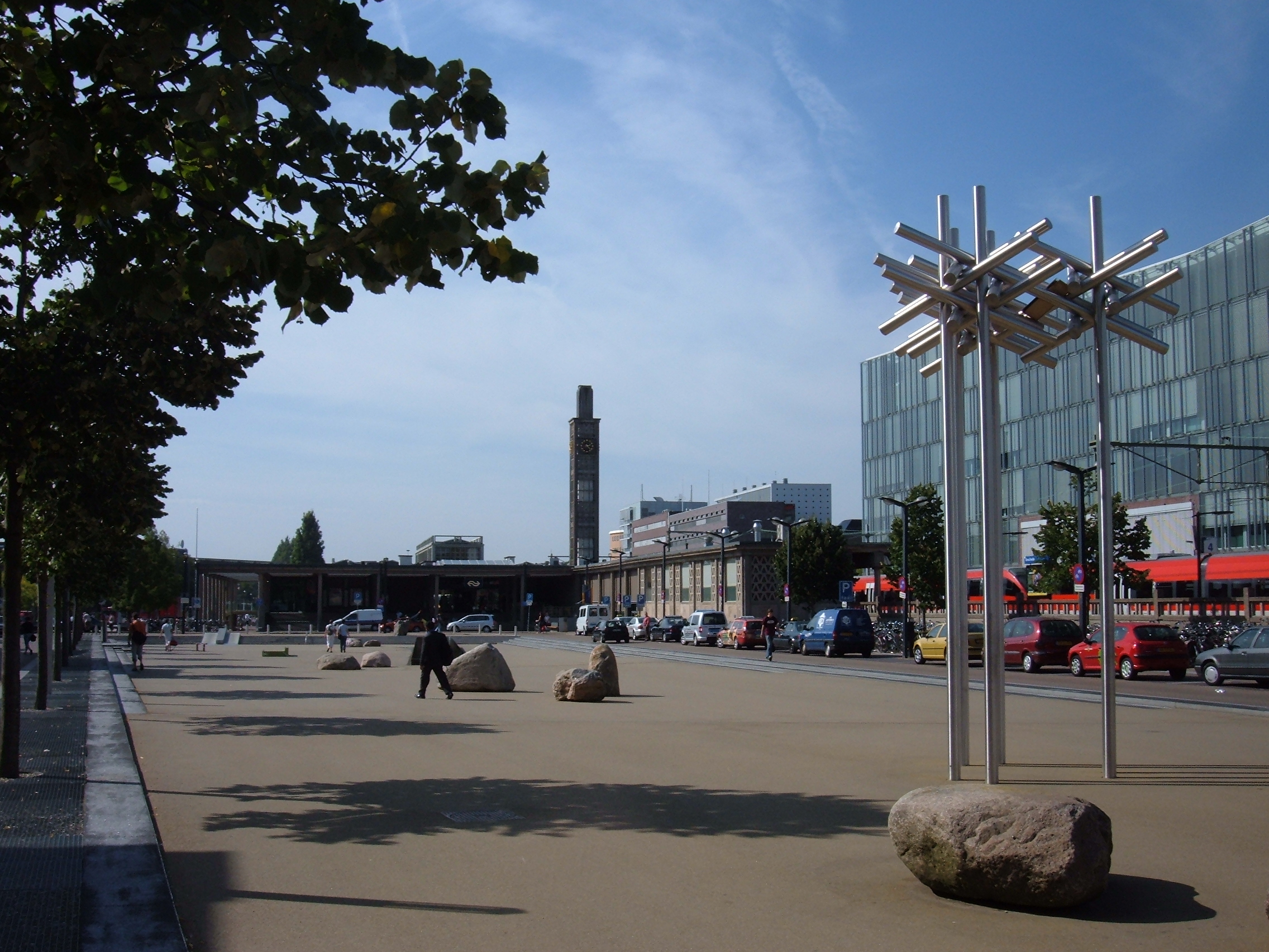
 The Grote Markt in Zwolle, the provincial capital
 The Bergkerk from the Bergstraat, Deventer
 A canal in Giethoorn
 Water tower at the Jannink building in Enschede
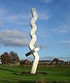 Beacon of Overijssel in Olst


See also
- Overisel Township, Michigan, US was named after Overijssel
- Tanfana
References
- "Error".
- "CBS Statline".
- "Sub-national HDI - Area Database - Global Data Lab". hdi.globaldatalab.org. Retrieved 2018-09-13.
- "CBS Statline".
- "Overijssel climate info | what's the weather like in Overijssel, the Netherlands".
- "Twenthe, long-term averages, time period 1981-2010 (in Dutch)" (PDF). Retrieved December 29, 2012.
- "Welke Statenleden zijn er? - Provincie Overijssel". 2018-09-13. Archived from the original on 2018-09-13. Retrieved 2021-08-05.
- Helft Nederlanders is kerkelijk of religieus, CBS, 22 december 2016
- "Regional GDP per capita ranged from 30% to 263% of the EU average in 2018". Eurostat.
- "Overijssel | province, Netherlands". Encyclopedia Britannica. Retrieved 2021-08-05.
- "Category:Overijssel - Hitchwiki: The Hitchhiker's guide to Hitchhiking".
- "Airports in Overijssel, Netherlands @ OurAirports".
External links
- Official website
- Participation platform of Overijssel
 Overijssel travel guide from Wikivoyage
Overijssel province | ||
|---|---|---|
| Municipalities |  | |
| Regions |
| |
| ||
Provinces of the Netherlands | ||
|---|---|---|
| ||
 | ||
Authority control | |
|---|---|
| General | |
| National libraries | |
| Other |
|
На других языках
[de] Provinz Overijssel
Overijssel ( anhören?/i; niedersächsisch Oaveriessel, deutsch Oberyssel) ist eine Provinz in den Niederlanden. Sie liegt zwischen dem IJsselmeer, der IJssel und den Hügeln der Veluwe im Westen, Drenthe im Norden, den deutschen Bundesländern Niedersachsen und Nordrhein-Westfalen im Osten und dem Achterhoek (Provinz Gelderland) im Süden. Die Ortsdialekte werden dem Niedersächsischen (Plattdeutsch) zugerechnet.- [en] Overijssel
Другой контент может иметь иную лицензию. Перед использованием материалов сайта WikiSort.org внимательно изучите правила лицензирования конкретных элементов наполнения сайта.
WikiSort.org - проект по пересортировке и дополнению контента Википедии