world.wikisort.org - Netherlands
Losser (Dutch pronunciation: [ˈlɔsər] (![]() listen)) is a municipality and a town in the eastern Netherlands. It is at the eastern end of the A1 motorway.
listen)) is a municipality and a town in the eastern Netherlands. It is at the eastern end of the A1 motorway.
Losser | |
|---|---|
Municipality | |
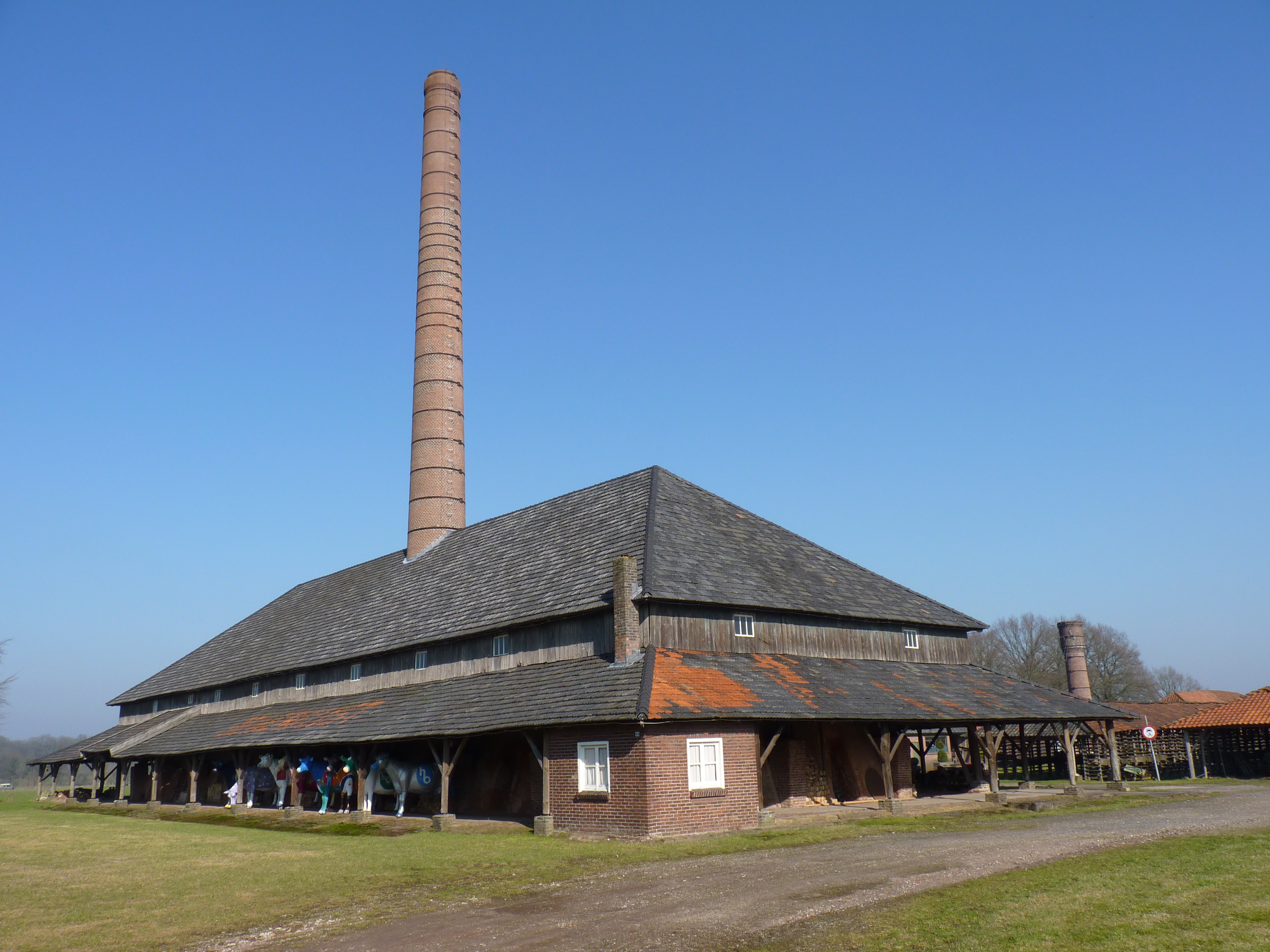 Monumental former factory in Losser | |
 Flag  Coat of arms | |
 Location in Overijssel | |
| Coordinates: 52°16′N 7°0′E | |
| Country | Netherlands |
| Province | Overijssel |
| Government | |
| • Body | Municipal council |
| • Mayor | Cia Kroon (VVD) |
| Area | |
| • Total | 99.62 km2 (38.46 sq mi) |
| • Land | 98.76 km2 (38.13 sq mi) |
| • Water | 0.86 km2 (0.33 sq mi) |
| Elevation | 35 m (115 ft) |
| Population (January 2019)[4] | |
| • Total | 22,622 |
| • Density | 229/km2 (590/sq mi) |
| Demonym(s) | Lossernaar, Lossenaar |
| Time zone | UTC+1 (CET) |
| • Summer (DST) | UTC+2 (CEST) |
| Postcode | 7580–7589 |
| Area code | 053, 0541 |
| Website | www |

Population centres
- Beuningen
- De Lutte
- Glane
- Losser
- Overdinkel
Losser
The oldest known reference to Losser dates from the tenth century.[5] Originally, the village consisted of two separate parts. Both were almost completely destroyed when on 21 September 1665, troops from Münster set fire to them.[6]
One of the town's oldest buildings is the Martinustoren (St. Martin's Tower), dating from around 1500 and the only remaining part of a church demolished in 1903.
Geography
A few kilometers west of De Lutte, close to the border with Oldenzaal, lies the Tankenberg, a hill the top of which (85 m) is the highest point in the province. (For myths of the Tankenberg, see Tanfana.)
The municipality's most important body of water is the river Dinkel.
Sister cities
Losser is twinned with:
|
Notable people
- Pi de Bruijn (born 1942 in Losser) a Dutch architect
- Kim Kötter (born 1982 in Losser) a Dutch director, model and beauty pageant titleholder [7]
- Moniek Nijhuis (born 1988 in Overdinkel) a Dutch swimmer, competed in the 2012 Summer Olympics
Gallery
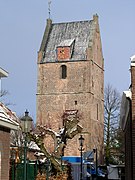 Martin's Tower
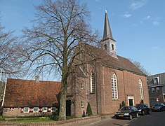 Reformed church
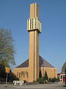 Church: de Sint Martinuskerk
 Overdinkel, Rooms katholieke Kerk


References
- "College van B&W" [Board of mayor and aldermen] (in Dutch). Gemeente Losser. Archived from the original on 27 July 2014. Retrieved 31 March 2014.
- "Kerncijfers wijken en buurten 2020" [Key figures for neighbourhoods 2020]. StatLine (in Dutch). CBS. 24 July 2020. Retrieved 19 September 2020.
- "Postcodetool for 7581AG". Actueel Hoogtebestand Nederland (in Dutch). Het Waterschapshuis. Archived from the original on 21 September 2013. Retrieved 31 March 2014.
- "Bevolkingsontwikkeling; regio per maand" [Population growth; regions per month]. CBS Statline (in Dutch). CBS. 1 January 2019. Retrieved 1 January 2019.
- Stenvert, R. et al. (1998). Monumenten in Nederland: Overijssel, p. 213–215, 240. Zwolle: Waanders Uitgevers. ISBN 90-400-9200-1.
- Buisman, J. (2000). Duizend jaar weer, wind en water in de lage landen: 1575–1675, p. 597. Franeker: Van Wijnen. ISBN 90-5194-136-6.
- IMDb Database retrieved 04 October 2019
External links
 Media related to Losser at Wikimedia Commons
- Official website
Places adjacent to Losser | ||||||||||||||||
|---|---|---|---|---|---|---|---|---|---|---|---|---|---|---|---|---|
| ||||||||||||||||
Overijssel province | ||
|---|---|---|
| Municipalities |
|  |
| Regions |
| |
| ||
На других языках
- [en] Losser
[ru] Лоссер (община)
Лоссер (нидерл. Losser) — община в провинции Оверэйссел (Нидерланды). В общине исторически проживают много католиков, особенно в деревне Де-Лютте.Другой контент может иметь иную лицензию. Перед использованием материалов сайта WikiSort.org внимательно изучите правила лицензирования конкретных элементов наполнения сайта.
WikiSort.org - проект по пересортировке и дополнению контента Википедии