world.wikisort.org - Netherlands
Twenterand (Dutch: [ˈtʋɛntərɑnt] (![]() listen); Twents: Tweanteraand) is a municipality in the province of Overijssel in the eastern Netherlands. The name means "edge of Twente" as it is situated on the northwestern fringe of the historical region of Twente.
listen); Twents: Tweanteraand) is a municipality in the province of Overijssel in the eastern Netherlands. The name means "edge of Twente" as it is situated on the northwestern fringe of the historical region of Twente.
Twenterand
Tweanteraand (Twents) | |
|---|---|
Municipality | |
 Windmill in Vriezenveen | |
 Flag Coat of arms | |
 Location in Overijssel | |
| Coordinates: 52°25′N 6°38′E | |
| Country | Netherlands |
| Province | Overijssel |
| Established | 1 January 2001[1] |
| Renamed | 1 January 2003[2] |
| Government | |
| • Body | Municipal council |
| • Mayor | Hans Broekhuizen (CDA) |
| Area | |
| • Total | 108.14 km2 (41.75 sq mi) |
| • Land | 106.17 km2 (40.99 sq mi) |
| • Water | 1.97 km2 (0.76 sq mi) |
| Elevation | 10 m (30 ft) |
| Population (January 2019)[6] | |
| • Total | 33,792 |
| • Density | 318/km2 (820/sq mi) |
| Time zone | UTC+1 (CET) |
| • Summer (DST) | UTC+2 (CEST) |
| Postcode | 7670–7677, 7680–7683 |
| Area code | 0546 |
| Website | www |
The municipality of Twenterand also had two city halls, because of the merger between the former municipalities of Vriezenveen and Den Ham in 2001. The city hall in Vriezenveen remained. The extended municipality of Vriezenveen is called Twenterand since 2003. The former municipal area of Vriezenveen belongs to the region of Twente and the former municipal area of Den Ham partly to the region of Salland and partly to the region of Twente.
Population centres
- Bruinehaar
- De Pollen
- Den Ham
- Geerdijk
- Kloosterhaar
- Meer
- Vriezenveen
- Vroomshoop
- Weitemanslanden
- Westerhaar-Vriezenveensewijk
- Westerhoeven

Dutch topographic map of the municipality of Twenterand, June 2015
Transportation
- Geerdijk railway station
- Vriezenveen railway station
- Vroomshoop railway station
Notable people

- Louis Reijtenbagh (born 1946 in Den Ham) a Dutch businessman, investor, a retired general practitioner and art collector
- Sabine Uitslag (born 1973 in Westerhaar-Vriezenveensewijk) a former Dutch politician
- Manon Fokke (born 1976 in Vriezenveen) a Dutch politician
- Sanne Nijhof (born 1987 in Den Ham) a Dutch model
Sport
- Berend Veneberg (born 1963 in Den Ham) a former strongman and powerlifter
- Jarno Hams (born 1974 in Hengelo) a strongman
- Johan Kenkhuis (born 1980 in Vriezenveen) swimmer, won bronze at the 2000 Summer Olympics
- Christian Kist (born 1986 in Mariënberg) a Dutch professional darts player
- Maayke Heuver (born 1990 in Vriezenveen) a former Dutch footballer, 154 caps for FC Twente and 17 for NL women's team
Gallery
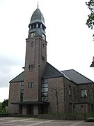 Ned. Hervormde Kerk Vriezenveen
 De Veene-leiding loopt hier over in de Linderbeek - Vroomshoop
 Den Ham, klokkenstoel
 Vriezenveen


References
- "Gemeentelijke indeling op 1 januari 2001" [Municipal divisions on 1 January 2001]. cbs.nl (in Dutch). CBS. Retrieved 2 April 2014.
- "Gemeentelijke indeling op 1 januari 2003" [Municipal divisions on 1 January 2003]. cbs.nl (in Dutch). CBS. Retrieved 2 April 2014.
- "Collegeleden" [Members of the board] (in Dutch). Gemeente Twenterand. Archived from the original on 7 April 2014. Retrieved 2 April 2014.
- "Kerncijfers wijken en buurten 2020" [Key figures for neighbourhoods 2020]. StatLine (in Dutch). CBS. 24 July 2020. Retrieved 19 September 2020.
- "Postcodetool for 7671GS". Actueel Hoogtebestand Nederland (in Dutch). Het Waterschapshuis. Retrieved 2 April 2014.
- "Bevolkingsontwikkeling; regio per maand" [Population growth; regions per month]. CBS Statline (in Dutch). CBS. 1 January 2019. Retrieved 1 January 2019.
External links
 Media related to Twenterand at Wikimedia Commons
- Official website
Places adjacent to Twenterand | ||||||||||||||||
|---|---|---|---|---|---|---|---|---|---|---|---|---|---|---|---|---|
| ||||||||||||||||
Overijssel province | ||
|---|---|---|
| Municipalities |
|  |
| Regions |
| |
| ||
Другой контент может иметь иную лицензию. Перед использованием материалов сайта WikiSort.org внимательно изучите правила лицензирования конкретных элементов наполнения сайта.
WikiSort.org - проект по пересортировке и дополнению контента Википедии