world.wikisort.org - Netherlands
Dinkelland (Dutch pronunciation: [ˈdɪŋkəllɑnt] (![]() listen)) is a municipality in the eastern Netherlands. For a short time it was known as Denekamp (one of its component towns) until it was renamed in 2002.
listen)) is a municipality in the eastern Netherlands. For a short time it was known as Denekamp (one of its component towns) until it was renamed in 2002.
Dinkelland | |
|---|---|
Municipality | |
 Castle in Dinkelland | |
 Flag Coat of arms | |
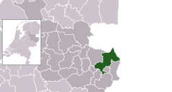 Location in Overijssel | |
| Coordinates: 52°22′N 7°0′E | |
| Country | Netherlands |
| Province | Overijssel |
| Government | |
| • Body | Municipal council |
| • Acting Mayor | John Joosten (VVD) |
| Area | |
| • Total | 176.83 km2 (68.27 sq mi) |
| • Land | 175.71 km2 (67.84 sq mi) |
| • Water | 1.12 km2 (0.43 sq mi) |
| Elevation | 26 m (85 ft) |
| Population (January 2019)[4] | |
| • Total | 26,350 |
| • Density | 150/km2 (400/sq mi) |
| Time zone | UTC+1 (CET) |
| • Summer (DST) | UTC+2 (CEST) |
| Postcode | Parts of 7500 and 7600 ranges |
| Area code | 0541, 074 |
| Website | www |

Population centres
- Breklenkamp
- Denekamp
- Deurningen
- Dulder
- Gammelke
- Groot Agelo
- Het Stift
- Klein Agelo
- Lattrop
- Lemselo
- Noord Deurningen
- Noordijk
- Nutter
- Ootmarsum
- Oud Ootmarsum
- Rossum
- Saasveld
- Tilligte
- Volthe
- Weerselo
Notable people
- Johan Jongkind (1819 in Lattrop – 1891) a Dutch painter and printmaker
- Theo Budde (1889 in Ootmarsum - 1959) a watchmaker, jeweler, antique dealer and poet
- Ton Schulten (born 1938 in Ootmarsum) a Dutch painter who mainly paints landscapes
- Roméo Dallaire (born 1946 in Denekamp) a Canadian humanitarian, author, statesman and retired senator and general
- Marcha (born 1956 in Lattrop) a Dutch singer and TV presenter, took part in the 1987 Eurovision Song Contest
- Han Polman (born 1963 in Ootmarsum) a Dutch politician
- Tanja Nijmeijer (born 1978 in Denekamp) a Dutch former guerrilla fighter in Colombia and English teacher
Sport
- Felix von Heijden (1890 in Weerselo – 1982) a footballer team bronze medallist at the 1920 Summer Olympics; & Mayor of Rosmalen 1923–1955
- Hennie Kuiper (born 1949 in Denekamp) a former professional road racing cyclist, gold medallist at the 1972 Summer Olympics
- Jos Lansink (born 1961 in Weerselo) an equestrian, team gold medallist at the 1992 Summer Olympics
- Marieke Westerhof (born 1974 in Denekamp) a retired rower, team silver medallist at the 2000 Summer Olympics
- Elles Leferink (born 1976 in Weerselo) a volleyball player, competed at the 1996 Summer Olympics
References
- "Ineke Bakker (acting mayor)" (in Dutch). Gemeente Dinkelland. Retrieved 27 March 2014.
- "Kerncijfers wijken en buurten 2020" [Key figures for neighbourhoods 2020]. StatLine (in Dutch). CBS. 24 July 2020. Retrieved 19 September 2020.
- "Postcodetool for 7591MA". Actueel Hoogtebestand Nederland (in Dutch). Het Waterschapshuis. Retrieved 27 March 2014.
- "Bevolkingsontwikkeling; regio per maand" [Population growth; regions per month]. CBS Statline (in Dutch). CBS. 1 January 2019. Retrieved 1 January 2019.
External links
| Wikivoyage has a travel guide for Dinkelland. |
 Media related to Dinkelland at Wikimedia Commons
- Official website (in Dutch)
Places adjacent to Dinkelland | ||||||||||||||||
|---|---|---|---|---|---|---|---|---|---|---|---|---|---|---|---|---|
| ||||||||||||||||
Overijssel province | ||
|---|---|---|
| Municipalities |
|  |
| Regions |
| |
| ||
This Overijssel location article is a stub. You can help Wikipedia by expanding it. |
Текст в блоке "Читать" взят с сайта "Википедия" и доступен по лицензии Creative Commons Attribution-ShareAlike; в отдельных случаях могут действовать дополнительные условия.
Другой контент может иметь иную лицензию. Перед использованием материалов сайта WikiSort.org внимательно изучите правила лицензирования конкретных элементов наполнения сайта.
Другой контент может иметь иную лицензию. Перед использованием материалов сайта WikiSort.org внимательно изучите правила лицензирования конкретных элементов наполнения сайта.
2019-2026
WikiSort.org - проект по пересортировке и дополнению контента Википедии
WikiSort.org - проект по пересортировке и дополнению контента Википедии