world.wikisort.org - India
Anand District is an administrative district of Gujarat state in western India and whose popular nickname is Charotar.[2] It was carved out of the Kheda district in 1997. Anand is the administrative headquarters of the district. It is bounded by Kheda District to the north, Vadodara District to the east, Ahmedabad District to the west, and the Gulf of Khambhat to the south. Major towns are Umreth, Khambhat, Karamsad, Tarapur, Petlad, Borsad and Sojitra.
This article uses bare URLs, which are uninformative and vulnerable to link rot. (September 2022) |
Anand district | |
|---|---|
District of Gujarat | |
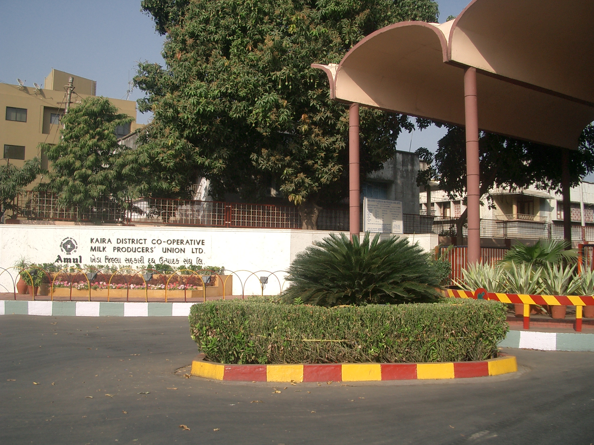 Entrance of the Amul dairy cooperative | |
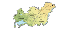
 Location of district in Gujarat | |
| Coordinates: 22.57°N 72.93°E | |
| Country | |
| State | Gujarat |
| Area | |
| • Total | 3,204 km2 (1,237 sq mi) |
| Population (2011) | |
| • Total | 2,092,745 |
| • Rank | 14th in state |
| • Density | 650/km2 (1,700/sq mi) |
| Languages | |
| • Official | Gujarati, Hindi |
| Time zone | UTC+5:30 (IST) |
| Vehicle registration | GJ-23[1] |
| Website | https://ananddp.gujarat.gov.in/Anand |
Demographics
According to the 2011 census Anand district has a population of 2,092,745[3] (With total Males 1,088,253[4] and total Females 1,002,023),[4] roughly equal to the nation of North Macedonia[5] or the US state of New Mexico.[6] This gives it a ranking of 219th in India (out of a total of 640).[3] The district has a population density of 711 inhabitants per square kilometre (1,840/sq mi).[3] Its population growth rate over the decade 2001-2011 was 12.57%.[3] Anand has a sex ratio of 921 females for every 1000 males,[3] and a literacy rate of 85.79%[3] (Males 93.23%[4] and Females 77.76%).[4] Scheduled Castes and Scheduled Tribes make up 4.99% and 1.19% of the population respectively.
At the time of the 2011 Census of India, 96.67% of the population in the district spoke Gujarati and 2.10% Hindi as their first language.[8]
| Year | Pop. | ±% p.a. |
|---|---|---|
| 1901 | 512,296 | — |
| 1911 | 502,049 | −0.20% |
| 1921 | 509,946 | +0.16% |
| 1931 | 554,746 | +0.85% |
| 1941 | 659,996 | +1.75% |
| 1951 | 796,376 | +1.90% |
| 1961 | 958,629 | +1.87% |
| 1971 | 1,173,757 | +2.05% |
| 1981 | 1,448,666 | +2.13% |
| 1991 | 1,642,615 | +1.26% |
| 2001 | 1,856,872 | +1.23% |
| 2011 | 2,092,745 | +1.20% |
| source:[9] | ||
Administrative divisions
Anand District is administratively divided into eight talukas or subdistricts: Anand, Anklav, Borsad, Khambhat, Petlad, Sojitra, Tarapur, and Umreth.[10]
Politics
| No. | Constituency | Name | Party | Remarks | |
|---|---|---|---|---|---|
| 108 | Khambhat | Mayur Raval | BJP | ||
| 109 | Borsad | Rajendrasinh Parmar | INC | ||
| 110 | Anklav | Amit Chavda | INC | ||
| 111 | Umreth | Govind Parmar | BJP | ||
| 112 | Anand | Kantibhai Sodharparmar | INC | ||
| 113 | Petlad | Niranjan Patel | INC | ||
| 114 | Sojitra | Punambhai Parmar | INC | ||
Points of interest
- Anand City[11] - birthplace of Tribhuvandas Patel, Founder of Anand Milk Union Limited and Cooperative movement, Milk City.
- Amul - Origin of Operation Flood, the White Revolution of India
- National Dairy Development Board - Headquarters
- Institute of Rural Management Anand
- Anand Agricultural University[12]
- Sardar Patel University- Located in Vallabh Vidyanagar in Anand District.
- Karamsad - Native place of Sardar Patel.
- Khambhat - A historic and ancient port in the bay of Khambhat, known for its trade with foreign countries.
- Bhadran - was given nickname "Paris of Gaekwad state" due to its prosperity and civil works carried by Maharaja Sayajirao Gaekwad III about one century ago.
- Umreth - Heritage City for Jainisam
- Vadtal
See also
- Bhurakoi
- Finav
- Ode, Gujarat
- Kaniya,gujarat
References
- "RTO Gujarat Codes". Archived from the original on 2016-05-21. Retrieved 2016-05-28.
- "History of Anand District". Gujarat Government. Archived from the original on 10 February 2015. Retrieved 9 October 2012.
- "Gujarat Distrct Census - Anand" (PDF). Office of the Registrar General & Census Commissioner, India.
- "Anand District Panchayat". ananddp.gujarat.gov.in. 2016. Retrieved 2016-05-28.
- US Directorate of Intelligence. "Country Comparison:Population". Archived from the original on June 13, 2007. Retrieved 2011-10-01.
Macedonia 2,077,328 July 2011 est.
- "2010 Resident Population Data". U. S. Census Bureau. Archived from the original on 2013-10-19. Retrieved 2011-09-30.
New Mexico - 2,059,179
- "C-16 Population By Religion - Gujarat". census.gov.in. Office of the Registrar General & Census Commissioner, India.
- 2011 Census of India, Population By Mother Tongue
- Decadal Variation In Population Since 1901
- "Gujarat Administrative Divisions 2011" (PDF). Office of The Registrar General & Census Commissioner, Ministry of Home Affairs, Government of India. Archived (PDF) from the original on 26 October 2011.
- http://anandct.com
- "Welcome to Anand Agricultural University | Anand Agricultural University, Anand". Archived from the original on 2019-08-27. Retrieved 2009-08-25.
External links
Places adjacent to Anand district | |
|---|---|
Capital: Gandhinagar | ||
| Topics |
|  |
| Regions of Gujarat |
| |
| Districts |
| |
| Major cities | ||
| Ecoregions |
| |
| Economy |
| |
| ||
Authority control | |
|---|---|
| General |
|
| National libraries | |
На других языках
[de] Anand (Distrikt)
Anand (Gujarati: આણંદ જિલ્લો) ist ein Distrikt im westindischen Bundesstaat Gujarat.- [en] Anand district
[ru] Ананд (округ)
Ана́нд (гудж. આણંદ જિલ્લો, англ. Anand) — округ в индийском штате Гуджарат. Образован в 1997 году из части территории округа Кхеда. Административный центр — город Ананд. Площадь округа — 2942 км². По данным всеиндийской переписи 2001 года население округа составляло 1 856 872 человека. Уровень грамотности взрослого населения составлял 74,51 %, что выше среднеиндийского уровня (59,5 %). Доля городского населения составляла 27,36 %.Другой контент может иметь иную лицензию. Перед использованием материалов сайта WikiSort.org внимательно изучите правила лицензирования конкретных элементов наполнения сайта.
WikiSort.org - проект по пересортировке и дополнению контента Википедии