world.wikisort.org - France
Saint-Benoît-du-Sault (French pronunciation: [sɛ̃ bənwa dy so] (![]() listen); Occitan: Sent Benet de Saul) is a commune in the Indre department in central France.
listen); Occitan: Sent Benet de Saul) is a commune in the Indre department in central France.
This article may be expanded with text translated from the corresponding article in French. (July 2020) Click [show] for important translation instructions.
|
Saint-Benoît-du-Sault | |
|---|---|
Commune | |
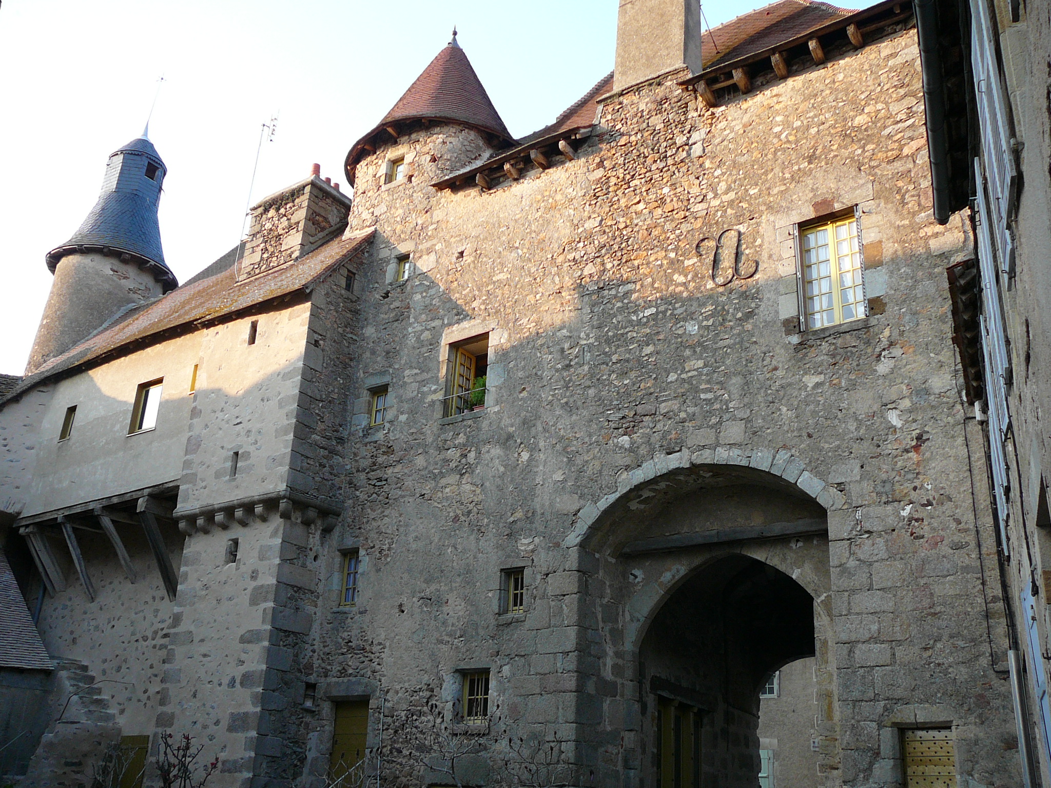
 The priory of Saint-Benoît | |
 Coat of arms | |
Location of Saint-Benoît-du-Sault  | |
 Saint-Benoît-du-Sault  Saint-Benoît-du-Sault | |
| Coordinates: 46°26′29″N 1°23′29″E | |
| Country | France |
| Region | Centre-Val de Loire |
| Department | Indre |
| Arrondissement | Le Blanc |
| Canton | Saint-Gaultier |
| Government | |
| • Mayor (2020–2026) | Christian Brec |
| Area 1 | 1.8 km2 (0.7 sq mi) |
| Population | 576 |
| • Density | 320/km2 (830/sq mi) |
| Time zone | UTC+01:00 (CET) |
| • Summer (DST) | UTC+02:00 (CEST) |
| INSEE/Postal code | 36182 /36170 |
| Elevation | 175–246 m (574–807 ft) (avg. 223 m or 732 ft) |
| 1 French Land Register data, which excludes lakes, ponds, glaciers > 1 km2 (0.386 sq mi or 247 acres) and river estuaries. | |
It is a medieval village, perched in a curve on a rocky butte overlooking the Portefeuille River in the former province of Berry. In 1988, it was named one of "the most beautiful villages of France."
History
Located in the area of Gaul settled by a powerful Celtic tribe, the Bituriges, "Kings of the World" (summa penes imperii bituriges), powerful until their defeat against Julius Caesar at Bourges (Avaricum), part of Roman Aquitania.
Two dolmens (Passebonneau and des Gorces) near to Saint-Benoît-du-Sault attest to the ancientness of human presence, if not of the Bituriges. Ten centuries later, in 974, some benedictine monks of Sacierges-Saint-Martin took refuge on a granite spur, where they founded a priory: Salis, future Saint-Benoît-du-Sault. From the 10th to the 17th century, the history of the priory and the new village is made up of resistance to the possessive desires of feudal neighbours, such as the Limoges and de Brosse family. The town was surrounded by a double line of ramparts. The first, the most ancient, protected the priory, the church and the fort, the second established in the 15th century, encircled the commercial part. Its maze of narrow cobbled streets remains popular with sightseers.
Population
|
|
Sights
Of architectural significance:
- Belfry.
- 14th-century portal.
- 14th-century Roman Priory. (Monuments Historiques)
- The medieval city in general.
- Castle of Brosse
 14th-century portal
 Medieval town

Personalities
People associated with Saint-Benoît-du-Sault:
- Hervé Faye (1814–1902), astronomer
- François-Timoléon de Choisy (1644–1724), priest and author
- Herbert Southworth (1908–1999), historian
See also
Citations
- "Populations légales 2019". The National Institute of Statistics and Economic Studies. 29 December 2021.
General bibliography
- Les origines de la vicomté de Brosse et de la prévôté de Saint Benoît du Sault, by Roland Aubert. Imprimerie Sodimass S.A Le Pont-Chrétien-Chabenet (Indre) 2005, ISBN 2-9525069-0-6
- Recherches archéologiques dans la région de Saint-Benoît du-Sault, by E. de Beaufort.
- Sur les Miracles de Saint-Benoît du Sault, by Adrevald, Adelaire, Aimoin and André (Monks of the Fleury abbay) 878-1050.
External links
Authority control | |
|---|---|
| General | |
| National libraries | |
| Other |
|
На других языках
- [en] Saint-Benoît-du-Sault
[es] Saint-Benoît-du-Sault
Saint-Benoît-du-Sault (en lengua occitana Sant Benoit dau Saut) es una comuna francesa del sur del departamento del Indre en la región del Centro y dentro del espacio natural del Boischaut Sur.[ru] Сен-Бенуа-дю-Со
Сен-Бенуа́-дю-Со (фр. Saint-Benoît-du-Sault) — коммуна во Франции, административный центр кантона Сен-Бенуа-дю-Со, округ Ле-Блан департамента Эндр, Центр — Долина Луары. Расположена на расстоянии[1] около 280 км на юг от Парижа, 170 км на юг от Орлеана, 50 км на юго-запад от Шатору.Другой контент может иметь иную лицензию. Перед использованием материалов сайта WikiSort.org внимательно изучите правила лицензирования конкретных элементов наполнения сайта.
WikiSort.org - проект по пересортировке и дополнению контента Википедии