world.wikisort.org - China
Urad Qianqi (Mongolian: ᠤᠷᠠᠳ ᠤᠨ ᠡᠮᠦᠨᠡᠳᠦ ᠬᠣᠰᠢᠭᠤ Урадын Өмнөд Хошуу Urad-un Emünedü Qosiɣu; simplified Chinese: 乌拉特前旗; traditional Chinese: 烏拉特前旗; pinyin: Wūlātè Qián Qí) is a banner of the Inner Mongolia Autonomous Region, People's Republic of China. It is located in the west of the region, situated on the northern (left) bank of the Yellow River, on the Ordos Loop, and in between the cities of Bayan Nur and Baotou. Administratively, it is part of Bayan Nur City, and has a total area of 7,476 square kilometres (2,886 sq mi) and in 2020 had 257,826 inhabitants. Its seat is the town of Mona-uul (乌拉山镇). Other towns include Dashetai (Tashetai) (大佘太镇).[2]

Urad Qianqi
乌拉特前旗 · ᠤᠷᠠᠳ ᠤᠨ ᠡᠮᠦᠨᠡᠳᠦ ᠬᠣᠰᠢᠭᠤ | |
|---|---|
Banner | |
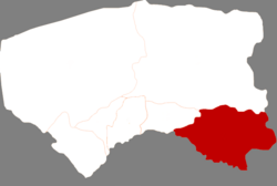 Urad Qianqi in Bayannur | |
 Bayannur in Inner Mongolia | |
| Coordinates: 40°44′13″N 108°39′07″E | |
| Country | People's Republic of China |
| Province | Inner Mongolia |
| Prefecture-level city | Bayannur |
| Area | |
| • Total | 7,460 km2 (2,880 sq mi) |
| Population (2020[1]) | |
| • Total | 257,826 |
| • Density | 35/km2 (90/sq mi) |
| Time zone | UTC+8 (China Standard) |
References
Baotou–Lanzhou railway | ||
|---|---|---|
| ||
| ||
Authority control | |
|---|---|
| General |
|
| National libraries | |
This Inner Mongolia location article is a stub. You can help Wikipedia by expanding it. |
На других языках
- [en] Urad Front Banner
[ru] Урад-Цяньци
Урад-Цяньци (кит. упр. 乌拉特前旗, пиньинь Wūlātè Qián qí) — хошун городского округа Баян-Нур автономного района Внутренняя Монголия (КНР). Название хошуна означает «Урадское переднее знамя».Текст в блоке "Читать" взят с сайта "Википедия" и доступен по лицензии Creative Commons Attribution-ShareAlike; в отдельных случаях могут действовать дополнительные условия.
Другой контент может иметь иную лицензию. Перед использованием материалов сайта WikiSort.org внимательно изучите правила лицензирования конкретных элементов наполнения сайта.
Другой контент может иметь иную лицензию. Перед использованием материалов сайта WikiSort.org внимательно изучите правила лицензирования конкретных элементов наполнения сайта.
2019-2026
WikiSort.org - проект по пересортировке и дополнению контента Википедии
WikiSort.org - проект по пересортировке и дополнению контента Википедии