world.wikisort.org - Canada
The District of North Saanich is located on the Saanich Peninsula of British Columbia, approximately 25 km (16 mi) north of Victoria on southern Vancouver Island. It is one of the 13 Greater Victoria municipalities. The District is surrounded on three sides by 20 km (12 mi) of ocean shoreline, and consists of rural/residential areas, a large agricultural base and is home to the Victoria International Airport and the Swartz Bay Ferry Terminal.
North Saanich | |
|---|---|
District municipality | |
| District of North Saanich[1] | |
| Motto(s): "Eetsun-Hunnumut" "The land where it is good to be" | |
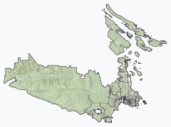 North Saanich Location of North Saanich within the Capital Regional District | |
 Location of District of North Saanich within the Capital District in British Columbia, Canada  North Saanich (Canada) | |
| Coordinates: 48°36′51″N 123°25′12″W | |
| Country | Canada |
| Province | British Columbia |
| Regional district | Capital |
| Electoral district (federal) | Saanich—Gulf Islands |
| Electoral district (provincial) | Saanich North and the Islands |
| Incorporated | 1965 |
| Government | |
| • Governing body | North Saanich Municipal Council |
| • Mayor | Peter Jones |
| • MP | Elizabeth May (Green) |
| • MLA | Adam Olsen (BC Green) |
| Area | |
| • Total | 37.27 km2 (14.39 sq mi) |
| Elevation | 23 m (75 ft) |
| Population (2016)[2] | |
| • Total | 11,249 |
| • Density | 301.8/km2 (782/sq mi) |
| Time zone | UTC−08:00 (PST) |
| Highways | 17 |
| Waterways | Strait of Georgia Saanich Inlet |
| Website | North Saanich |
History
In July 1905, North Saanich, then including the townsite of Sidney, was incorporated with the original Municipal Hall located in Sidney. Lacking population and a firm tax base, the municipality was dissolved in 1911. In 1940, the site of the present Victoria International Airport was selected as a military forces base and the area boomed with the influx of 10,000 military personnel, leading to incorporation for the Village of Sidney in 1952. Four years later, the residents of the North Saanich unorganized area, numbering 2,865, requested that letters patent be issued to form the "North Saanich Fire Prevention District" with power to own property, to tax and to borrow. In 1965, after a favourable public vote, the letters patent were withdrawn and the North Saanich Municipal District was established with offices at the present location on Mills Road.
Demographics
In the 2021 Canadian census conducted by Statistics Canada, North Saanich had a population of 12,235 living in 5,010 of its 5,235 total private dwellings, a change of 8.8% from its 2016 population of 11,249. With a land area of 37.16 km2 (14.35 sq mi), it had a population density of 329.3/km2 (852.8/sq mi) in 2021.[3]
Ethnicity
| Canada 2016 Census | Population | % of Total Population | |
|---|---|---|---|
| Visible minority group Source:[4] | Chinese | 170 | 1.3% |
| South Asian | 145 | 1.5% | |
| Black | 60 | 0.5% | |
| Filipino | 80 | 0.7% | |
| Latin American | 20 | 0.2% | |
| Southeast Asian | 40 | 0.4% | |
| Arab | 0 | 0.0% | |
| West Asian | 10 | 0.1% | |
| Korean | 15 | 0.1% | |
| Japanese | 35 | 0.3% | |
| Other visible minority | 20 | 0.2% | |
| Mixed visible minority | 15 | 0.1% | |
| Total visible minority population | 610 | 5.4% | |
| Indigenous groups Source:[5] | First Nations | 180 | 1.6% |
| Métis | 145 | 1.3% | |
| Inuit | 0 | 0.0% | |
| Total Indigenous population | 325 | 2.9% | |
| White | 10,314 | 91.7% | |
| Total population | 11,249 | 100% | |
Religion
According to the 2021 census, religious groups in North Saanich included:[6]
- Irreligion (6,910 persons or 56.7%)
- Christianity (4,905 persons or 40.2%)
- Sikhism (150 persons or 1.2%)
- Buddhism (100 persons or 0.8%)
- Judaism (20 persons or 0.2%)
- Other (110 persons or 0.9%)
Fauna
The largest animal to be found in North Saanich is the cougar. Other native mammals include the black-tailed deer, mink, otter, raccoon, and deer mouse. Of introduced mammal species, the cottontail rabbit and gray squirrel are often seen. Common native birds include the northwestern crow, common raven, bald eagle, turkey vulture, American robin, varied thrush, Steller's jay, and several species of gull. Introduced birds are represented by the abundant common starling and the now declining Eurasian skylark.
Flora
The most common native tree in North Saanich is Douglas fir. The other common large conifers are Abies grandis (grand fir) and Thuja plicata (western red cedar). Tsuga heterophylla (western hemlock) is occasionally found. Taxus brevifolia (Pacific yew) is a frequent understory tree. The Arbutus menziesii (Pacific madrone) is a large broadleaf evergreen species. Large deciduous trees are Populus balsamifera (black cottonwood), Acer macrophyllum (bigleaf maple), Alnus rubra (red alder), and Quercus garryana (Garry oak). Small deciduous species include Prunus emarginata (bitter cherry), Rhamnus purshiana (cascara), Malus fusca (Pacific crabapple), Cornus nuttallii (Pacific dogwood), Populus tremuloides (quaking aspen), Acer glabrum (Douglas maple), Crataegus monogyna (common hawthorn) and Salix lucida (Pacific willow).
Climate
North Saanich has a warm-summer Mediterranean climate (Köppen Csb) with short, warm, and dry summers and long, cool, and wet winters.
| Climate data for North Saanich (Victoria International Airport) WMO ID: 1018620; coordinates 48°38′50″N 123°25′33″W; elevation: 19.5 m (64 ft); 1981-2010 normals, extremes 1940-present | |||||||||||||
|---|---|---|---|---|---|---|---|---|---|---|---|---|---|
| Month | Jan | Feb | Mar | Apr | May | Jun | Jul | Aug | Sep | Oct | Nov | Dec | Year |
| Record high humidex | 16.4 | 17.1 | 20.9 | 26.1 | 33.6 | 42.6 | 39.6 | 36.8 | 34.7 | 27.0 | 20.0 | 17.7 | 42.6 |
| Record high °C (°F) | 16.1 (61.0) |
18.3 (64.9) |
21.4 (70.5) |
26.3 (79.3) |
31.5 (88.7) |
39.4 (102.9) |
36.3 (97.3) |
34.4 (93.9) |
31.1 (88.0) |
27.6 (81.7) |
18.3 (64.9) |
16.1 (61.0) |
39.4 (102.9) |
| Average high °C (°F) | 7.6 (45.7) |
8.8 (47.8) |
10.8 (51.4) |
13.6 (56.5) |
16.9 (62.4) |
19.9 (67.8) |
22.4 (72.3) |
22.4 (72.3) |
19.6 (67.3) |
14.2 (57.6) |
9.7 (49.5) |
7.0 (44.6) |
14.4 (57.9) |
| Daily mean °C (°F) | 4.6 (40.3) |
5.1 (41.2) |
6.8 (44.2) |
9.0 (48.2) |
12.1 (53.8) |
14.9 (58.8) |
16.9 (62.4) |
16.8 (62.2) |
14.2 (57.6) |
10.0 (50.0) |
6.4 (43.5) |
4.0 (39.2) |
10.0 (50.0) |
| Average low °C (°F) | 1.5 (34.7) |
1.3 (34.3) |
2.6 (36.7) |
4.3 (39.7) |
7.2 (45.0) |
9.8 (49.6) |
11.3 (52.3) |
11.1 (52.0) |
8.6 (47.5) |
5.7 (42.3) |
3.0 (37.4) |
1.1 (34.0) |
5.6 (42.1) |
| Record low °C (°F) | −15.6 (3.9) |
−15.0 (5.0) |
−10.0 (14.0) |
−3.9 (25.0) |
−1.1 (30.0) |
2.1 (35.8) |
4.1 (39.4) |
4.4 (39.9) |
−1.1 (30.0) |
−4.4 (24.1) |
−13.3 (8.1) |
−14.4 (6.1) |
−15.6 (3.9) |
| Record low wind chill | −19.0 | −24.0 | −14.0 | −7.0 | −5.0 | 0.0 | 0.0 | 0.0 | 0.0 | −9.0 | −19.0 | −25.0 | −25.0 |
| Average precipitation mm (inches) | 143.2 (5.64) |
89.3 (3.52) |
78.4 (3.09) |
47.9 (1.89) |
37.5 (1.48) |
30.6 (1.20) |
17.9 (0.70) |
23.8 (0.94) |
31.1 (1.22) |
88.1 (3.47) |
152.6 (6.01) |
142.5 (5.61) |
882.9 (34.76) |
| Average rainfall mm (inches) | 132.8 (5.23) |
83.0 (3.27) |
75.2 (2.96) |
47.5 (1.87) |
37.5 (1.48) |
30.6 (1.20) |
17.9 (0.70) |
23.8 (0.94) |
31.1 (1.22) |
88.0 (3.46) |
148.4 (5.84) |
129.7 (5.11) |
845.3 (33.28) |
| Average snowfall cm (inches) | 10.9 (4.3) |
6.3 (2.5) |
3.4 (1.3) |
0.4 (0.2) |
0.0 (0.0) |
0.0 (0.0) |
0.0 (0.0) |
0.0 (0.0) |
0.0 (0.0) |
0.2 (0.1) |
4.7 (1.9) |
13.7 (5.4) |
39.7 (15.6) |
| Average precipitation days (≥ 0.2 mm) | 18.6 | 14.9 | 16.7 | 13.3 | 12.0 | 9.5 | 5.3 | 5.2 | 7.6 | 14.0 | 19.2 | 18.6 | 155.1 |
| Average rainy days (≥ 0.2 mm) | 17.8 | 14.3 | 16.5 | 13.3 | 12.0 | 9.5 | 5.3 | 5.2 | 7.6 | 14.0 | 18.7 | 17.6 | 151.9 |
| Average snowy days (≥ 0.2 cm) | 2.0 | 1.7 | 0.9 | 0.1 | 0.0 | 0.0 | 0.0 | 0.0 | 0.0 | 0.0 | 1.0 | 2.2 | 8.0 |
| Average relative humidity (%) | 78.2 | 70.1 | 66.0 | 60.3 | 59.5 | 57.5 | 55.9 | 56.7 | 60.0 | 69.3 | 77.4 | 79.4 | 65.8 |
| Mean monthly sunshine hours | 70.8 | 95.5 | 145.3 | 191.3 | 241.5 | 251.7 | 318.1 | 297.5 | 228.6 | 136.9 | 72.8 | 58.9 | 2,108.8 |
| Percent possible sunshine | 26.0 | 33.3 | 39.5 | 46.7 | 51.2 | 52.2 | 65.4 | 66.9 | 60.3 | 40.7 | 26.2 | 22.7 | 44.3 |
| Source: Environment and Climate Change Canada[7][8] | |||||||||||||
Council and government
The 2022 – 2024 council is:[9]
- Mayor Peter Jones
- Councillor Jack McClintock
- Councillor Sanjiv Shrivastava
- Councillor Celia Stock
- Councillor Irene McConkey
- Councillor Phil DiBattista
- Councillor Brett Smyth
The next election is scheduled for October 19, 2024 following provincial law. All municipalities in British Columbia will also hold elections on this date (the third Saturday of October every 4 years). Voters will vote for councillors, school board trustees and the mayor on the same ballot.
Education
Public schools serving North Saanich residents are operated by School District 63 Saanich. These include ḰELSET and Deep Cove Elementary Schools, North Saanich Middle School, and Parkland Secondary School.
Transportation
North Saanich can be accessed by highway on Highway 17 from Victoria, Sidney or Vancouver (through the BC Ferries terminal at Swartz Bay). Victoria International Airport is also located in the municipality, which offers daily service to Calgary, Edmonton, SeaTac, San Francisco, Kelowna, Toronto and hourly service to Vancouver International from Air Canada Express. The airport also offers seasonal services to Mexico and Hawaii, with talk about expansion to Europe or Asia. North Saanich also has a floatplane aerodrome near the Institute of Ocean Sciences in Patricia Bay, the Victoria Airport Water Aerodrome. Formerly the hub for Pat Bay Air, the aerodrome is now served by Harbour Air Seaplanes, Kenmore Air, Ocean Air Floatplanes and Salt Spring Air, which offer scheduled and charter flights.
Public transport is provided by the Victoria Regional Transit System.
North Saanich has seven marinas, many of which can accommodate temporary visitors. The highest concentration of marinas (five of the seven) is on the southern coast, between Curteis Point (near the ferry terminal) and McDonald Park Road, near Parkland Secondary School.
Neighbourhoods
- Ardmore: population approximately 1,050; the entire neighbourhood is mostly evenly dense. Ardmore contains a cemetery and the nine hole Ardmore Golf Course. It borders the Institute of Ocean Sciences to the north and Pauquachin First Nation to the south.
- Cloake and Horth Hills: population approximately 1,200; the densest area is uphill on Cloake Hill. Horth Hill Regional Park, managed by the Capital Regional District (CRD) is located near the centre. The park offers a viewpoint, the second highest in North Saanich after Mount Newton. There are no commercial establishments in all of this neighbourhood, it is purely residential and forested, like much of the municipality. The north shore, at the very end of the Saanich Peninsula, offers several beach accesses with views of the Satellite Channel, Mount Tuam on Salt Spring Island and other surrounding islands.
- Dean Park: population approximately 3,200; it is the most populous and dense neighbourhood in the municipality. It is mostly located on the sloped eastern flank of Mount Newton, directly below John Dean Provincial Park. Below the hill with a high concentration of streets is where Kelset Elementary, the Panorama Recreation Centre and the McTavish Junction (containing commercial space) are located. Dean Park borders Central Saanich.
- Deep Cove: population approximately 2,000 with the Coal Point and marina area being the most densely populated area. Along West Saanich Road between Clayton and Wain roads is where "downtown" is located. This area contains a firehall, gas station, the Deep Cove Market, a church and Deep Cove Elementary School.
- Central North Saanich: the population of this area is not well defined. The area is often regarded as having several neighbourhoods within and is little known as a whole, associated neighbourhoods include Pat Bay, Sandown, Victoria International Airport and the Eagle Ridge Estates. Central North Saanich contains the airport, the Dunsmuir Lodge, the Institute of Ocean Sciences and the former Sandown Harness Racetrack. This neighbourhood is the largest in terms of area, and the least in terms of density and perhaps population. The two First Nations reserves, industrial area, Municipal Hall of North Saanich, rock quarry, free ride park, gun club and most agricultural land can also be found here.
- McDonald Park/Curteis Point: population approximately 900; it is the least populous and smallest neighbourhood. Although small, it is the most industrious for its size. Dubbed "North Saanich's Marine Neighbourhood", McDonald Park/Curteis Point consists of five marinas around a small cove and inlet, which includes repair and boat yards. BC Ferries' Swartz Bay Ferry Terminal is on the north edge. McDonald Campground part of the Gulf Islands National Park Reserve occupies much of the southeast along with Blue Heron Park, which includes a soccer field. Parkland Secondary School, North Saanich Middle School and a small suburban-like sliver of the district surrounded by Sidney can be found at the southernmost extent.
- Southeast Quadrant ("Bazan Bay"): Population approximately 1,200; it is a small neighbourhood, the second most developed after Dean Park. Sidney borders discreetly to the north and Central Saanich to the south. highway 17 splits down this neighbourhood. The northern third is more rural, and the southern two thirds are sloped with many houses. The houses and beaches have a superb view of the Gulf and San Juan islands as well as downtown Sidney and, at night, possibly a glimpse of Metro Vancouver Regional District. The Government of Canada operates a plant health research centre here for the Food Inspection Agency.
North Saanich also surrounds two First Nations reserves, namely the Tseycum First Nation, located on the northeastern shore of Patricia Bay, and the Pauquachin First Nation, located on the southeastern shore of Coles Bay south of Ardmore. These First Nations are not, strictly speaking, part of North Saanich.
Attractions

- North Saanich Farm Market[10]
- British Columbia Aviation Museum
- Institute of Ocean Sciences
- North Saanich Freeride Park[11]
- 443 Maritime Helicopter Squadron (Canadian Forces)
- Victoria International Airport
- BC Ferries Swartz Bay Ferry Terminal
- Panorama Recreation Centre[12]
Notable people
- Muriel Wylie Blanchet, travel writer (1891–1961) best known for The Curve of Time, lived on Curteis Point in North Saanich.[13]: 3
- Sebastian Cabot, star of the television program Family Affair, had a summer home in the Deep Cove neighbourhood of North Saanich.
References
- "British Columbia Regional Districts, Municipalities, Corporate Name, Date of Incorporation and Postal Address" (XLS). British Columbia Ministry of Communities, Sport and Cultural Development. Retrieved November 2, 2014.
- "North Saanich, District municipality [Census subdivision], British Columbia and Capital, Regional district [Census division], British Columbia". Statistics Canada. January 23, 2017. Retrieved February 8, 2017.
- "Population and dwelling counts: Canada, provinces and territories, and census subdivisions (municipalities), British Columbia". Statistics Canada. February 9, 2022. Retrieved February 20, 2022.
- "Community Profiles from the 2006 Census, Statistics Canada – Census Subdivision". 2.statcan.gc.ca. 2010-12-06. Retrieved 2013-04-13.
- "Aboriginal Peoples – Data table". 2.statcan.ca. 2010-10-06. Retrieved 2013-04-13.
- Government of Canada, Statistics Canada (2022-10-26). "Census Profile, 2021 Census of Population". www12.statcan.gc.ca. Retrieved 2022-11-09.
- "Canadian Climate Normals 1981-2010 Station Data". Environment Canada. 25 September 2013. Retrieved 11 July 2019.
- "Daily Data Report for June 2021". Environment and Climate Change Canada. 31 October 2011. Retrieved June 28, 2021.
- Mayor & Council
- North Saanich Farm Market
- North Saanich Freeride
- Panorama Recreation
- Converse, Cathy (2018) [2008]. Horsdal, Marlyn (ed.). Following the Curve of Time: The Untold Story of Capi Blanchet (Book) (2nd ed.). TouchWood Editions. ISBN 978-1-77151-296-1.
External links
Subdivisions of British Columbia | |
|---|---|
| Subdivisions |
|
| Communities |
|
| Metro areas and agglomerations |
|
| District municipalities |
|
| |
Authority control | |
|---|---|
| General | |
| National libraries | |
| Other |
|
На других языках
[de] North Saanich
North Saanich ist ein Bezirk (District municipality) im Norden der Saanich-Halbinsel auf Vancouver Island in der kanadischen Provinz British Columbia.- [en] North Saanich
Другой контент может иметь иную лицензию. Перед использованием материалов сайта WikiSort.org внимательно изучите правила лицензирования конкретных элементов наполнения сайта.
WikiSort.org - проект по пересортировке и дополнению контента Википедии