world.wikisort.org - Canada
Fort St. James is a district municipality and former fur trading post in northern central British Columbia, Canada. It is located on the south-eastern shore of Stuart Lake in the Omineca Country, at the northern terminus of Highway 27, which connects to Highway 16 at Vanderhoof.
Fort St. James | |
|---|---|
District municipality | |
| District of Fort St. James[1] | |
 | |
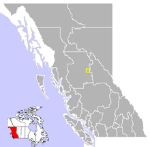 Location of Fort St. James in British Columbia | |
 Fort St. James  Fort St. James | |
| Coordinates: 54°26′35″N 124°15′15″W | |
| Country | Canada |
| Province | British Columbia |
| Region | Omineca Country |
| Regional district | Regional District of Bulkley Nechako |
| Founded | 1806 |
| Incorporated | 1952 |
| Government | |
| • Governing body | Municipal Council |
| • Mayor | Bob Motion |
| Area | |
| • Total | 23.47 km2 (9.06 sq mi) |
| Elevation | 700 m (2,300 ft) |
| Population (2016) | |
| • Total | 1,598 |
| • Density | 72.0/km2 (186/sq mi) |
| Time zone | UTC−8 (PST) |
| • Summer (DST) | UTC−7 (PDT) |
| Postal code span | V0J 1P0 |
| Area code(s) | +250, +778 |
| Highways | 27 |
| Waterways | Stuart Lake, Stuart River, Necoslie River, Nahounli Creek |
| Website | District of Fort St. James |
National Historic Site of Canada | |
| Official name | Fort St. James National Historic Site of Canada |
| Designated | 1948 |
It is home to the John Prince Research Forest which features abundant wildlife.[2] This community celebrated its bicentennial in 2016 and is incorporated as a district municipality.
Fort St. James National Historic Site
Founded by the North West Company explorer and fur trader Simon Fraser in 1806, it came under the management of the Hudson's Bay Company in 1821 with the forced merger of the two battling fur companies. Also known historically as Stuart Lake Post, it is one of British Columbia's oldest permanent European settlements and was the administrative centre for the Hudson's Bay Company's New Caledonia fur district.[3] The fort, rebuilt four times, continued as an important trading post well into the twentieth century. Now the fort is a National Historic Site of Canada[4][5] with some buildings dating to the 1880s.
History
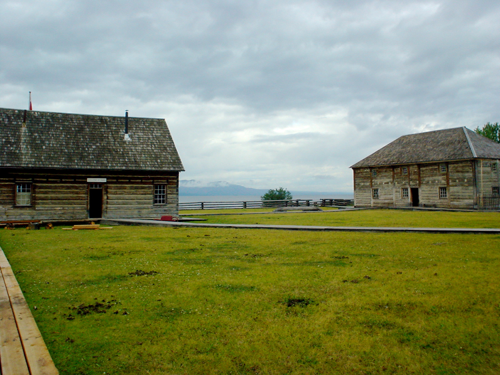
As part of his commission from the North West Company, Fraser and his assistants John Stuart and James McDougall explored potential river routes to the Pacific Ocean from 1805 through 1808. Explorations in the Winter of 1805-06 by McDougall resulted in the discovery of Carrier's Lake, now known as Stuart Lake. In the heart of territory inhabited by the Carrier or Dakelh First Nation, this proved to be a lucrative locale for fur trading and so a post - Fort St. James - was built on its shore in 1806. In 1821, the fort came under the control of the Hudson's Bay Company, when the North West Company merged with it. It subsequently became the administrative headquarters of the Company's vast New Caledonia District.
The fur trade was slow to take root in the area, since the economy of the Dakelh people had been based on the fishery, rather than on trapping. In addition, there were customary and ceremonial restrictions which placed obstacles in the way of an efficient fur economy. Nonetheless, eventually the post became profitable, and continued to function until its closure in 1952.
The community is located on the south-eastern shore of Stuart Lake, at the head of the Stuart River. Both the lake and the river are named for Fraser's assistant John Stuart, who would later become head of the New Caledonia District of the North West Company.
Climate
Fort St. James is located in the sub-boreal spruce zone of British Columbia, a sub-division of the hemiboreal climatic zone. It is characterised by severe, snowy winters and short, warm summers. The region is rich in wildlife. Under the Köppen climate classification Fort St. James is classified as a humid continental climate (Dfb).
| Climate data for Fort St. James, 1981–2010 normals, extremes 1895–present | |||||||||||||
|---|---|---|---|---|---|---|---|---|---|---|---|---|---|
| Month | Jan | Feb | Mar | Apr | May | Jun | Jul | Aug | Sep | Oct | Nov | Dec | Year |
| Record high °C (°F) | 12.0 (53.6) |
13.0 (55.4) |
17.1 (62.8) |
24.4 (75.9) |
35.0 (95.0) |
33.9 (93.0) |
36.7 (98.1) |
35.6 (96.1) |
29.5 (85.1) |
26.5 (79.7) |
16.1 (61.0) |
11.0 (51.8) |
36.7 (98.1) |
| Average high °C (°F) | −5.3 (22.5) |
−1.7 (28.9) |
4.0 (39.2) |
9.9 (49.8) |
15.6 (60.1) |
19.6 (67.3) |
21.8 (71.2) |
21.7 (71.1) |
16.4 (61.5) |
9.0 (48.2) |
0.6 (33.1) |
−3.8 (25.2) |
9.0 (48.2) |
| Daily mean °C (°F) | −9.5 (14.9) |
−6.8 (19.8) |
−1.8 (28.8) |
3.9 (39.0) |
9.2 (48.6) |
13.4 (56.1) |
15.4 (59.7) |
14.8 (58.6) |
10.2 (50.4) |
4.3 (39.7) |
−3.0 (26.6) |
−7.8 (18.0) |
3.5 (38.3) |
| Average low °C (°F) | −13.7 (7.3) |
−11.8 (10.8) |
−7.7 (18.1) |
−2.2 (28.0) |
2.8 (37.0) |
7.2 (45.0) |
8.9 (48.0) |
7.9 (46.2) |
3.9 (39.0) |
−0.5 (31.1) |
−6.5 (20.3) |
−11.7 (10.9) |
−2.0 (28.4) |
| Record low °C (°F) | −49.4 (−56.9) |
−49.4 (−56.9) |
−39.4 (−38.9) |
−29.4 (−20.9) |
−11.7 (10.9) |
−6.1 (21.0) |
−5.6 (21.9) |
−7.8 (18.0) |
−13.3 (8.1) |
−23.0 (−9.4) |
−37.8 (−36.0) |
−47.2 (−53.0) |
−49.4 (−56.9) |
| Average precipitation mm (inches) | 48.1 (1.89) |
30.0 (1.18) |
25.7 (1.01) |
23.7 (0.93) |
38.9 (1.53) |
50.6 (1.99) |
50.6 (1.99) |
45.0 (1.77) |
39.3 (1.55) |
48.1 (1.89) |
44.5 (1.75) |
42.6 (1.68) |
487.2 (19.18) |
| Average rainfall mm (inches) | 4.9 (0.19) |
3.6 (0.14) |
5.9 (0.23) |
18.0 (0.71) |
38.2 (1.50) |
50.6 (1.99) |
50.6 (1.99) |
45.0 (1.77) |
39.1 (1.54) |
38.7 (1.52) |
15.7 (0.62) |
4.2 (0.17) |
314.5 (12.38) |
| Average snowfall cm (inches) | 43.3 (17.0) |
26.4 (10.4) |
19.8 (7.8) |
5.7 (2.2) |
0.7 (0.3) |
0 (0) |
0 (0) |
0 (0) |
0.2 (0.1) |
9.5 (3.7) |
28.8 (11.3) |
38.4 (15.1) |
172.7 (68.0) |
| Average precipitation days (≥ 0.2 mm) | 12.7 | 8.9 | 8.6 | 8.3 | 12.4 | 12.7 | 13.7 | 11.3 | 12.1 | 14.0 | 13.1 | 11.3 | 139.1 |
| Average rainy days (≥ 0.2 mm) | 2.0 | 1.8 | 3.2 | 6.8 | 12.2 | 12.7 | 13.7 | 11.3 | 12.1 | 12.4 | 5.3 | 1.8 | 95.2 |
| Average snowy days (≥ 0.2 cm) | 11.4 | 7.4 | 6.0 | 2.2 | 0.4 | 0 | 0 | 0 | 0.08 | 2.4 | 9.0 | 10.0 | 48.8 |
| Average relative humidity (%) | 81.6 | 72.6 | 57.0 | 45.0 | 44.1 | 48.0 | 47.3 | 47.7 | 52.7 | 62.9 | 79.8 | 84.2 | 60.2 |
| Mean monthly sunshine hours | 51.3 | 85.5 | 151.3 | 207.6 | 245.7 | 260.2 | 275.3 | 256.8 | 177.7 | 116.0 | 60.2 | 41.0 | 1,928.6 |
| Percent possible sunshine | 20.8 | 31.3 | 41.3 | 49.3 | 49.5 | 50.6 | 53.4 | 55.6 | 46.4 | 35.4 | 23.5 | 17.9 | 39.6 |
| Source: Environment Canada,[6][7][8] (Sunshine and humidity data from Fort St. James Airport) | |||||||||||||
Demographics
In the 2021 Census of Population conducted by Statistics Canada, Fort St. James had a population of 1,386 living in 586 of its 671 total private dwellings, a change of -13.3% from its 2016 population of 1,598. With a land area of 23.45 km2 (9.05 sq mi), it had a population density of 59.1/km2 (153.1/sq mi) in 2021.[9]
About one quarter of the population of the greater Fort St. James area identify as being of First Nations origin[10] The town is surrounded by numerous, small First Nations communities and Indian reserves, including Pinchie, Tachie, and Nak'azdli.
In the 1990s, Fort St. James had the highest proportion of South Asians of any municipality in Canada - at approximately 20%.[11] The South Asian community of Fort St. James was composed mostly of Punjabis of the Sikh faith. The local Sikh temple was put for sale in 2012, as fewer than 50 South Asian residents remain in the community.[12]
Economy
The local economy is well diversified, although resource-oriented. The forest industries constitute the leading sector followed by mining, agriculture and tourism.[citation needed] Recent developments also include a small high technology sector.[citation needed]
Notable people
- Jim Playfair, Associate Coach of the Edmonton Oilers, NHL
- Larry Playfair, Former NHL player with the Buffalo Sabres and the Los Angeles Kings
- Dylan Playfair, Actor, most notable role is "Reilly" on TV show Letterkenny.[13]
- Brian Spencer "Spinner", former player in the National Hockey League and the subject of the film, 'Gross Misconduct'.
- Chief Kwah (aka Chief Kw’eh), (ca. 1755-1840), leading Dakelh chief of the Stuart Lake area.
- Cody Legebokoff, Convicted serial killer
- Johan Pitka, Estonian military commander
See also
- List of National Historic Sites of Canada in British Columbia
References
- "British Columbia Regional Districts, Municipalities, Corporate Name, Date of Incorporation and Postal Address" (XLS). British Columbia Ministry of Communities, Sport and Cultural Development. Archived from the original on 13 July 2014. Retrieved 2 November 2014.
- "John Prince Research Forest".
- "Fort St. James (District Municipality)". BC Geographical Names.
- Fort St. James. Canadian Register of Historic Places. Retrieved 8 January 2012.
- "Fort Saint James National Historic Site". BC Geographical Names.
- "Fort St James". Environment Canada. 25 September 2013. Retrieved 5 March 2017.
- "Daily Data Report for March 2016". Environment Canada. 31 October 2011. Retrieved 5 March 2017.
- "Fort St James A". Environment Canada. Retrieved 5 March 2017.
- "Population and dwelling counts: Canada, provinces and territories, and census subdivisions (municipalities), British Columbia". Statistics Canada. 9 February 2022. Retrieved 20 February 2022.
- Community Profile, Statistics Canada, 2001 Canadian census
- "1996 Census of Population Total Population by Visible Minority Population (14) and Age Groups (13), Showing Sex (3), for Canada, Provinces, Territories, Census Divisions and Census Subdivisions, 1996 Census (20% Sample Data) Fort St. James, DM".
- "Sikh Temple sale in limbo". Caledonia Courier. 13 October 2012. Retrieved 11 August 2020.
- "Dylan Playfair". imdb.com. Retrieved 18 August 2021.
External links
Subdivisions of British Columbia | |
|---|---|
| Subdivisions |
|
| Communities |
|
| Metro areas and agglomerations |
|
| District municipalities |
|
| |
The Columbia Department | ||||||||
|---|---|---|---|---|---|---|---|---|
Historic HBC operations in the Pacific Northwest | ||||||||
| Columbia Department |
| |||||||
| New Caledonia District |
| |||||||
Protected areas of British Columbia | |||||||||||||||||||||||||||||||||||||||||||||||||||||||||||||||||||||||||
|---|---|---|---|---|---|---|---|---|---|---|---|---|---|---|---|---|---|---|---|---|---|---|---|---|---|---|---|---|---|---|---|---|---|---|---|---|---|---|---|---|---|---|---|---|---|---|---|---|---|---|---|---|---|---|---|---|---|---|---|---|---|---|---|---|---|---|---|---|---|---|---|---|---|
| |||||||||||||||||||||||||||||||||||||||||||||||||||||||||||||||||||||||||
| |||||||||||||||||||||||||||||||||||||||||||||||||||||||||||||||||||||||||
| |||||||||||||||||||||||||||||||||||||||||||||||||||||||||||||||||||||||||
| |||||||||||||||||||||||||||||||||||||||||||||||||||||||||||||||||||||||||
| |||||||||||||||||||||||||||||||||||||||||||||||||||||||||||||||||||||||||
| |||||||||||||||||||||||||||||||||||||||||||||||||||||||||||||||||||||||||
| |||||||||||||||||||||||||||||||||||||||||||||||||||||||||||||||||||||||||
| |||||||||||||||||||||||||||||||||||||||||||||||||||||||||||||||||||||||||
| |||||||||||||||||||||||||||||||||||||||||||||||||||||||||||||||||||||||||
| |||||||||||||||||||||||||||||||||||||||||||||||||||||||||||||||||||||||||
| Authority control: National libraries |
|---|
На других языках
[de] Fort St. James (British Columbia)
Fort St. James (seltener auch Fort Saint James geschrieben) ist eine Gemeinde, die im Zentrum der kanadischen Provinz British Columbia liegt. Das dieser Gemeinde den Namen gebende Fort wurde 1948 zur National Historic Site of Canada ernannt.[2]- [en] Fort St. James
Другой контент может иметь иную лицензию. Перед использованием материалов сайта WikiSort.org внимательно изучите правила лицензирования конкретных элементов наполнения сайта.
WikiSort.org - проект по пересортировке и дополнению контента Википедии