world.wikisort.org - Canada
Sooke /suːk/ is a district municipality on the southern tip of Vancouver Island, Canada, 38 kilometres (24 mi) by road from Victoria, the capital of British Columbia. Sooke, the westernmost of Greater Victoria's Western Communities, is to the north and west of the Sooke Basin.
This article needs additional citations for verification. (June 2013) |
SooKe | |
|---|---|
District municipality | |
| District of Sooke[1] | |
 | |
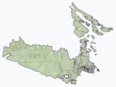 Sooke Sooke (Capital Regional District) Location of Sooke within the Capital Regional District | |
 SooKe Location of Sooke within British Columbia | |
| Coordinates: 48°22′34″N 123°44′16″W | |
| Country | Canada |
| Province | British Columbia |
| Regional district | Capital |
| Incorporated | December 7, 1999 |
| Government | |
| • Mayor | Maja Tait |
| • Councillors | Jeff Bateman, Al Beddows, Ebony Logins, Megan McMath; Tony St-Pierre; Dana Lajeunesse; |
| • By Election September 28, 2019 | Dana Lajeunesse won the By-Election replacing Councillor Brenda Parkinson (deceased June 2019) |
| Area | |
| • Total | 56.62 km2 (21.86 sq mi) |
| Elevation | 50 m (160 ft) |
| Population (2016)[2] | |
| • Total | 13,001 |
| • Density | 229.6/km2 (595/sq mi) |
| Time zone | UTC−8 (PST) |
| • Summer (DST) | UTC−7 (PDT) |
| Forward sortation area | V9Z |
| Highways | 14 |
| Waterways | Strait of Juan de Fuca |
| Website | sooke |
Tourism and recreation

Sooke's popularity as a scenic tourist destination has existed for generations. Well-known destinations in Sooke, such as Whiffin Spit Park, the Sooke Potholes Regional Park and adjacent Sooke Potholes Provincial Park attract visitors both locally and from around the world. Sooke is also home to the Sooke Region Museum and Visitor Centre; where visitors and locals are able to get information on regional attractions and history. The area's popularity has increased as a base for visiting the wilderness parks of Vancouver Island's southwest coast — the West Coast Trail and the Juan de Fuca Provincial Park which includes the now highly popular Juan de Fuca Marine Trail. Sooke, BC is also famous for its beaches just on the outskirts of its neighbouring communities such as Shirley and Jordan River. These beaches include Sandcut, French beach, Fishboat bay, China beach, Mystic beach and more.
Mountain biking is growing in popularity in British Columbia, and Sooke is establishing itself as a destination for the sport. Local advocacy groups such as the Sooke Bike Club are working to have areas such as Broom Hill set aside as parkland.
The Galloping Goose Regional Trail, part of the Trans-Canada Trail, runs through Sooke and is a popular cycling route to Victoria.
Arts community
The vibrant arts community of Sooke enjoys the annual Sooke Fine Arts Festival (established in 1987) which brings hundreds of tourists to Sooke each summer by featuring the adjudicated art of local and regional artists. Sooke is known for its wealth of painters, writers, sculptors, potters, fabric artists, jewellery crafters and more. The Sooke Community Arts Council plays a large role in fostering art in the region. The Sooke Harbour House art gallery is a main display opportunity for many local artisans.
Real estate
In April of 2022, an average single-family home in Sooke costs $887,500 based on the home price index, drawing from data from the Victoria Real Estate Board (VREB).[3] By June of 2022, that number (directly from VREB) increased to $938,000.[4]
Demographics
In the 2021 Census of Population conducted by Statistics Canada, Sooke had a population of 15,086 living in 6,129 of its 6,431 total private dwellings, a change of 16% from its 2016 population of 13,001. With a land area of 56.6 km2 (21.9 sq mi), it had a population density of 266.5/km2 (690.3/sq mi) in 2021.[5]
| Canada 2016 Census | Population | % of Total Population | |
|---|---|---|---|
| Visible minority group Source:[6] | Chinese | 140 | 0.9% |
| South Asian | 65 | 1.2% | |
| Black | 35 | 0.8% | |
| Filipino | 75 | 0.3% | |
| Latin American | 20 | 0.2% | |
| Southeast Asian | 25 | 0.2% | |
| Arab | 10 | 0% | |
| West Asian | 0 | 0.2% | |
| Korean | 0 | 0.2% | |
| Japanese | 50 | 0.2% | |
| Other visible minority | 30 | 0.2% | |
| Mixed visible minority | 15 | 0.3% | |
| Total visible minority population | 465 | 4.6% | |
| Aboriginal group Source:[7] | First Nations | 805 | 4% |
| Métis | 410 | 0% | |
| Inuit | 0 | 0% | |
| Total Aboriginal population | 1,120 | 4% | |
| White | 12,430 | 91.3% | |
| Total population | 13,001 | 100% | |
Politics
The District of Sooke is its own independent municipality, part of the Capital Regional District.
Municipal
Sooke is governed by a mayor and six councilors, who are elected every four years.
Mayor Maja Tait[8]
Councillor Al Beddows
Councillor Dana Lajeunesse
Councillor Ebony Logins
Councillor Jeff Bateman
Councillor Megan McMath
Councillor Tony St-Pierre
Provincial
Sooke in part of the riding of Langford-Juan de Fuca represented by John Horgan of the BC NDP, who first won in 2009.
Federal
Federally the town is in the riding of Esquimalt-Saanich-Sooke, represented by Randall Garrison of the New Democratic Party. He was first elected in 2011.
Climate
Sooke has a Mediterranean climate, with warm summers and mild winters, defined by the Köppen climate classification as Csb. Although its precipitation is more like dry summer climates, its temperatures resemble oceanic climates as found in Ireland, for example.[9]
| Climate data for Sooke (Park-Isle Marine), elevation: 32 m or 105 ft, 1967-1990 normals and extremes | |||||||||||||
|---|---|---|---|---|---|---|---|---|---|---|---|---|---|
| Month | Jan | Feb | Mar | Apr | May | Jun | Jul | Aug | Sep | Oct | Nov | Dec | Year |
| Record high °C (°F) | 15.1 (59.2) |
15.6 (60.1) |
16.0 (60.8) |
23.6 (74.5) |
28.2 (82.8) |
28.3 (82.9) |
29.4 (84.9) |
29.6 (85.3) |
27.2 (81.0) |
21.5 (70.7) |
21.8 (71.2) |
15.9 (60.6) |
29.6 (85.3) |
| Average high °C (°F) | 6.7 (44.1) |
8.4 (47.1) |
10.1 (50.2) |
11.9 (53.4) |
14.2 (57.6) |
16.4 (61.5) |
18.2 (64.8) |
18.6 (65.5) |
17.1 (62.8) |
13.1 (55.6) |
9.3 (48.7) |
6.9 (44.4) |
12.6 (54.6) |
| Daily mean °C (°F) | 4.2 (39.6) |
5.4 (41.7) |
6.6 (43.9) |
8.1 (46.6) |
10.5 (50.9) |
12.6 (54.7) |
14.0 (57.2) |
14.3 (57.7) |
13.0 (55.4) |
9.7 (49.5) |
6.6 (43.9) |
4.5 (40.1) |
9.1 (48.4) |
| Average low °C (°F) | 1.6 (34.9) |
2.4 (36.3) |
3.0 (37.4) |
4.3 (39.7) |
6.7 (44.1) |
8.8 (47.8) |
9.9 (49.8) |
10.1 (50.2) |
8.8 (47.8) |
6.2 (43.2) |
3.8 (38.8) |
2.0 (35.6) |
5.6 (42.1) |
| Record low °C (°F) | −10.6 (12.9) |
−12.5 (9.5) |
−6.2 (20.8) |
−2.2 (28.0) |
0.0 (32.0) |
3.3 (37.9) |
5.0 (41.0) |
4.4 (39.9) |
1.7 (35.1) |
−2.8 (27.0) |
−10.8 (12.6) |
−13.9 (7.0) |
−13.9 (7.0) |
| Average precipitation mm (inches) | 193.1 (7.60) |
142.2 (5.60) |
108.8 (4.28) |
75.6 (2.98) |
44.7 (1.76) |
28.6 (1.13) |
21.0 (0.83) |
26.5 (1.04) |
54.8 (2.16) |
121.3 (4.78) |
213.0 (8.39) |
197.2 (7.76) |
1,226.8 (48.31) |
| Average rainfall mm (inches) | 181.5 (7.15) |
138.4 (5.45) |
107.2 (4.22) |
75.2 (2.96) |
44.7 (1.76) |
28.6 (1.13) |
21.0 (0.83) |
26.5 (1.04) |
54.8 (2.16) |
121.3 (4.78) |
209.4 (8.24) |
189.0 (7.44) |
1,197.6 (47.16) |
| Average snowfall cm (inches) | 11.7 (4.6) |
3.9 (1.5) |
1.6 (0.6) |
0.4 (0.2) |
0.0 (0.0) |
0.0 (0.0) |
0.0 (0.0) |
0.0 (0.0) |
0.0 (0.0) |
0.0 (0.0) |
3.4 (1.3) |
8.2 (3.2) |
29.2 (11.4) |
| Average precipitation days (≥ 0.2 mm) | 20 | 17 | 17 | 15 | 12 | 9 | 5 | 6 | 10 | 15 | 21 | 21 | 168 |
| Average rainy days (≥ 0.2 mm) | 18 | 16 | 17 | 15 | 12 | 9 | 5 | 6 | 10 | 15 | 20 | 20 | 163 |
| Average snowy days (≥ 0.2 cm) | 3 | 1 | trace | trace | trace | 0 | 0 | 0 | 0 | 0 | trace | 2 | 6 |
| Average relative humidity (%) | 84 | 83 | 81 | — | — | 82 | 83 | — | — | 87 | 86 | 85 | 83 |
| Source: NOAA[10] | |||||||||||||
Education
Sooke is a part of the School District 62 Sooke. There is one high school, Edward Milne Community School, and one junior high school, Journey Middle School. The four elementary schools in the area are John Muir (in the town's west end), Sooke Elementary (town centre), the French immersion Ecole Poirier (town centre), and Saseenos Elementary (east end). In 2018, SD62 announced it would be building Sooke River Elementary in the Sunriver neighbourhood. Continuing adult education programs are offered by the Edward Milne Community School (EMCS) Society, which also operates with day, evening and weekend programs. The closest post-secondary institutions are Royal Roads University and Camosun College's Interurban campus.
Neighbourhoods
(in order from east to west)
- North Sooke
- Saseenos
- Milne's Landing
- Sunriver Estates
- Sooke Town Centre or "Upsooke"
- Broom Hill
- Whiffin Spit
- Otter Point
- Kemp Lake
Neighbouring communities
- Metchosin - East of Sooke
- East Sooke - South of Sooke
- Otter Point - West of Sooke
Publications
- The long-established weekly newspaper is the Sooke News Mirror, edited by Kevin Laird and one of more than 70 Black Press Media community papers in B.C.
Notable residents
- Canadian poet, novelist and playwright Marilyn Bowering lives in the Sooke area.
- Bryce Soderberg, bassist and vocalist for American rock band Lifehouse.
- J. Lee Thompson (1914-2002), British film director (Cape Fear, The Guns of Navarone), died in Sooke.
- Kevin Wenstob, Canadian logger and subject of the reality TV series Big Timber.
References
- "British Columbia Regional Districts, Municipalities, Corporate Name, Date of Incorporation and Postal Address" (XLS). British Columbia Ministry of Communities, Sport and Cultural Development. Retrieved November 2, 2014.
- "Sooke, District municipality [Census subdivision], British Columbia and Capital, Regional district [Census division], British Columbia". Statistics Canada. January 23, 2017. Retrieved February 8, 2017.
- "Sooke at low end of high home prices". Victoria Real Estate Board. April 14, 2022. Retrieved 8 July 2022.
- Steibel, Rick (July 4, 2022). "Victoria's hot housing market levels off, supply still important for long-term attainability" (PDF). VREB. Retrieved 8 July 2022.
- "Population and dwelling counts: Canada, provinces and territories, and census subdivisions (municipalities), British Columbia". Statistics Canada. February 9, 2022. Retrieved February 20, 2022.
- "Census Profile, 2016 Census, Sooke, District municipality [Census subdivision], British Columbia and British Columbia [Province]". Statistic Canada. Retrieved 2013-04-13.
- "Census Profile, 2016 Census Sooke, District municipality [Census subdivision], British Columbia and British Columbia [Province]". Statistics Canada. Retrieved 2013-04-13.
- "Mayor Maja Tait". Retrieved 2021-07-10.
- "Sooke, British Columbia Köppen Climate Classification (Weatherbase)". Weatherbase. Retrieved 2019-07-10.
- "Sooke (01018642) - National Weather Station". NOAA. Retrieved July 10, 2019.
External links
- Official website

 Sooke travel guide from Wikivoyage
Subdivisions of British Columbia | |
|---|---|
| Subdivisions |
|
| Communities |
|
| Metro areas and agglomerations |
|
| District municipalities |
|
| |
Authority control | |
|---|---|
| General | |
| National libraries | |
На других языках
[de] Sooke
Sooke [.mw-parser-output .IPA a{text-decoration:none}suːk] ist eine kanadische Kleinstadt. Sie liegt ca. 20 km entfernt von Victoria, der Hauptstadt British Columbias, auf Vancouver Island. Sie liegt am Sooke Basin, einer Meeresbucht, die mit der Juan-de-Fuca-Straße nur über eine schmale Öffnung verbunden ist. Sie gehört ist Teil der Metropolregion Greater Victoria, im Capital Regional District und der Highway 14 durchquert sie. East-Sooke, ca. 10 Minuten von Sooke entfernt, ist ein reines Wohngebiet inmitten eines dichten Waldgebiets.- [en] Sooke
Другой контент может иметь иную лицензию. Перед использованием материалов сайта WikiSort.org внимательно изучите правила лицензирования конкретных элементов наполнения сайта.
WikiSort.org - проект по пересортировке и дополнению контента Википедии