world.wikisort.org - Canada
The District of Metchosin is a municipality and community in Greater Victoria on the southern tip of Vancouver Island in British Columbia, Canada. It is a coastal community adjacent to the Strait of Juan de Fuca. Metchosin is part of the Western Communities and one of the 13 regional municipalities.
Metchosin | |
|---|---|
District municipality | |
| District of Metchosin[1] | |
 Mount Helmcken | |
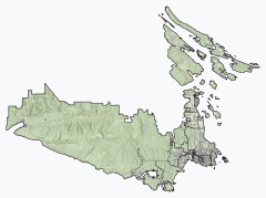 Metchosin Location of Metchosin within the Capital Regional District | |
 Metchosin Location of Metchosin in British Columbia | |
| Coordinates: 48°22′55″N 123°32′16″W | |
| Country | Canada |
| Province | British Columbia |
| Regional district | Capital |
| Founded | 1840 |
| Incorporated | 1984 |
| Government | |
| • Governing body | Metchosin Council |
| • Mayor | Marie-Térèse Little |
| Area | |
| • Total | 71.13 km2 (27.46 sq mi) |
| Elevation | 40 m (130 ft) |
| Population (2016)[2] | |
| • Total | 4,708 |
| • Density | 66.2/km2 (171/sq mi) |
| Demonym | Metchosinite |
| Time zone | UTC-8 (PST) |
| Highways | 14 |
| Waterways | Strait of Juan de Fuca |
| Website | Official website |
Climate
Metchosin has a warm-summer Mediterranean climate (Köppen: Csb) in parts caused by the rain shadow and to the east of the strait of the Strait of Juan de Fuca, but keeping some oceanic characteristics (Cfb).[3] Sligo, Ireland has very close temperatures with only a slightly warmer summer. The biggest difference is in the summer drying, common of the Pacific Northwest.[4]
| Climate data for Metchosin. elevation: 164 m or 538 ft, extremes 1911-1938 | |||||||||||||
|---|---|---|---|---|---|---|---|---|---|---|---|---|---|
| Month | Jan | Feb | Mar | Apr | May | Jun | Jul | Aug | Sep | Oct | Nov | Dec | Year |
| Record high °C (°F) | 12.2 (54.0) |
15 (59) |
18.3 (64.9) |
23.9 (75.0) |
29.4 (84.9) |
32.2 (90.0) |
32.2 (90.0) |
31.1 (88.0) |
30 (86) |
24.4 (75.9) |
15.6 (60.1) |
14.4 (57.9) |
32.2 (90.0) |
| Record low °C (°F) | −13.9 (7.0) |
−12.2 (10.0) |
−4.4 (24.1) |
−2.8 (27.0) |
−0.6 (30.9) |
1.7 (35.1) |
3.9 (39.0) |
5.6 (42.1) |
−0.6 (30.9) |
−5 (23) |
−6.1 (21.0) |
−12.2 (10.0) |
−13.9 (7.0) |
| Average precipitation mm (inches) | 168.1 (6.62) |
107.5 (4.23) |
89.2 (3.51) |
59.8 (2.35) |
39.9 (1.57) |
28.0 (1.10) |
16.5 (0.65) |
24.8 (0.98) |
32.6 (1.28) |
112.8 (4.44) |
213.0 (8.39) |
146.8 (5.78) |
1,039 (40.9) |
| Average rainfall mm (inches) | 159.5 (6.28) |
100.5 (3.96) |
85.8 (3.38) |
59.8 (2.35) |
39.9 (1.57) |
28.0 (1.10) |
16.5 (0.65) |
24.8 (0.98) |
32.6 (1.28) |
112.5 (4.43) |
207.8 (8.18) |
140.6 (5.54) |
1,008.3 (39.7) |
| Average snowfall cm (inches) | 8.6 (3.4) |
7.0 (2.8) |
3.4 (1.3) |
0.0 (0.0) |
0.0 (0.0) |
0.0 (0.0) |
0.0 (0.0) |
0.0 (0.0) |
0.0 (0.0) |
0.3 (0.1) |
5.2 (2.0) |
6.2 (2.4) |
30.7 (12) |
| Average precipitation days (≥ 0.2 mm) | 19.5 | 15.2 | 17.7 | 14.6 | 11.7 | 8.8 | 4.8 | 4.9 | 7.2 | 15.0 | 21.0 | 18.3 | 158.7 |
| Average rainy days (≥ 0.2 mm) | 18.7 | 14.4 | 17.5 | 14.6 | 11.7 | 8.8 | 4.8 | 4.9 | 7.2 | 14.9 | 20.6 | 17.6 | 155.7 |
| Average snowy days (≥ 0.2 cm) | 1.7 | 1.7 | 0.92 | 0.0 | 0.0 | 0.0 | 0.0 | 0.0 | 0.0 | 0.08 | 0.8 | 1.4 | 6.6 |
| Source: Environment Canada[5] | |||||||||||||
Demographics
In the 2021 Census of Population conducted by Statistics Canada, Metchosin had a population of 5,067 living in 1,856 of its 1,938 total private dwellings, a change of 7.6% from its 2016 population of 4,708. With a land area of 69.57 km2 (26.86 sq mi), it had a population density of 72.8/km2 (188.6/sq mi) in 2021.[6]
Parks
- Albert Head Lagoon Regional Park[7]
- Blinkhorn Nature Park
- Buckbrush Swamp
- Devonian Regional Park[7]
- Matheson Lake Regional Park[7]
- Witty's Lagoon Regional Park[7]
- Galloping Goose Regional Park [8]
References
- "British Columbia Regional Districts, Municipalities, Corporate Name, Date of Incorporation and Postal Address" (XLS). British Columbia Ministry of Communities, Sport and Cultural Development. Archived from the original on July 13, 2014. Retrieved November 2, 2014.
- "Metchosin, District municipality [Census subdivision], British Columbia and Capital, Regional district [Census division], British Columbia". Statistics Canada. January 23, 2017. Retrieved February 8, 2017.
- "Metchosin, British Columbia Köppen Climate Classification (Weatherbase)". Weatherbase. Retrieved May 24, 2019.
- "O clima típico de qualquer lugar da Terra - Weather Spark". pt.weatherspark.com. Retrieved May 24, 2019.
- "Metchosin - Canadian Climate Normals". 1981 to 2010 Canadian Climate Normals. Environment Canada. March 21, 2019. Climate ID: 6158350. Retrieved May 24, 2019.
- "Population and dwelling counts: Canada, provinces and territories, and census subdivisions (municipalities), British Columbia". Statistics Canada. February 9, 2022. Retrieved February 20, 2022.
- "Regional Parks and Trails Maps". Archived from the original on July 6, 2011.
- "District of Metchosin Regional Parks". Archived from the original on October 28, 2016.
External links
Subdivisions of British Columbia | |
|---|---|
| Subdivisions |
|
| Communities |
|
| Metro areas and agglomerations |
|
| District municipalities |
|
| |
| Authority control |
|
|---|
На других языках
[de] Metchosin
Metchosin ist eine Gemeinde am südlichen Ende von Vancouver Island in British Columbia, Kanada. Die Gemeinde, welche zur Metropolregion Greater Victoria gehört, liegt im Capital Regional District und grenzt direkt an die Juan-de-Fuca-Straße. Innerhalb Greater Victorias wird die Gemeinde, ebenso wie Langford, Colwood, View Royal und Highlands, zu den West Shore municipalities gezählt und ist die kleinste dieser Gemeinden.- [en] Metchosin
Другой контент может иметь иную лицензию. Перед использованием материалов сайта WikiSort.org внимательно изучите правила лицензирования конкретных элементов наполнения сайта.
WikiSort.org - проект по пересортировке и дополнению контента Википедии