world.wikisort.org - Canada
Lantzville is a coastal community on the east side of Vancouver Island, British Columbia, Canada, along the western shore of the Strait of Georgia and immediately north of Nanaimo.
Lantzville | |
|---|---|
District municipality | |
| District of Lantzville[1] | |
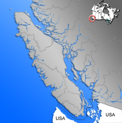 Location of Lantzville within the Regional District of Nanaimo on Vancouver Island | |
| Coordinates: 49°15′N 124°4′W | |
| Country | Canada |
| Province | British Columbia |
| Regional district | Nanaimo |
| Incorporated | 2003 |
| Government | |
| • Mayor | Mark Swain |
| • Governing body | District of Lantzville Council |
| • MP | Paul Manly (Green) |
| • MLA | Michelle Stilwell (BC Liberal) |
| Area | |
| • Total | 27.08 km2 (10.46 sq mi) |
| Elevation | 20 m (70 ft) |
| Population (2016) | |
| • Total | 3,605 |
| • Density | 130.2/km2 (337/sq mi) |
| Time zone | UTC-8 (PST) |
| Postal code span | V0R 2H0 |
| Area code | +1-250 |
| Website | District of Lantzville |
The District of Lantzville was incorporated on June 25, 2003. It covers an area of 27.08 square kilometres (10.46 sq mi) and has a population of 3,807. The district is almost completely residential, with some commercial buildings on Lantzville Road (formerly part of the Island Highway).
The area is served by the coast-spanning Island Highway and the Island Rail Corridor.
History
Lantzville was originally a mining town and is named after its American founder, Fraser Harry Lantz who invested in a coal mine in Nanoose.[3]: 149
In honour of its history as a coal mining area, Lantzville annually celebrates Minetown Day, which is a community fair. According to Lantzville: The First Hundred Years, the first European settler in the area was an English Coal Miner named Emanuel Wiles, also known as Robert Emanuel or Bob. Lantzville is a tourist destination with a number of well located bed and breakfast operations.
Demographics
In the 2021 Census of Population conducted by Statistics Canada, Lantzville had a population of 3,817 living in 1,520 of its 1,568 total private dwellings, a change of 5.9% from its 2016 population of 3,605. With a land area of 27.68 km2 (10.69 sq mi), it had a population density of 137.9/km2 (357.2/sq mi) in 2021.[4]
Education
Lantzville is home to Seaview Elementary School which is K - 7 and part of the Nanaimo-Ladysmith School District #68.[5] There is also a local private school called Aspengrove School, which is JK - 12.[6]
Grades 8 - 12 are schooled in Nanaimo at Dover Bay Secondary School.
Notable residents
- John Wilson
- Dylan Ferguson
- Callum Montgomery
References
- "British Columbia Regional Districts, Municipalities, Corporate Name, Date of Incorporation and Postal Address" (XLS). British Columbia Ministry of Communities, Sport and Cultural Development. Archived from the original on July 13, 2014. Retrieved November 2, 2014.
- District of Lantzville - Council Members
- Akrigg, G.P.V.; Akrigg, Helen B. (1986), British Columbia Place Names (3rd, 1997 ed.), Vancouver: UBC Press, ISBN 0-7748-0636-2
- "Population and dwelling counts: Canada, provinces and territories, and census subdivisions (municipalities), British Columbia". Statistics Canada. February 9, 2022. Retrieved February 20, 2022.
- "School Plan – Seaview Elementary". Retrieved 2019-10-22.
- "Admissions Presentations". Aspengrove School. Retrieved 2019-10-22.
External links
На других языках
[de] Lantzville
Lantzville ist eine Gebietsgemeinde („District Municipality“) in der kanadischen Provinz British Columbia. Die Gemeinde gehört zum Regional District of Nanaimo und liegt an der Ostküste von Vancouver Island.- [en] Lantzville
Другой контент может иметь иную лицензию. Перед использованием материалов сайта WikiSort.org внимательно изучите правила лицензирования конкретных элементов наполнения сайта.
WikiSort.org - проект по пересортировке и дополнению контента Википедии