world.wikisort.org - Brazil
Paragominas is a municipality in the state of Pará in the Northern region of Brazil.[2][3][4][5] Paragominas mine, one of the largest bauxite mines in the world, is approximately 70 km away. According to an estimate dated 1 July 2020,[6] the city has a population of 111,764 and is at an altitude of 90 m above sea level. M. With a municipal area of approximately 19,342 km², it has a population density of 5.7 inhabitants per km², approximately the size of the state of Rhineland-Palatinate. Its distance from the capital Belém is 300 km.
Paragominas | |
|---|---|
Municipality | |
 Flag  Seal | |
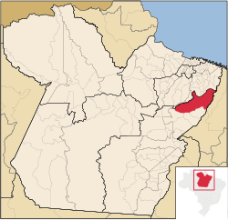 | |
 Location in Brazil | |
| Coordinates: 02°59′45″S 47°21′10″W | |
| Country | |
| Region | Northern |
| State | Pará |
| Mesoregion | Sudeste Paraense |
| Area | |
| • Total | 7,468 sq mi (19,342 km2) |
| Elevation | 300 ft (90 m) |
| Population (2020 [1]) | |
| • Total | 114,503 |
| • Density | 15/sq mi (5.9/km2) |
| Time zone | UTC−3 (BRT) |
Since 2011 it has been allowed to call itself Município Verde (Green City or Eco-City).
Toponimia
The name of the municipality originates from a series of abbreviations for the states of Pará, Goiás and Minas Gerais ("Para-Go-Minas").[7]
History
The city was founded in 1965 .
Climate
The city has a tropical climate according to Köppen-Geiger. The average temperature is 26.6 °C. Average annual precipitation is 1805 mm.[8]
Average monthly temperature and precipitation for Paragominas
| Jan | Feb | Mär | Apr | Mai | Jun | Jul | Aug | Sep | Okt | Nov | Dez | |||
| Temperatur (°C) | 26,3 | 26,3 | 26,3 | 26,6 | 26,5 | 26,3 | 26,5 | 26,8 | 26,9 | 27,1 | 27,2 | 26,9 | Ø | 26,6 |
| Precipitation ( mm ) | 240 | 316 | 391 | 304 | 149 | 66 | 29 | 36 | 37 | 56 | 60 | 121 | Σ | 1805 |
Population
Source: IBGE (2020 figure is an estimate only).[9]

ethnic composition
Ethnic groups according to the statistical classification of the IBGE[10]
| Group | 1991 | 2000 | 2010 | Note |
|---|---|---|---|---|
| Pardos | 48.521 | 49.139 | 66.928 | Pardo |
| Brancos | 15.167 | 20.051 | 20.215 | White |
| Pretos | 2.948 | 5.313 | 8.705 | Black |
| Amarelos | 26 | 390 | 887 | Asian |
| Indígenas | 152 | 806 | 1.084 | Indıan |
| without specification | 262 | 752 | – | |
| without specification |
See also
- List of municipalities in Pará
References
- IBGE 2020
- "Divisão Territorial do Brasil" (in Portuguese). Divisão Territorial do Brasil e Limites Territoriais, Instituto Brasileiro de Geografia e Estatística (IBGE). July 1, 2008. Retrieved December 17, 2009.
- "Estimativas da população para 1º de julho de 2009" (PDF) (in Portuguese). Estimativas de População, Instituto Brasileiro de Geografia e Estatística (IBGE). August 14, 2009. Retrieved December 17, 2009.
- "Ranking decrescente do IDH-M dos municípios do Brasil" (in Portuguese). Atlas do Desenvolvimento Humano, Programa das Nações Unidas para o Desenvolvimento (PNUD). 2000. Archived from the original on October 3, 2009. Retrieved December 17, 2009.
- "Produto Interno Bruto dos Municípios 2002-2005" (PDF) (in Portuguese). Instituto Brasileiro de Geografia e Estatística (IBGE). December 19, 2007. Retrieved December 17, 2009.
- "Estimativas da população residente no Brasil e unidades da federação com data de referência em 1° de julho de 2020" (PDF).
{{cite web}}: CS1 maint: url-status (link) - Foweraker, J. (2002-08-15). The Struggle for Land: A Political Economy of the Pioneer Frontier in Brazil from 1930 to the Present Day. Cambridge University Press. ISBN 978-0-521-52600-5.
- Climate data retrieved March 31, 2018.
- "Tabela 200: População residente, por sexo, situação e grupos de idade - Amostra - Características Gerais da População". sidra.ibge.gov.br. Retrieved 2022-01-13.
- "Tabela 136: População residente, por cor ou raça". gov.br. sidra.ibge.gov.br.
Capital: Belém | |||||||||||||||
| Mesoregion Lower Amazonas |
|  | |||||||||||||
| Mesoregion Marajó |
| ||||||||||||||
| Mesoregion Metropolitan Belém |
| ||||||||||||||
| Mesoregion Northeastern Pará |
| ||||||||||||||
| Mesoregion Southeastern Pará |
| ||||||||||||||
| Mesoregion Southwestern Pará |
| ||||||||||||||
На других языках
[de] Paragominas
Paragominas, amtlich portugiesisch Município de Paragominas, ist eine Stadt im Bundesstaat Pará in Brasilien. In ca. 70 km Entfernung befindet sich die Mine von Paragominas, eine der größten Bauxitminen weltweit. Die Stadt hatte 115.838 Einwohner laut Schätzung zum 1. Juli 2021[1] und liegt auf 90 m ü. M. Bei einer Gemeindefläche von rund 19.342,6 km², etwa so groß wie das Land Rheinland-Pfalz, ergibt sich eine Bevölkerungsdichte von 5,7 Einwohnern pro km². Die Entfernung zur Hauptstadt Belém beträgt 300 km.- [en] Paragominas
[ru] Парагоминас
Парагоминас (порт. Paragominas) — муниципалитет в Бразилии, входит в штат Пара. Составная часть мезорегиона Юго-восток штата Пара. Входит в экономико-статистический микрорегион Парагоминас. Население составляет 97 819 человек на 2010 год. Занимает площадь 19 342,250 км². Плотность населения — 5,06 чел./км².Другой контент может иметь иную лицензию. Перед использованием материалов сайта WikiSort.org внимательно изучите правила лицензирования конкретных элементов наполнения сайта.
WikiSort.org - проект по пересортировке и дополнению контента Википедии