world.wikisort.org - Brazil
Curuçá is a municipality in the state of Pará in the Northern region of Brazil.[2][3][4][5]
Curuçá | |
|---|---|
Municipality | |
 | |
 Flag  Seal | |
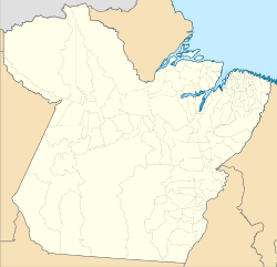 Curuçá Location in Brazil  Curuçá Curuçá (Brazil) | |
| Coordinates: .733889°S 47.855°W | |
| Country | |
| Region | Northern |
| State | Pará |
| Mesoregion | Nordeste Paraense |
| Population (2020 [1]) | |
| • Total | 40,584 |
| Time zone | UTC−3 (BRT) |
Curuçá was founded in 1775, but only became a city in 1895. Some of the municipality was split off into separate municipalities in 1939, 1955 and 1991. The Curuçá River flows from south to north through the municipality, emptying into the Atlantic Ocean. The municipality contains the 37,062 hectares (91,580 acres) Mãe Grande de Curuçá Extractive Reserve, created in 2002, which protects the waters and banks of the estuary.[6]
See also
- List of municipalities in Pará
References
- IBGE 2020
- "Divisão Territorial do Brasil" (in Portuguese). Divisão Territorial do Brasil e Limites Territoriais, Instituto Brasileiro de Geografia e Estatística (IBGE). July 1, 2008. Retrieved December 17, 2009.
- "Estimativas da população para 1º de julho de 2009" (PDF) (in Portuguese). Estimativas de População, Instituto Brasileiro de Geografia e Estatística (IBGE). August 14, 2009. Retrieved December 17, 2009.
- "Ranking decrescente do IDH-M dos municípios do Brasil" (in Portuguese). Atlas do Desenvolvimento Humano, Programa das Nações Unidas para o Desenvolvimento (PNUD). 2000. Archived from the original on October 3, 2009. Retrieved December 17, 2009.
- "Produto Interno Bruto dos Municípios 2002-2005" (PDF) (in Portuguese). Instituto Brasileiro de Geografia e Estatística (IBGE). December 19, 2007. Archived from the original (PDF) on October 2, 2008. Retrieved December 17, 2009.
- RESEX Mãe Grande de Curuçá (in Portuguese), ISA: Instituto Socioambiental, retrieved 2016-09-11
Wikimedia Commons has media related to Curuçá.
Capital: Belém | |||||||||||||||
| Mesoregion Lower Amazonas |
|  | |||||||||||||
| Mesoregion Marajó |
| ||||||||||||||
| Mesoregion Metropolitan Belém |
| ||||||||||||||
| Mesoregion Northeastern Pará |
| ||||||||||||||
| Mesoregion Southeastern Pará |
| ||||||||||||||
| Mesoregion Southwestern Pará |
| ||||||||||||||
Authority control | |
|---|---|
| General |
|
| National libraries | |
This Pará, Brazil location article is a stub. You can help Wikipedia by expanding it. |
На других языках
- [en] Curuçá
[ru] Куруса (Бразилия)
Куруса (порт. Curuçá) — муниципалитет в Бразилии, входит в штат Пара. Составная часть мезорегиона Северо-восток штата Пара. Входит в экономико-статистический микрорегион Салгаду. Население составляет 34 294 человек на 2010 год. Занимает площадь 672,675 км². Плотность населения — 50,98 чел./км².Текст в блоке "Читать" взят с сайта "Википедия" и доступен по лицензии Creative Commons Attribution-ShareAlike; в отдельных случаях могут действовать дополнительные условия.
Другой контент может иметь иную лицензию. Перед использованием материалов сайта WikiSort.org внимательно изучите правила лицензирования конкретных элементов наполнения сайта.
Другой контент может иметь иную лицензию. Перед использованием материалов сайта WikiSort.org внимательно изучите правила лицензирования конкретных элементов наполнения сайта.
2019-2026
WikiSort.org - проект по пересортировке и дополнению контента Википедии
WikiSort.org - проект по пересортировке и дополнению контента Википедии