world.wikisort.org - Brazil
Almeirim is a city on the Amazon and the northernmost municipality in the Brazilian state of Pará. It is also the fourth largest municipality in that state and the eighth largest in Brazil (by area). The municipality is crossed by the Equator.
Almeirim | |
|---|---|
 | |
 Flag | |
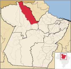 Location of Almeirim municipality in Pará | |
| Coordinates: 01°31′22″S 52°34′55″W | |
| Country | Brazil |
| Region | Norte |
| State | Pará |
| Area | |
| • Total | 72,960 km2 (28,170 sq mi) |
| Elevation | 65 m (213 ft) |
| Population (2020 [1]) | |
| • Total | 34,076 |
| • Density | 0.5/km2 (1/sq mi) |
| Time zone | UTC−3 (BRT) |
| HDI (2000) | 0.745 – medium[2] |
| Website | almeirim.pa.gov.br |
History
Almeirim was first inhabited by the Amerindians. Manoel da Mota e Siqueira constructed the Paru Fort which was designated a village in 1758, and named Almerim. In 1835, the Cabanagem Revolt started in Almeirim which resulted in widespread devastation. In 1890, Almeirim became an independent municipality.[3] The Santo Antonio do Jari hydroelectric system is located on the Jari River and provides 373.4 MW of hydro electricity. Construction began in 2011 and was completed in 2014.[4]
Nature
The municipality includes a large part (94.49%) of the 11,518 square kilometres (4,447 sq mi) Maicuru Biological Reserve.[5] It also contains part of the Jari Ecological Station.[6]
Transport
The city is served by Almeirim Airport. Serra do Areão Airport located in the district of Monte Dourado 73 km away serves the population residing and working for the Jari project. The city of Laranjal do Jari in Amapá can be reached by ferry from Monte Dourado.[7]
Towns and villages
- Aldeia Bona
- Monte Dourado
- Munguba
- Suisuimënë
Notable people
Gallery
 Panama Waterfalls, Paru River
 Cellulose factory, Jari project


References
- IBGE 2020
- "Archived copy". Archived from the original on 2009-10-03. Retrieved 2009-12-17.
{{cite web}}: CS1 maint: archived copy as title (link) - UNDP - "Almeirim". IBGE (in Portuguese). Retrieved 7 April 2021.
- Furtado, N. V.; Galardo, A. K.; Galardo, C. D.; Firmino, V. C.; Vasconcelos Dos Santos, T. (2016). "Phlebotomines (Diptera: Psychodidae) in a Hydroelectric System Affected Area from Northern Amazonian Brazil: Further Insights into the Effects of Environmental Changes on Vector Ecology". Journal of Tropical Medicine. 2016: 1–12. doi:10.1155/2016/9819723. PMC 5153513. PMID 28042300.
- Maicuru Reserva Biológica (in Portuguese), ISA: Instituto Socioambiental, retrieved 2016-05-14
- Figueiredo, João (13 March 1984), "DECRETO Nº 89.440, DE 13 DE MARÇO DE 1984", Brazilian Federal Senate (in Portuguese), Brazilian Government, retrieved 10 March 2016
- "Balsa que faz travessia de laranjal do Jari para Monte Dourado está quebrada, no AP". Globo (in Portuguese). Retrieved 6 April 2021.
- "Abuda". Soccerway. Retrieved 12 April 2021.
- "Joelma". Pure People. Retrieved 6 April 2021.
External links
- Official site (in Portuguese)
 Media related to Almeirim (Pará) at Wikimedia Commons
Capital: Belém | |||||||||||||||
| Mesoregion Lower Amazonas |
|  | |||||||||||||
| Mesoregion Marajó |
| ||||||||||||||
| Mesoregion Metropolitan Belém |
| ||||||||||||||
| Mesoregion Northeastern Pará |
| ||||||||||||||
| Mesoregion Southeastern Pará |
| ||||||||||||||
| Mesoregion Southwestern Pará |
| ||||||||||||||
На других языках
- [en] Almeirim, Pará
[ru] Алмейрин (Пара)
Алмейрин (порт. Almeirim) — муниципалитет в Бразилии, входит в штат Пара. Составная часть мезорегиона Байшу-Амазонас. Входит в экономико-статистический микрорегион Алмейрин. Население составляет 33 614 человек на 2010 год. Занимает площадь 72 954,800 км². Плотность населения — 0,46 чел./км².Другой контент может иметь иную лицензию. Перед использованием материалов сайта WikiSort.org внимательно изучите правила лицензирования конкретных элементов наполнения сайта.
WikiSort.org - проект по пересортировке и дополнению контента Википедии