world.wikisort.org - Brazil
Salvaterra is a Brazilian municipality located in the state of Pará. Its population as of 2020 is estimated to be 24,075 people. The area of the municipality is 1,043.504 km². The city is located in the mesoregion Marajó and the microregion of Arari.
Salvaterra | |
|---|---|
Municipality | |
 | |
 Flag  Seal | |
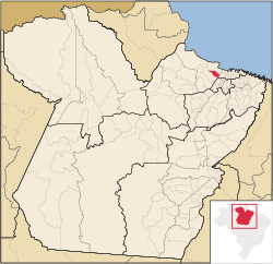 Location in the State of Pará | |
 Salvaterra | |
| Coordinates: 00°45′10″S 48°31′01″W | |
| Country | |
| Region | North |
| State | |
| Area | |
| • Total | 1,043.504 km2 (402.899 sq mi) |
| Elevation | 5 m (16 ft) |
| Population (2020 [1]) | |
| • Total | 24,075 |
| • Density | 16.8/km2 (44/sq mi) |
| Time zone | UTC−3 (BRT) |
| Postal Code | 68860-000 |
Conservation
The municipality is contained in the 59,985 square kilometres (23,160 sq mi) Marajó Archipelago Environmental Protection Area, a sustainable use conservation unit established in 1989 to protect the environment of the delta region.[2] The municipality operates the Mata do Bacurizal e do Lago Caraparu Ecological Reserve, a forest area with a lake just south of the town of Salvaterra.[3]
References
Sources
- APA Arquipélago do Marajó (in Portuguese), ISA: Instituto Socioambiental, retrieved 2016-06-27
- Giovanni Salera Júnior (24 August 2012), "Reserva Ecológica da Mata do Bacurizal e do Lago Caraparu", Mesa de Bar News, Gurupi – Estado do Tocantins. (476), retrieved 2016-07-17
| Wikimedia Commons has media related to Salvaterra (Pará). |
Capital: Belém | |||||||||||||||
| Mesoregion Lower Amazonas |
|  | |||||||||||||
| Mesoregion Marajó |
| ||||||||||||||
| Mesoregion Metropolitan Belém |
| ||||||||||||||
| Mesoregion Northeastern Pará |
| ||||||||||||||
| Mesoregion Southeastern Pará |
| ||||||||||||||
| Mesoregion Southwestern Pará |
| ||||||||||||||
This Pará, Brazil location article is a stub. You can help Wikipedia by expanding it. |
Текст в блоке "Читать" взят с сайта "Википедия" и доступен по лицензии Creative Commons Attribution-ShareAlike; в отдельных случаях могут действовать дополнительные условия.
Другой контент может иметь иную лицензию. Перед использованием материалов сайта WikiSort.org внимательно изучите правила лицензирования конкретных элементов наполнения сайта.
Другой контент может иметь иную лицензию. Перед использованием материалов сайта WikiSort.org внимательно изучите правила лицензирования конкретных элементов наполнения сайта.
2019-2025
WikiSort.org - проект по пересортировке и дополнению контента Википедии
WikiSort.org - проект по пересортировке и дополнению контента Википедии