world.wikisort.org - Brazil
Aveiro, Pará is a municipality in the state of Pará in the Northern region of Brazil.[2][3][4][5]
Aveiro, Pará | |
|---|---|
Municipality | |
 Flag  Seal | |
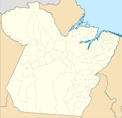 Aveiro, Pará Location in Brazil  Aveiro, Pará Aveiro, Pará (Brazil) | |
| Coordinates: 3°37′S 55°19′W | |
| Country | |
| Region | Northern |
| State | Pará |
| Mesoregion | Sudoeste Paraense |
| Population (2020 [1]) | |
| • Total | 16,404 |
| Time zone | UTC−3 (BRT) |
The municipality holds part of the Tapajós National Forest, a 549,067 hectares (1,356,770 acres) sustainable use conservation unit created in 1974.[6]
The town of Fordlândia is located in the municipality.[7]
See also
- List of municipalities in Pará
- Fordlândia
References
- IBGE 2020
- "Divisão Territorial do Brasil" (in Portuguese). Divisão Territorial do Brasil e Limites Territoriais, Instituto Brasileiro de Geografia e Estatística (IBGE). July 1, 2008. Retrieved December 17, 2009.
- "Estimativas da população para 1º de julho de 2009" (PDF) (in Portuguese). Estimativas de População, Instituto Brasileiro de Geografia e Estatística (IBGE). August 14, 2009. Retrieved December 17, 2009.
- "Ranking decrescente do IDH-M dos municípios do Brasil" (in Portuguese). Atlas do Desenvolvimento Humano, Programa das Nações Unidas para o Desenvolvimento (PNUD). 2000. Archived from the original on October 3, 2009. Retrieved December 17, 2009.
- "Produto Interno Bruto dos Municípios 2002–2005" (PDF) (in Portuguese). Instituto Brasileiro de Geografia e Estatística (IBGE). December 19, 2007. Archived from the original (PDF) on October 2, 2008. Retrieved December 17, 2009.
- Unidade de Conservação: Floresta Nacional do Tapajós (in Portuguese), MMA: Ministério do Meio Ambiente, retrieved 2016-05-30
- Reed, Drew (2 April 2021). "Lost cities #10: Fordlandia – the failure of Henry Ford's utopian city in the Amazon". The Guardian.
Capital: Belém | |||||||||||||||
| Mesoregion Lower Amazonas |
|  | |||||||||||||
| Mesoregion Marajó |
| ||||||||||||||
| Mesoregion Metropolitan Belém |
| ||||||||||||||
| Mesoregion Northeastern Pará |
| ||||||||||||||
| Mesoregion Southeastern Pará |
| ||||||||||||||
| Mesoregion Southwestern Pará |
| ||||||||||||||
This Pará, Brazil location article is a stub. You can help Wikipedia by expanding it. |
На других языках
- [en] Aveiro, Pará
[ru] Авейру (Пара)
Аве́йру (порт. Aveiro) — муниципалитет в Бразилии, входит в штат Пара. Составная часть мезорегиона Юго-запад штата Пара. Входит в экономико-статистический микрорегион Итаитуба. Население составляет 15 849 человек на 2010 год. Занимает площадь 17 074,050 км². Плотность населения — 0,93 чел./км².Текст в блоке "Читать" взят с сайта "Википедия" и доступен по лицензии Creative Commons Attribution-ShareAlike; в отдельных случаях могут действовать дополнительные условия.
Другой контент может иметь иную лицензию. Перед использованием материалов сайта WikiSort.org внимательно изучите правила лицензирования конкретных элементов наполнения сайта.
Другой контент может иметь иную лицензию. Перед использованием материалов сайта WikiSort.org внимательно изучите правила лицензирования конкретных элементов наполнения сайта.
2019-2026
WikiSort.org - проект по пересортировке и дополнению контента Википедии
WikiSort.org - проект по пересортировке и дополнению контента Википедии