world.wikisort.org - Brazil
Coari (Choary) is a Brazilian municipality in the Amazon region.
Coari | |
|---|---|
Municipality | |
 Flag  Seal | |
| Nickname: "Solimões Queen"
"Gas City" | |
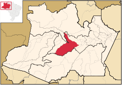 Coari municipality (red) in Amazonas state | |
| Coordinates: 04°05′06″S 63°08′27″W | |
| Country | |
| Region | North |
| State | |
| Government | |
| • Mayor | Manoel Adail Amaral Pinheiro (PRP) |
| Area | |
| • Municipality | 57,921.646 km2 (22,363.673 sq mi) |
| Elevation | 40 m (120 ft) |
| Population (2020[1]) | |
| • Metro | 85,910 |
| Time zone | UTC−4 (AMT) |
| ZIP code | 69460-000 |
| Climate | Af |
| Website | www |
Location
The municipal seat of Coari is one of the largest cities of the Amazonas state. It is the seat of the Roman Catholic Diocese of Coari. The area has reserves of oil and natural gas. Coari is served by Coari Airport located 6 km from downtown Coari. Porto Urucu Airport located in the district of Porto Urucu 470 km away serves the population residing and working for Petrobras.
Conservation
The municipality is in the Juruá-Purus moist forests ecoregion.[2] It contains part of the Amanã Sustainable Development Reserve.[3] It contains a small portion of the 1,008,167 hectares (2,491,230 acres) Piagaçu-Purus Sustainable Development Reserve, established in 2003.[4] The municipality contains 66.15% of the 217,486 hectares (537,420 acres) Catuá-Ipixuna Extractive Reserve, established in 2003 as the first extractive reserve in the state of Amazonas.[5]
Climate
| Climate data for Coari (1981–2010, extremes 1961–present) | |||||||||||||
|---|---|---|---|---|---|---|---|---|---|---|---|---|---|
| Month | Jan | Feb | Mar | Apr | May | Jun | Jul | Aug | Sep | Oct | Nov | Dec | Year |
| Record high °C (°F) | 36.9 (98.4) |
36.6 (97.9) |
36.4 (97.5) |
36.4 (97.5) |
36.0 (96.8) |
38.0 (100.4) |
39.8 (103.6) |
37.5 (99.5) |
38.3 (100.9) |
38.2 (100.8) |
38.3 (100.9) |
38.2 (100.8) |
39.8 (103.6) |
| Average high °C (°F) | 31.8 (89.2) |
31.9 (89.4) |
32.0 (89.6) |
31.9 (89.4) |
31.7 (89.1) |
31.7 (89.1) |
32.2 (90.0) |
33.2 (91.8) |
33.3 (91.9) |
33.2 (91.8) |
32.6 (90.7) |
32.1 (89.8) |
32.3 (90.1) |
| Daily mean °C (°F) | 26.4 (79.5) |
26.4 (79.5) |
26.6 (79.9) |
26.6 (79.9) |
26.6 (79.9) |
26.4 (79.5) |
26.8 (80.2) |
27.4 (81.3) |
27.4 (81.3) |
27.3 (81.1) |
27.0 (80.6) |
26.8 (80.2) |
26.8 (80.2) |
| Average low °C (°F) | 21.6 (70.9) |
21.8 (71.2) |
22.0 (71.6) |
22.0 (71.6) |
22.1 (71.8) |
21.9 (71.4) |
21.9 (71.4) |
22.2 (72.0) |
22.3 (72.1) |
22.4 (72.3) |
22.4 (72.3) |
22.2 (72.0) |
22.1 (71.8) |
| Record low °C (°F) | 14.6 (58.3) |
15.4 (59.7) |
10.6 (51.1) |
15.6 (60.1) |
14.0 (57.2) |
10.2 (50.4) |
11.0 (51.8) |
14.8 (58.6) |
15.0 (59.0) |
15.7 (60.3) |
16.4 (61.5) |
15.2 (59.4) |
10.2 (50.4) |
| Average precipitation mm (inches) | 264.5 (10.41) |
265.5 (10.45) |
322.3 (12.69) |
272.4 (10.72) |
213.1 (8.39) |
128.9 (5.07) |
87.2 (3.43) |
68.9 (2.71) |
100.4 (3.95) |
156.7 (6.17) |
215.6 (8.49) |
261.7 (10.30) |
2,357.2 (92.80) |
| Average precipitation days (≥ 1.0 mm) | 18 | 17 | 18 | 17 | 16 | 13 | 9 | 8 | 9 | 12 | 13 | 16 | 166 |
| Average relative humidity (%) | 85.6 | 84.9 | 84.9 | 85.0 | 85.1 | 83.9 | 80.8 | 78.1 | 78.8 | 79.7 | 81.9 | 83.6 | 82.7 |
| Mean monthly sunshine hours | 138.2 | 120.2 | 122.0 | 132.5 | 152.5 | 171.2 | 207.1 | 208.8 | 180.4 | 171.7 | 141.1 | 143.1 | 1,888.8 |
| Source 1: Instituto Nacional de Meteorologia[6] | |||||||||||||
| Source 2: Meteo Climat (record highs and lows)[7] | |||||||||||||
References
- IBGE 2020
- Sears, Robin, South America: Amazon Basin, northwestern Brazil (NT0133), WWF: World Wildlife Fund, retrieved 2017-03-28
- RDS Amanã (in Portuguese), ISA: Instituto Socioambiental, retrieved 2016-05-05
- RDS Piagaçu-Purus (in Portuguese), ISA: Instituto Socioambiental, retrieved 2016-08-20
- RESEX Catuá-Ipixuna (in Portuguese), ISA: Instituto Socioambiental, retrieved 2016-08-30
- "Normais Climatológicas Do Brasil 1981–2010" (in Portuguese). Instituto Nacional de Meteorologia. Retrieved 26 October 2018.
- "Station Coari" (in French). Meteo Climat. Retrieved 26 October 2018.
External links
Capital: Manaus | ||||||||||||||
| Mesoregion Centro Amazonense |
|  | ||||||||||||
| Mesoregion Norte Amazonense |
| |||||||||||||
| Mesoregion Sudoeste Amazonense |
| |||||||||||||
| Mesoregion Sul Amazonense |
| |||||||||||||
Authority control | |
|---|---|
| General |
|
| National libraries | |
This article about a location in the Brazilian state of Amazonas is a stub. You can help Wikipedia by expanding it. |
На других языках
[de] Coari
Coari, amtlich Município de Coari, ist eine brasilianische Gemeinde im Bundesstaat Amazonas. Die Stadt ist der Sitz der römisch-katholischen Diözese Coari. Die Bevölkerungszahl wurde zum 1. Juli 2021 auf 86.713 Einwohner geschätzt, die Coarienser (coarienses) genannt werden und auf einem Gemeindegebiet von rund 57.971 km² (2019) leben.[1] Die Entfernung zur Hauptstadt Manaus beträgt 363 km.- [en] Coari
[es] Coari
Coari es un municipio de Brasil, perteneciente al estado de Amazonas.[ru] Куари
Куа́ри (порт. Coari) — муниципалитет в Бразилии, входит в штат Амазонас. Составная часть мезорегиона Центр штата Амазонас. Входит в экономико-статистический микрорегион Коари. Население составляет 75 965 человека на 2010 год. Занимает площадь 57 976,07 км². Плотность населения — 1,31 чел./км².Другой контент может иметь иную лицензию. Перед использованием материалов сайта WikiSort.org внимательно изучите правила лицензирования конкретных элементов наполнения сайта.
WikiSort.org - проект по пересортировке и дополнению контента Википедии