world.wikisort.org - Brazil
Manacapuru (Munychapur) is a municipality located in the Brazilian state of Amazonas.
Manacapuru | |
|---|---|
Municipality | |
 Flag  Seal | |
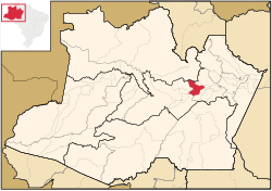 Location of the municipality inside Amazonas | |
| Coordinates: 3°17′59″S 60°37′14″W | |
| Country | |
| Region | North |
| State | |
| Founded | July 16, 1932 |
| Government | |
| • Mayor | Betanael da Silva Dangelo (PROS) |
| Area | |
| • Total | 7,329.234 km2 (2,829.833 sq mi) |
| Elevation | 25 m (82 ft) |
| Population (2020) | |
| • Total | 98,502 |
| • Density | 12.85/km2 (33.3/sq mi) |
| Time zone | UTC−4 (AMT) |
Population
The population of Manacapuru was 98,502 (2020)[1] and its area is 7,329 km².[2] The city is one of the biggest in the state. It is located about 80 km (50 mi) upstream (west) from Manaus, at the point where the Manacapuru River flows into the Solimões River.
Main sights
The municipality contains about 19% of the Rio Negro Right Bank Environmental Protection Area, a 1,140,990 hectares (2,819,400 acres) sustainable use conservation unit that controls use of an area of Amazon rainforest along the Rio Negro above the junction with the Solimões River.[3] It also contains about 4% of the Rio Negro Sustainable Development Reserve, a 103,086 hectares (254,730 acres) sustainable use conservation unit created in 2008 in an effort to stop deforestation in the area, which is threatened due to its proximity to Manaus.[4]
Notable people
- Marcelinho – Footballer, playing for the Bulgarian national football team.
References
- IBGE 2020
- Brazilian Institute of Geography and Statistics (IBGE) - "Archived copy". Archived from the original on 2007-01-09. Retrieved 2007-01-09.
{{cite web}}: CS1 maint: archived copy as title (link) - APA Margem Direita do Rio Negro (in Portuguese), ISA: Instituto Socioambiental, retrieved 2016-06-26
- RDS do Rio Negro (in Portuguese), ISA: Instituto Socioambiental, retrieved 2016-06-27
Capital: Manaus | ||||||||||||||
| Mesoregion Centro Amazonense |
|  | ||||||||||||
| Mesoregion Norte Amazonense |
| |||||||||||||
| Mesoregion Sudoeste Amazonense |
| |||||||||||||
| Mesoregion Sul Amazonense |
| |||||||||||||
Authority control | |
|---|---|
| General |
|
| National libraries | |
This article about a location in the Brazilian state of Amazonas is a stub. You can help Wikipedia by expanding it. |
На других языках
- [en] Manacapuru
[es] Manacapuru
Manacapuru es un municipio de Brasil en el estado de Amazonas . Con una población de 100.656 habitantes se ubica como la cuarta mayor ciudad del estado. Está situada a 84 kilómetros de Manaus de cuya área metropolitana forma parte. Posee un área de 7.399 km² Limita con los municipios de Iranduba, Manaquiri, Beruri, Anamã, Caapiranga y Novo Airão.[ru] Манакапуру
Манакапуру (порт. Manacapuru) — муниципалитет в Бразилии, входит в штат Амазонас. Составная часть мезорегиона Центр штата Амазонас. Входит в экономико-статистический микрорегион Манаус. Население составляет 85 141 человек на 2010 год. Занимает площадь 7 330,07 км². Плотность населения — 11,62 чел./км².Другой контент может иметь иную лицензию. Перед использованием материалов сайта WikiSort.org внимательно изучите правила лицензирования конкретных элементов наполнения сайта.
WikiSort.org - проект по пересортировке и дополнению контента Википедии