world.wikisort.org - Brazil
Santa Isabel do Rio Negro (Saint Isabel of Black River) is a municipality located in the Brazilian state of Amazonas. Its population was 25,865 (2020)[1] and its area is 62,846 square kilometres (24,265 sq mi).[2] The Municipality was formerly called Tapuruquara.
Santa Isabel do Rio Negro | |
|---|---|
Municipality | |
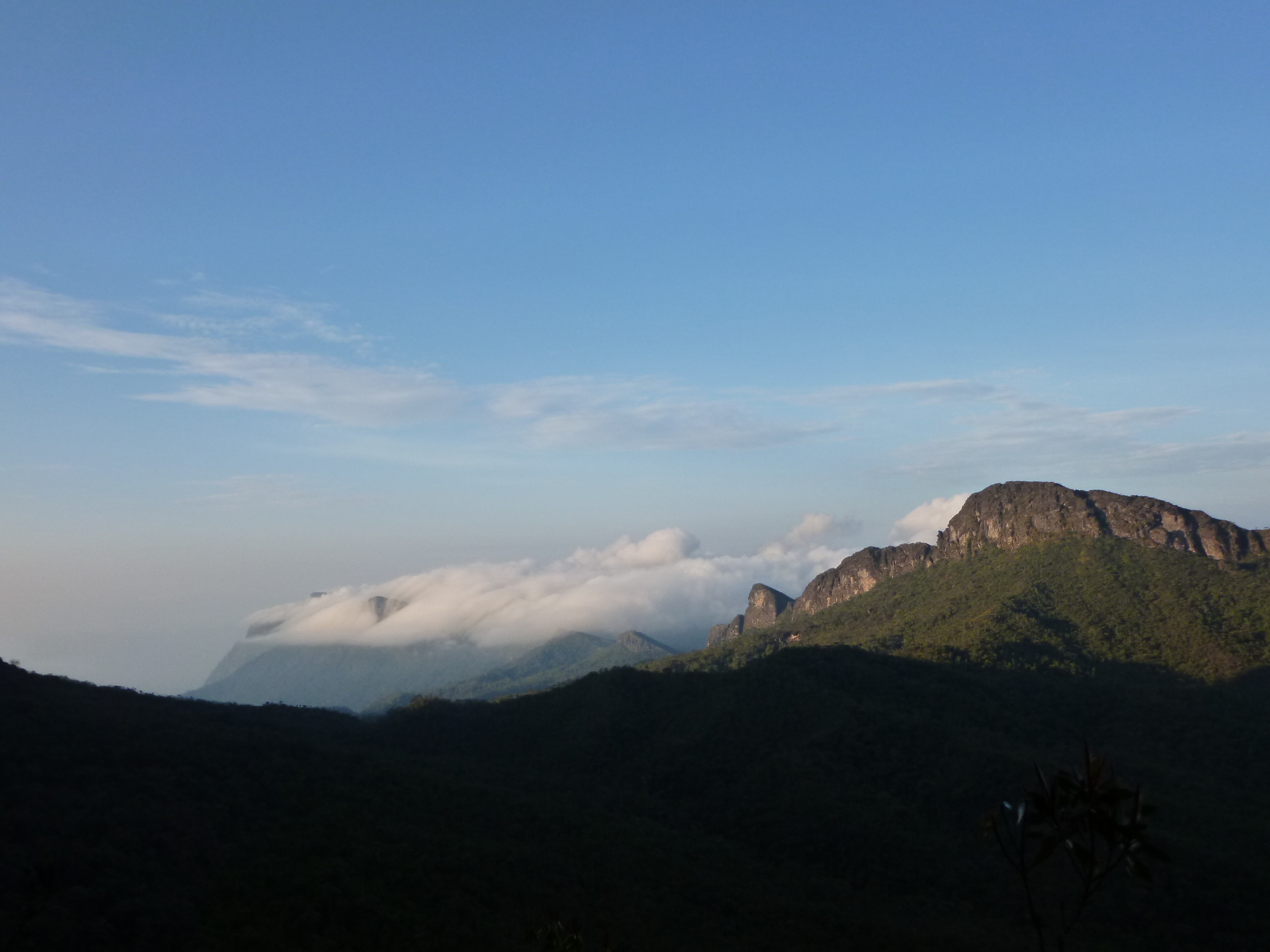 Pico da Neblina background covered by clouds, the highest point in Brazil located in the municipality, bordering Venezuela. | |
 Flag  Seal | |
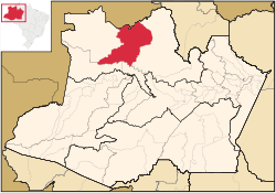 Location of the municipality inside Amazonas | |
 Santa Isabel do Rio Negro Location in Brazil | |
| Coordinates: 0°24′50″S 65°1′8″W | |
| Country | |
| Region | North |
| State | |
| Area | |
| • Total | 62,846 km2 (24,265 sq mi) |
| Population (2020) | |
| • Total | 25,865 |
| • Density | 0.29/km2 (0.8/sq mi) |
| Time zone | UTC−4 (AMT) |
Pico da Neblina, the highest mountain in Brazil at 2,994 metres (9,822 feet), is located in the municipality. However, the peak is 180 kilometres (110 mi) in a straight line from the urban seat of the municipality, inaccessible except through the Amazon rainforest, and in both a national park and a Yanomami reservation under federal control and with restricted access.
The municipality also contains part of the Amazonas National Forest.[3]
The city is served by Tapuruquara Airport.
References
- IBGE 2020
- IBGE -
- Unidade de Conservação: Floresta Nacional do Amazonas (in Portuguese), MMA: Ministério do Meio Ambiente, retrieved 2016-05-19
Capital: Manaus | ||||||||||||||
| Mesoregion Centro Amazonense |
|  | ||||||||||||
| Mesoregion Norte Amazonense |
| |||||||||||||
| Mesoregion Sudoeste Amazonense |
| |||||||||||||
| Mesoregion Sul Amazonense |
| |||||||||||||
This article about a location in the Brazilian state of Amazonas is a stub. You can help Wikipedia by expanding it. |
Другой контент может иметь иную лицензию. Перед использованием материалов сайта WikiSort.org внимательно изучите правила лицензирования конкретных элементов наполнения сайта.
WikiSort.org - проект по пересортировке и дополнению контента Википедии