world.wikisort.org - Brazil
Itapiranga is a municipality located in the state of Amazonas northern Brazil on the left bank of the Solimões River about 200 km east of Manaus. Its population was 9,230 (2020)[1] and its area is 4,231 km².[2]
Itapiranga | |
|---|---|
Municipality | |
 Seal | |
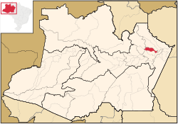 Location of the municipality inside Amazonas | |
| Coordinates: 2°44′56″S 58°1′19″W | |
| Country | |
| Region | North |
| State | |
| Area | |
| • Total | 4,231 km2 (1,634 sq mi) |
| Population (2020) | |
| • Total | 9,230 |
| • Density | 2/km2 (5/sq mi) |
| Time zone | UTC−4 (BRT) |
| • Summer (DST) | UTC−4 (DST no longer used) |
The name is of Indian origin, and was given to a quarry which has a port. It comes from ita, stone and pitanga, red, so the name means "red stone".
The municipality contains about 40% of the 424,430 hectares (1,048,800 acres) Uatumã Sustainable Development Reserve, which protects the lower part of the Uatumã River basin.[3]
History
It was founded in 1931 as a suburb of Silves.
References
- IBGE 2020
- IBGE - "Archived copy". Archived from the original on 2007-01-09. Retrieved 2014-08-03.
{{cite web}}: CS1 maint: archived copy as title (link) - RDS do Uatumã (in Portuguese), ISA: Instituto Socioambiental, retrieved 2016-07-25
Capital: Manaus | ||||||||||||||
| Mesoregion Centro Amazonense |
|  | ||||||||||||
| Mesoregion Norte Amazonense |
| |||||||||||||
| Mesoregion Sudoeste Amazonense |
| |||||||||||||
| Mesoregion Sul Amazonense |
| |||||||||||||
This article about a location in the Brazilian state of Amazonas is a stub. You can help Wikipedia by expanding it. |
На других языках
- [en] Itapiranga, Amazonas
[ru] Итапиранга (Амазонас)
Итапиранга (порт. Itapiranga) — муниципалитет в Бразилии, входит в штат Амазонас. Составная часть мезорегиона Центр штата Амазонас. Входит в экономико-статистический микрорегион Итакоатиара.Население составляет 8 211 человека на 2010 год. Занимает площадь 4 231,15 км². Плотность населения — 1,94 чел./км².Текст в блоке "Читать" взят с сайта "Википедия" и доступен по лицензии Creative Commons Attribution-ShareAlike; в отдельных случаях могут действовать дополнительные условия.
Другой контент может иметь иную лицензию. Перед использованием материалов сайта WikiSort.org внимательно изучите правила лицензирования конкретных элементов наполнения сайта.
Другой контент может иметь иную лицензию. Перед использованием материалов сайта WikiSort.org внимательно изучите правила лицензирования конкретных элементов наполнения сайта.
2019-2026
WikiSort.org - проект по пересортировке и дополнению контента Википедии
WikiSort.org - проект по пересортировке и дополнению контента Википедии